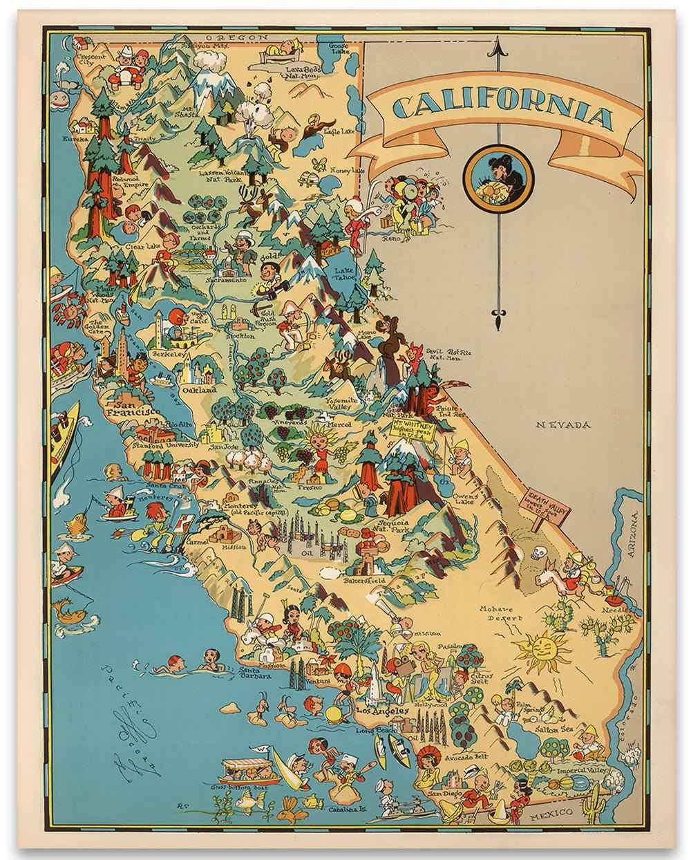
California Map Illustrated Vintage Landmarks Wall Art Print
Sale priceFrom $39.99
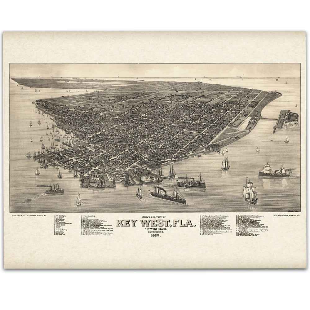
1889 Key West Map - Florida Bird’s-Eye View Vintage Map (Restored)
Sale priceFrom $34.00
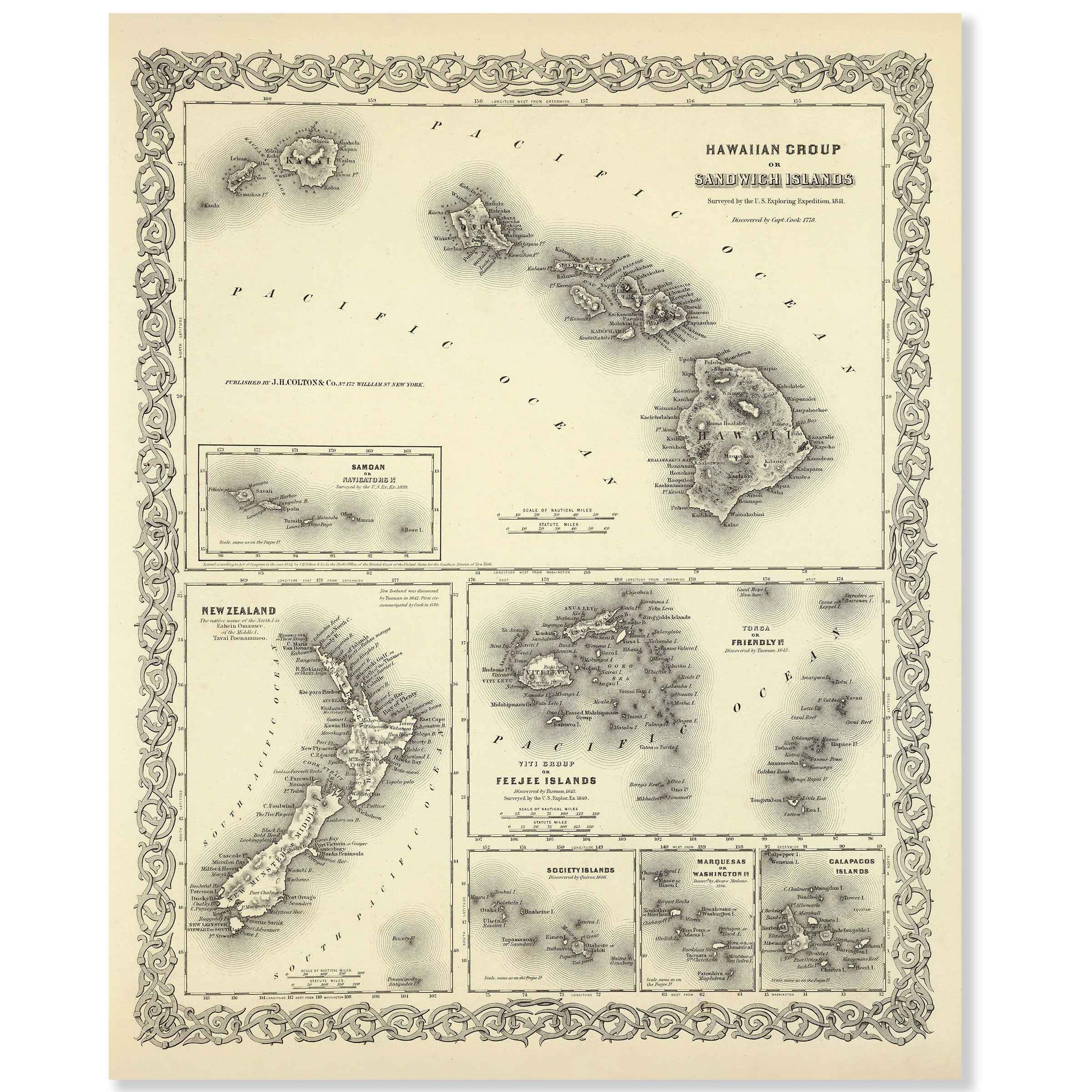
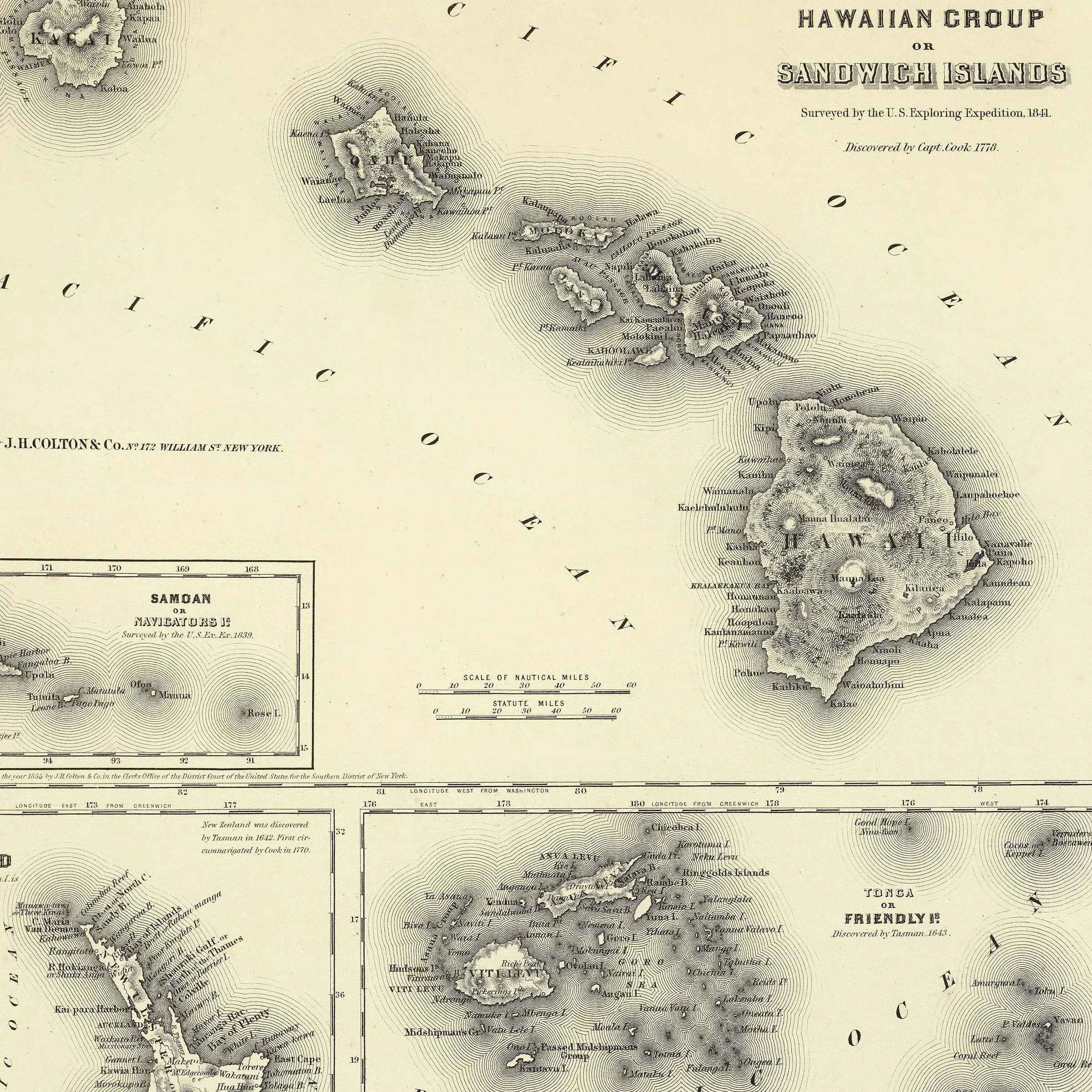
1856 Vintage Hawaii Map - Restored Hawaii Map of Sandwich Islands & Pacific Islands
Sale priceFrom $34.00
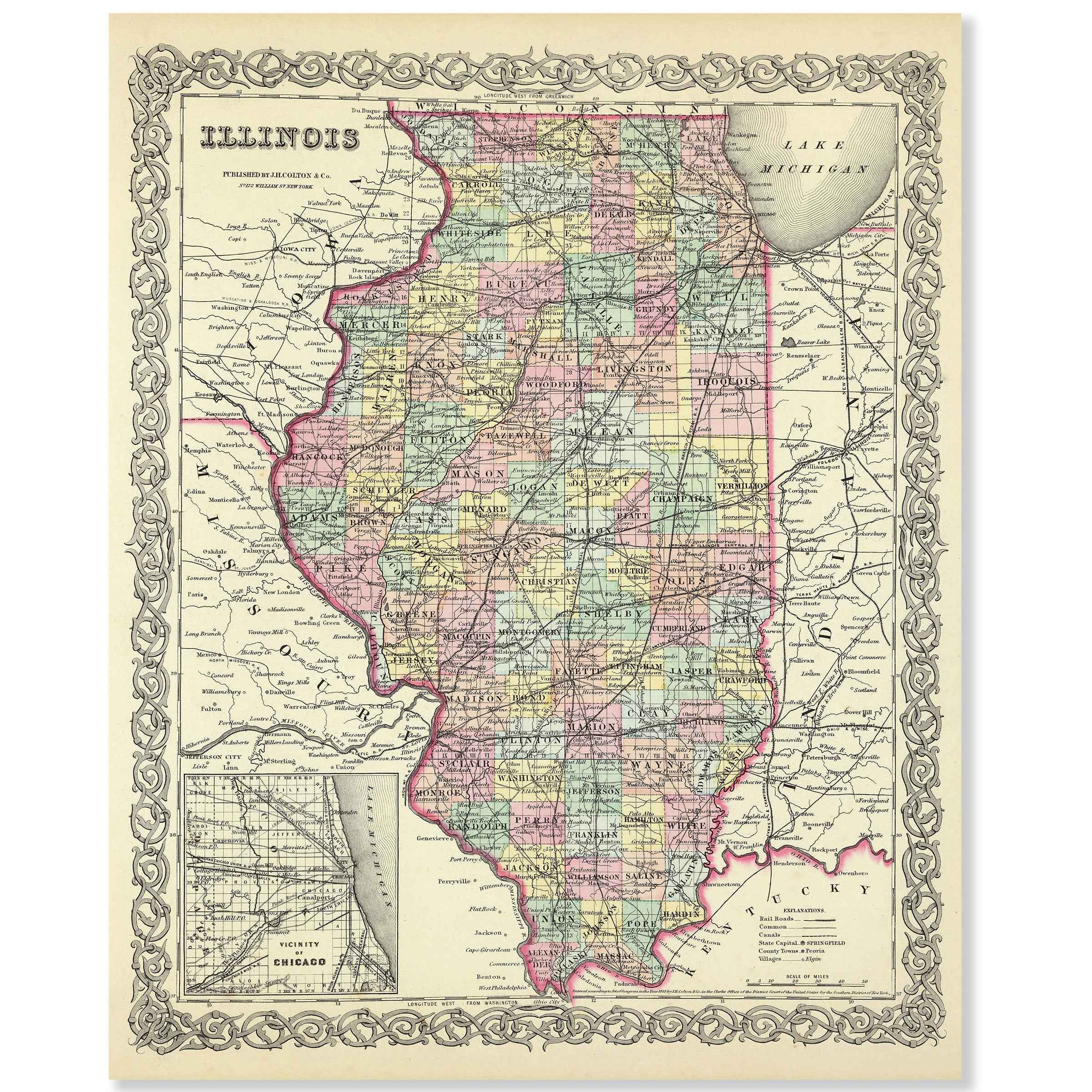
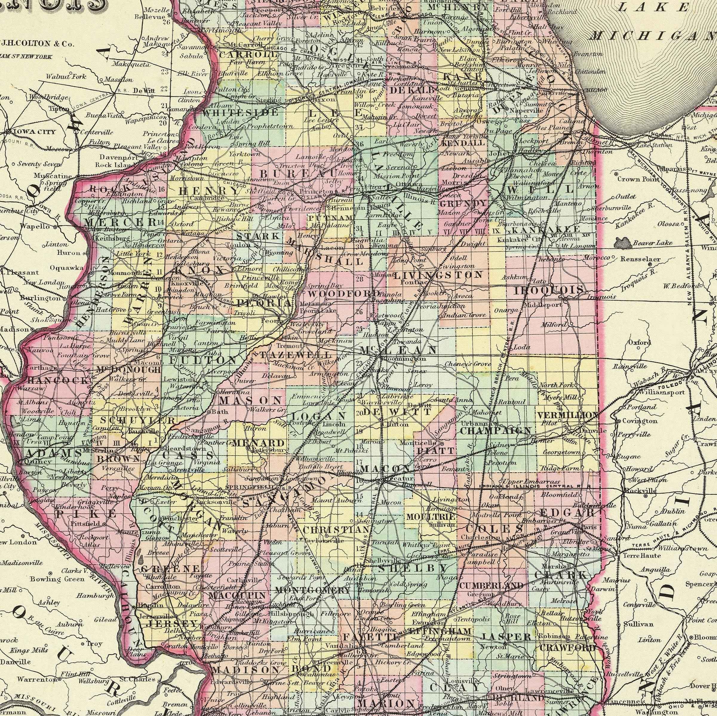
1855 Illinois Map - Vintage Colton State Map for Collectors
Sale priceFrom $34.00
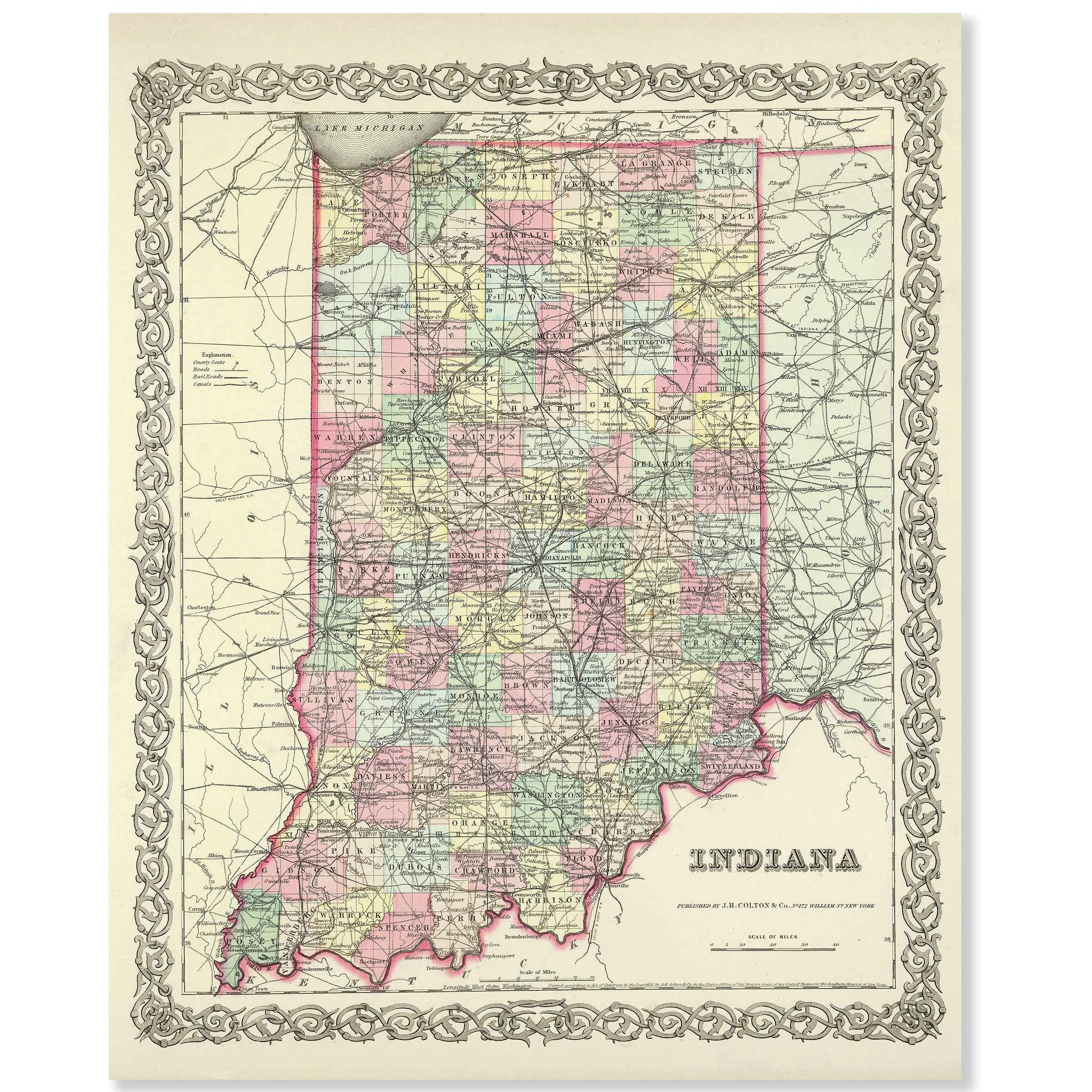
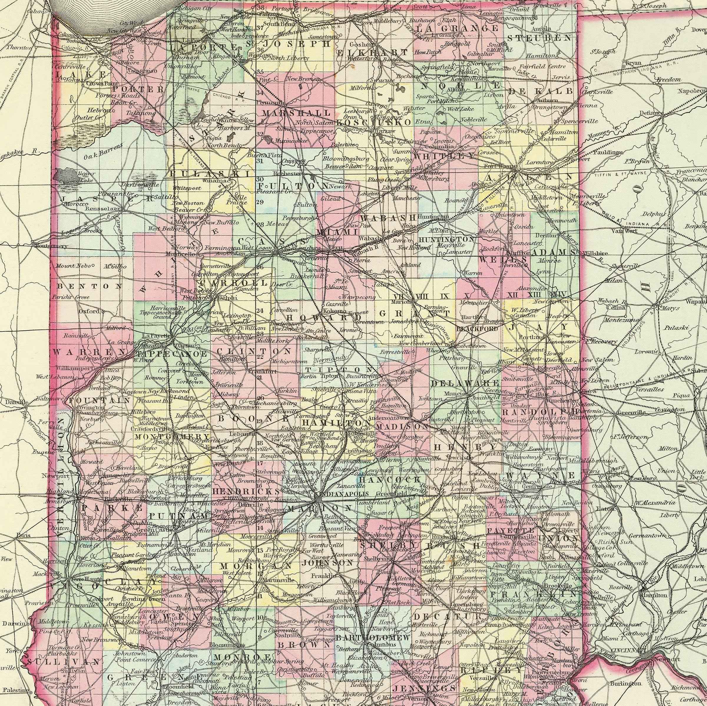
1856 Indiana Map - Vintage State Map by Colton (Restored) for Collectors
Sale priceFrom $34.00


Iowa Map - Vintage State Map by Colton for Home Decor and Travel Enthusiasts
Sale priceFrom $34.00
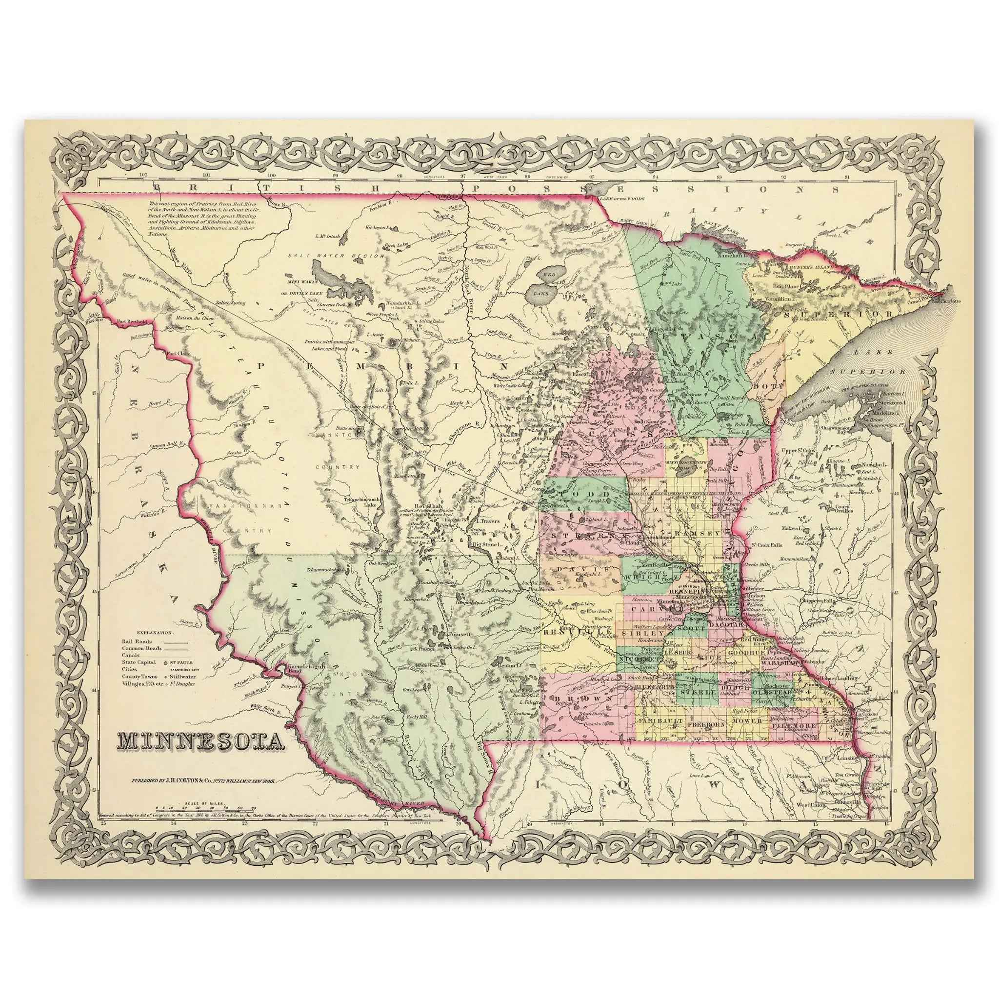
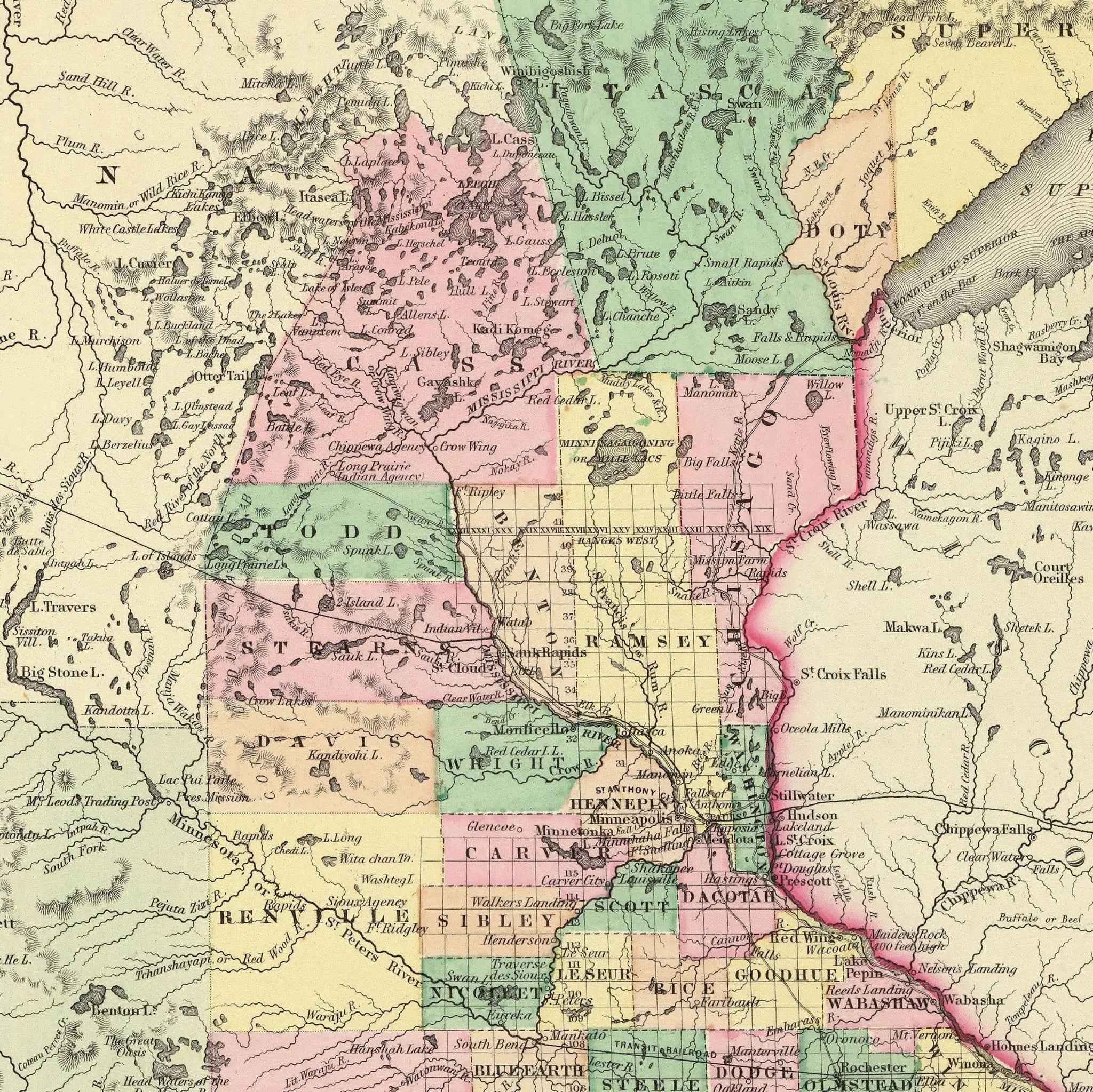
1856 Minnesota Map by Colton - Vintage Map Print for Collectors
Sale priceFrom $39.99
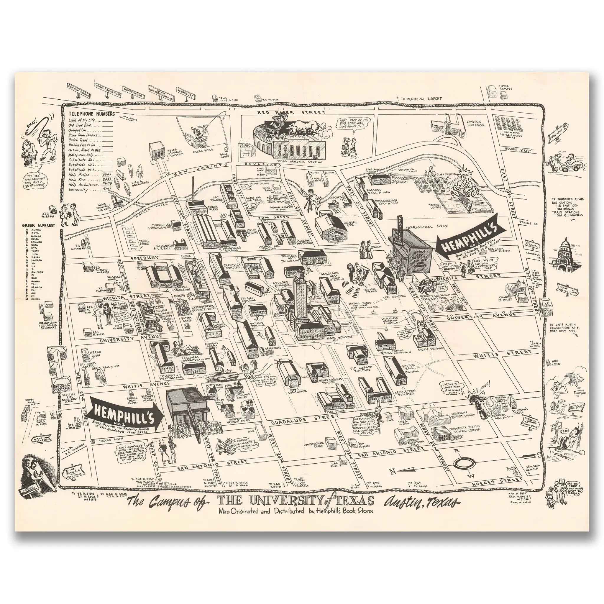
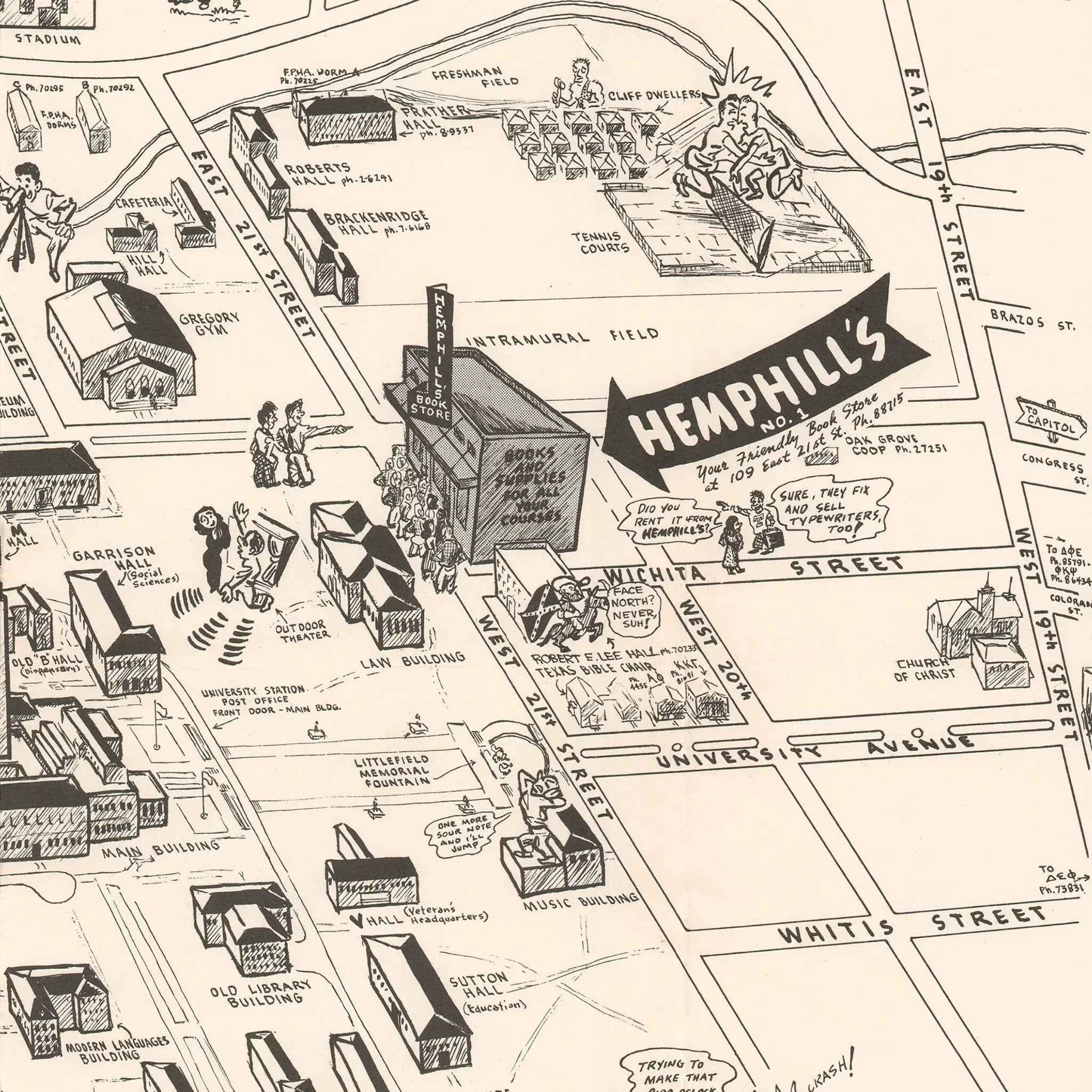
University of Texas Vintage Map - 1945 Illustrated Campus Life in Austin
Sale priceFrom $39.99
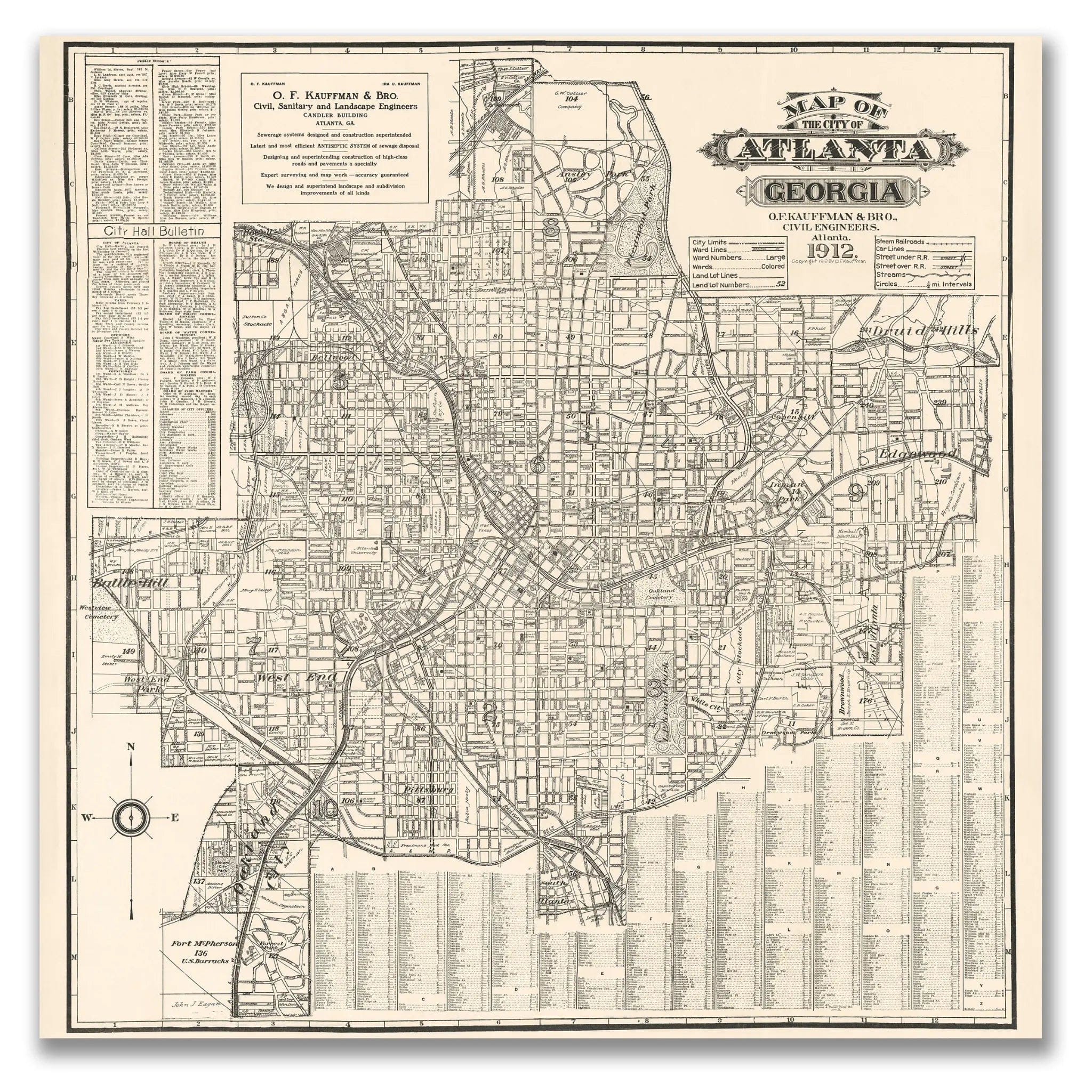
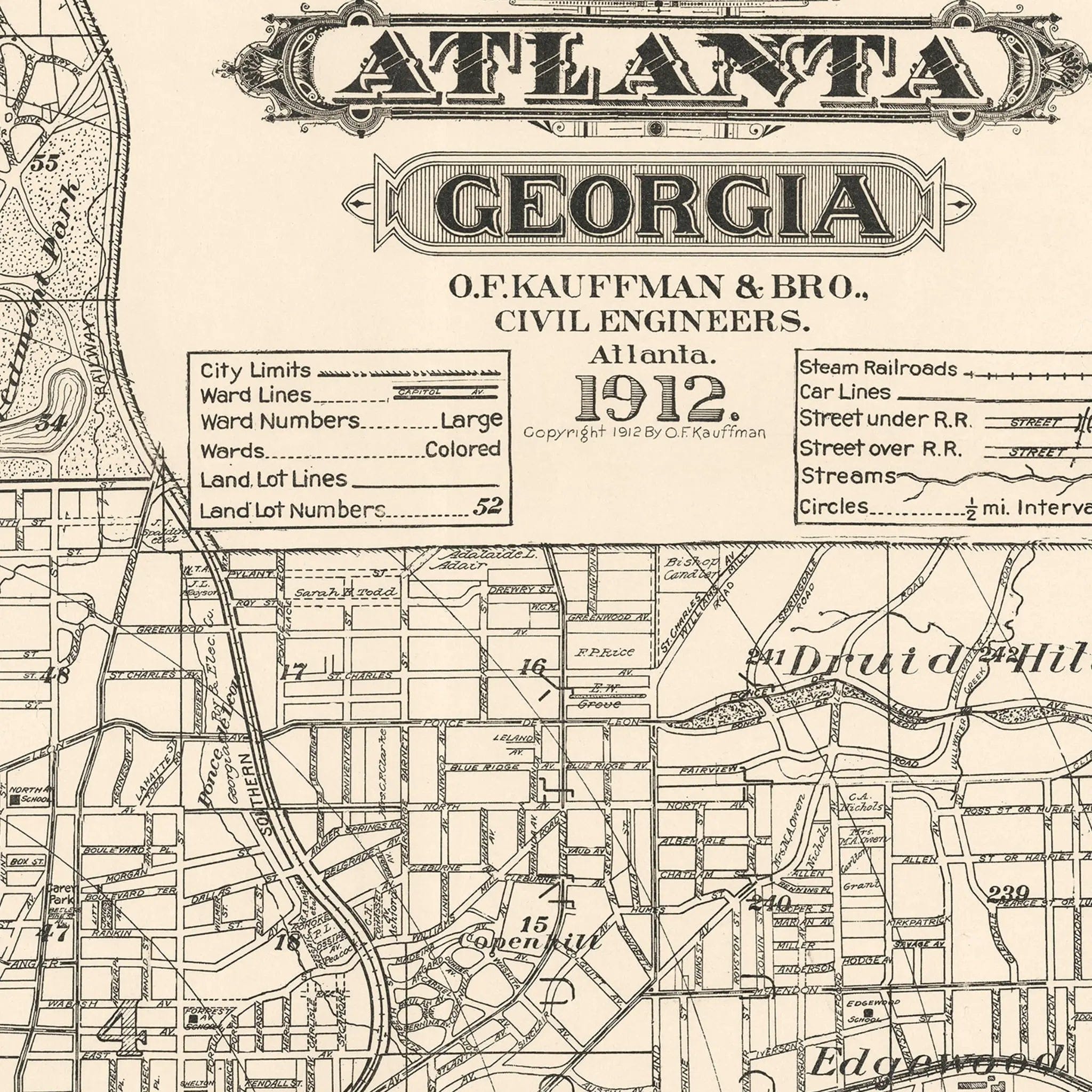
Atlanta Vintage Map 1912 - Historic Georgia City Map
Sale priceFrom $39.99
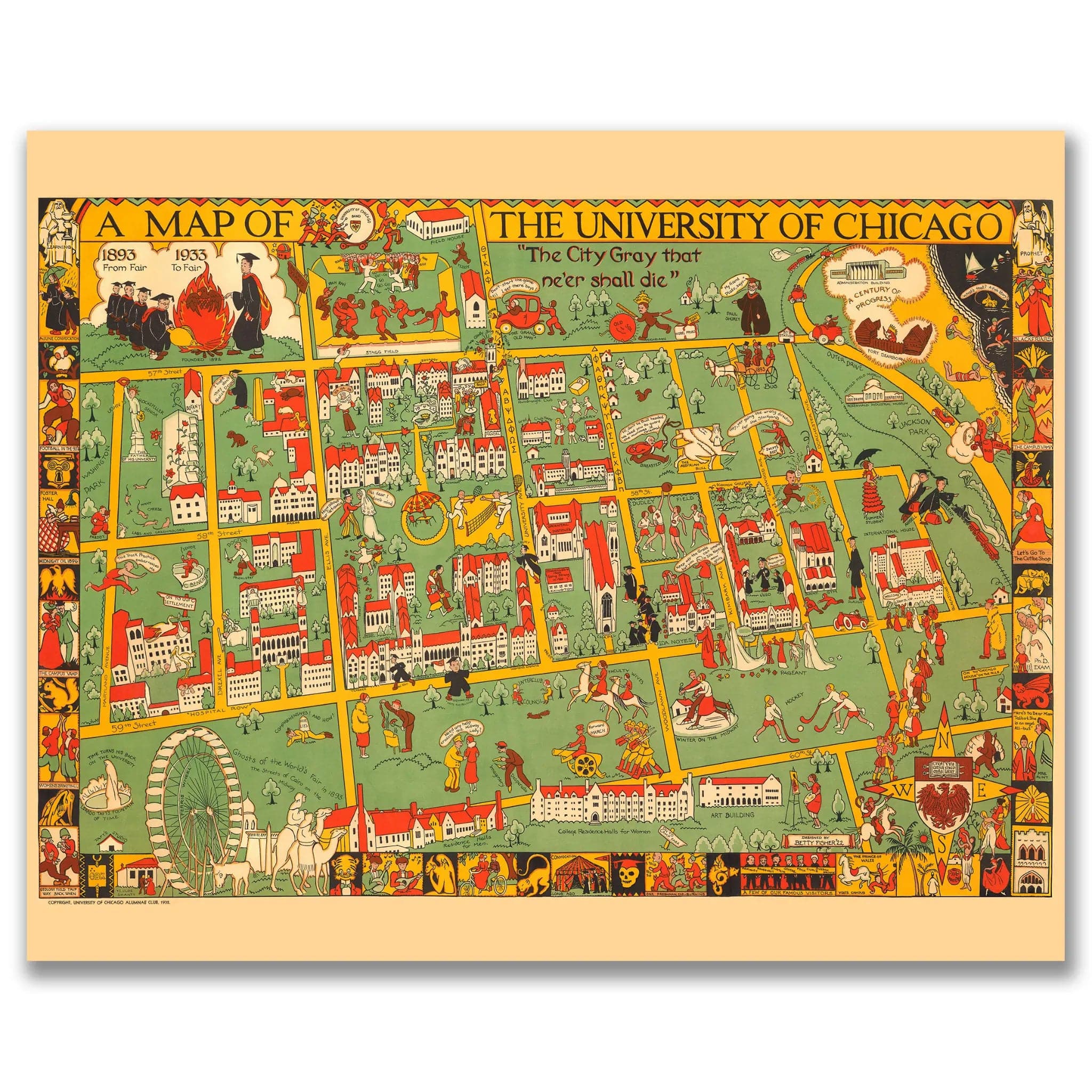
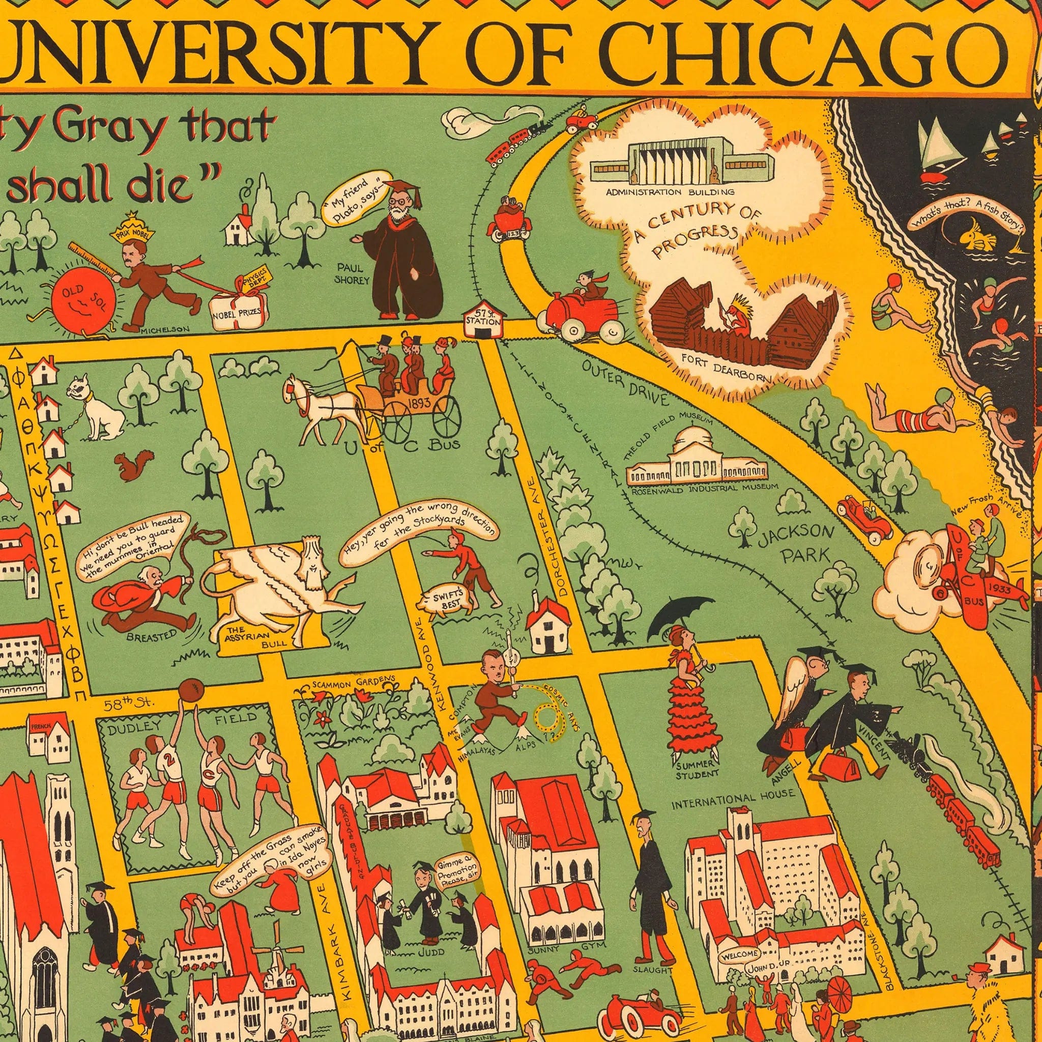
University of Chicago Vintage Map - 1932 Illustrated Campus Map
Sale priceFrom $39.99

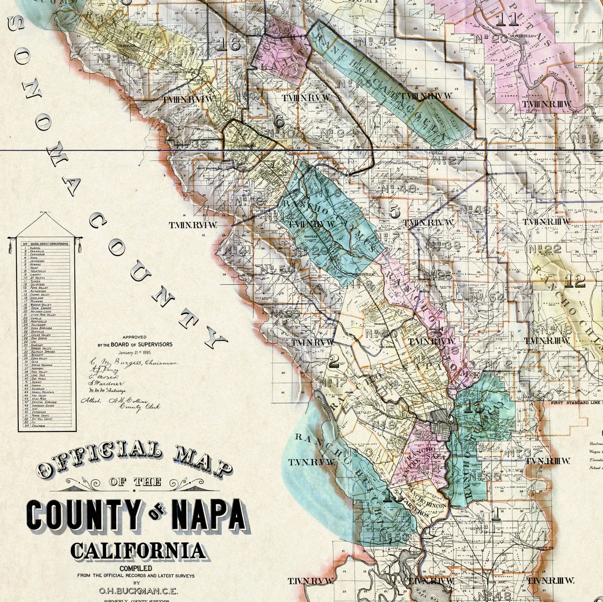
Napa Valley Vintage Map - Authentic 1895 County Map for Collectors
Sale priceFrom $39.99
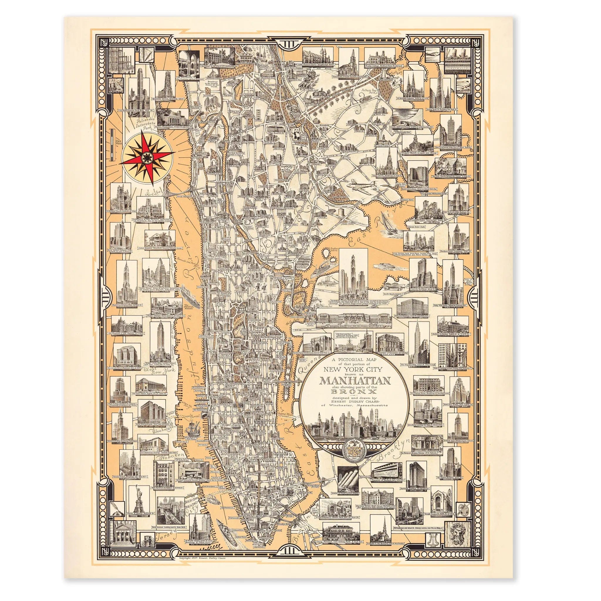
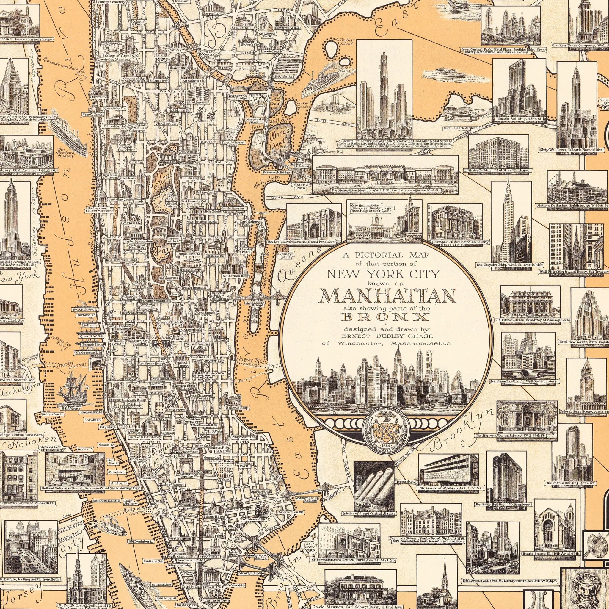
Manhattan Pictorial Map - Vintage 1939 New York City Map for Collectors
Sale priceFrom $39.99
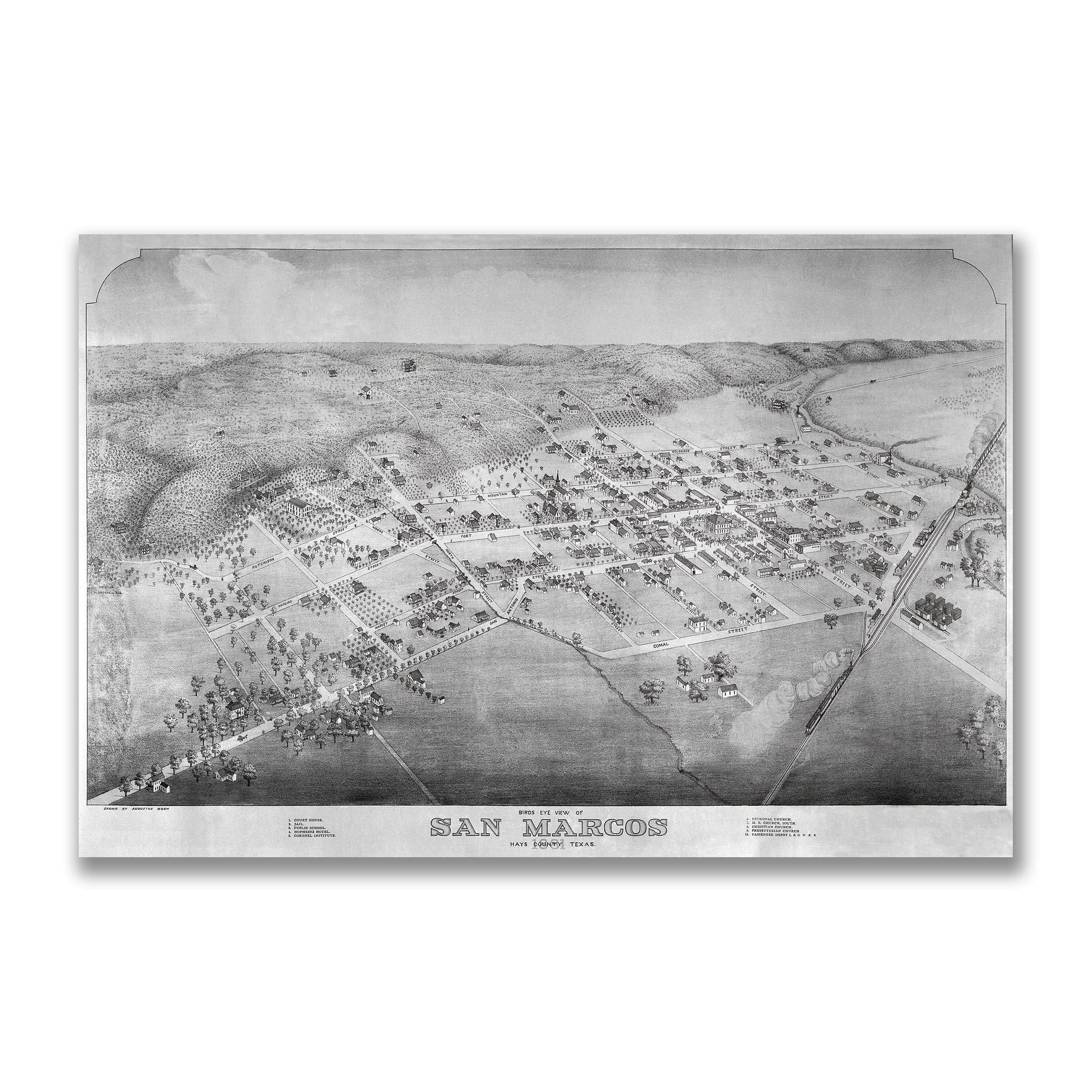
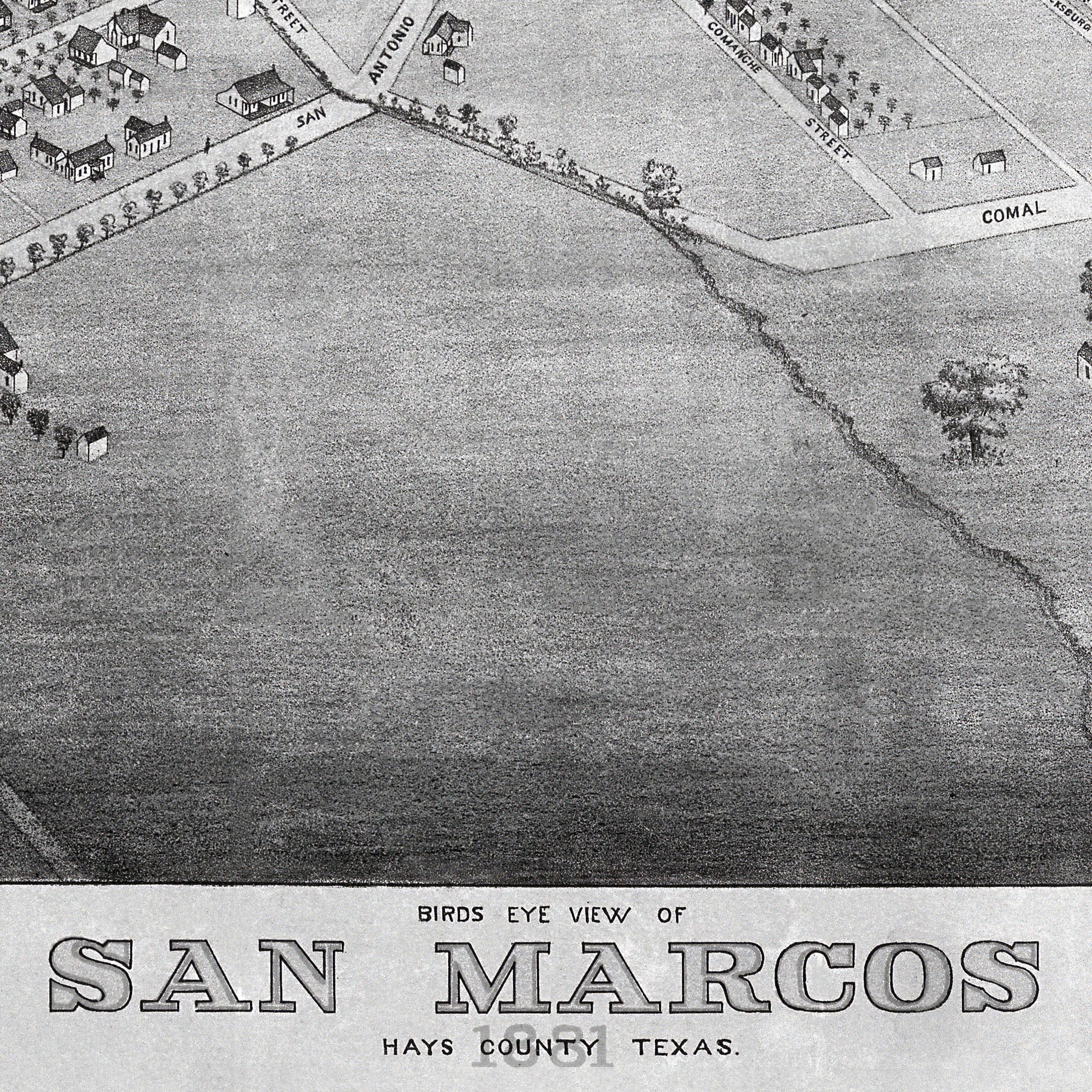
San Marcos Vintage Map - 1881 Bird's-Eye View of Texas
Sale priceFrom $39.99
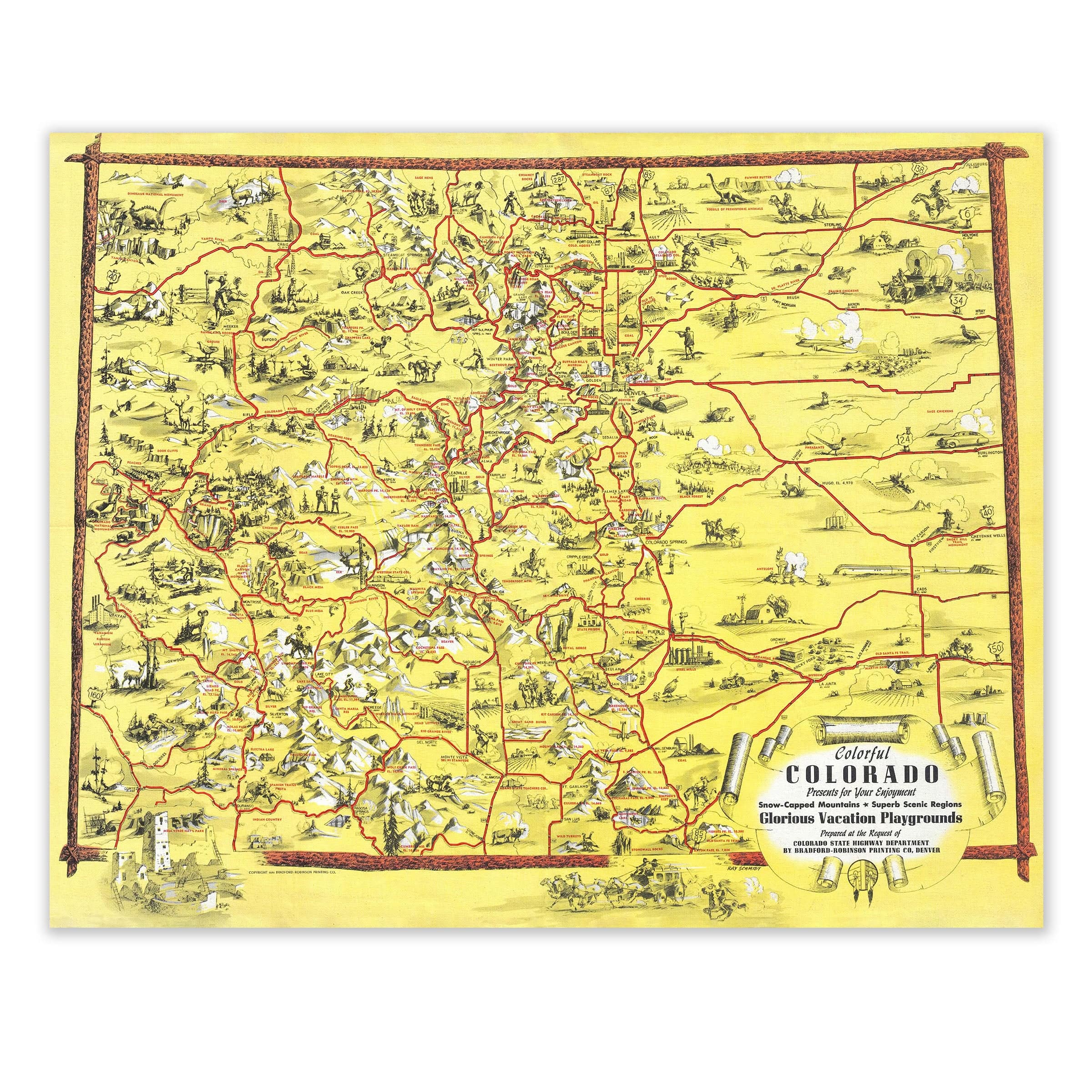
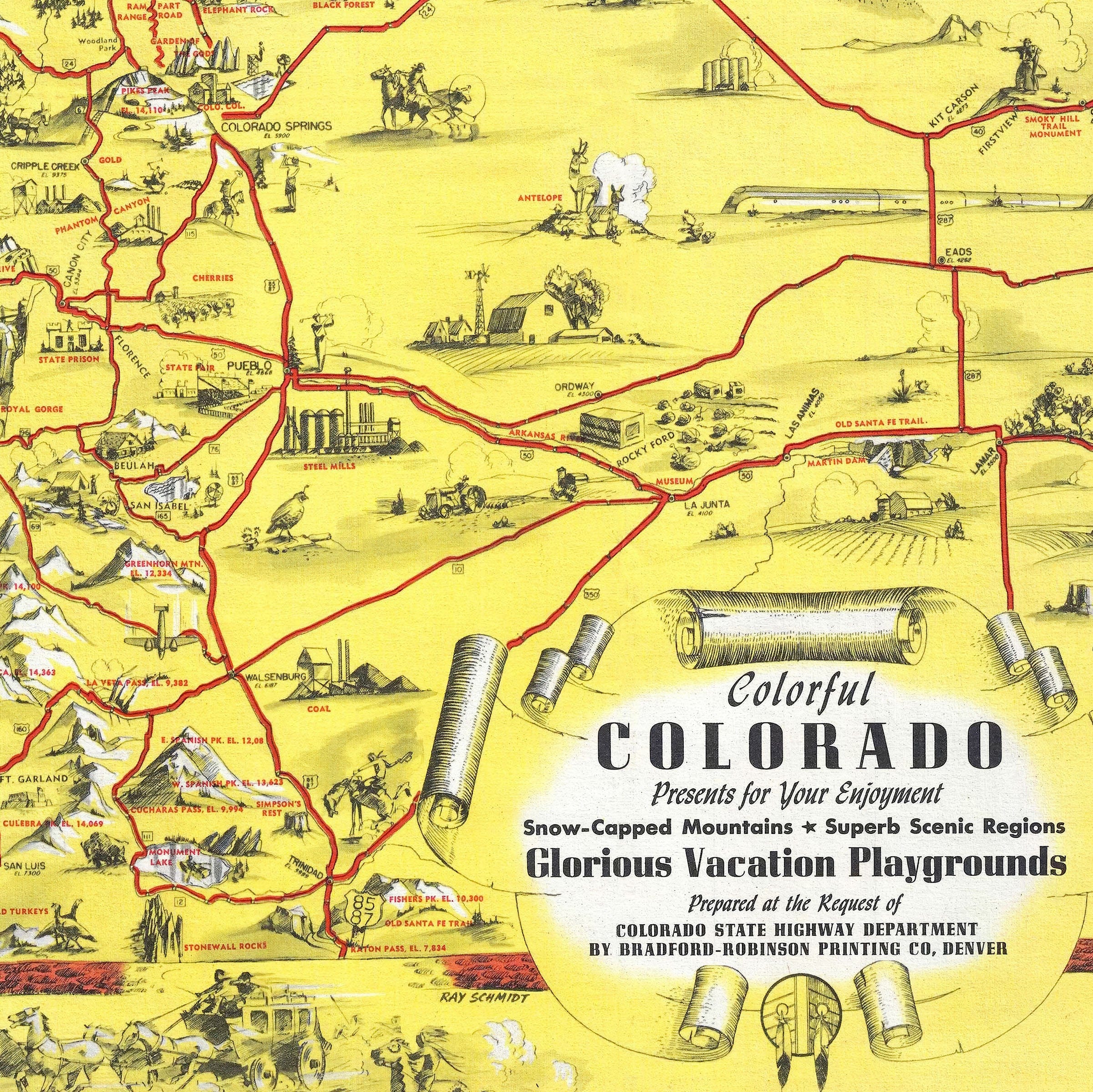
Colorful Colorado 1940 Vintage Pictorial Map Lithograph
Sale priceFrom $39.99
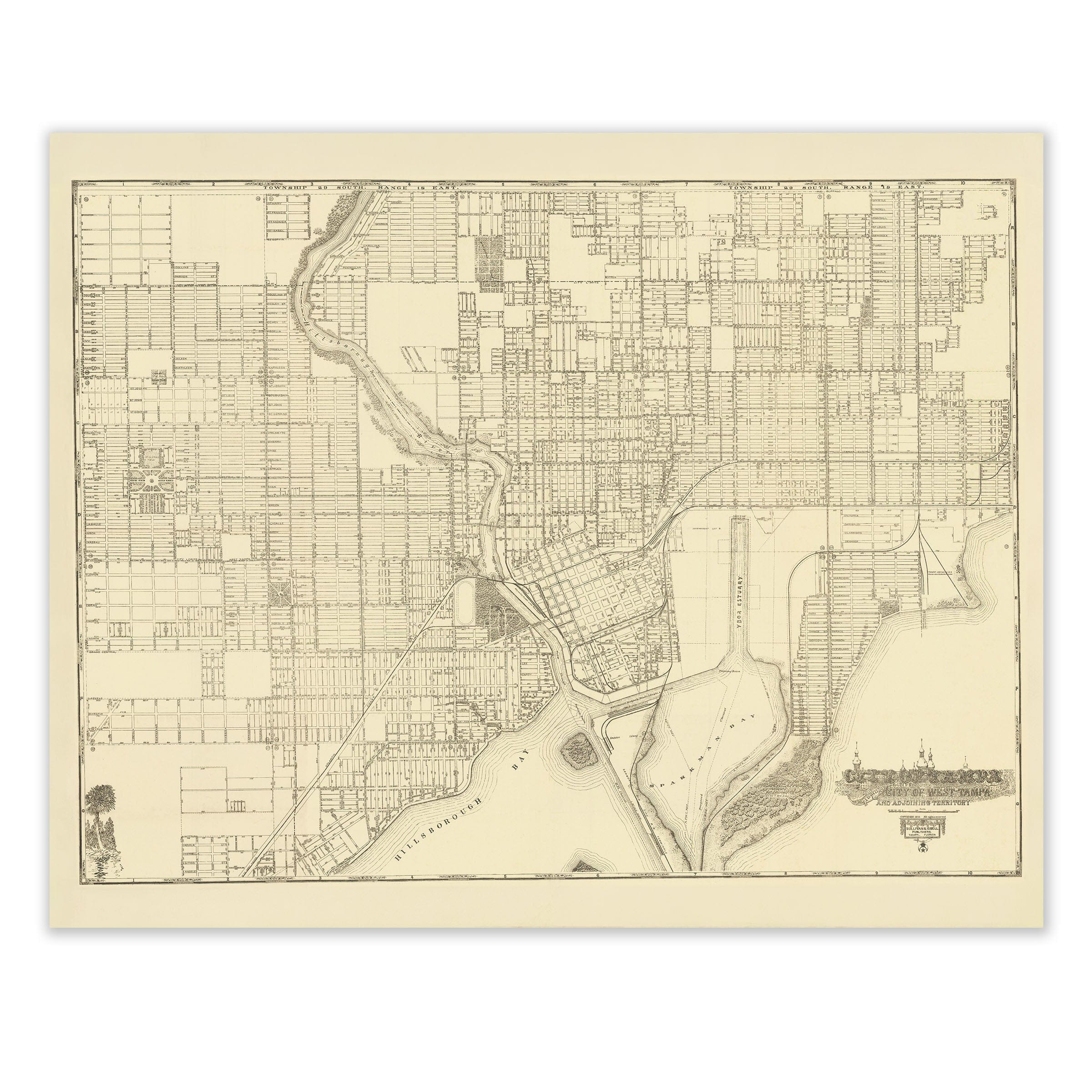
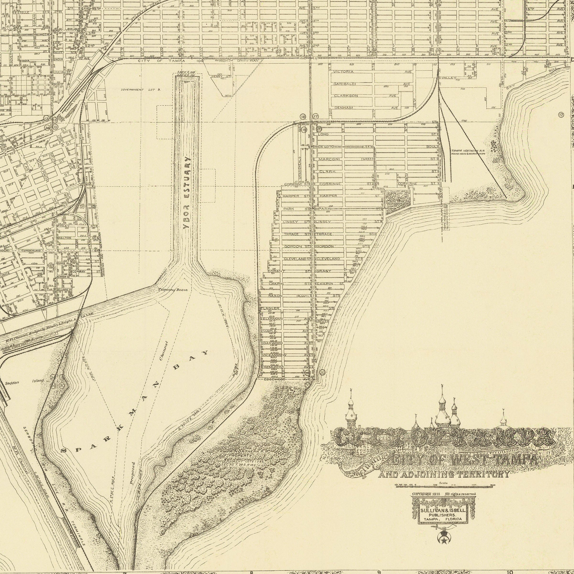
Tampa Vintage Map - 1913 Lithograph of City of Tampa, West Tampa, and Surrounding Areas
Sale priceFrom $39.99

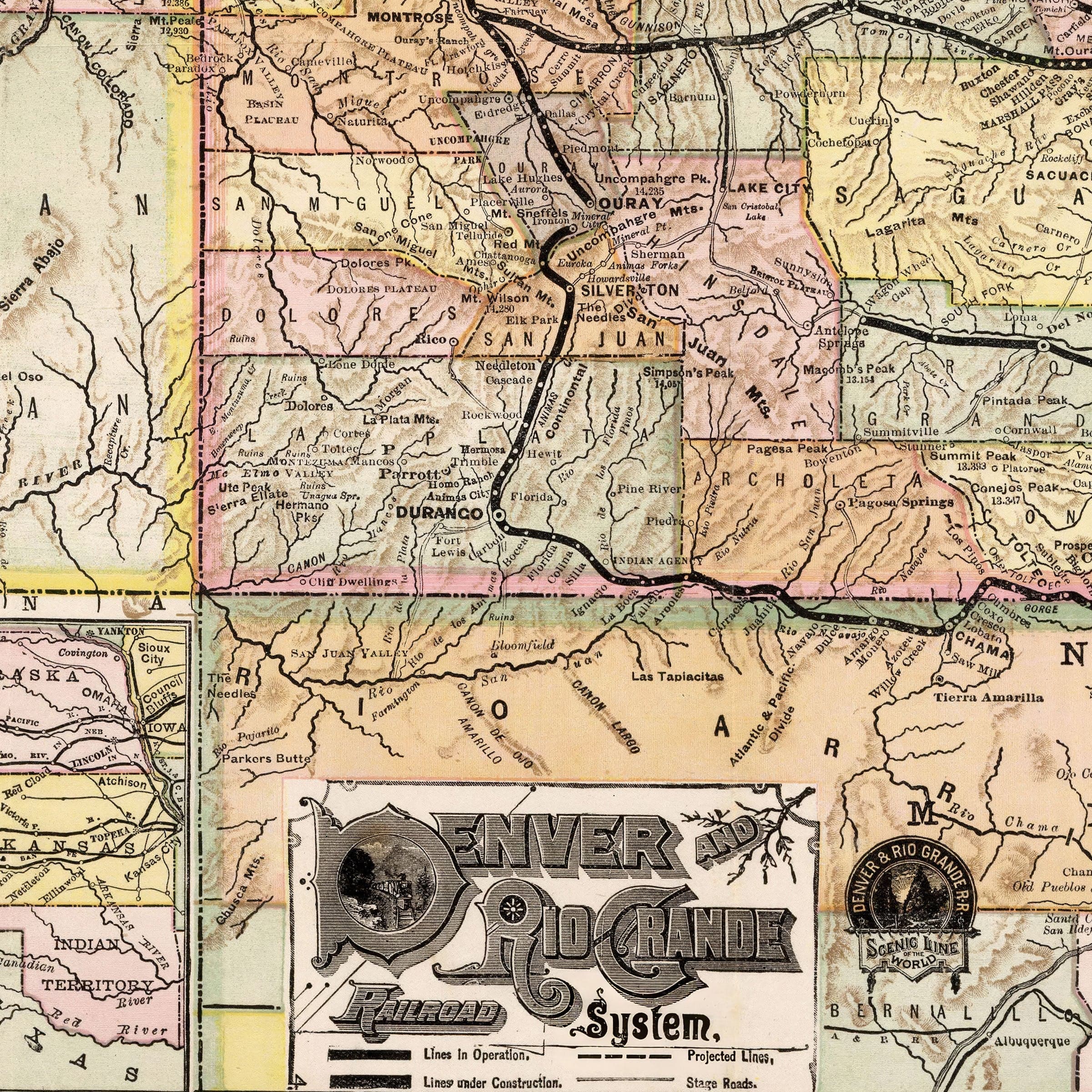
Denver and Rio Grande Railroad Map - Historic System Map from 1883
Sale priceFrom $39.99
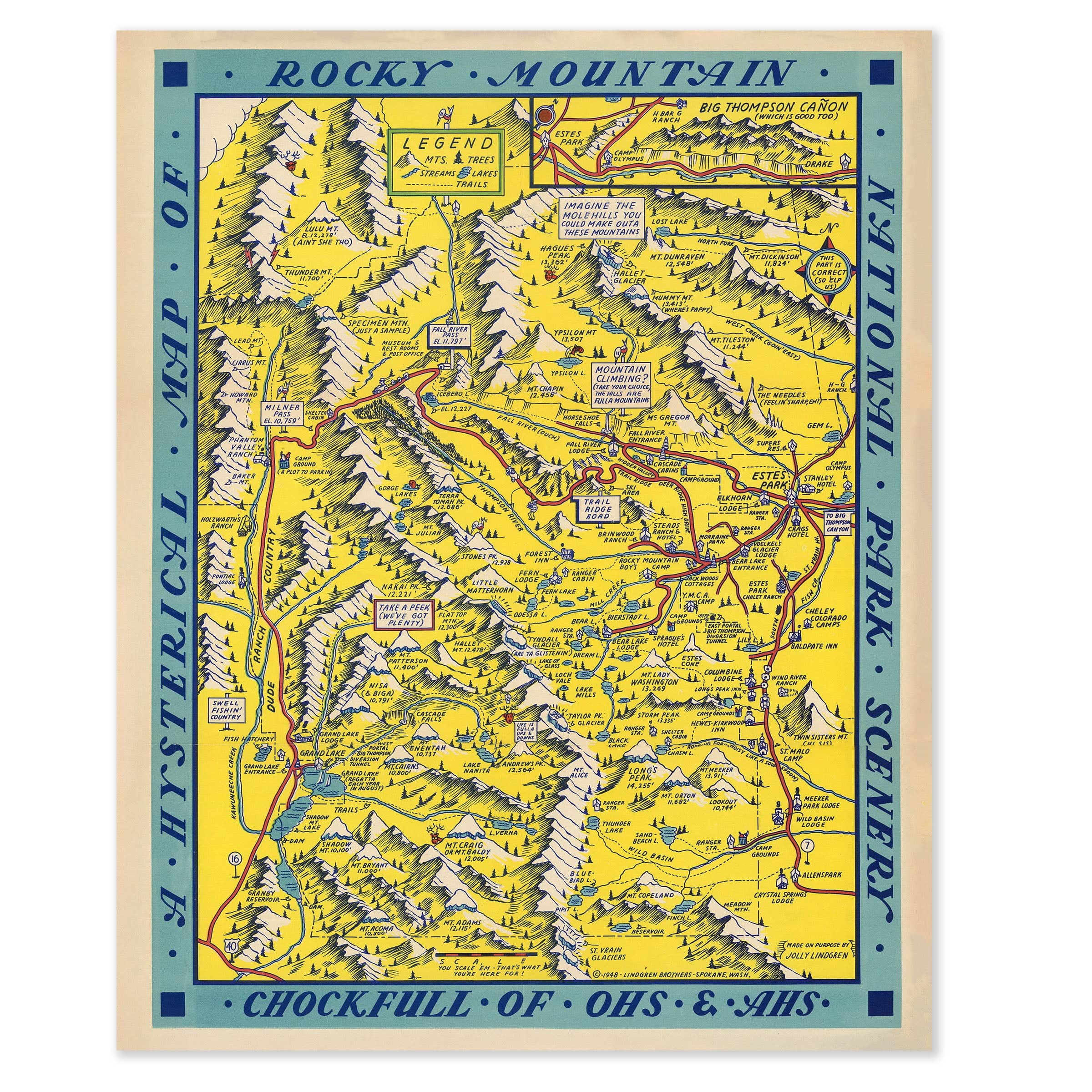
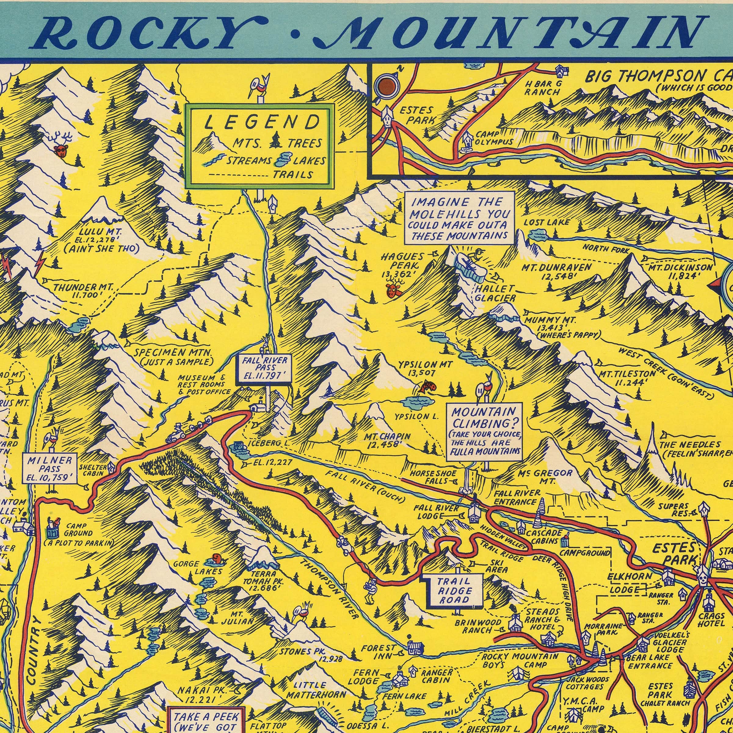
Hysterical Map of Rocky Mountain National Park 1948 - Jolly Lindgren Pictorial Map
Sale priceFrom $39.99
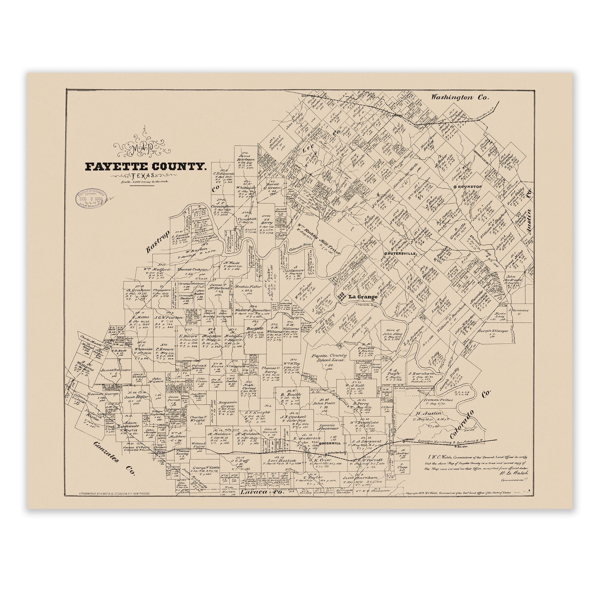
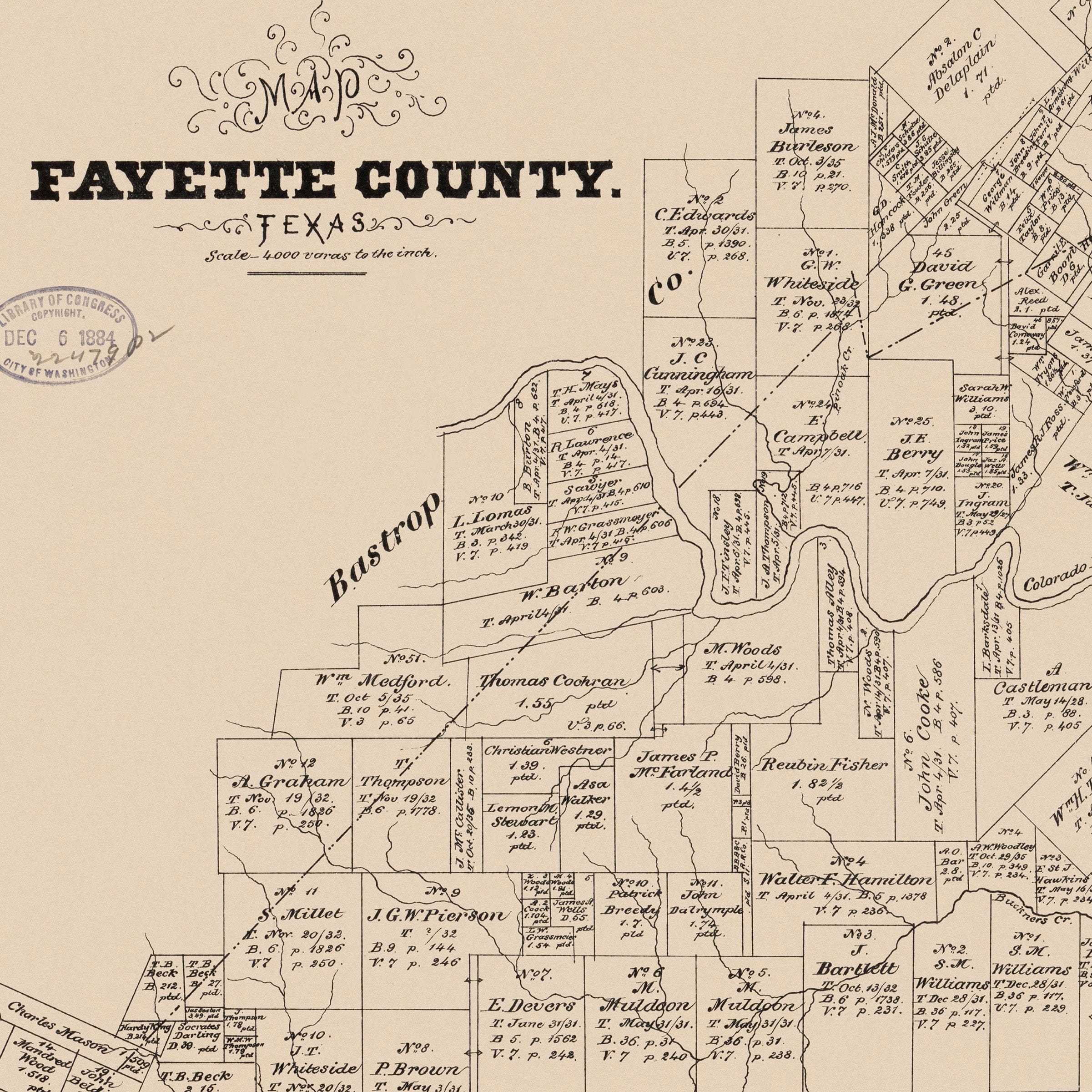
Fayette County Texas Land Ownership Map 1879 - Historical Official Map
Sale priceFrom $39.99
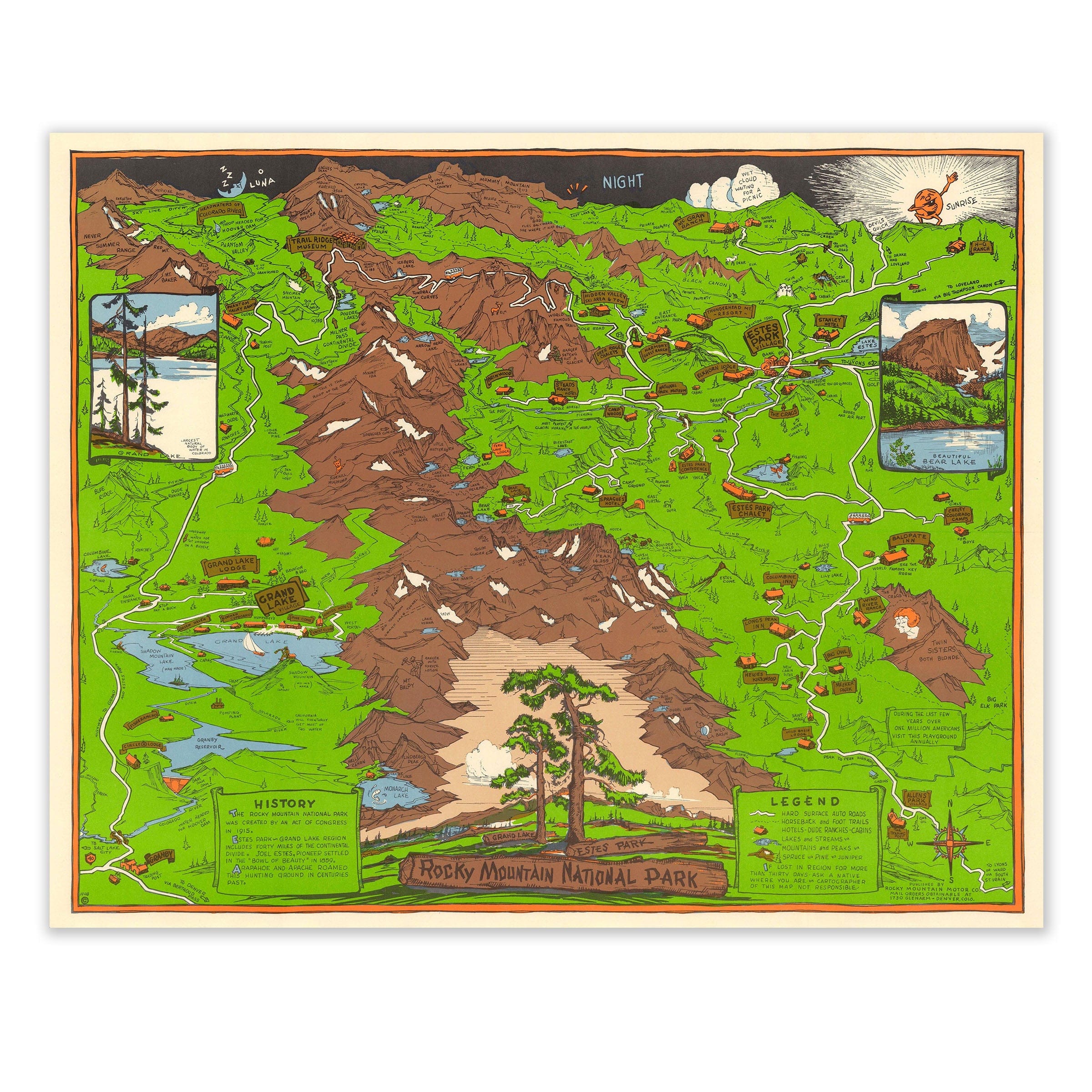
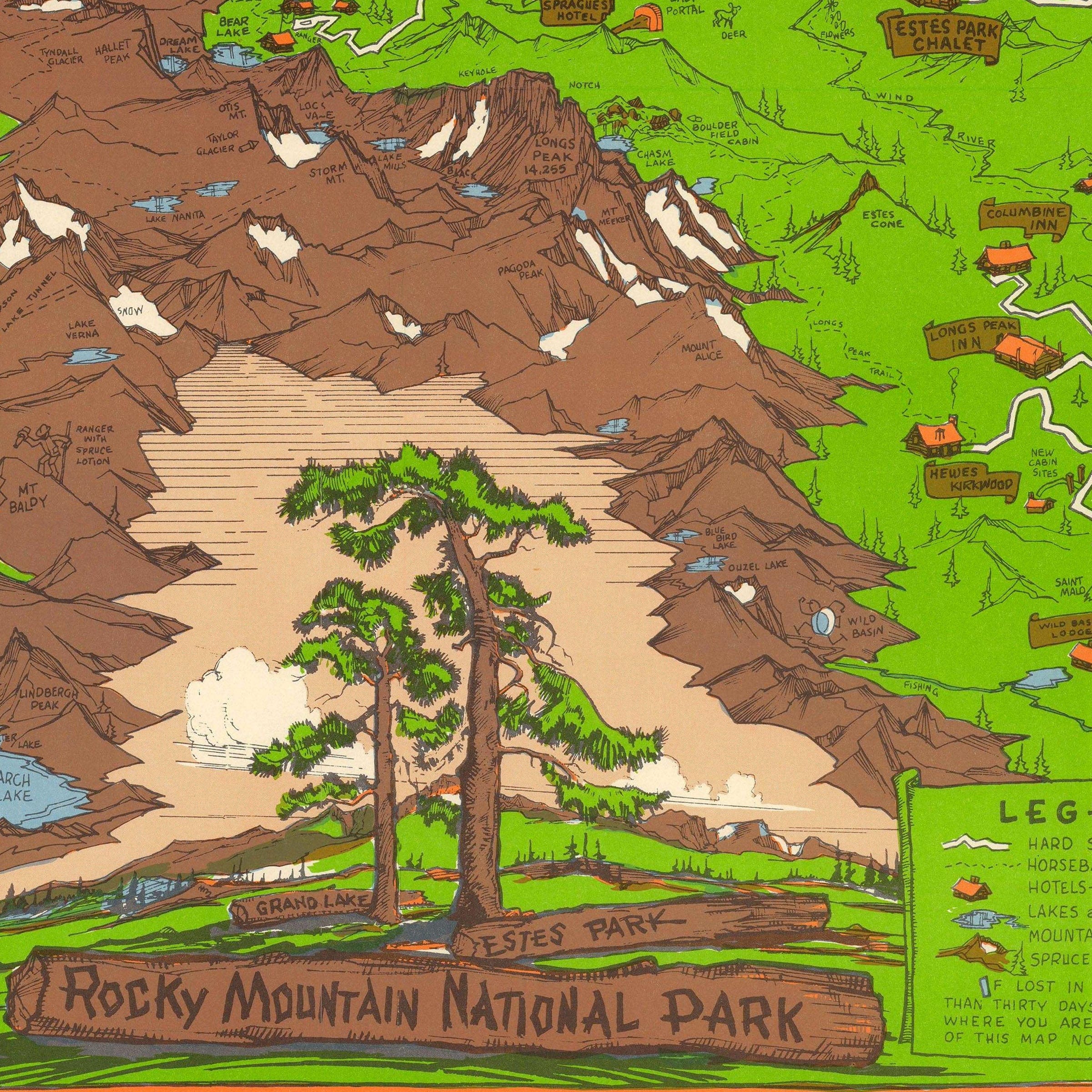
Rocky Mountain National Park (Estes Park) 1948 - Richardson Rome Pictorial Map
Sale priceFrom $39.99
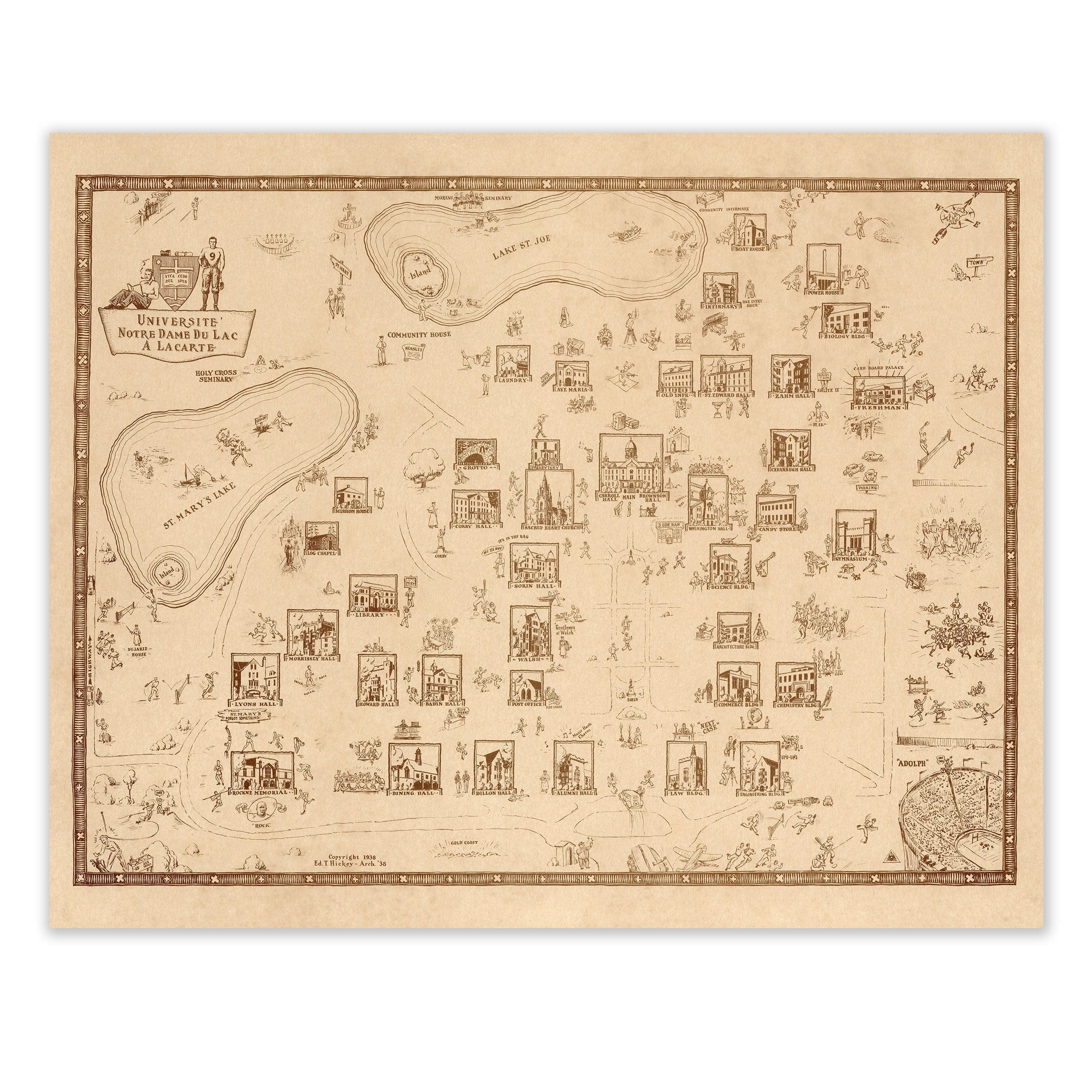
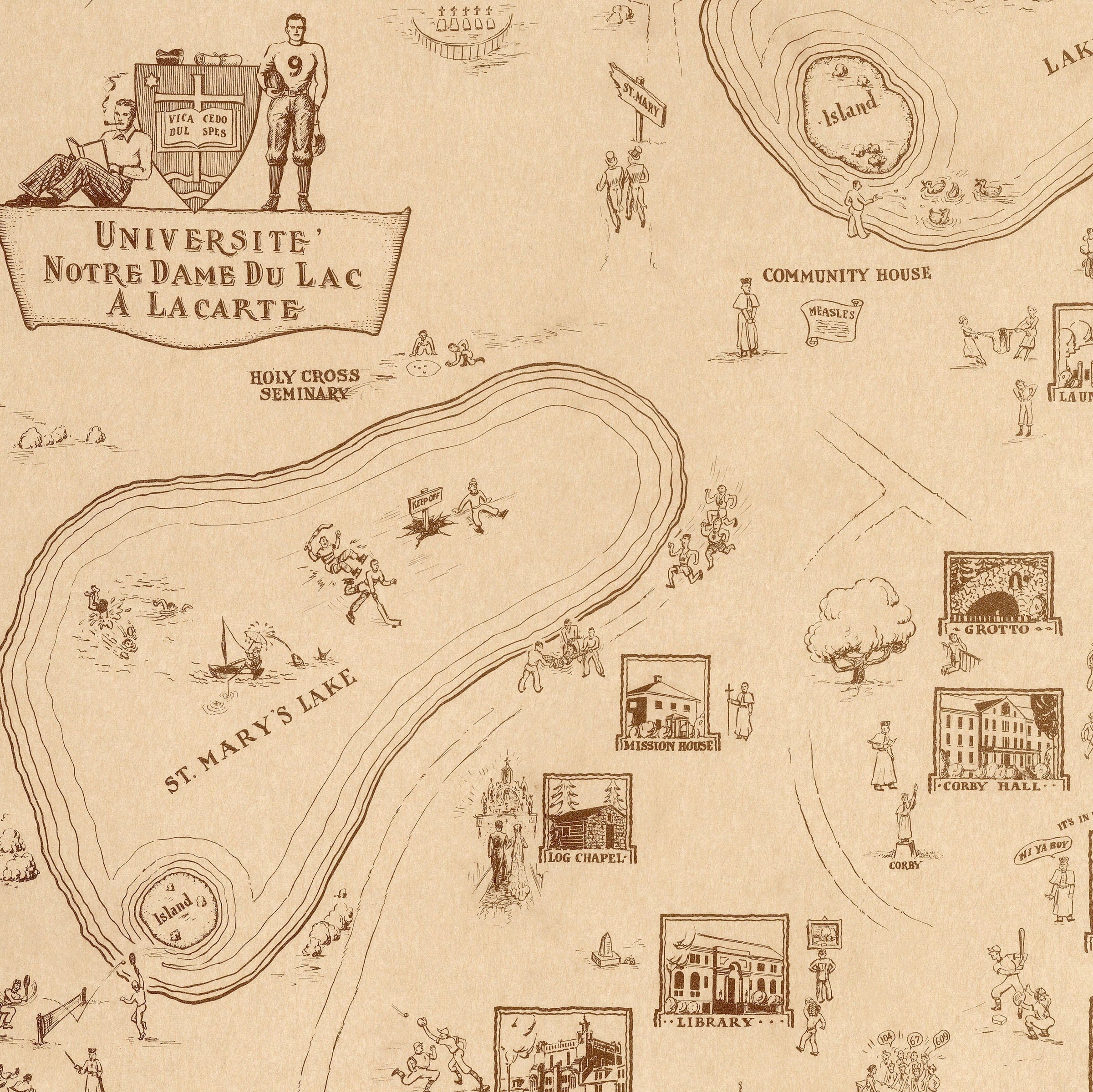
Université Notre Dame Campus Map 1938 - Ed Hickey Campus Map
Sale priceFrom $39.99