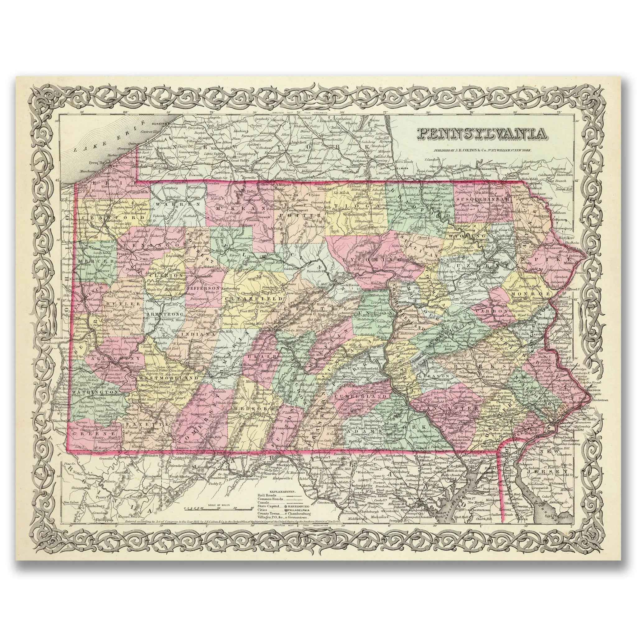
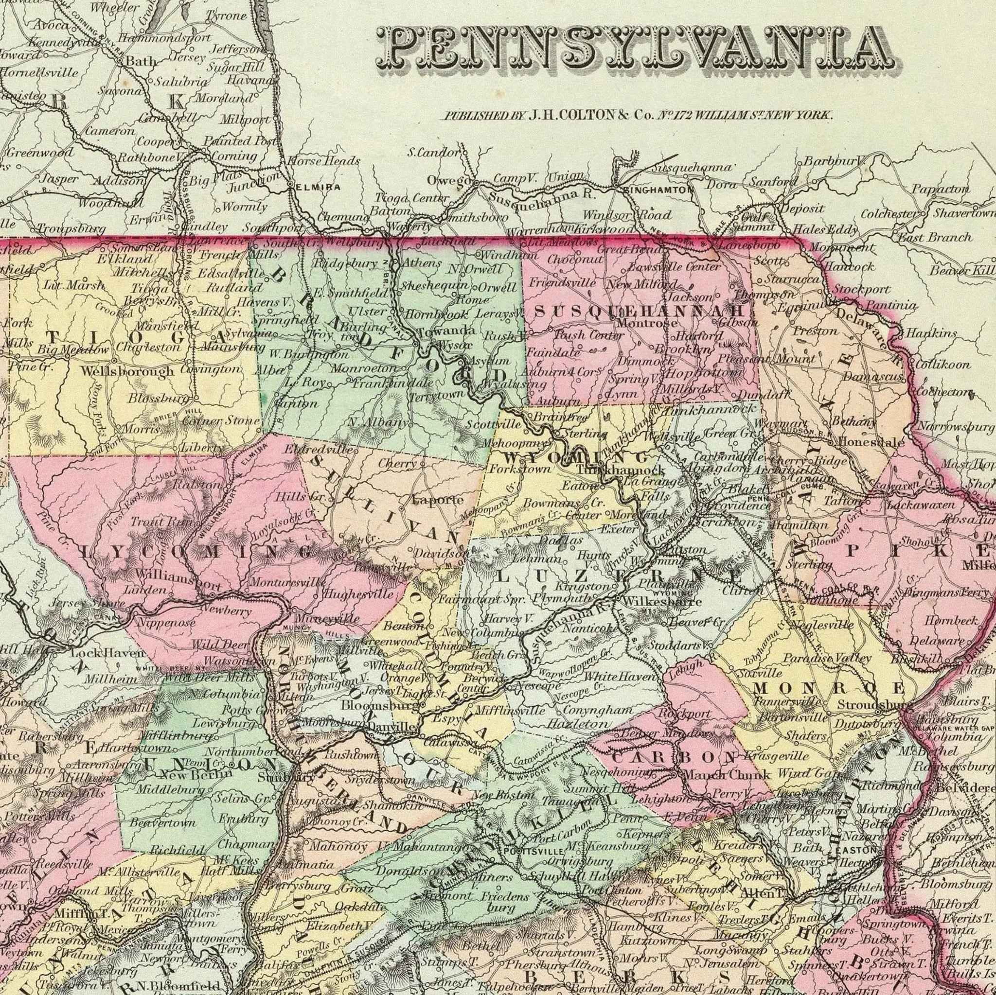
Vintage Pennsylvania Map - Vintage 1856 Colton Historical Map
Sale priceFrom $34.00
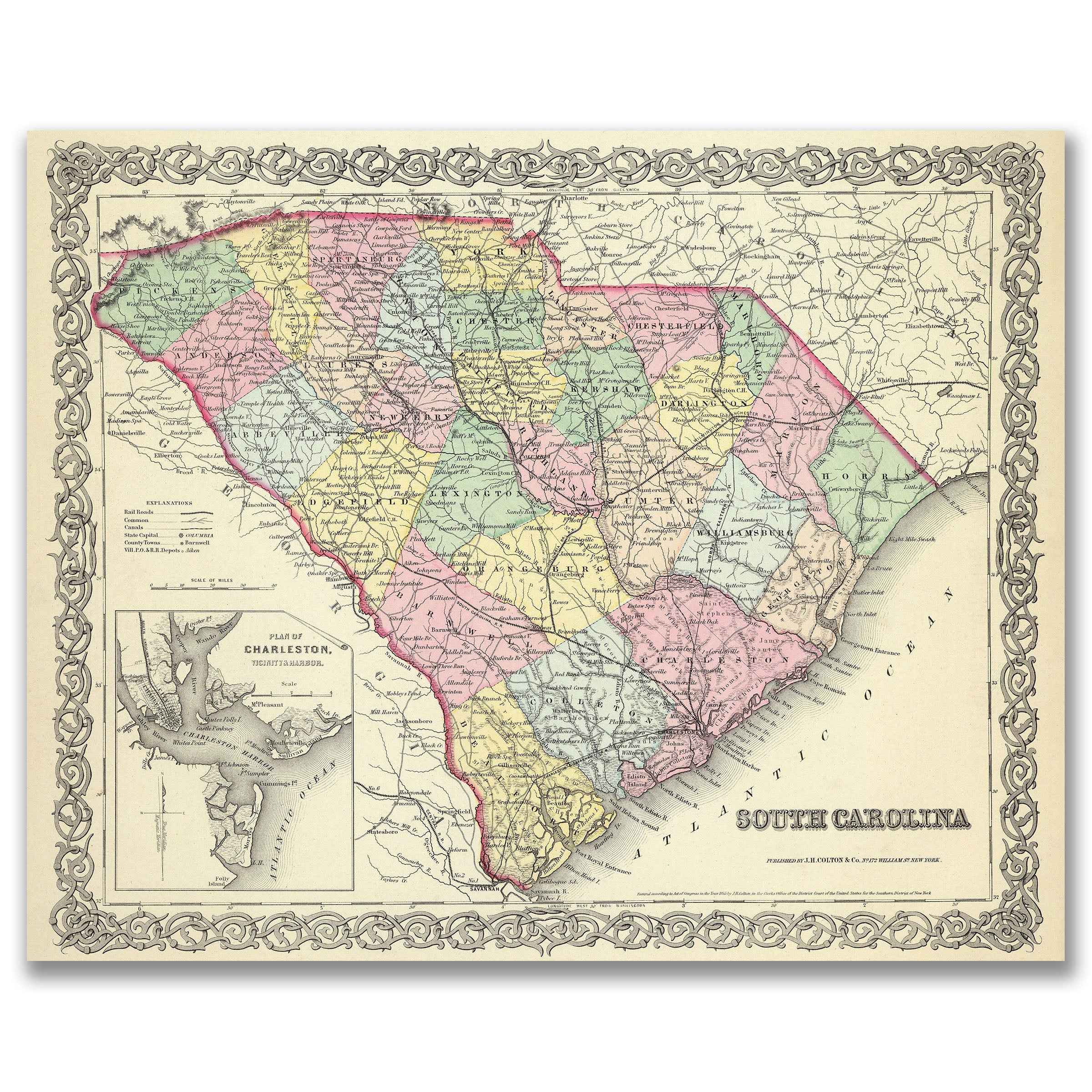
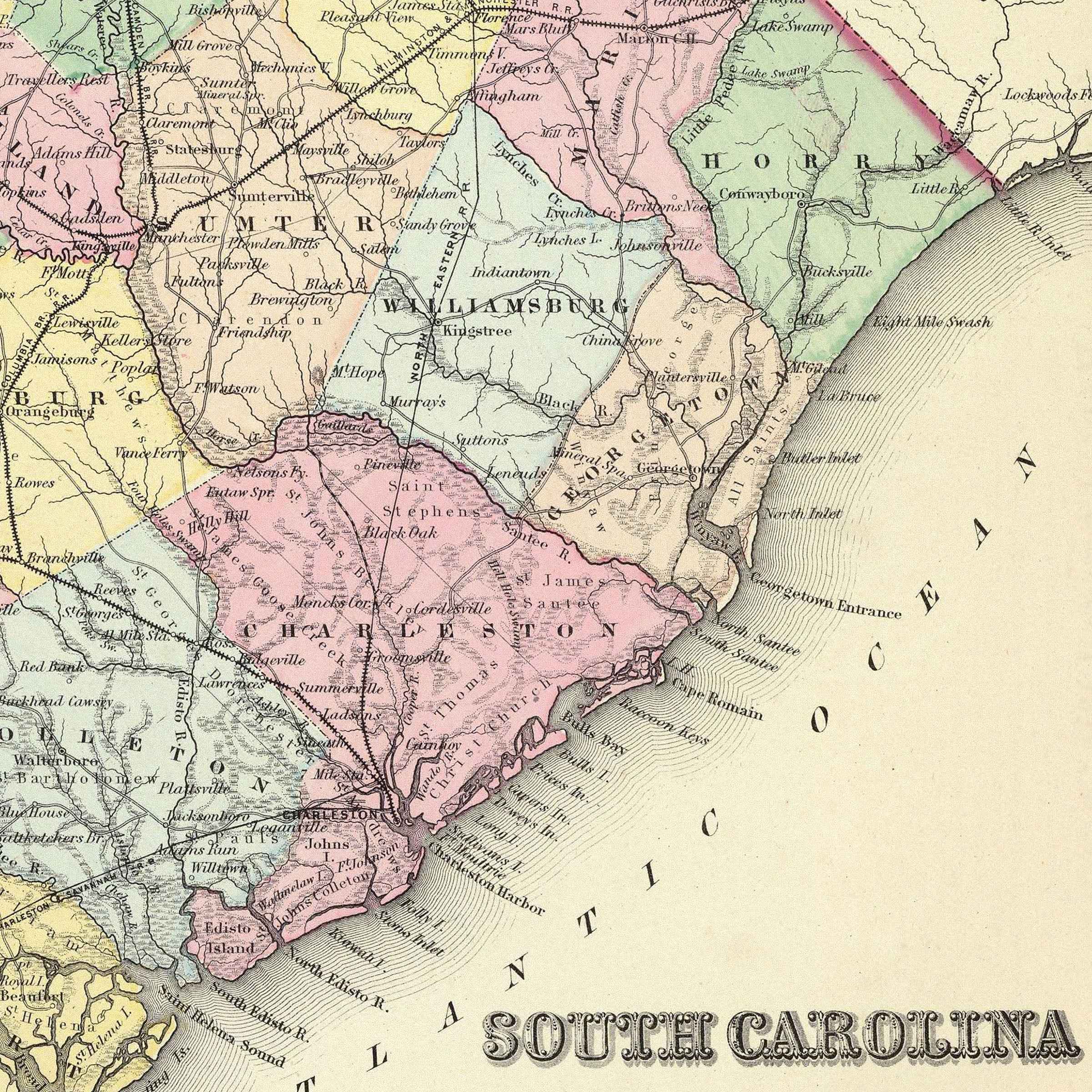
South Carolina Map - Vintage 1856 Colton Historical Map with Charleston Harbor
Sale priceFrom $34.00

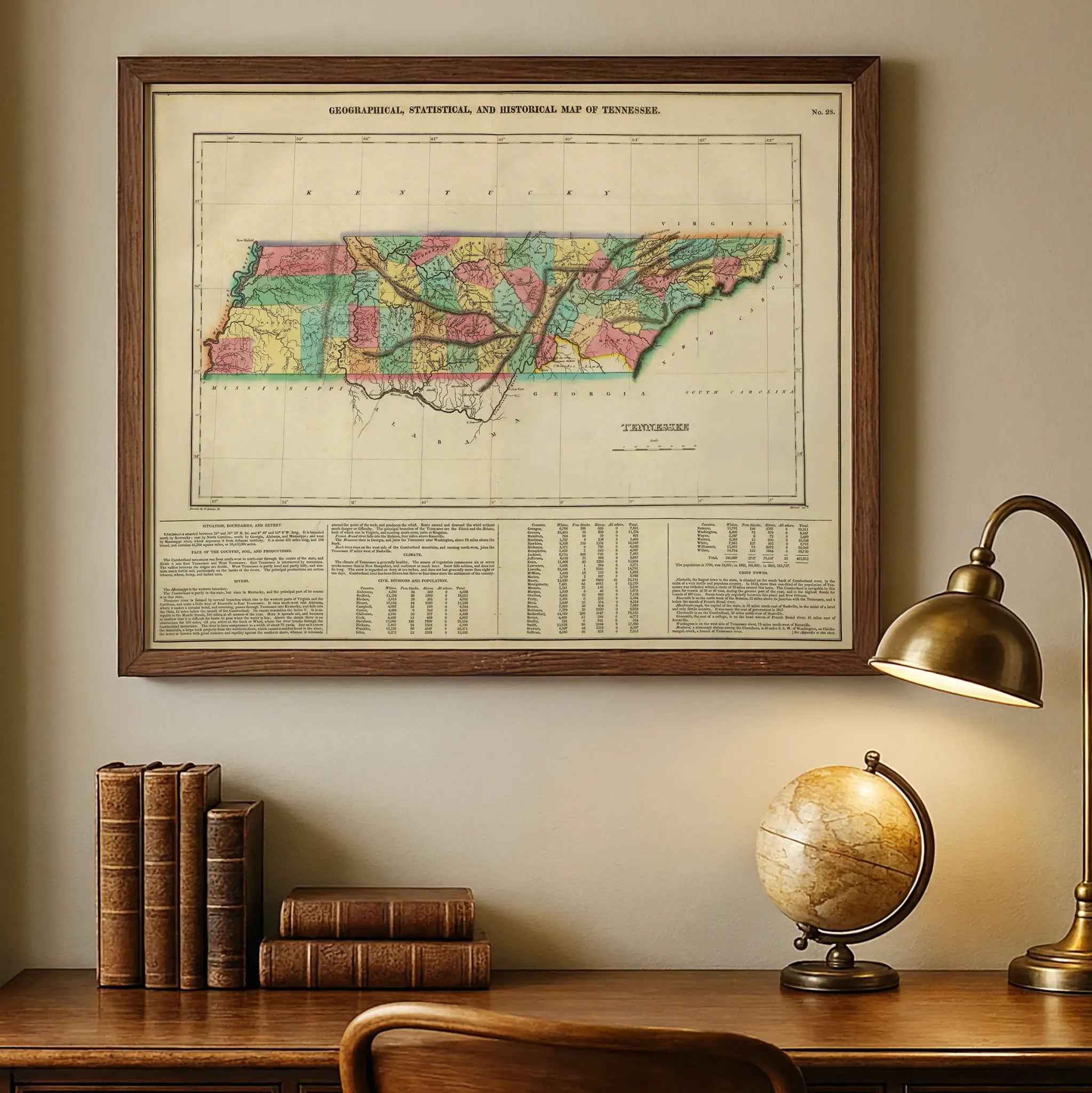
Tennessee Map - Vintage 1822 Carey & Lea Historical Map
Sale priceFrom $34.00

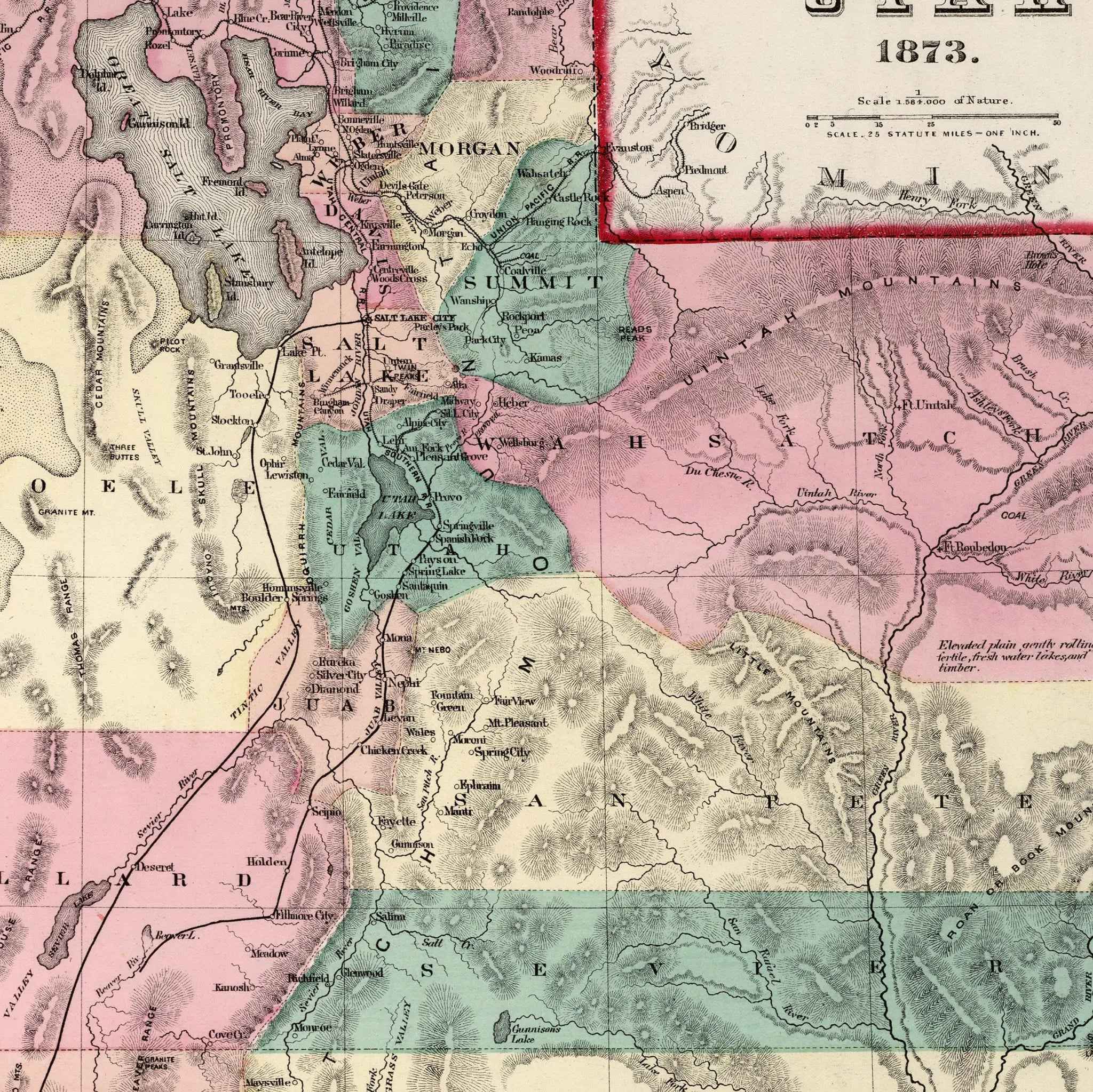
Utah Map - Vintage 1873 Gray's Atlas Historical Map for Collectors
Sale priceFrom $34.00

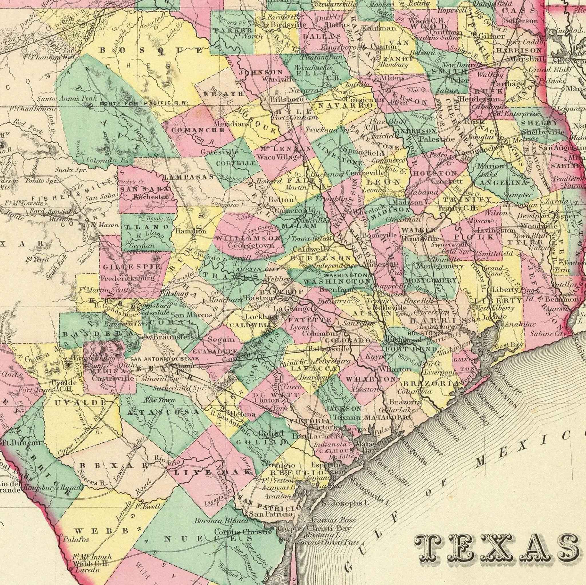
Texas Map - Vintage 1856 Colton Historical Wall Art
Sale priceFrom $34.00
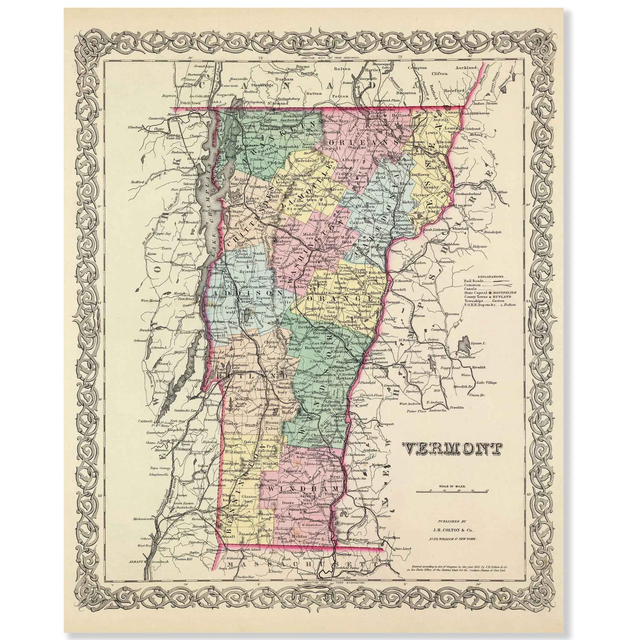
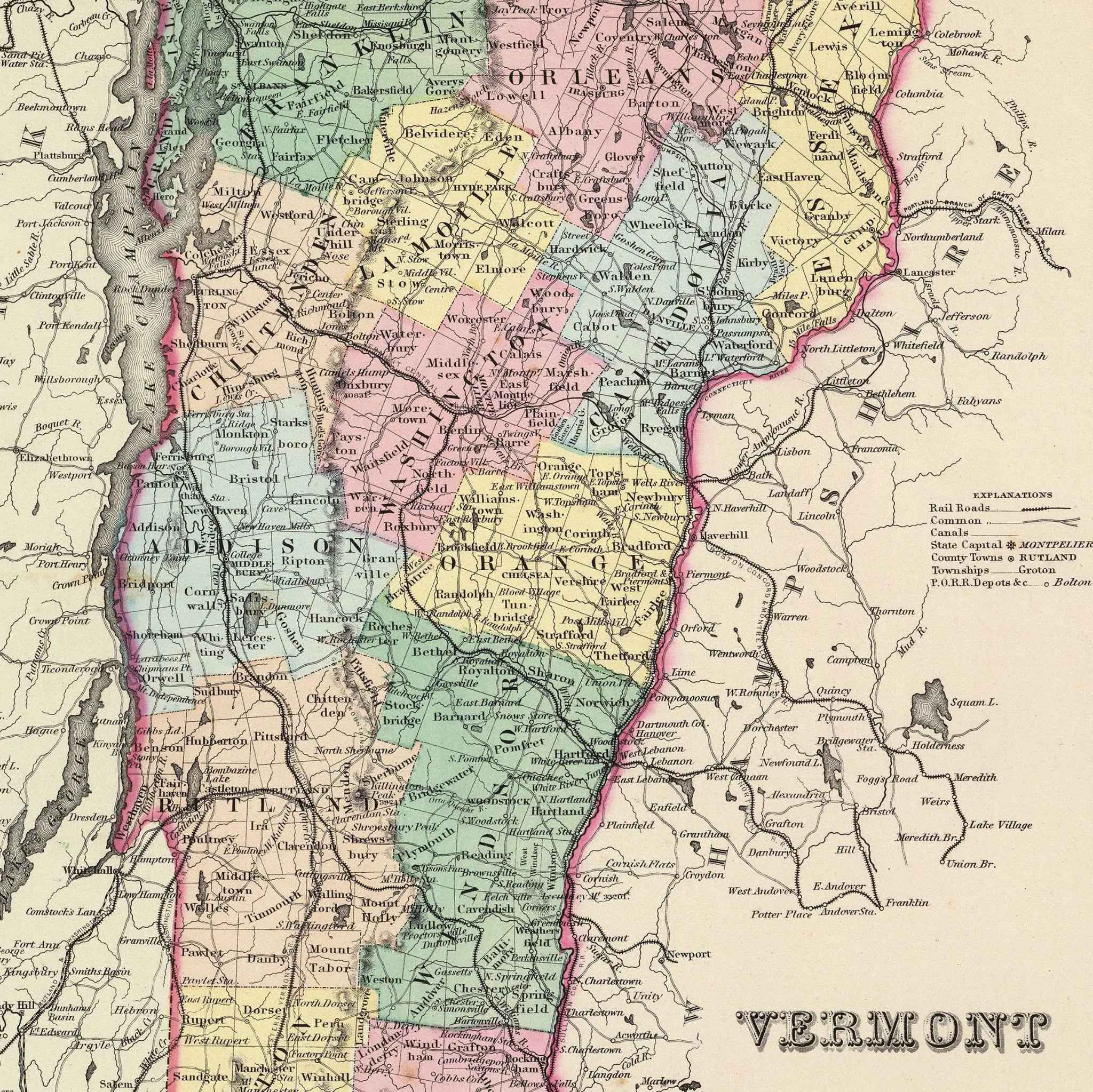
Vermont Map - Vintage 1855 Colton Historical Map for Home Decor
Sale priceFrom $34.00
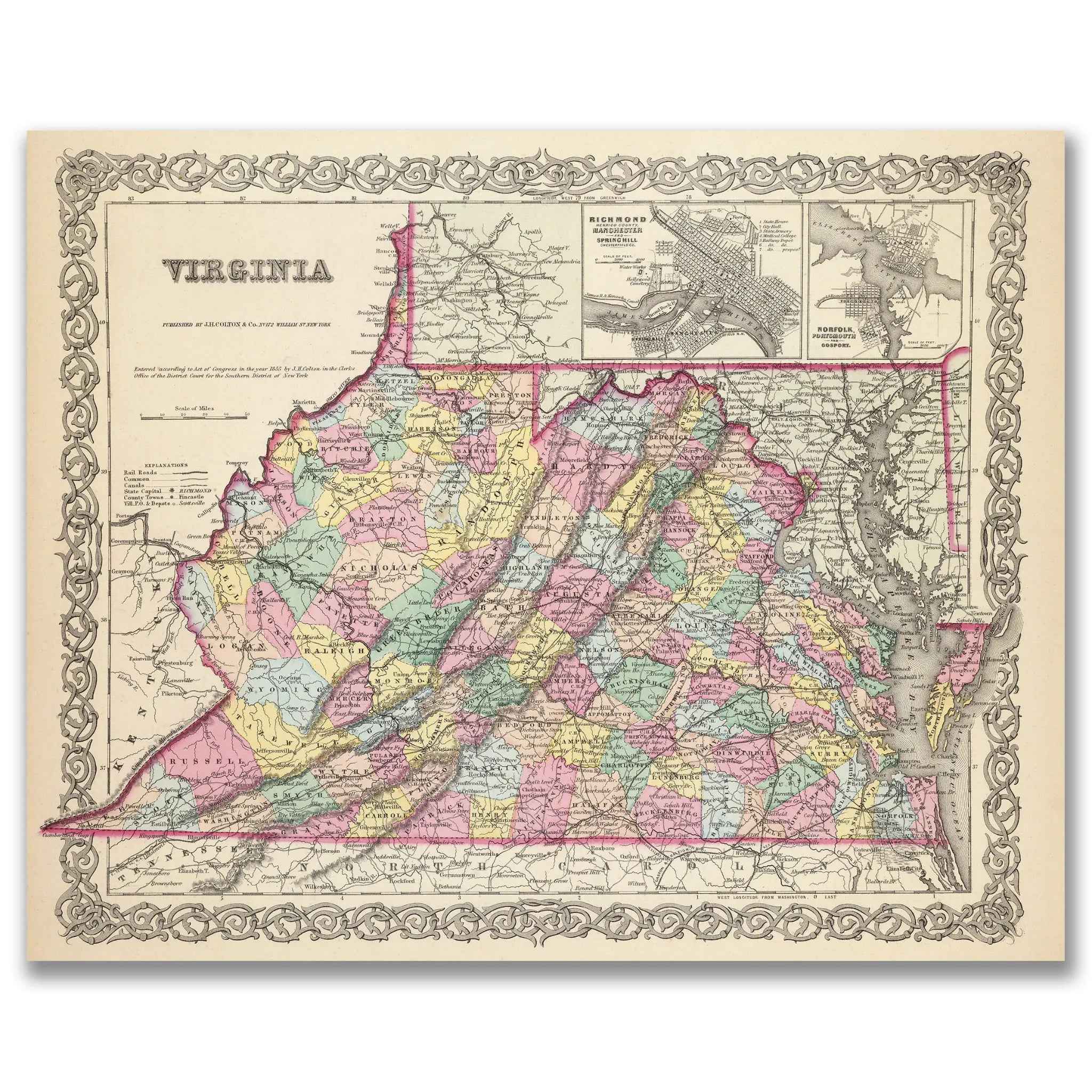
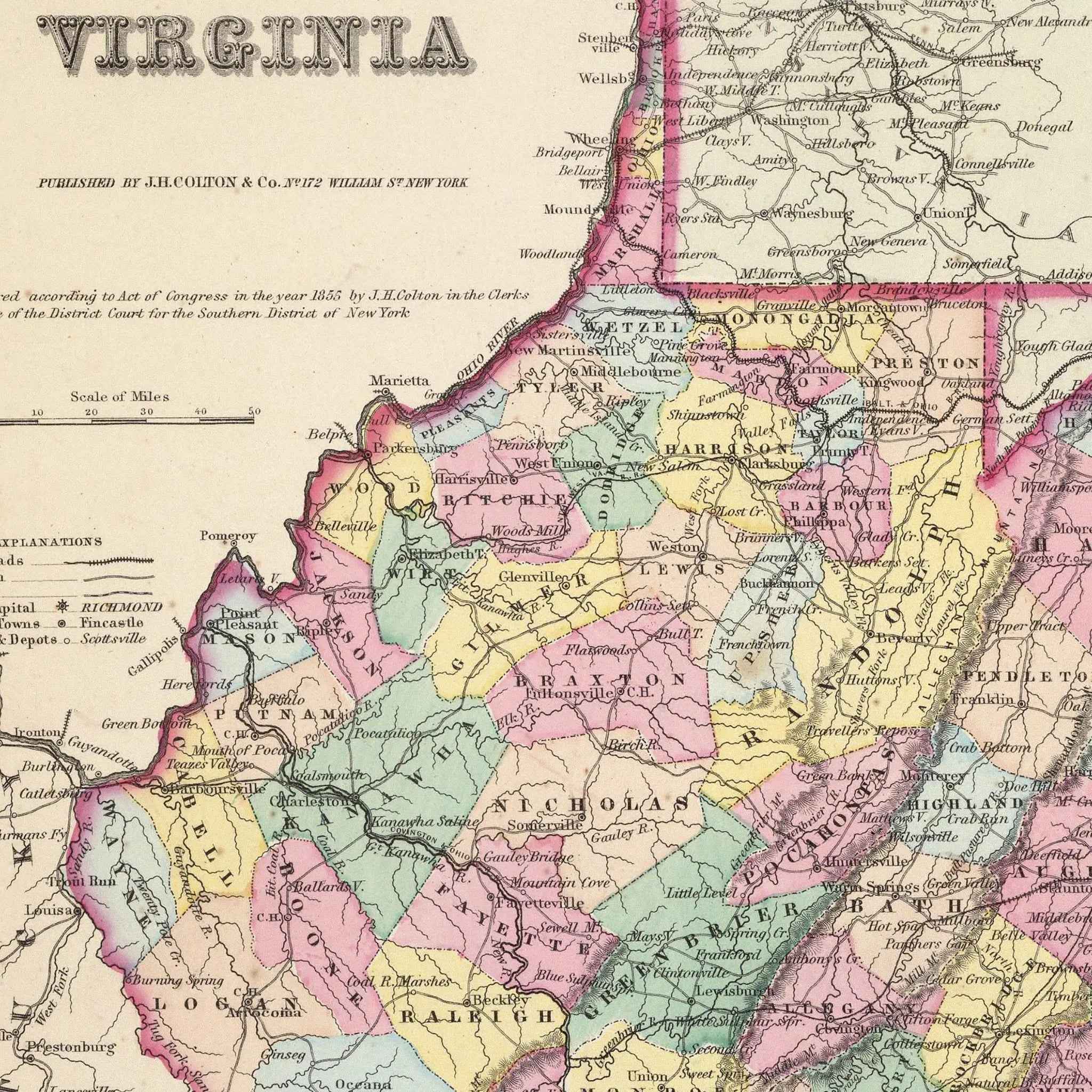
Virginia Map - Vintage 1855 Colton Historical Map for Collectors
Sale priceFrom $34.00

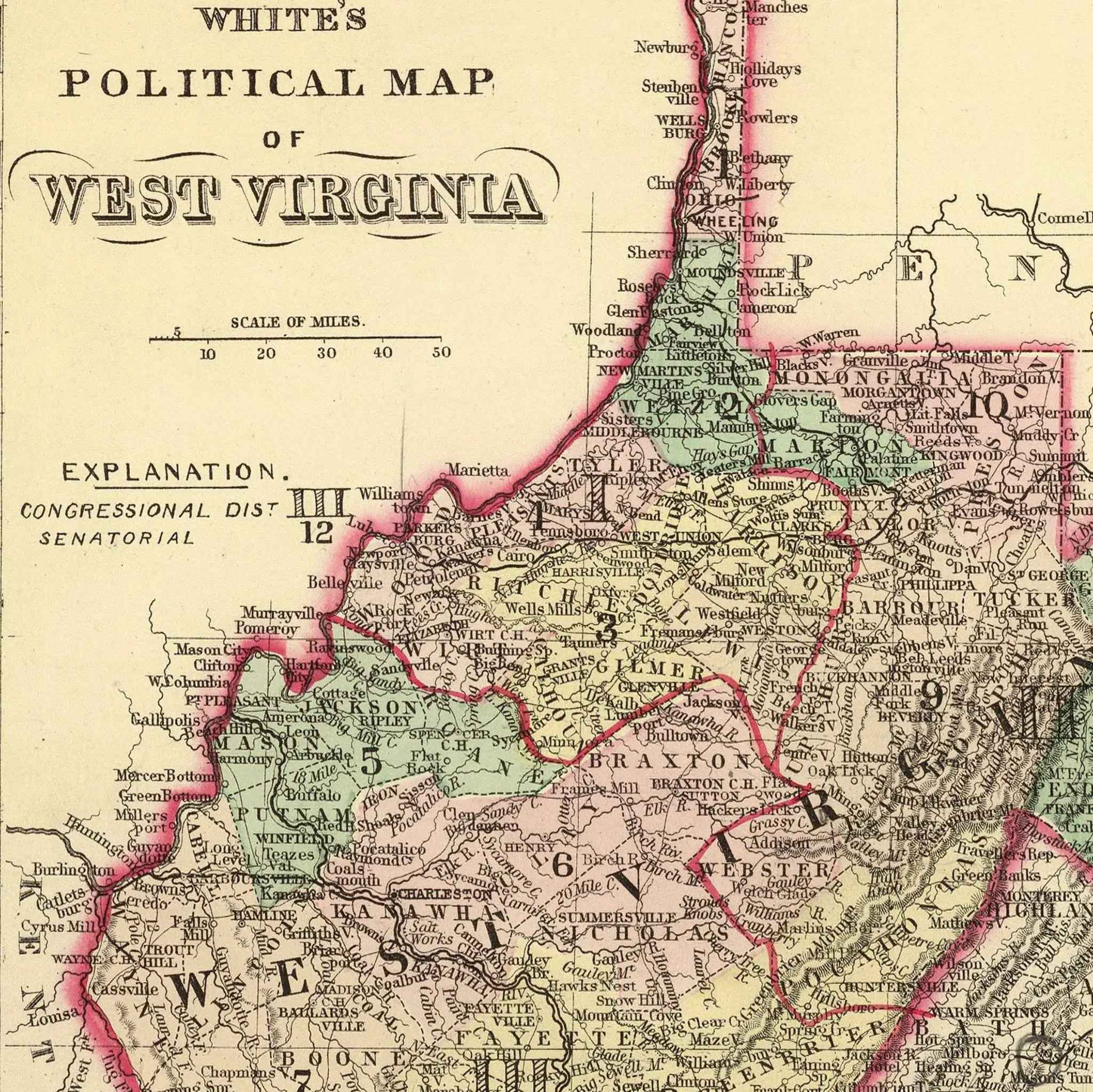
West Virginia Map - Vintage 1873 White's Political Map for Collectors
Sale priceFrom $34.00
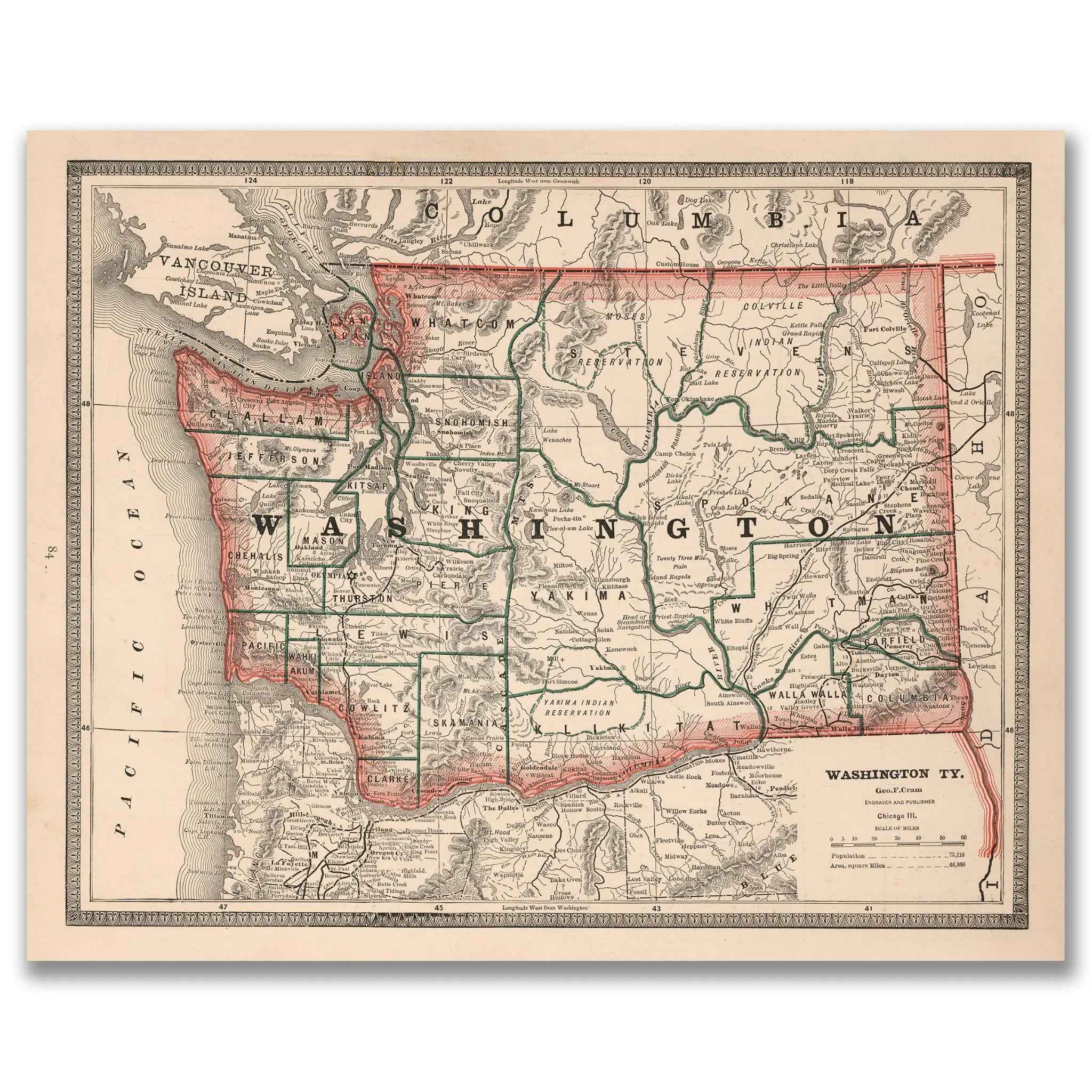
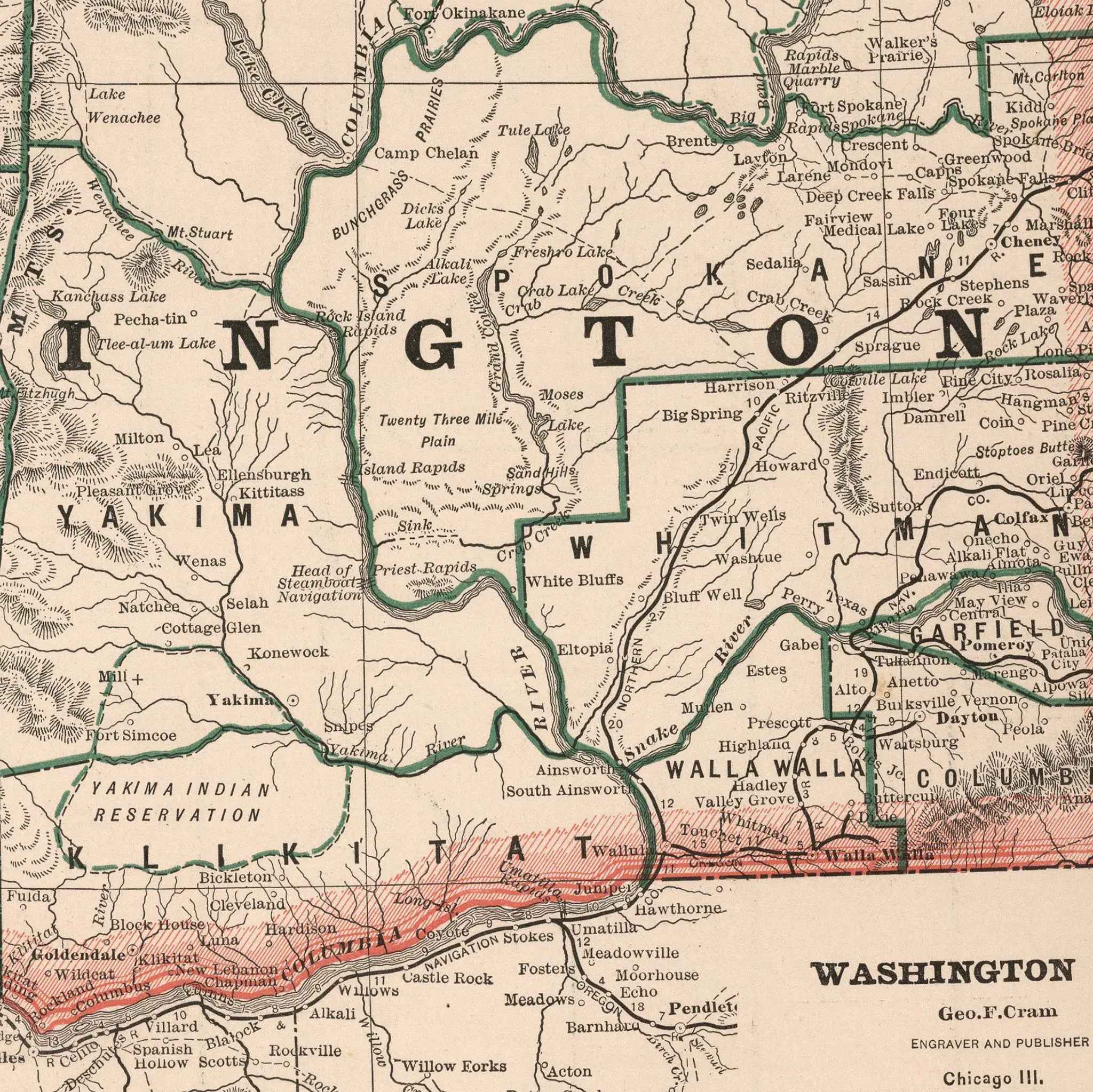
Washington State Map - Vintage 1883 Cram Historical Map of Washington Territory
Sale priceFrom $34.00

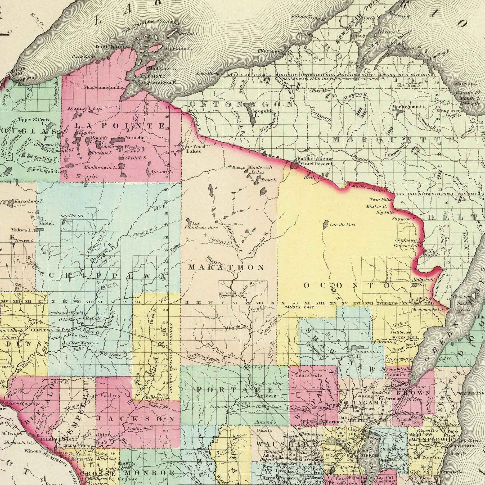
Wisconsin Map - Vintage 1855 Colton Historical Map
Sale priceFrom $34.00
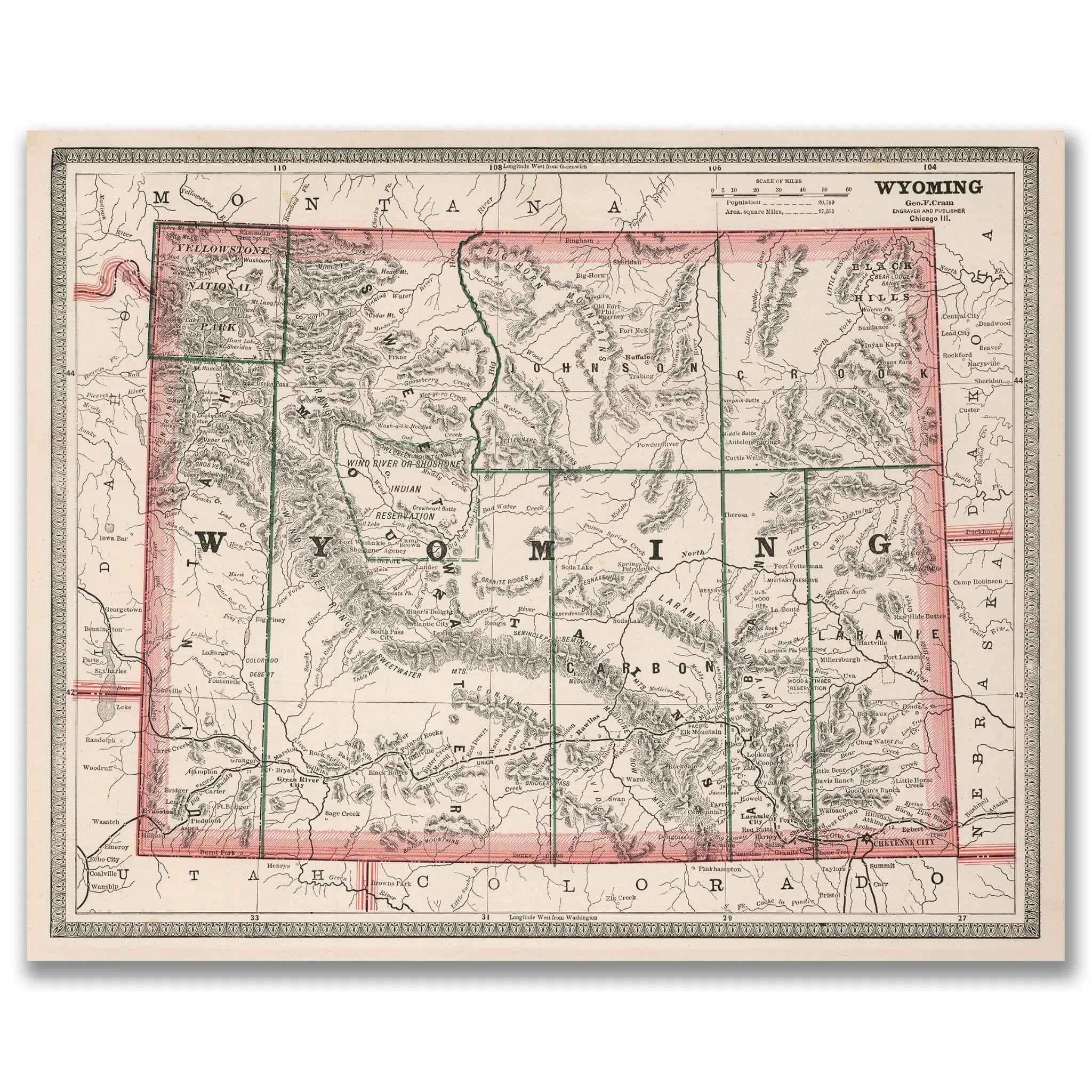
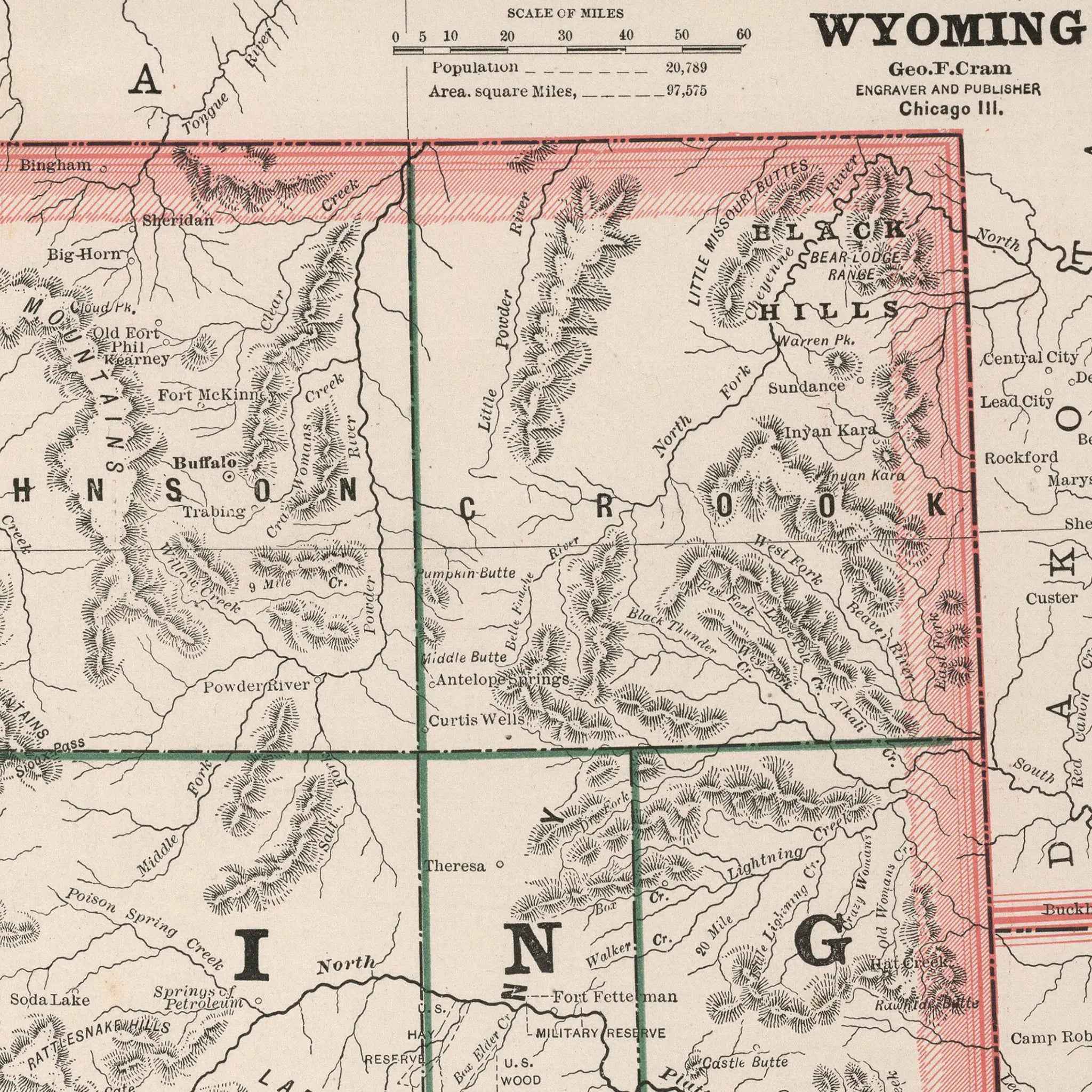
Wyoming Map - Vintage 1883 Cram Historical Territory Map
Sale priceFrom $34.00
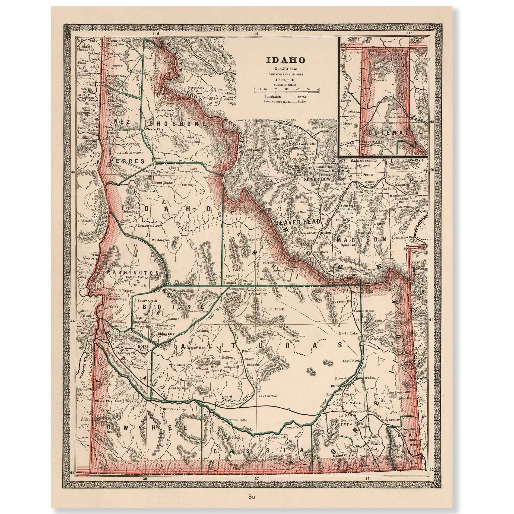
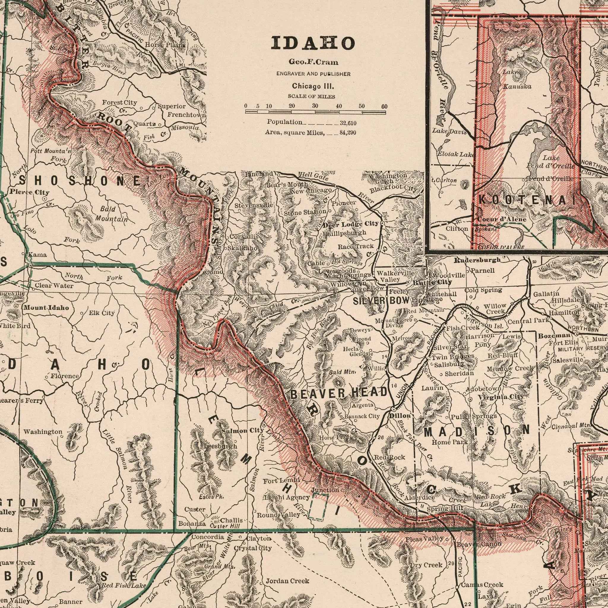
Idaho Map - Vintage 1883 Cram Historical Territory Map
Sale priceFrom $34.00
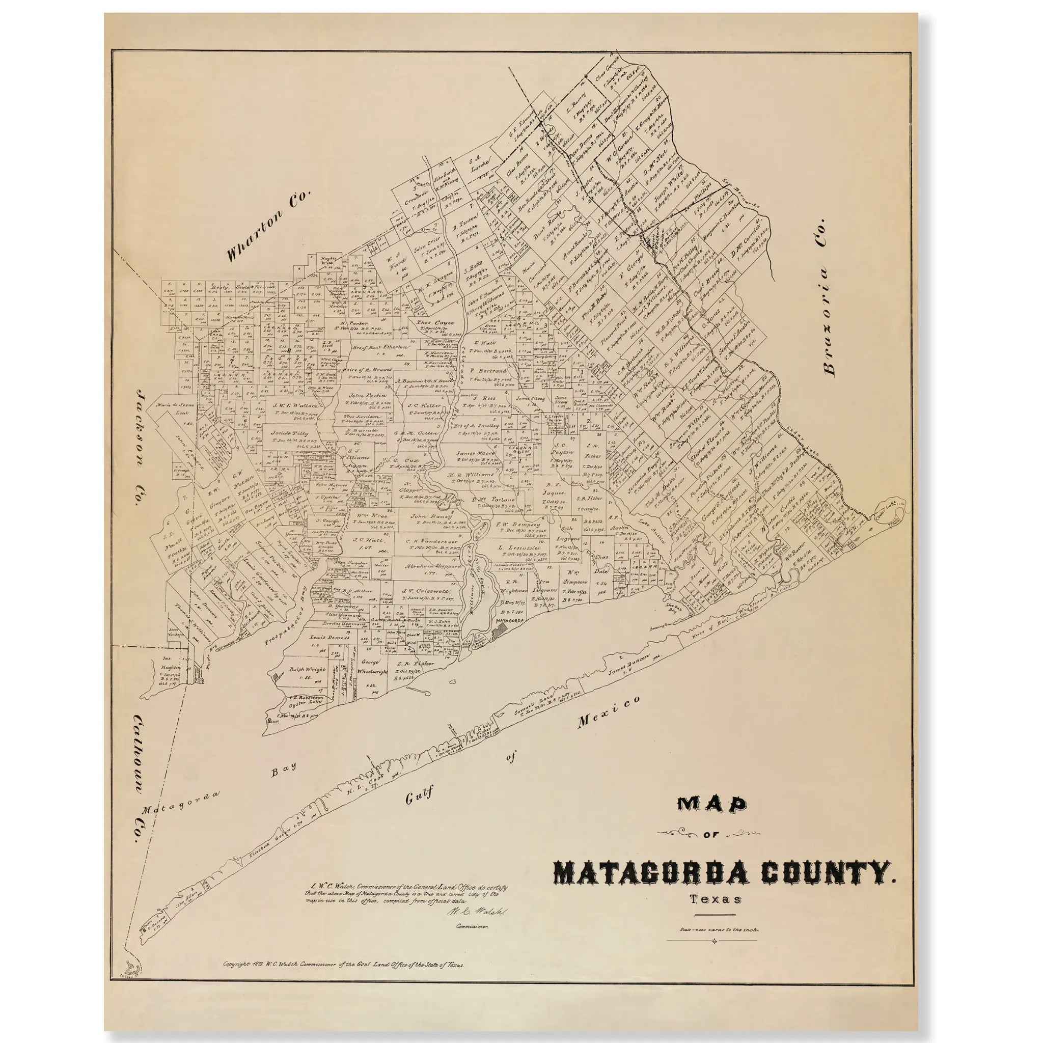
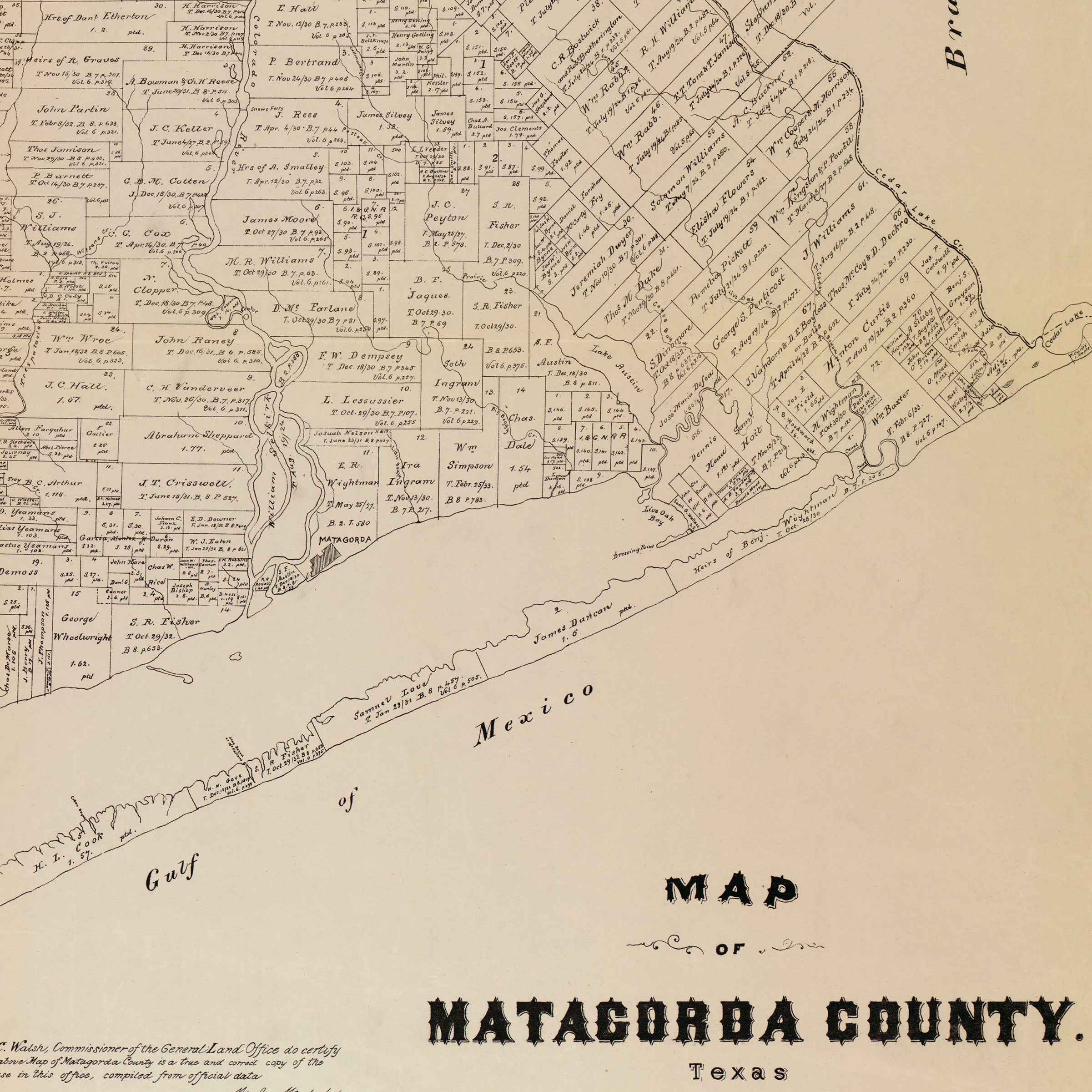
Matagorda County Vintage Map - 1879 Texas General Land Office Artwork
Sale priceFrom $34.00
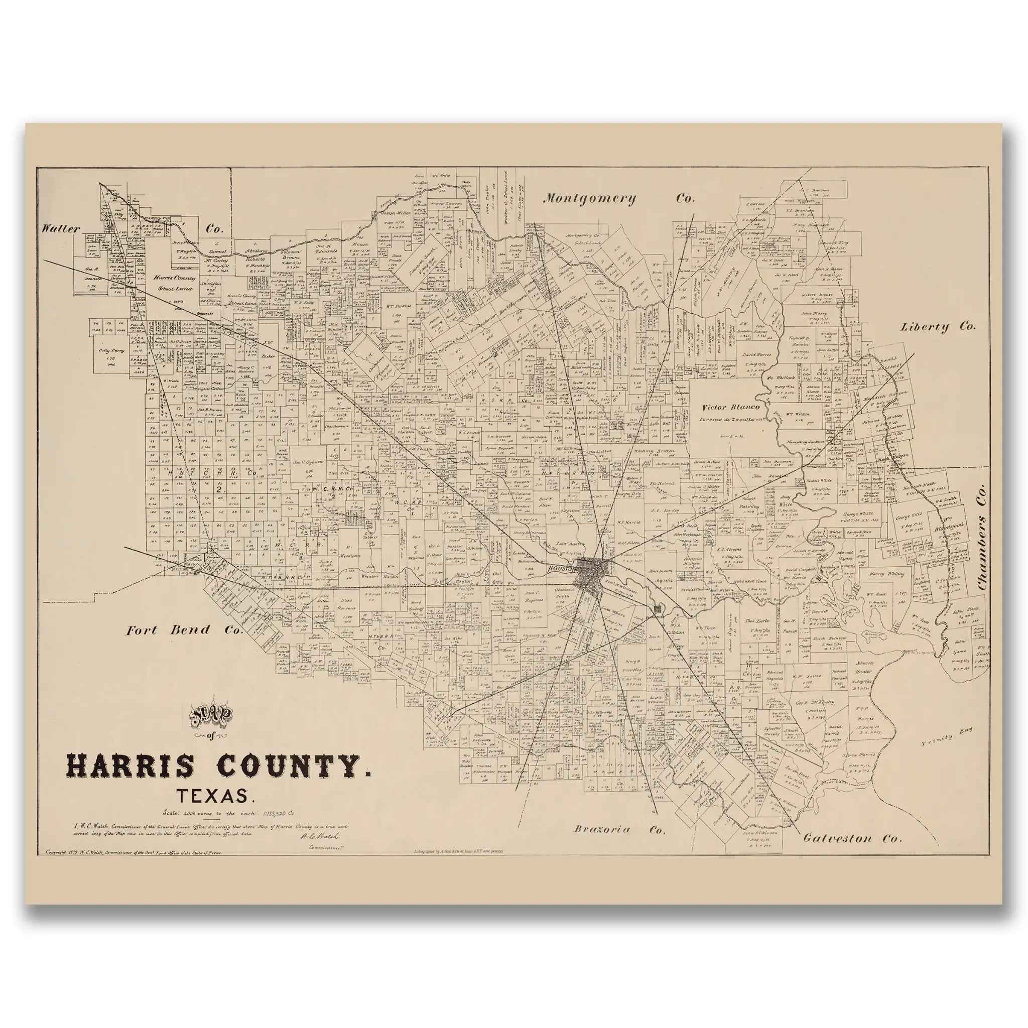

Harris County Vintage Map - Authentic 1879 Texas General Land Office Map
Sale priceFrom $39.99
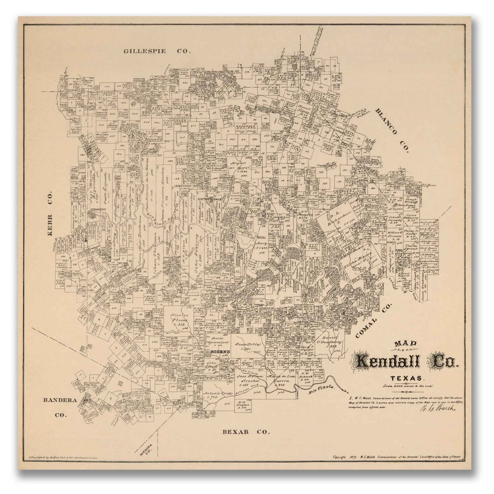

Kendall County Vintage Map - 1879 Texas General Land Office Map
Sale priceFrom $39.99
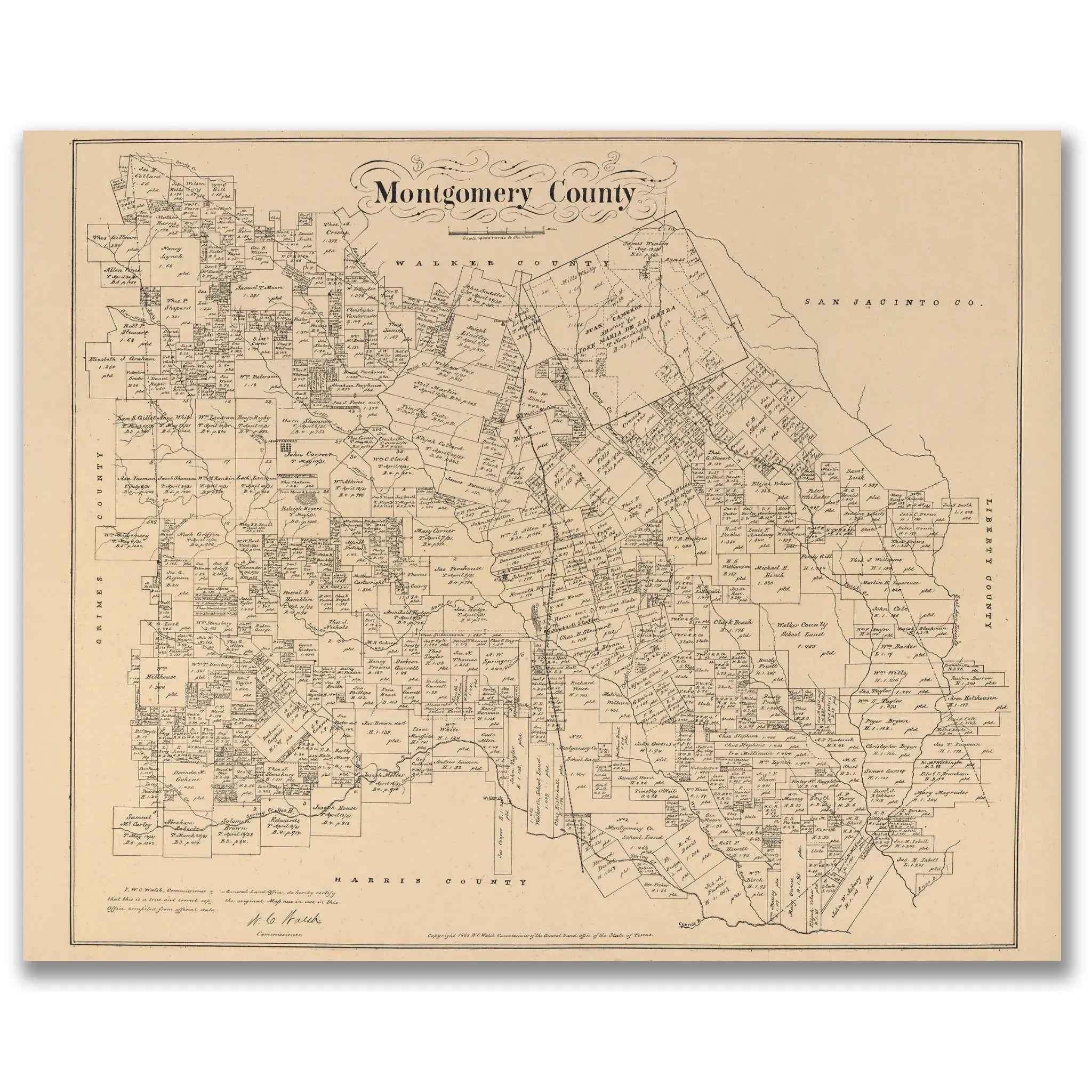
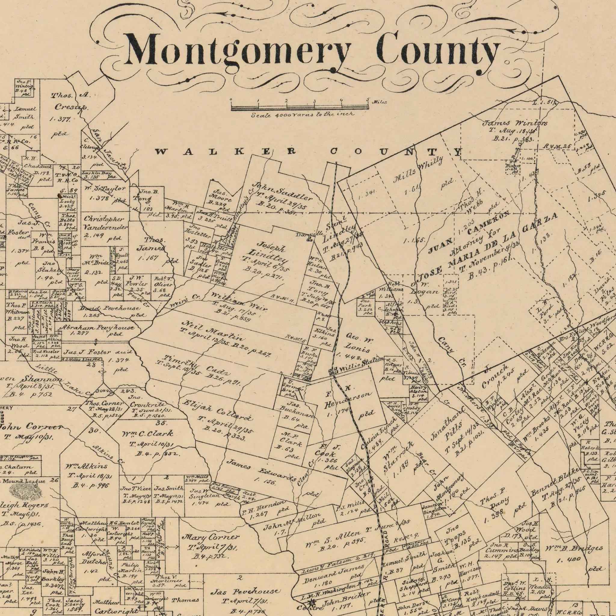
Montgomery County Vintage Map - Authentic 1880 Texas General Land Office Design
Sale priceFrom $39.99
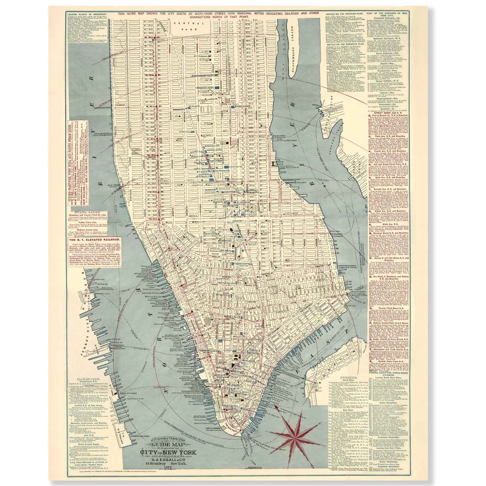
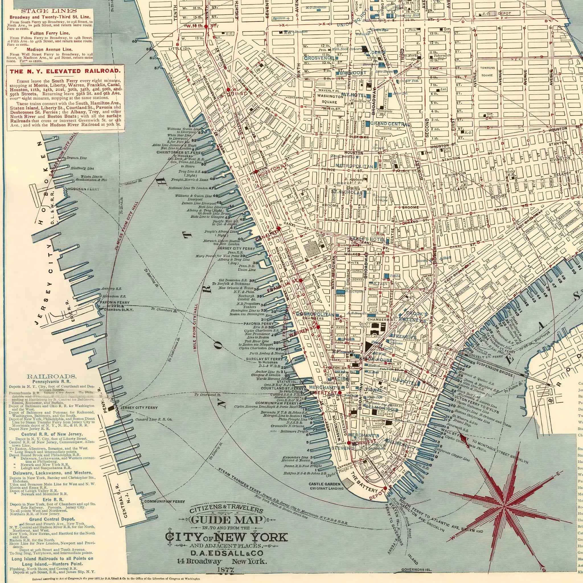
New York City Map - Vintage 1877 Citizens' & Travelers' Guide Map for Collectors
Sale priceFrom $39.99
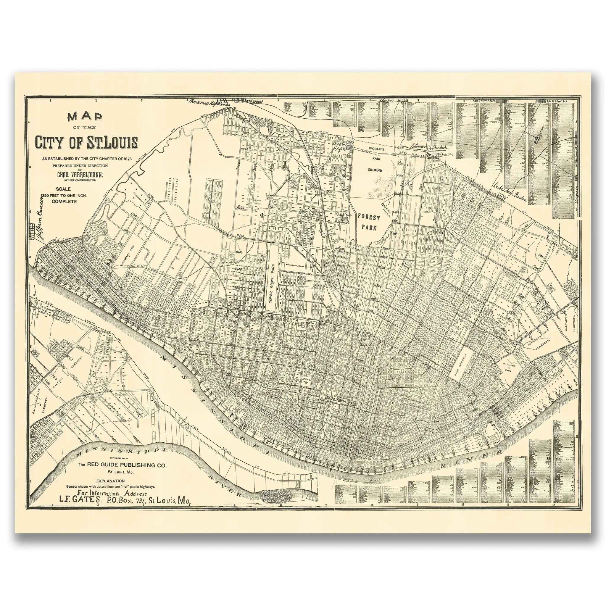
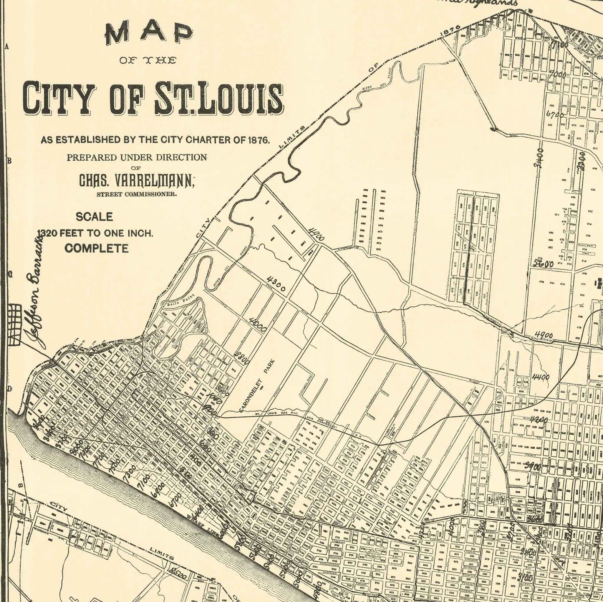
St. Louis Vintage Map 1876 - Historical City Charter Map by Charles Varrelmann
Sale priceFrom $39.99
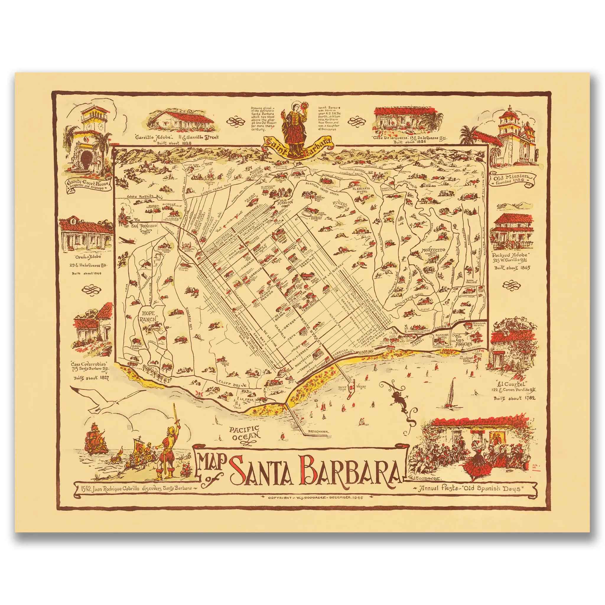
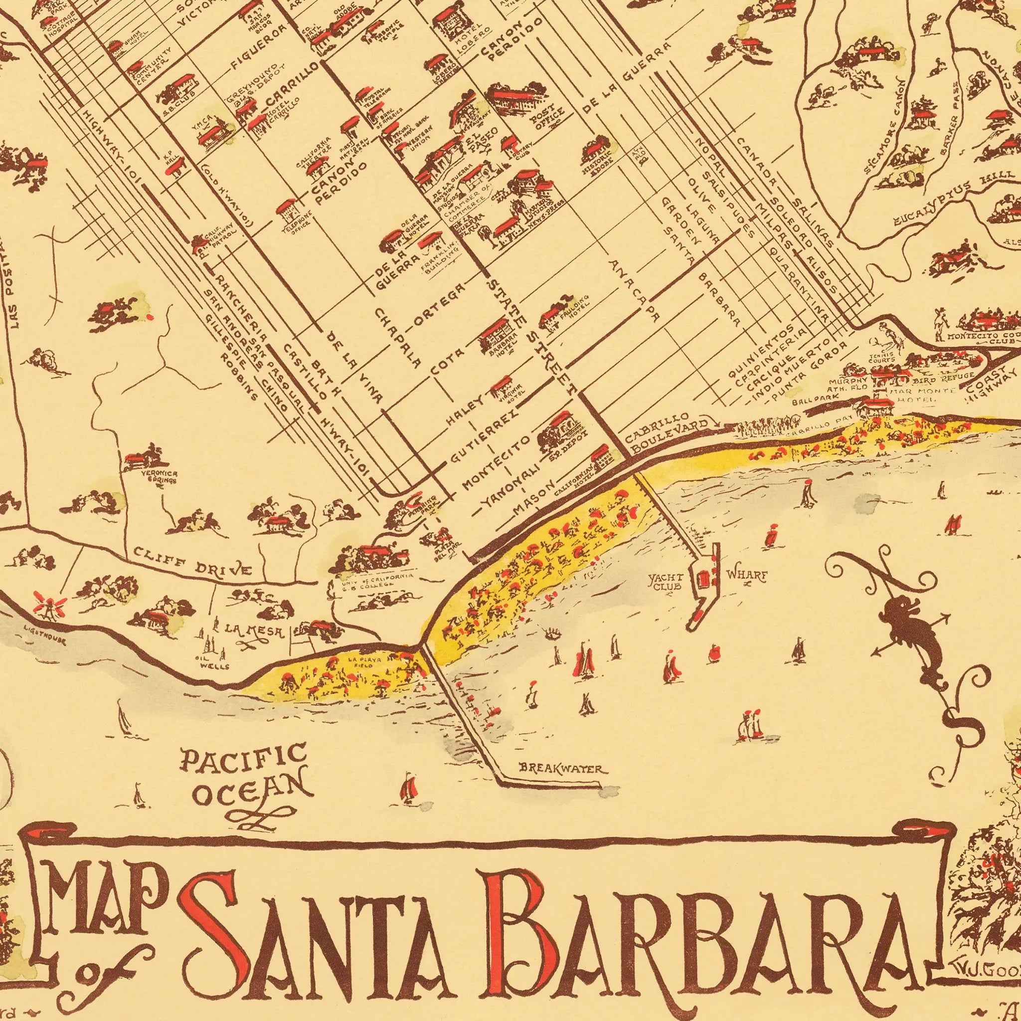
Santa Barbara Vintage Map - 1945 Fiesta & Old Spanish Days Pictorial Art
Sale priceFrom $39.99
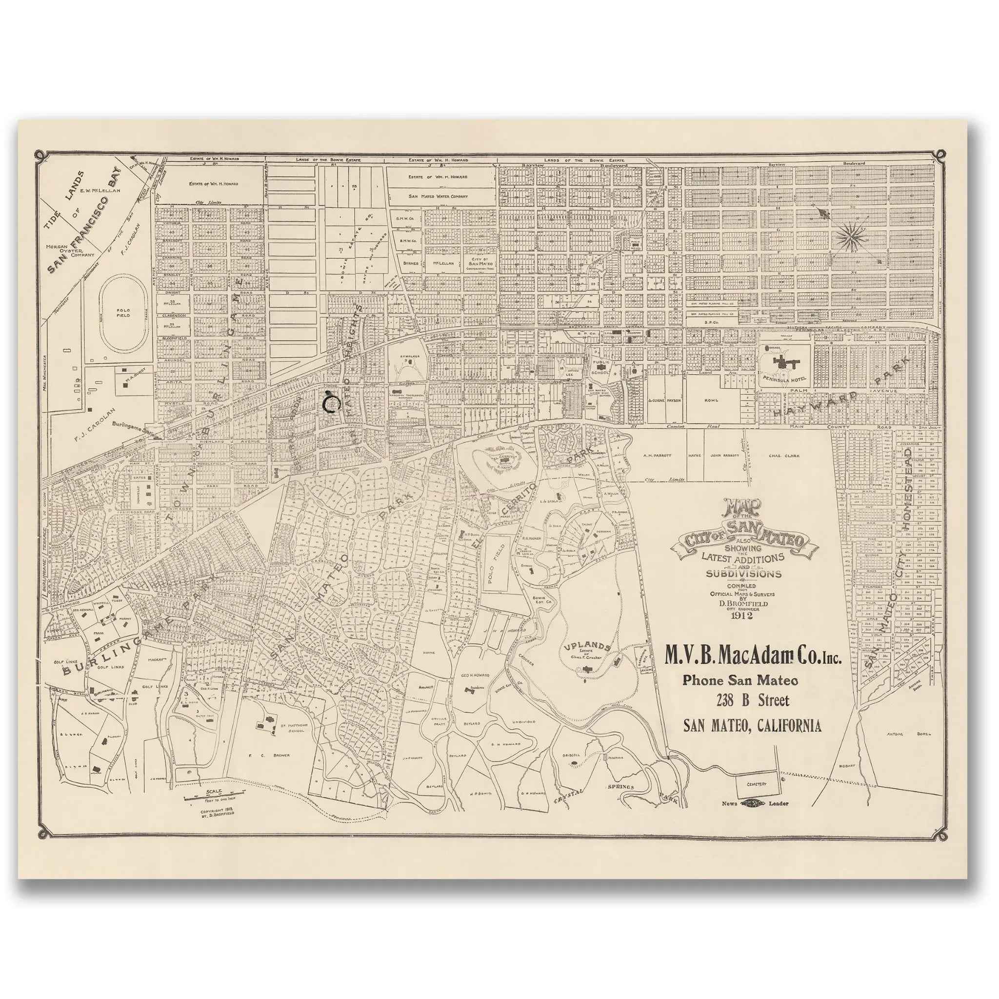
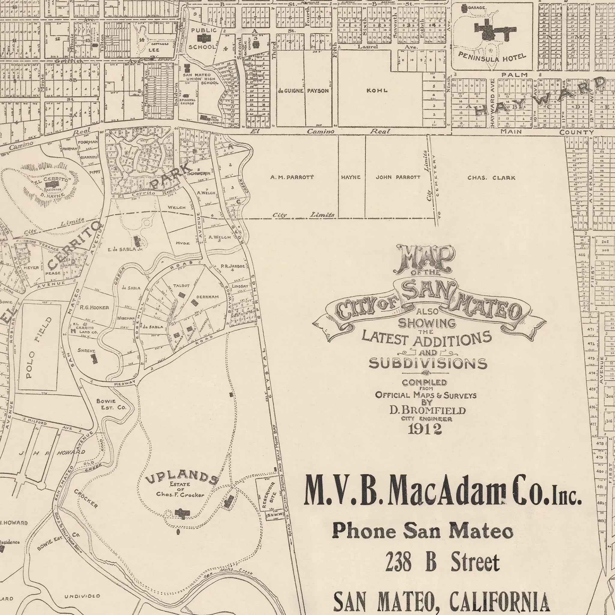
San Mateo Vintage Map - 1912 City Planning & Subdivisions Map
Sale priceFrom $39.99