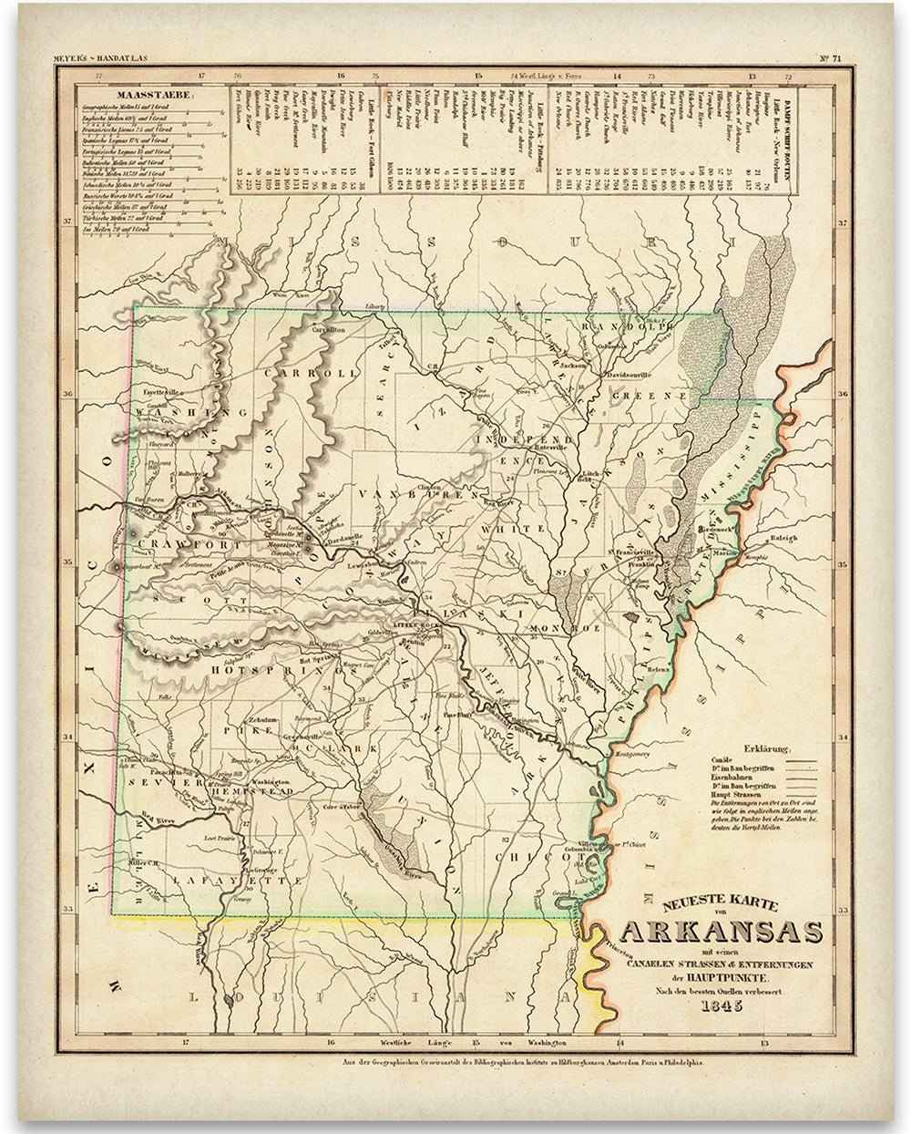
1845 Arkansas Map – Restored Vintage Wall Art for Home Decor
Sale priceFrom $39.99
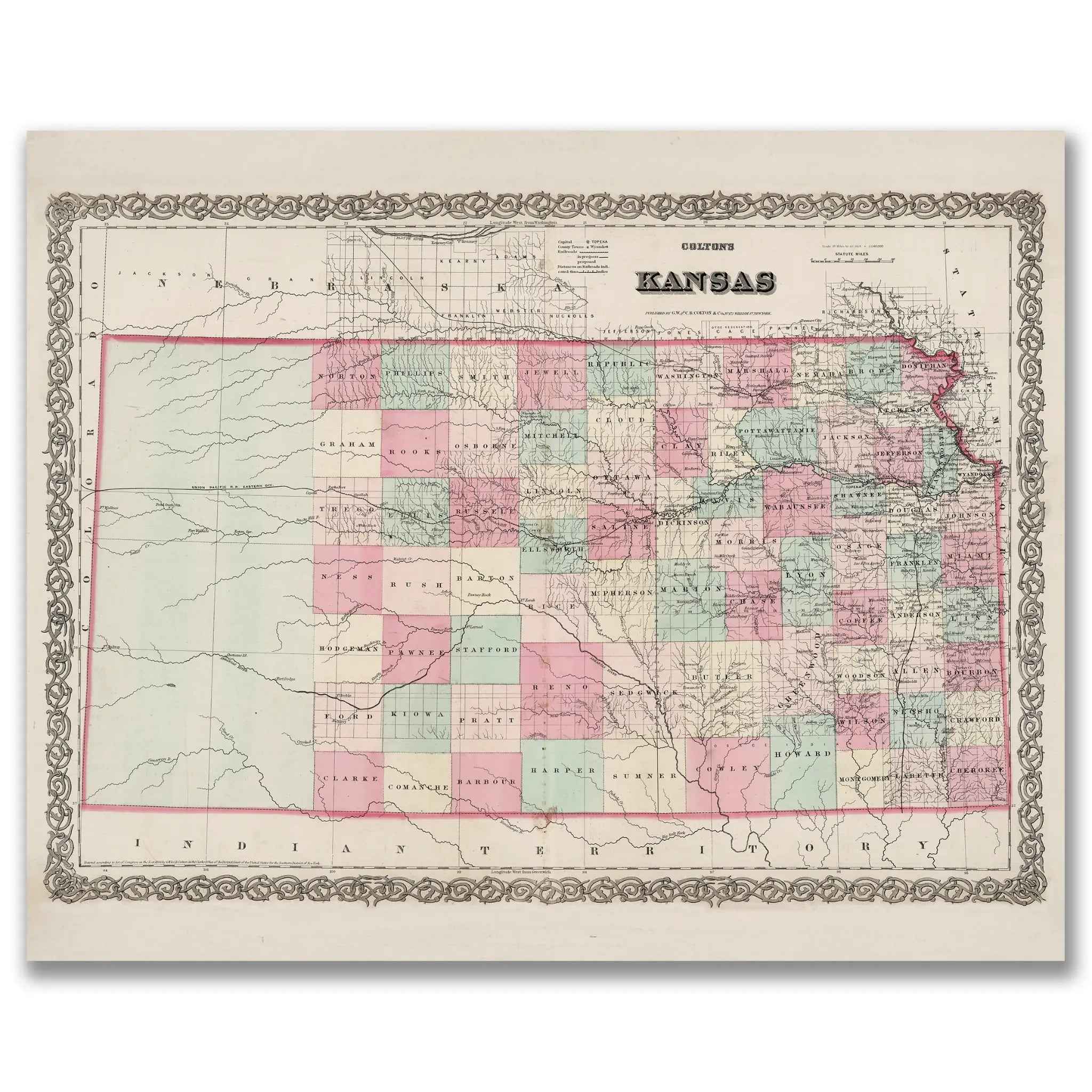
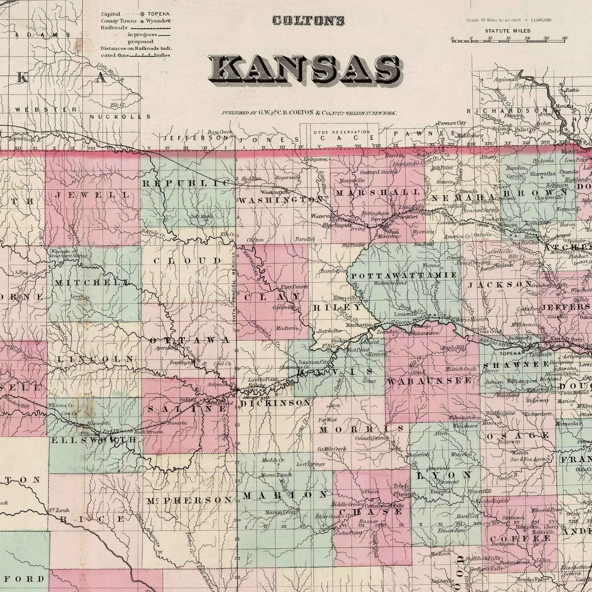
Kansas Map - Vintage State Map by Colton for Home Décor and Collectors
Sale priceFrom $39.99
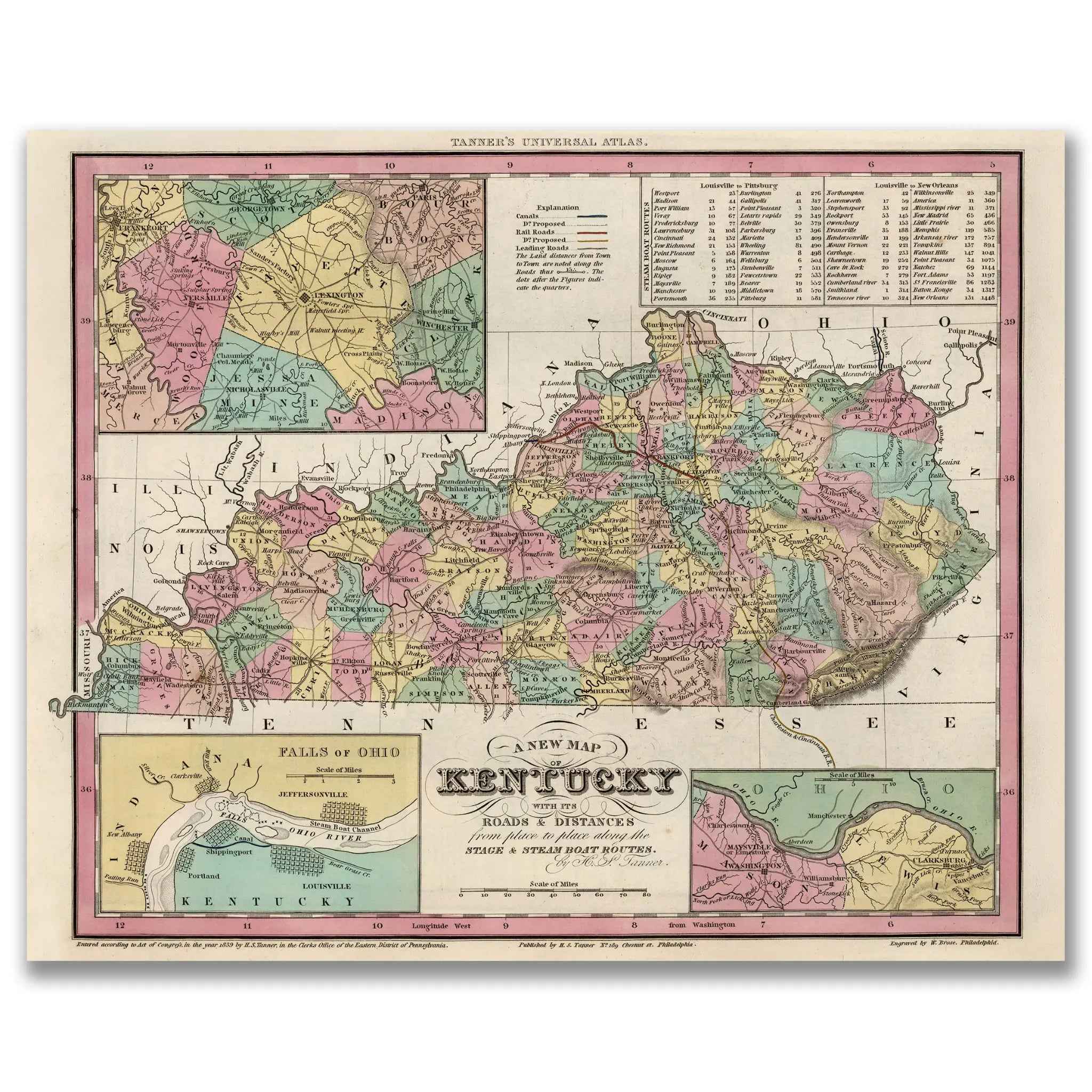
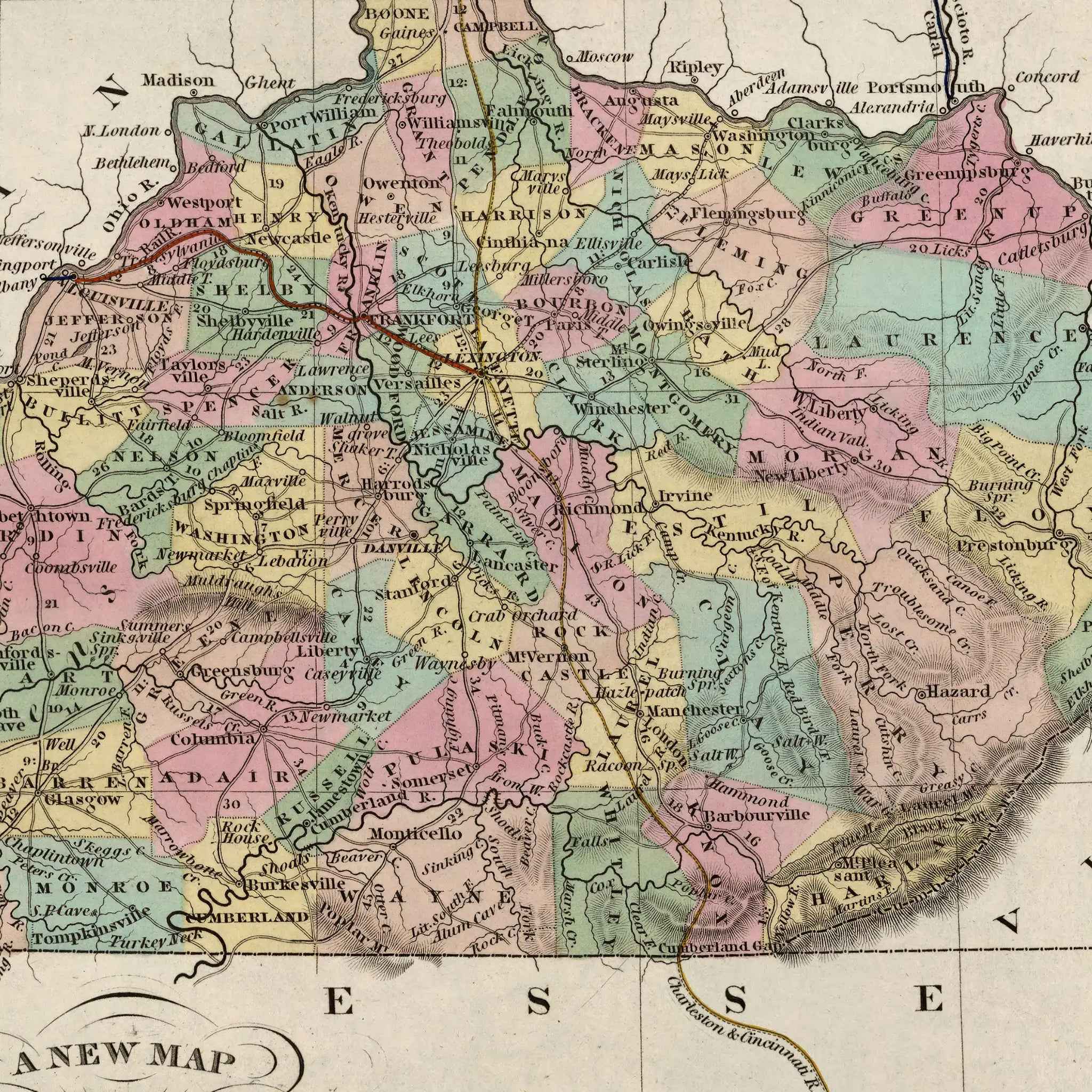
Kentucky Map - Vintage State Map by H.S. Tanner for Collectors
Sale priceFrom $39.99
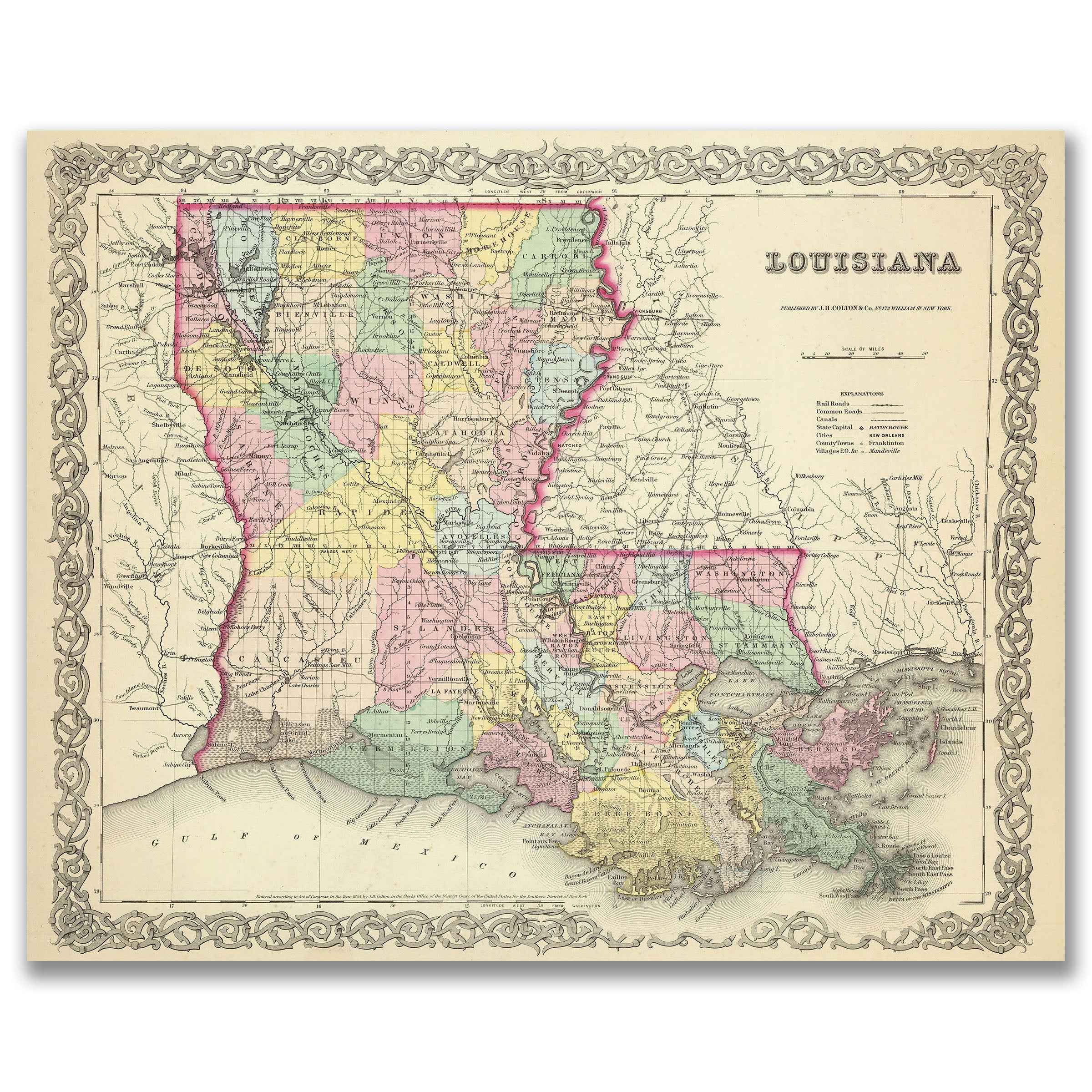
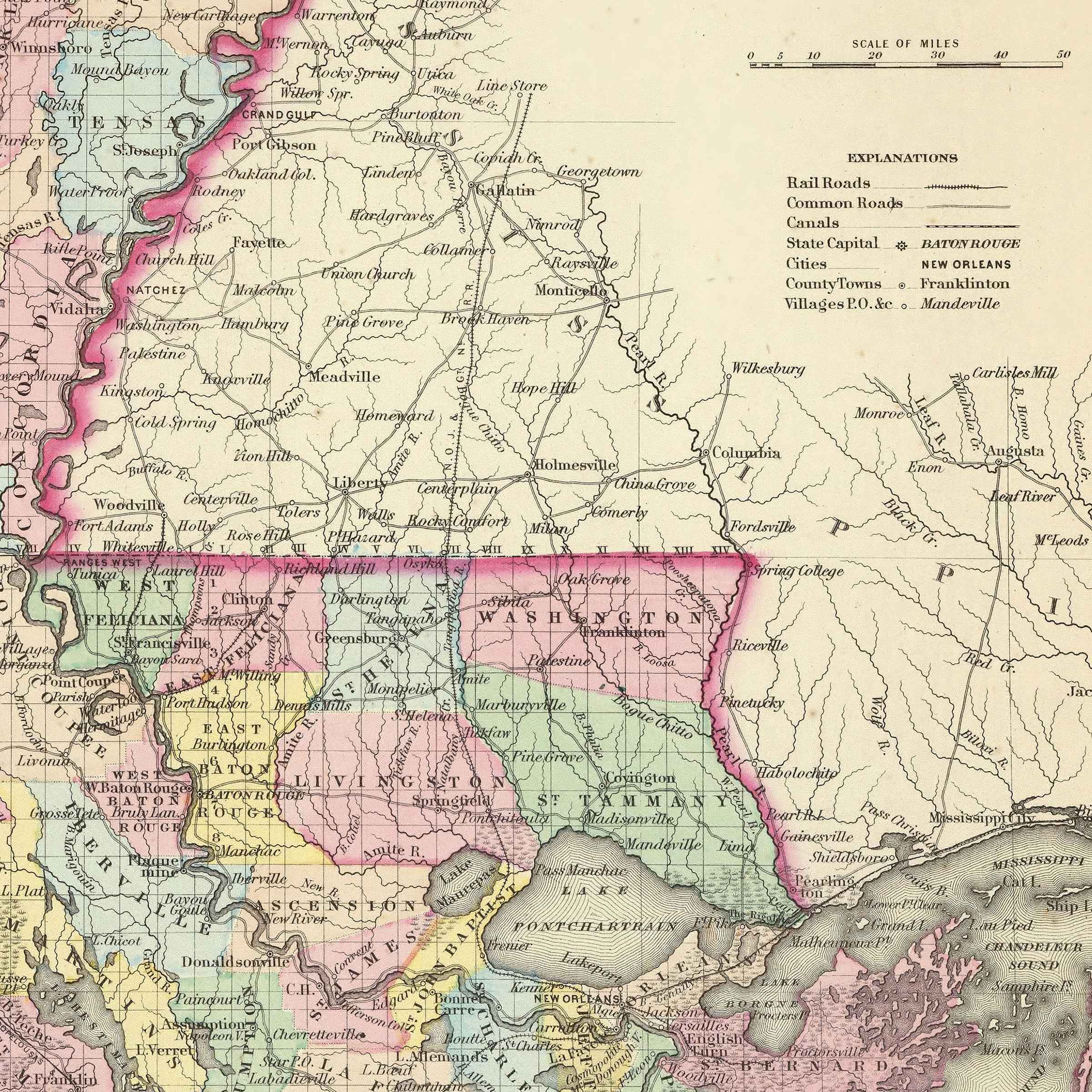
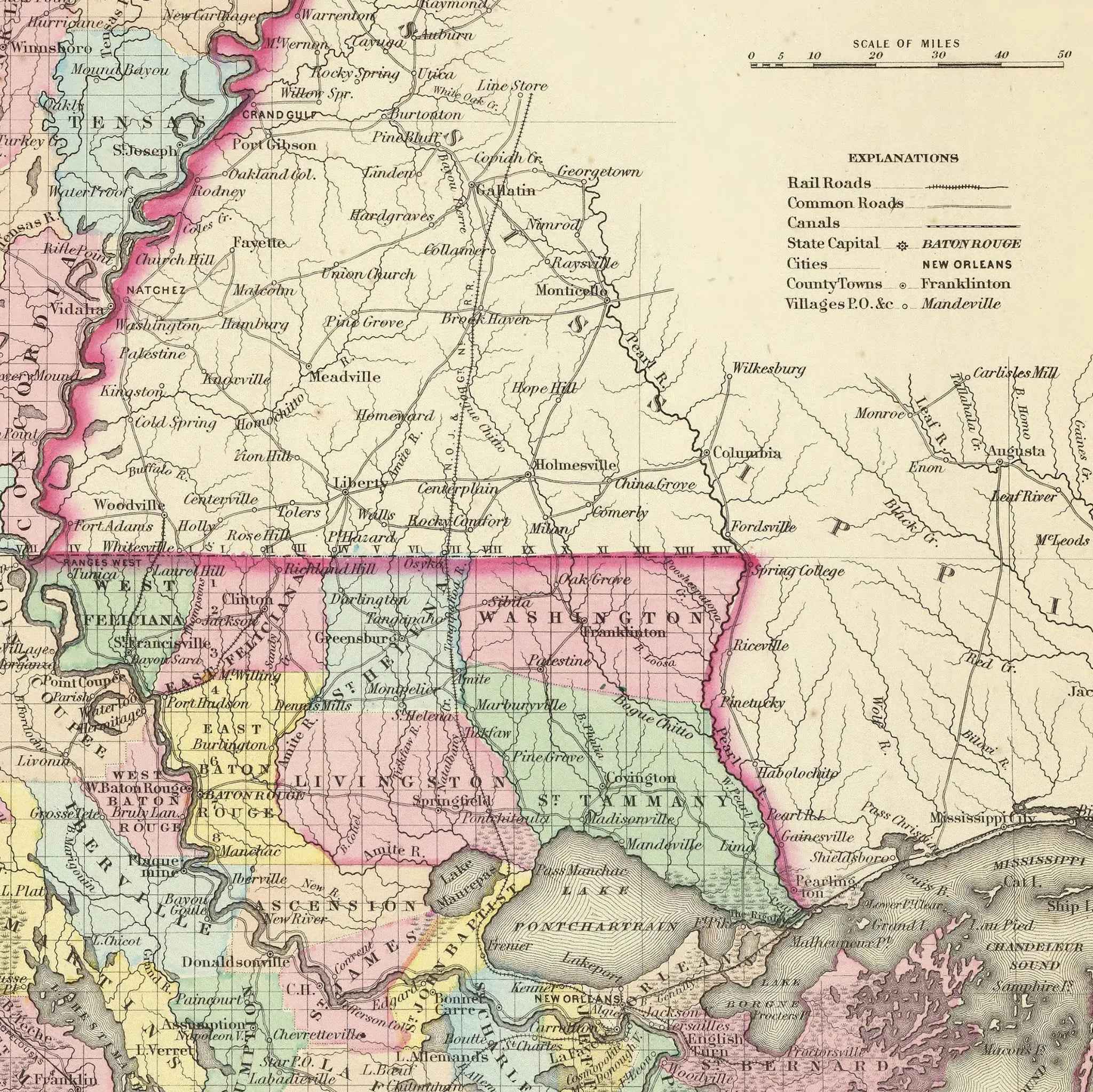
Louisiana Map - Vintage State Map by Colton for Home Decor
Sale priceFrom $39.99
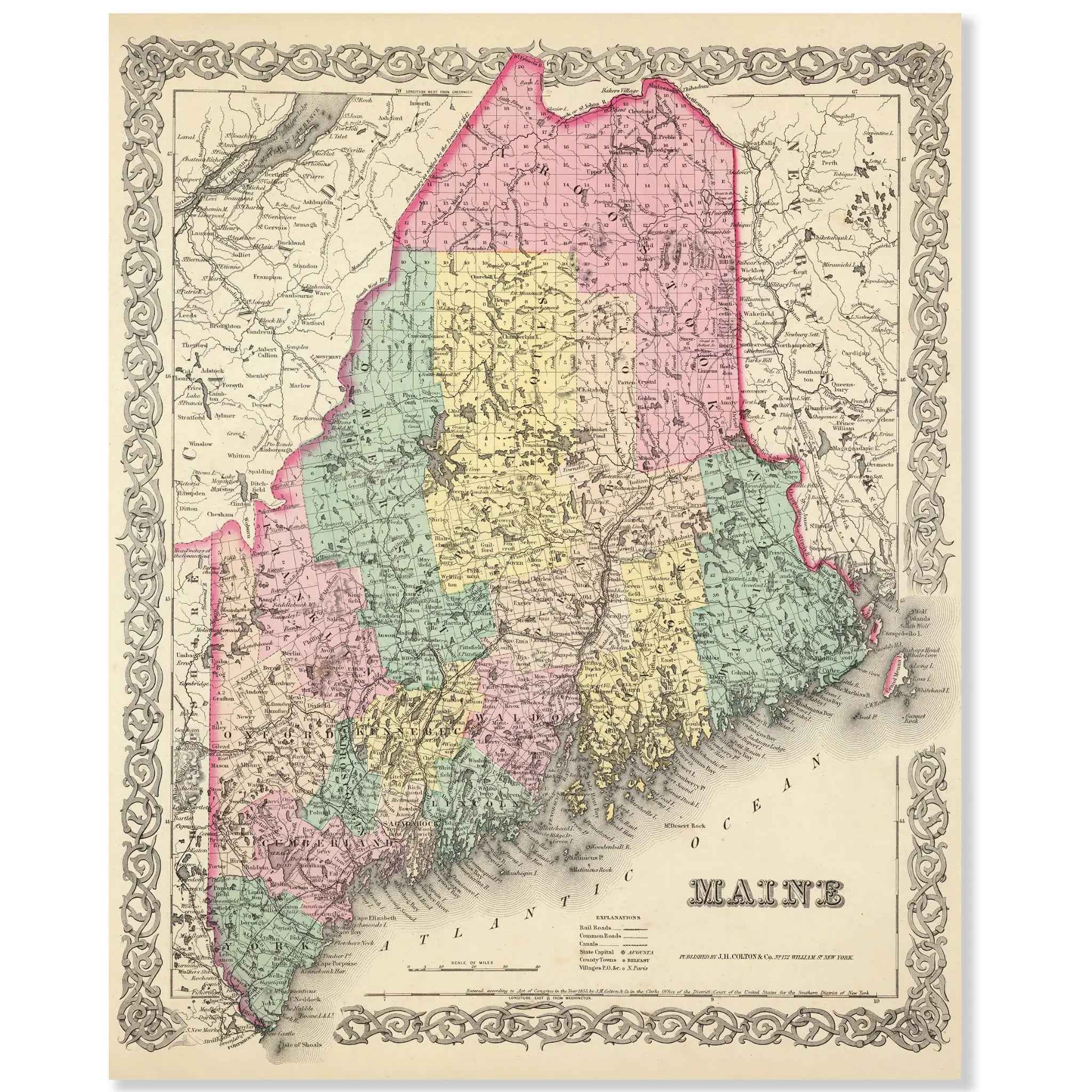
Maine Map - Vintage Colton State Map for Home Decor and Collection
Sale priceFrom $39.99
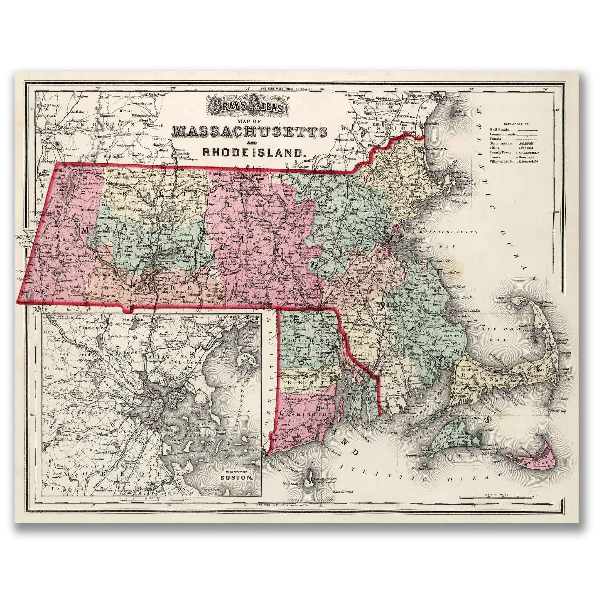
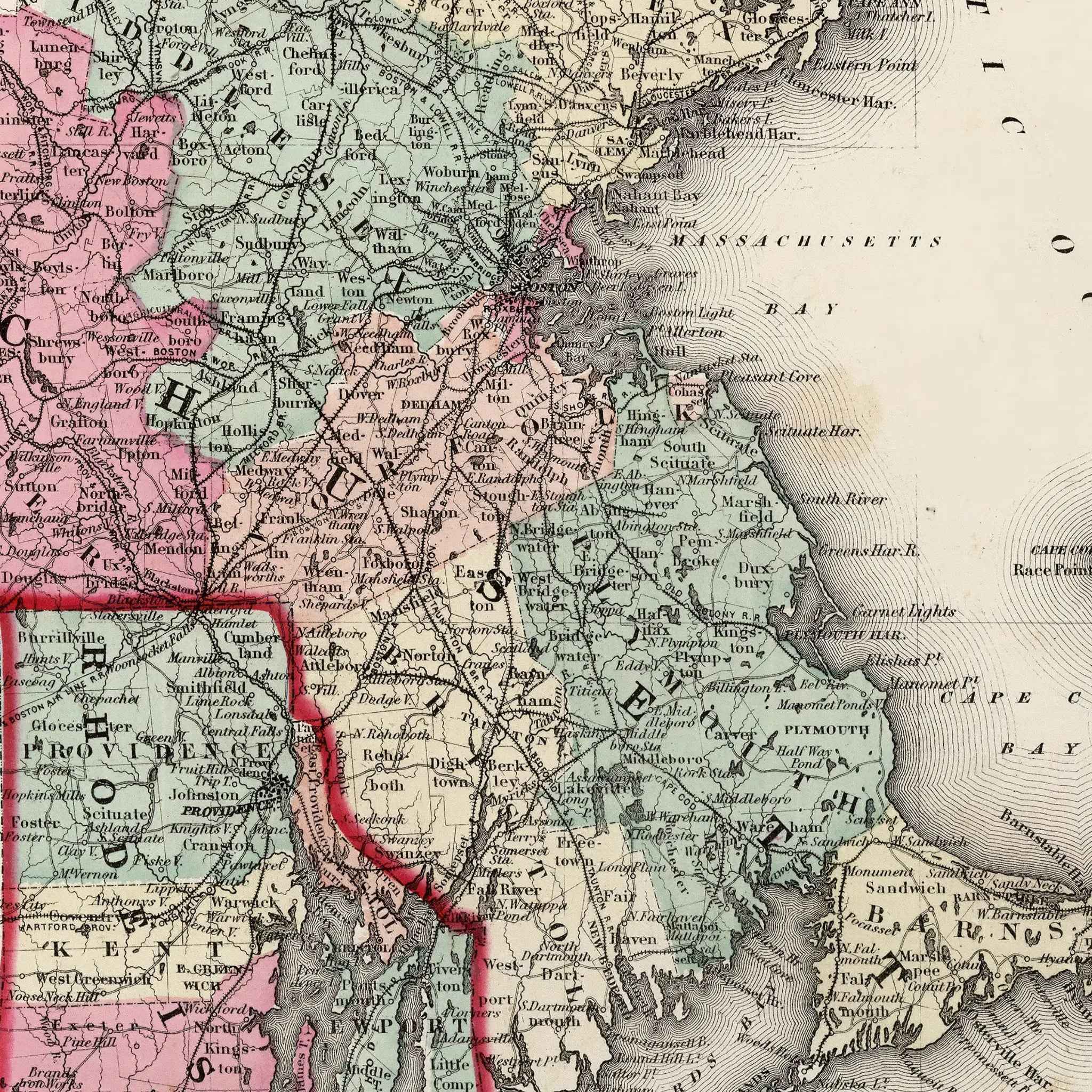
Massachusetts & Rhode Island Map - Vintage State Map by O.W. Gray for Collectors
Sale priceFrom $39.99


Connecticut Map - Vintage State Map by Colton for Collectors and Decor
Sale priceFrom $39.99
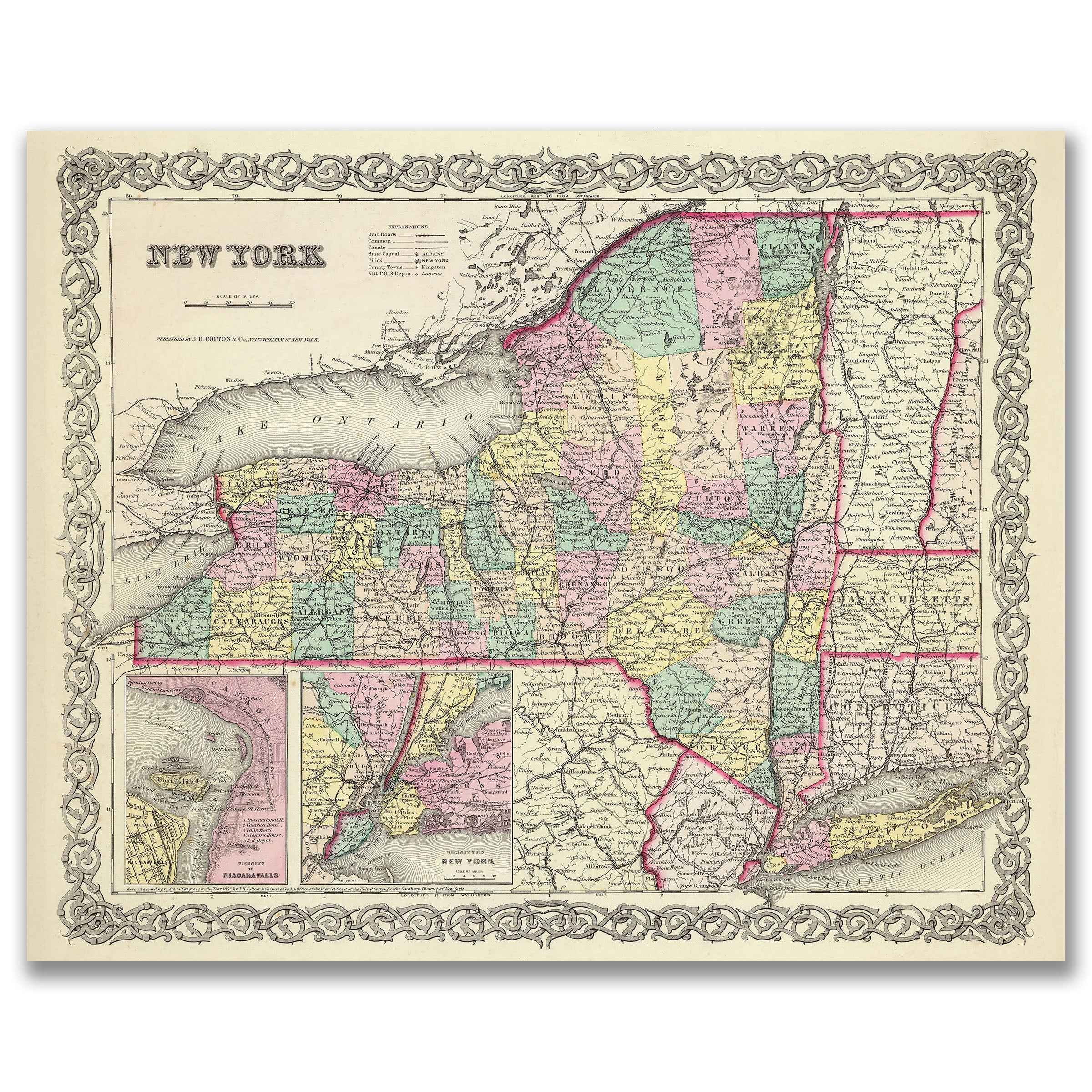
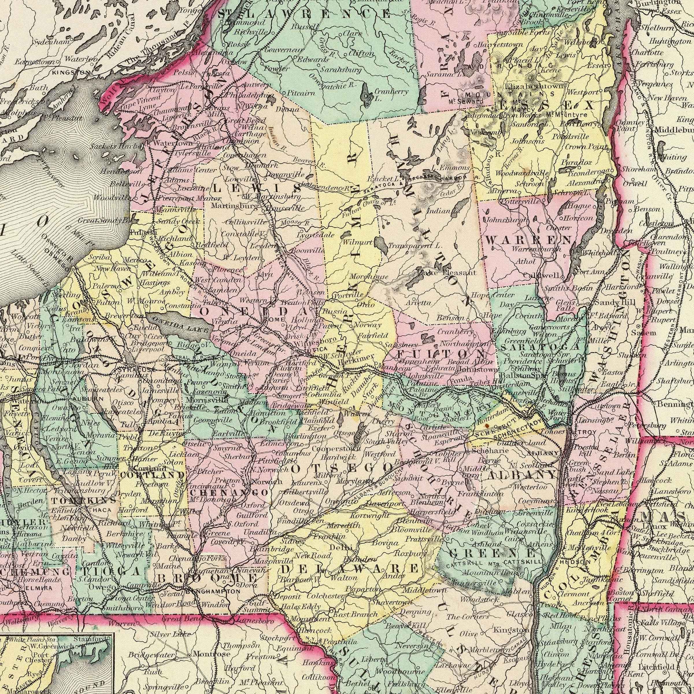
New York Map - Vintage State Map by Colton for Collectors and Decorators
Sale priceFrom $39.99

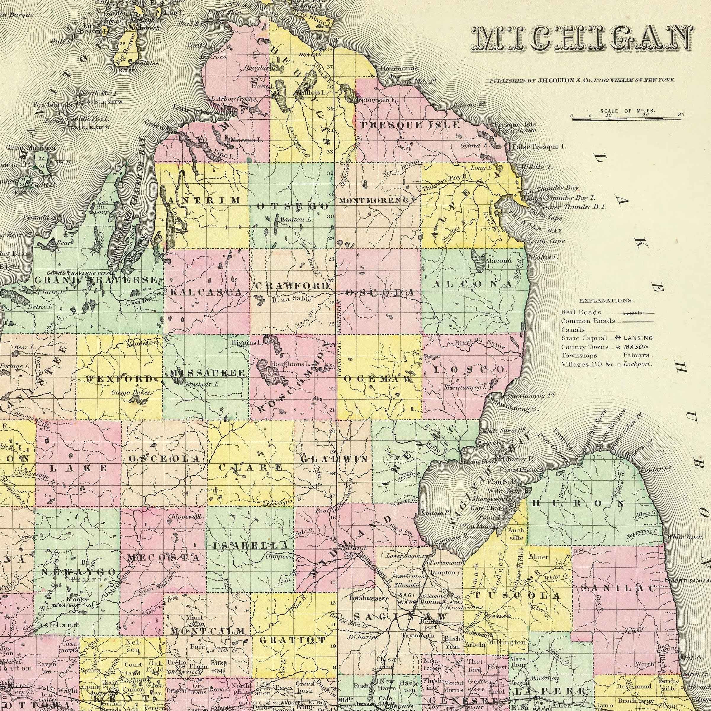
Michigan Map - Vintage State Map by Colton for Collectors and Home Decor
Sale priceFrom $39.99
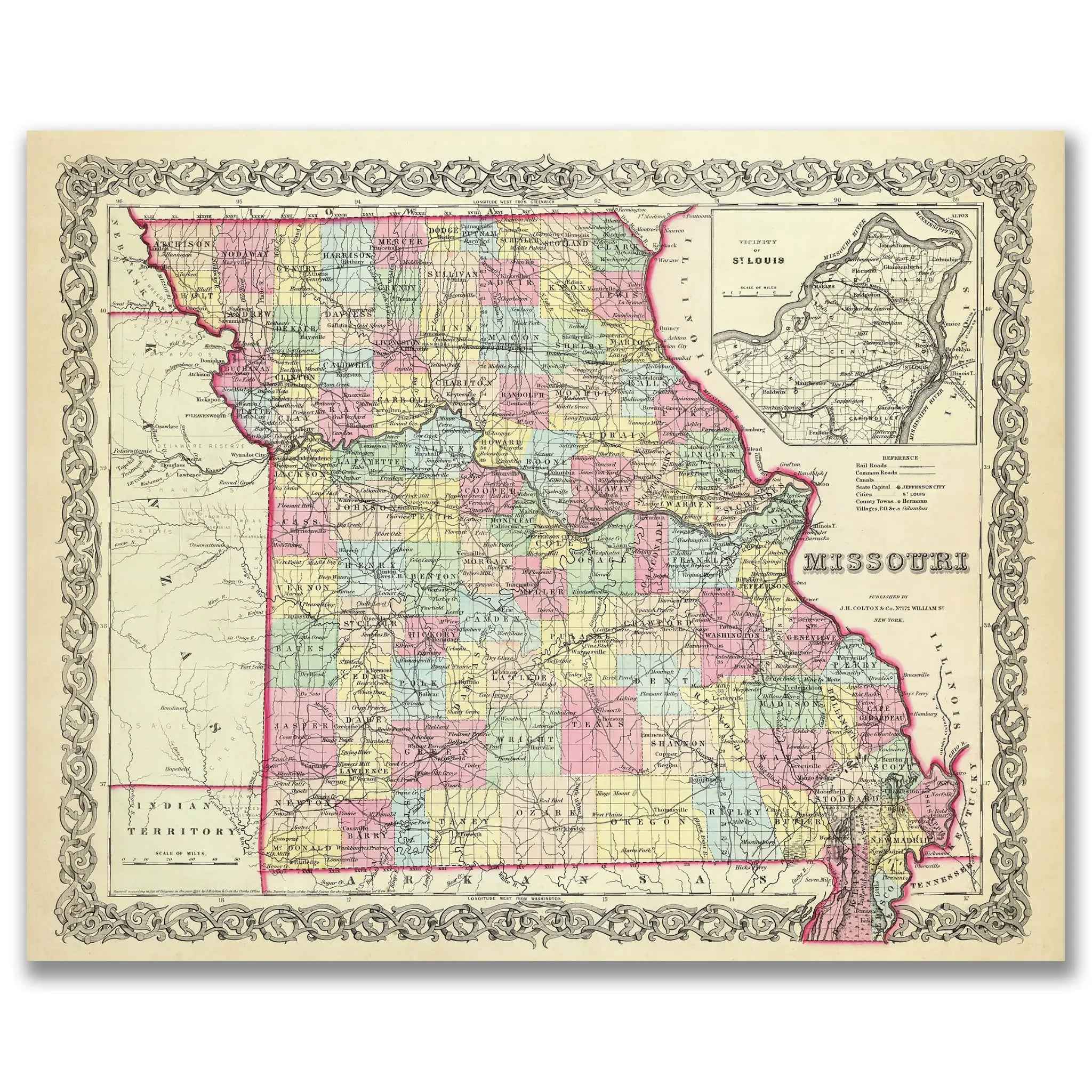
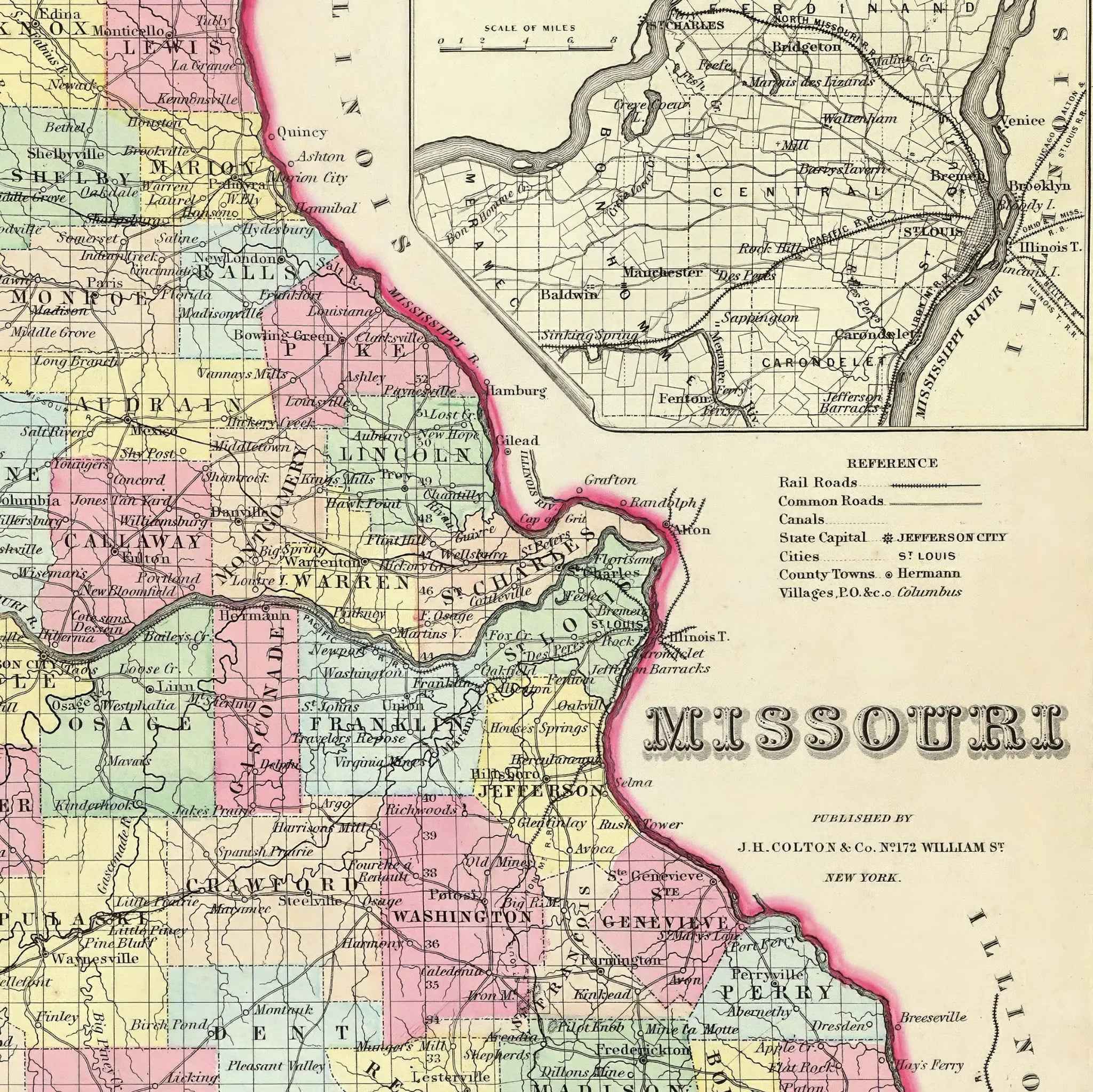
Missouri Map - Vintage State Map by Colton for Home Decor
Sale priceFrom $39.99
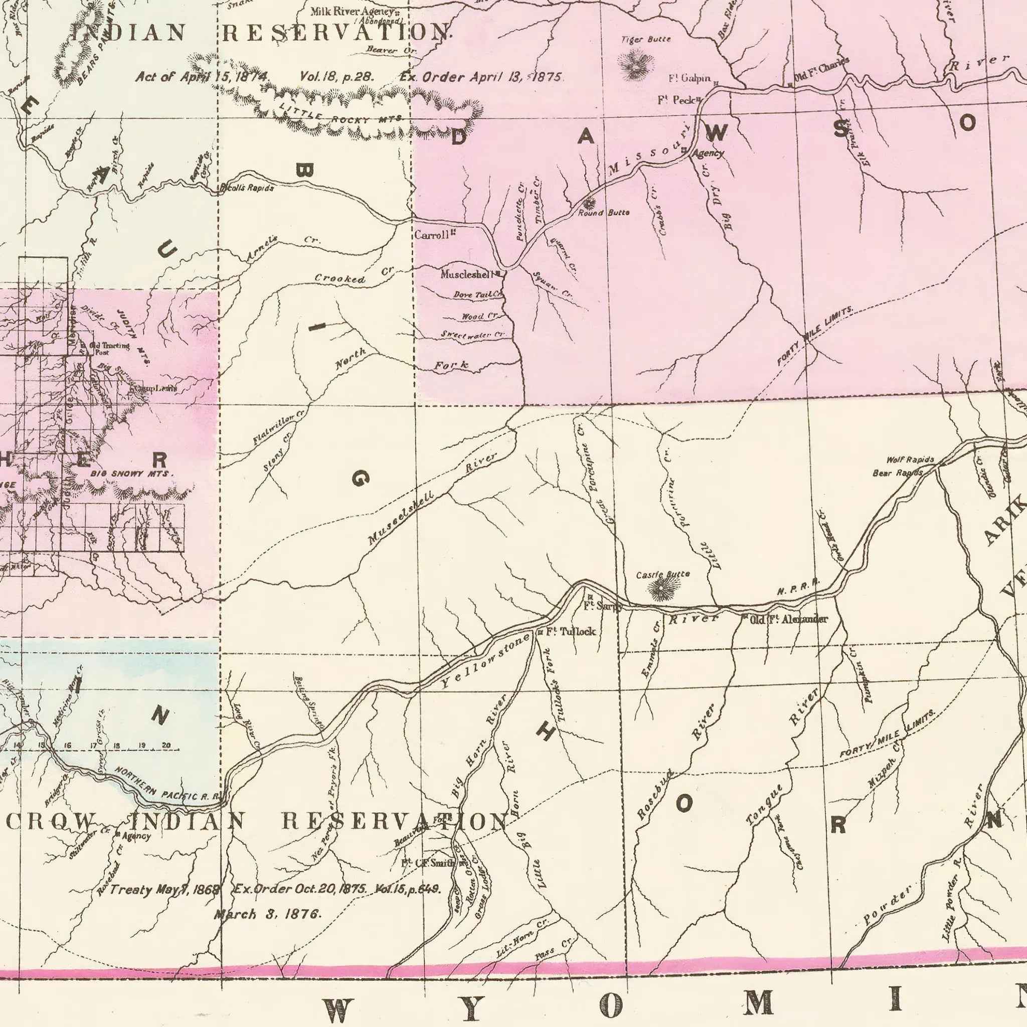
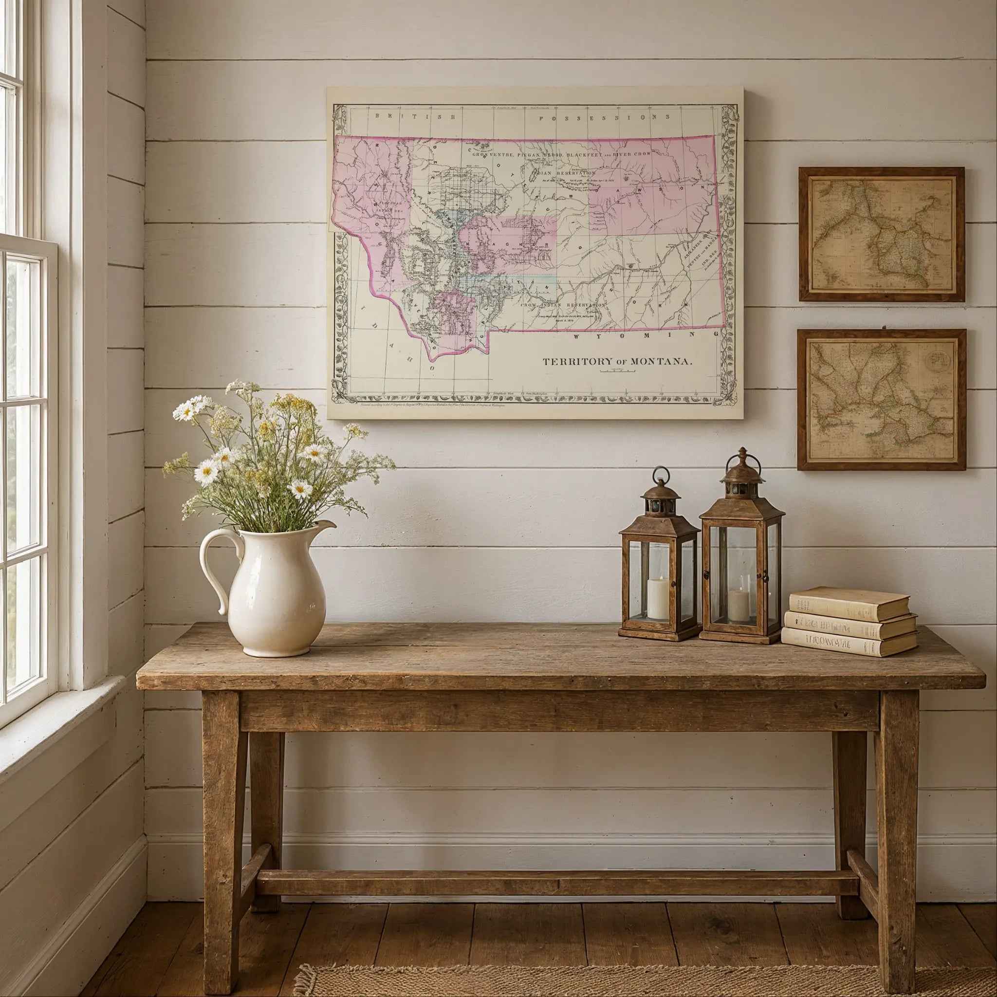
Montana Map - Vintage 1879 Historical Montana Territory Map
Sale priceFrom $39.99
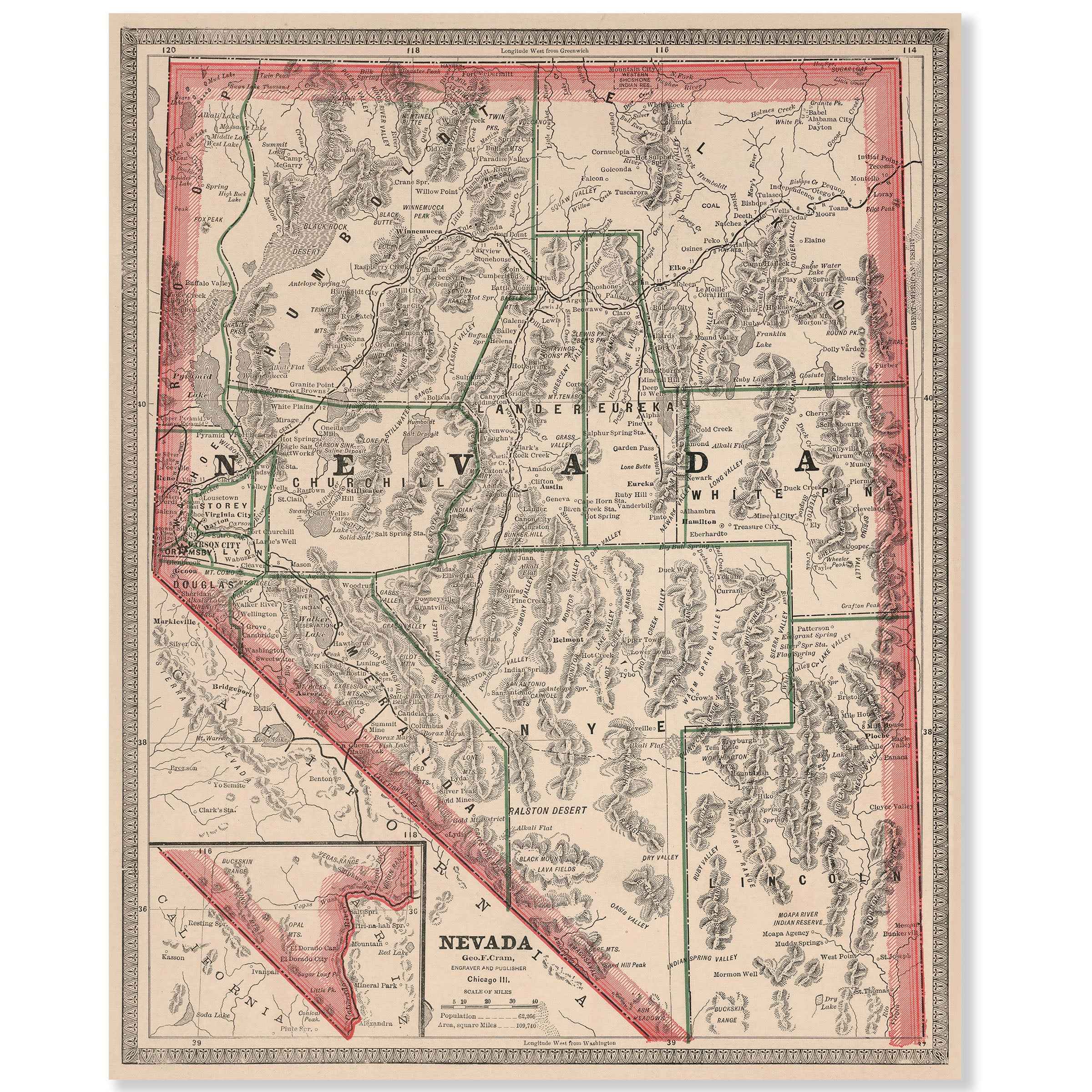
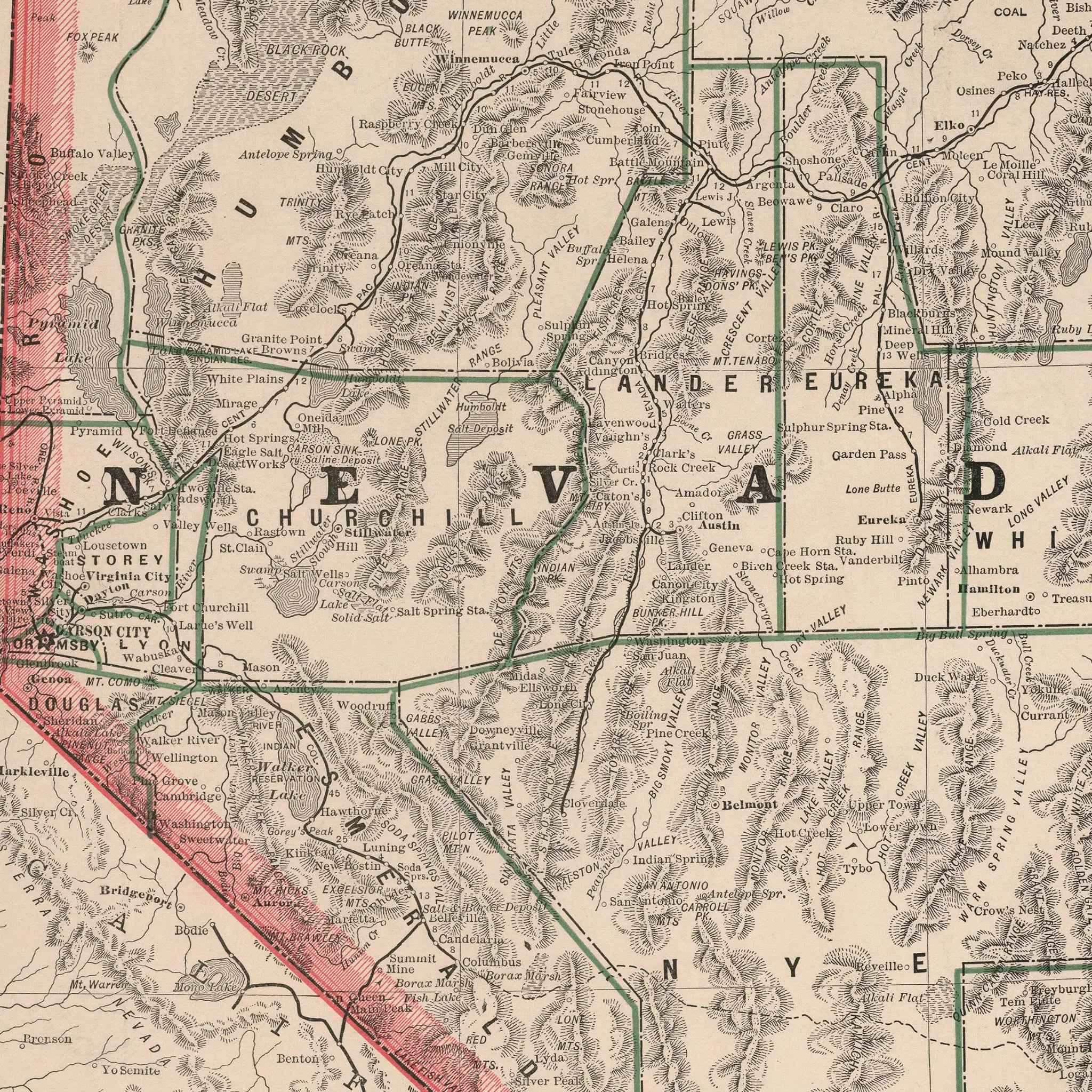
Nevada Map - Vintage 1883 Historical Map Art Print
Sale priceFrom $39.99
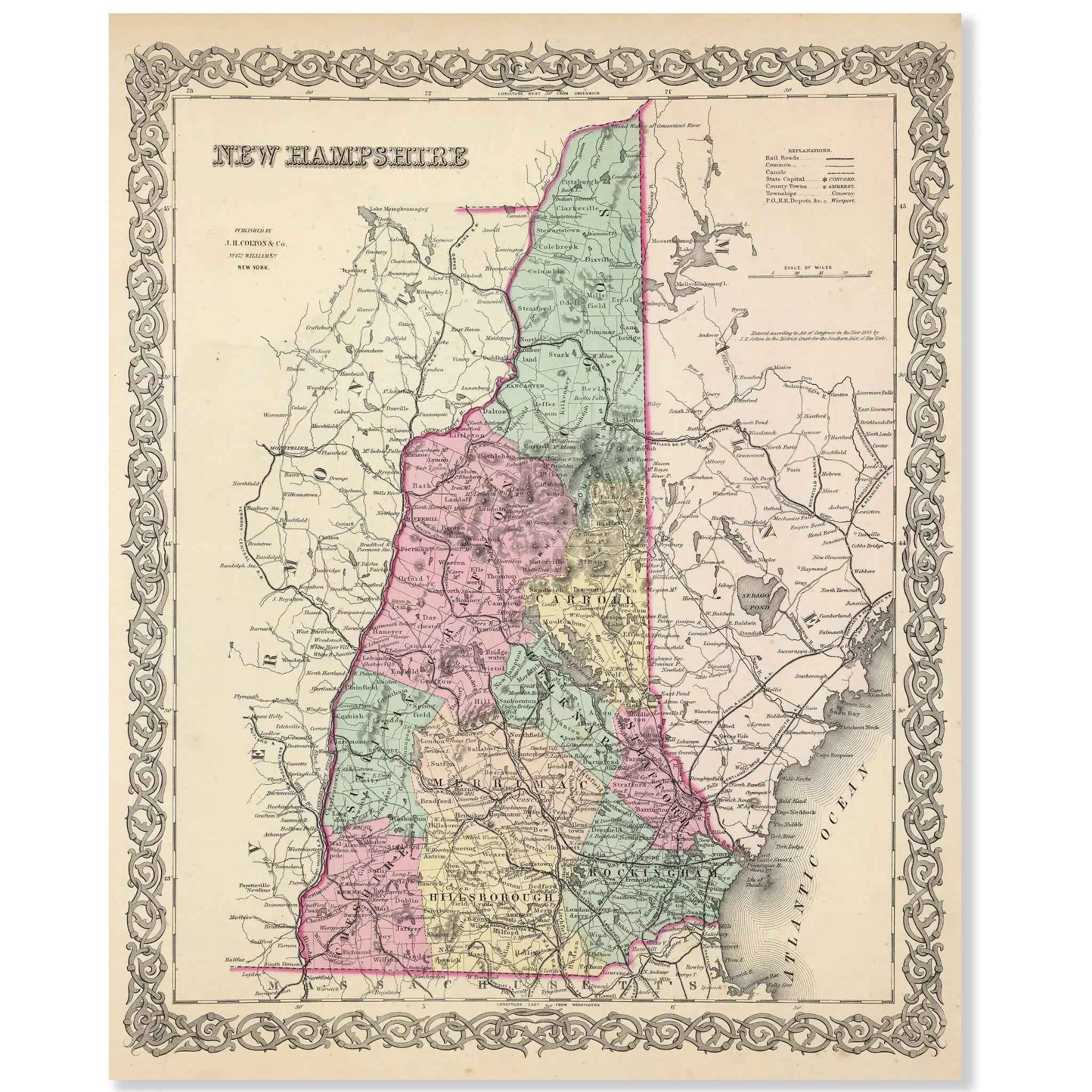
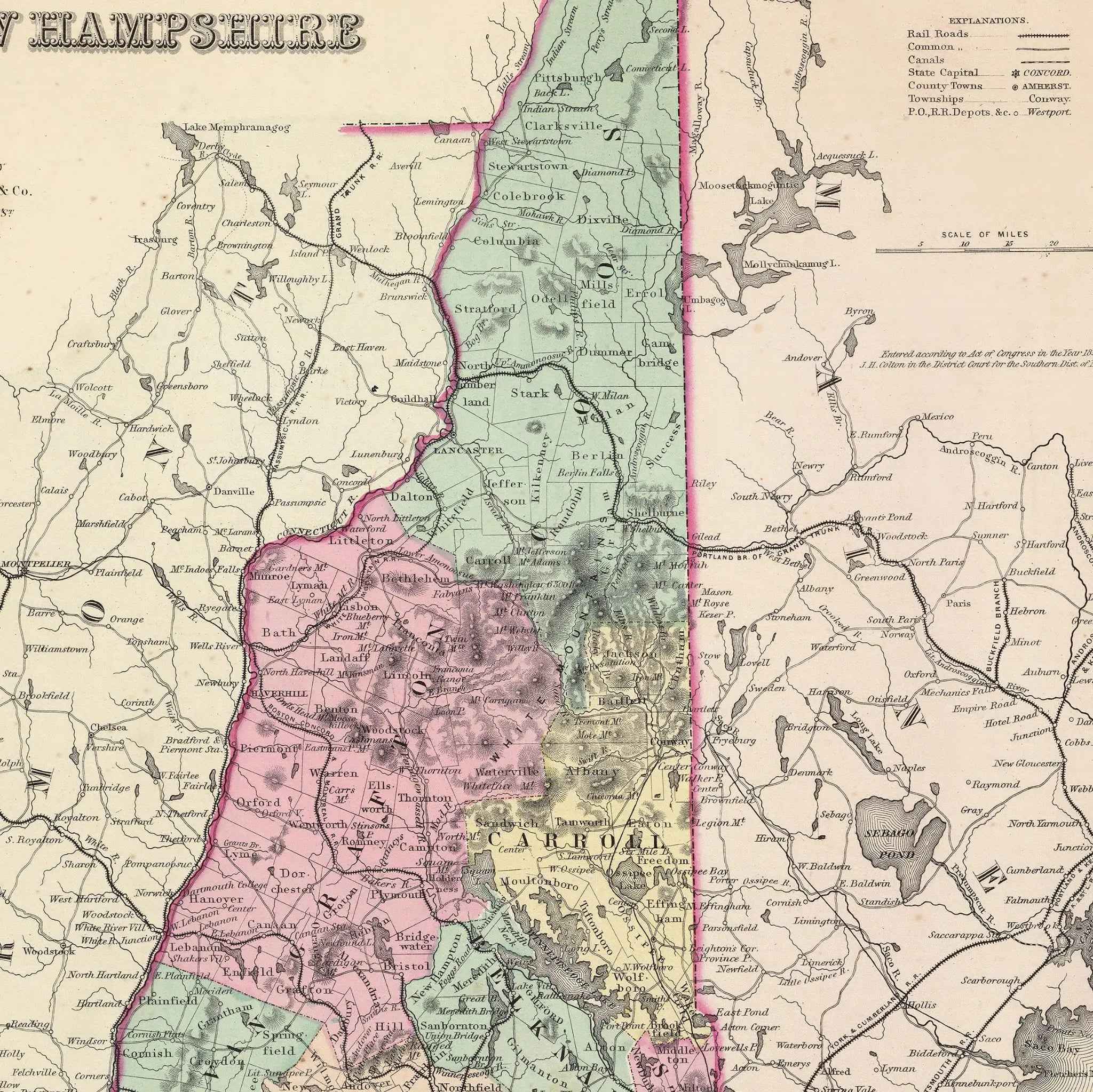
New Hampshire Map - Vintage 1856 Historical Map by Colton for Collectors and Decor
Sale priceFrom $39.99
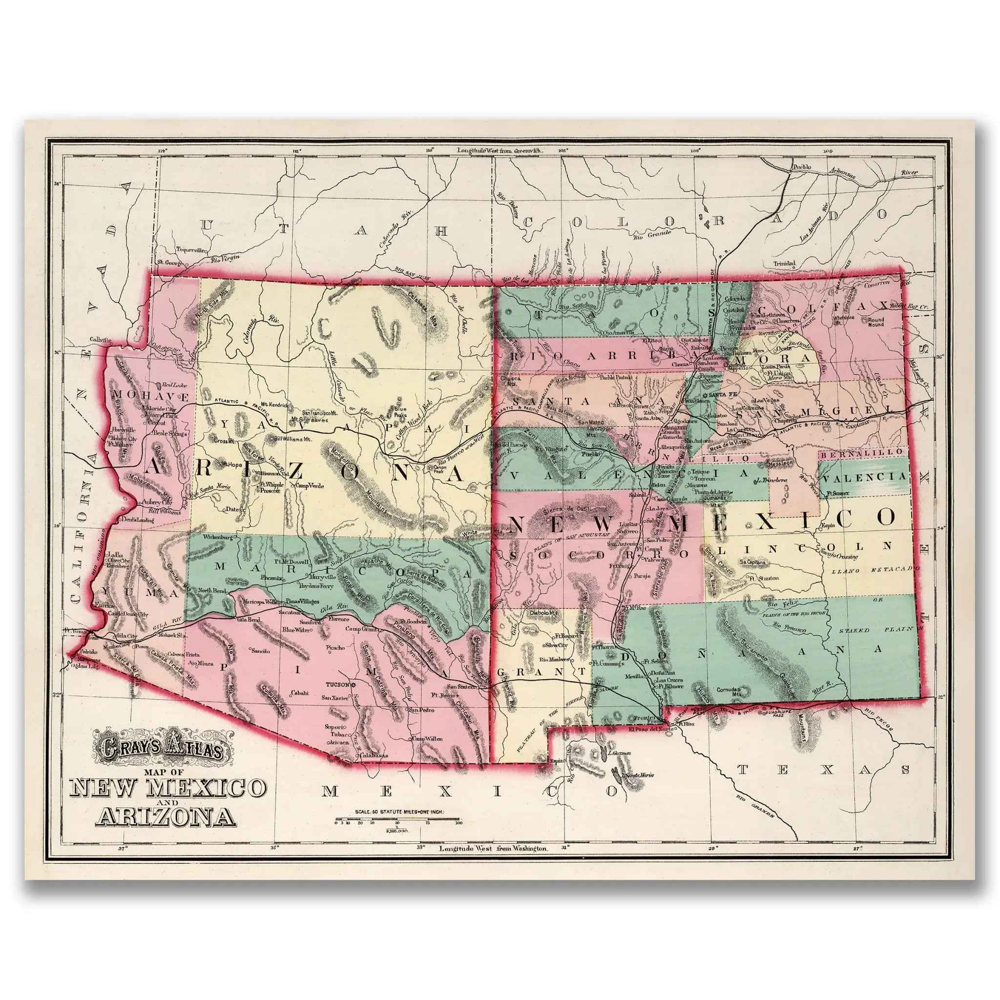
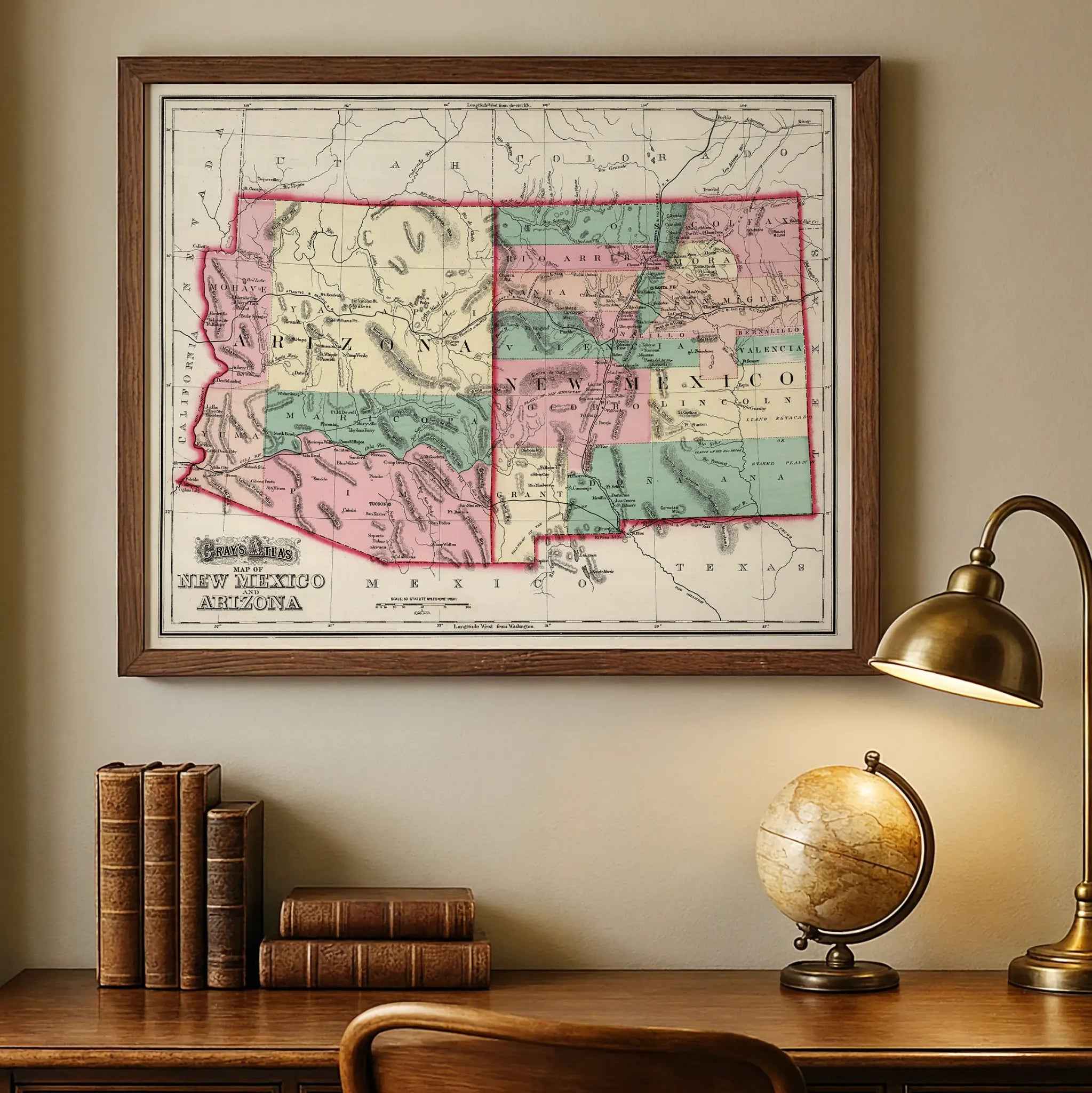
New Mexico Arizona Map - Vintage 1873 Gray's Atlas Historical Map for Collectors
Sale priceFrom $39.99

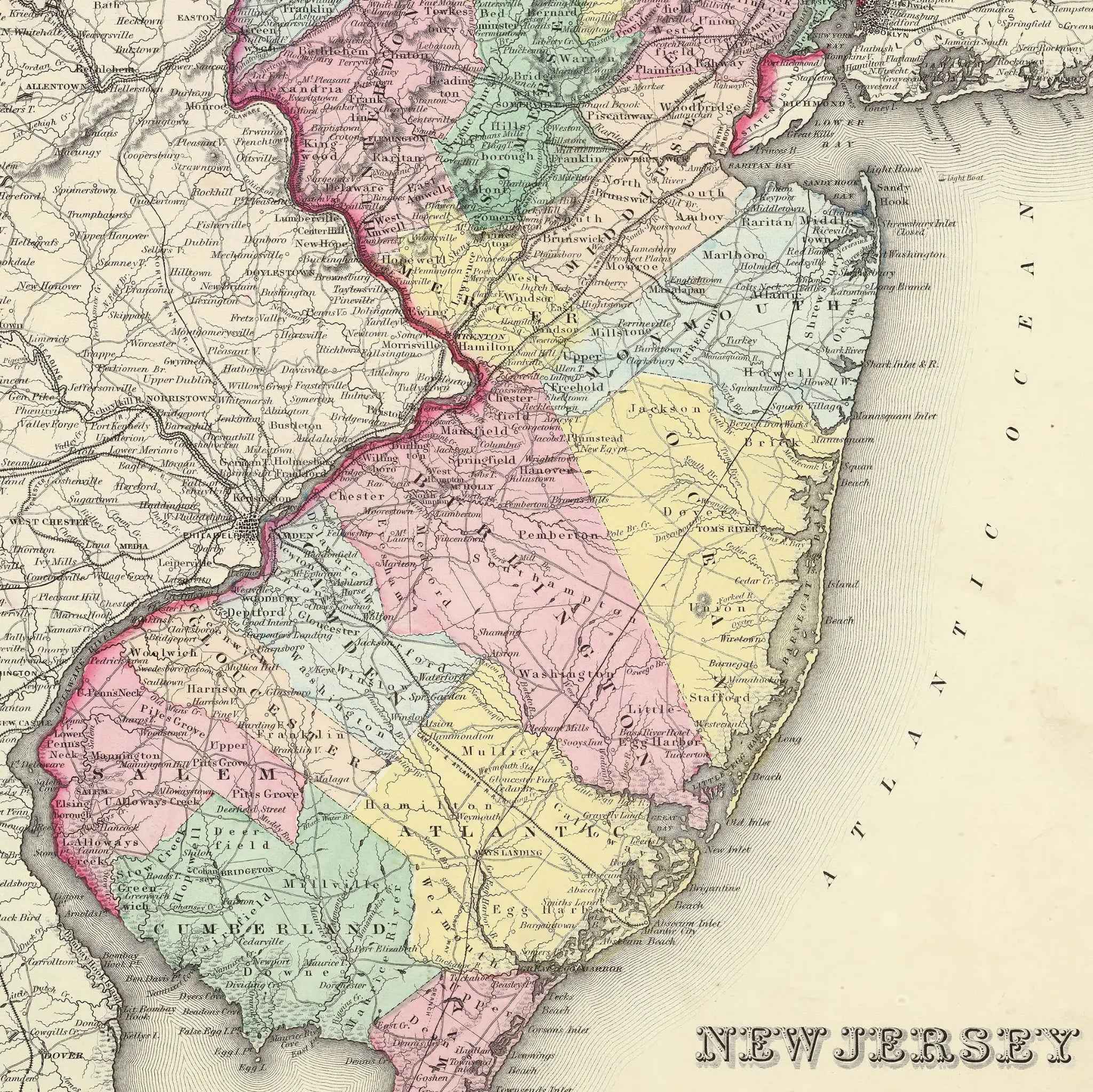
New Jersey Map - Vintage 1855 Colton Historical Map for Home Decor
Sale priceFrom $39.99

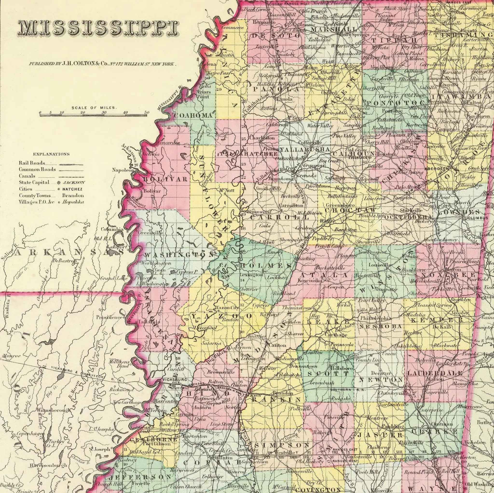
Mississippi Map - Vintage 1856 Colton Historical Art Print
Sale priceFrom $39.99
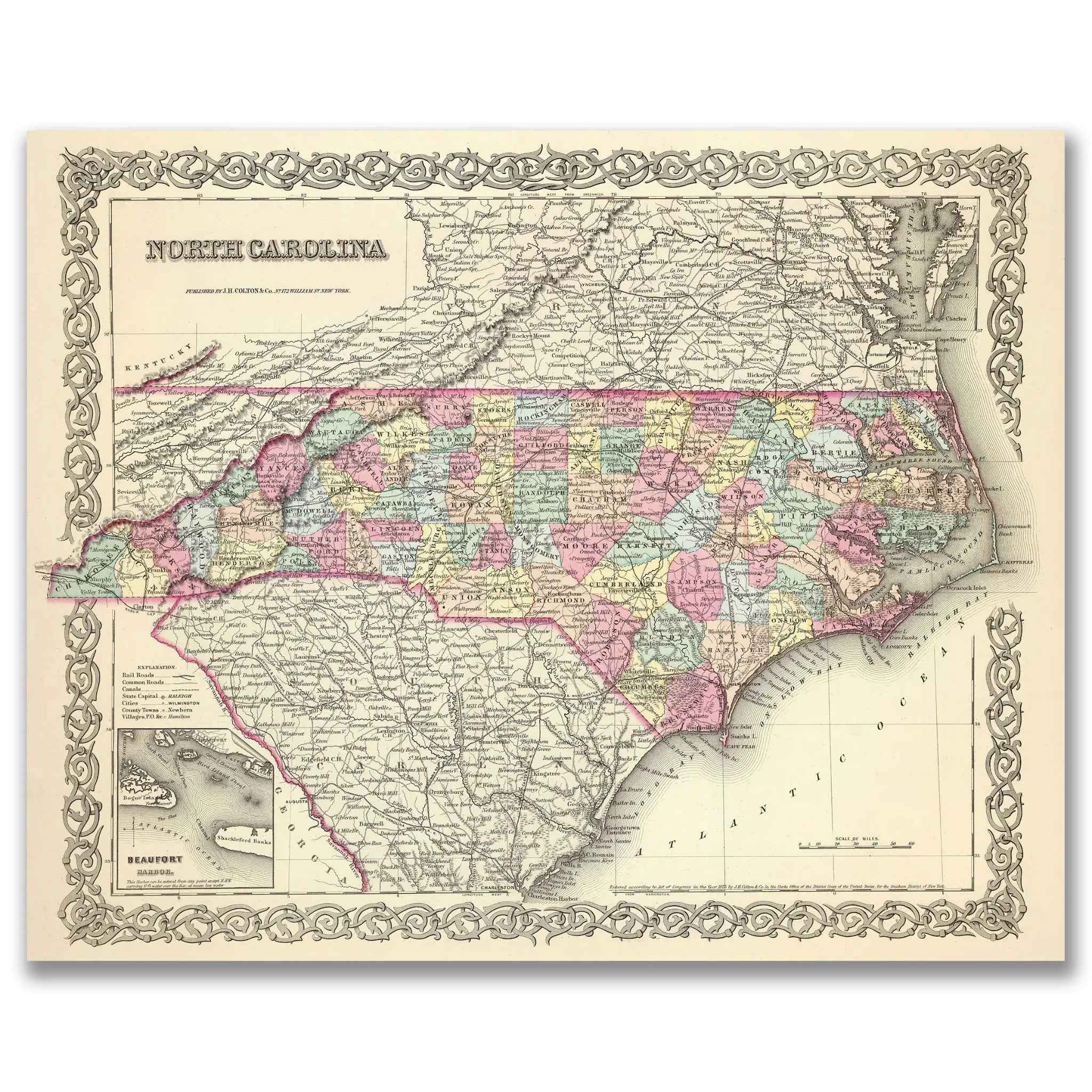
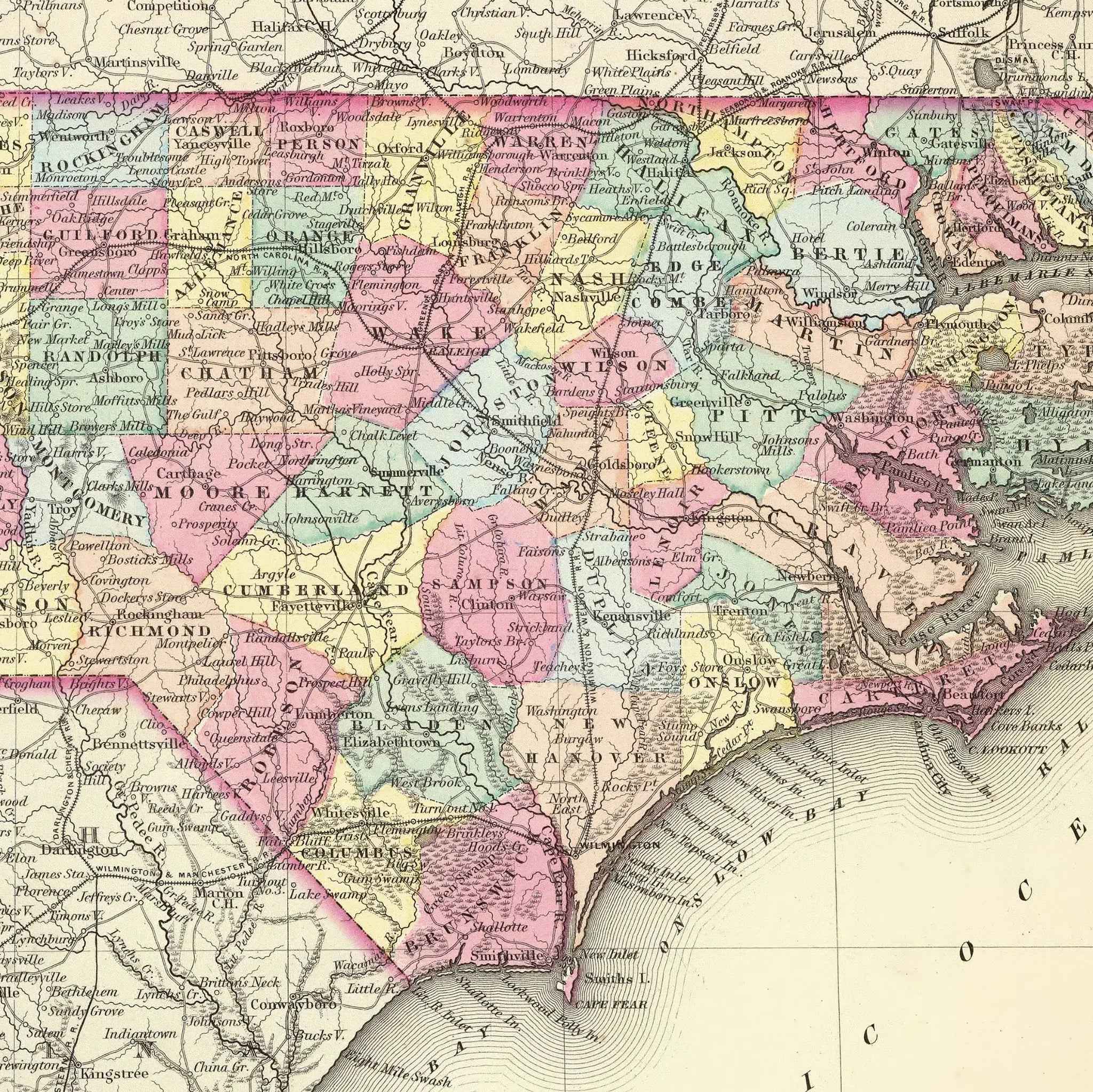
North Carolina Map - Vintage 1855 Colton Historical Map featuring Beaufort Harbor
Sale priceFrom $39.99
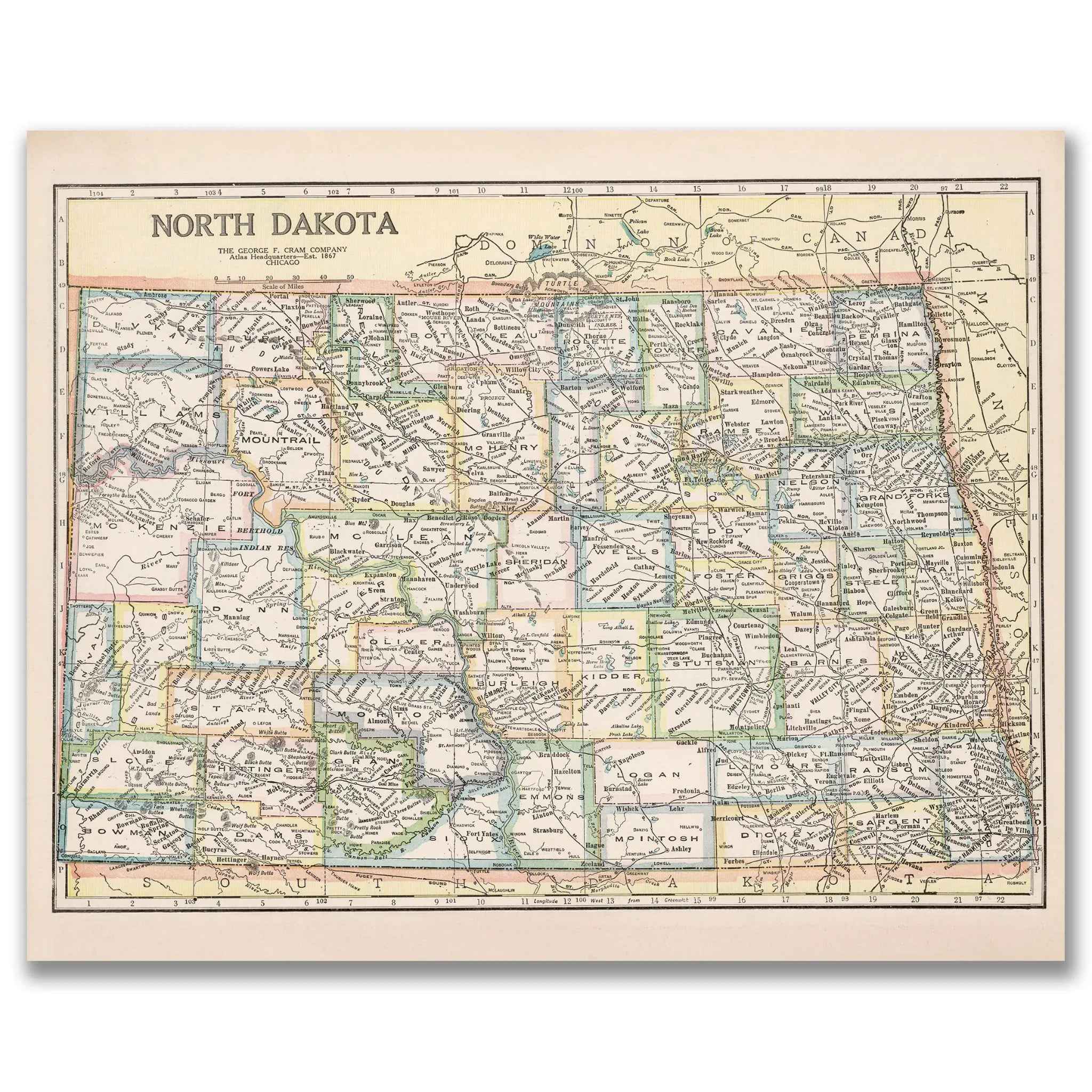
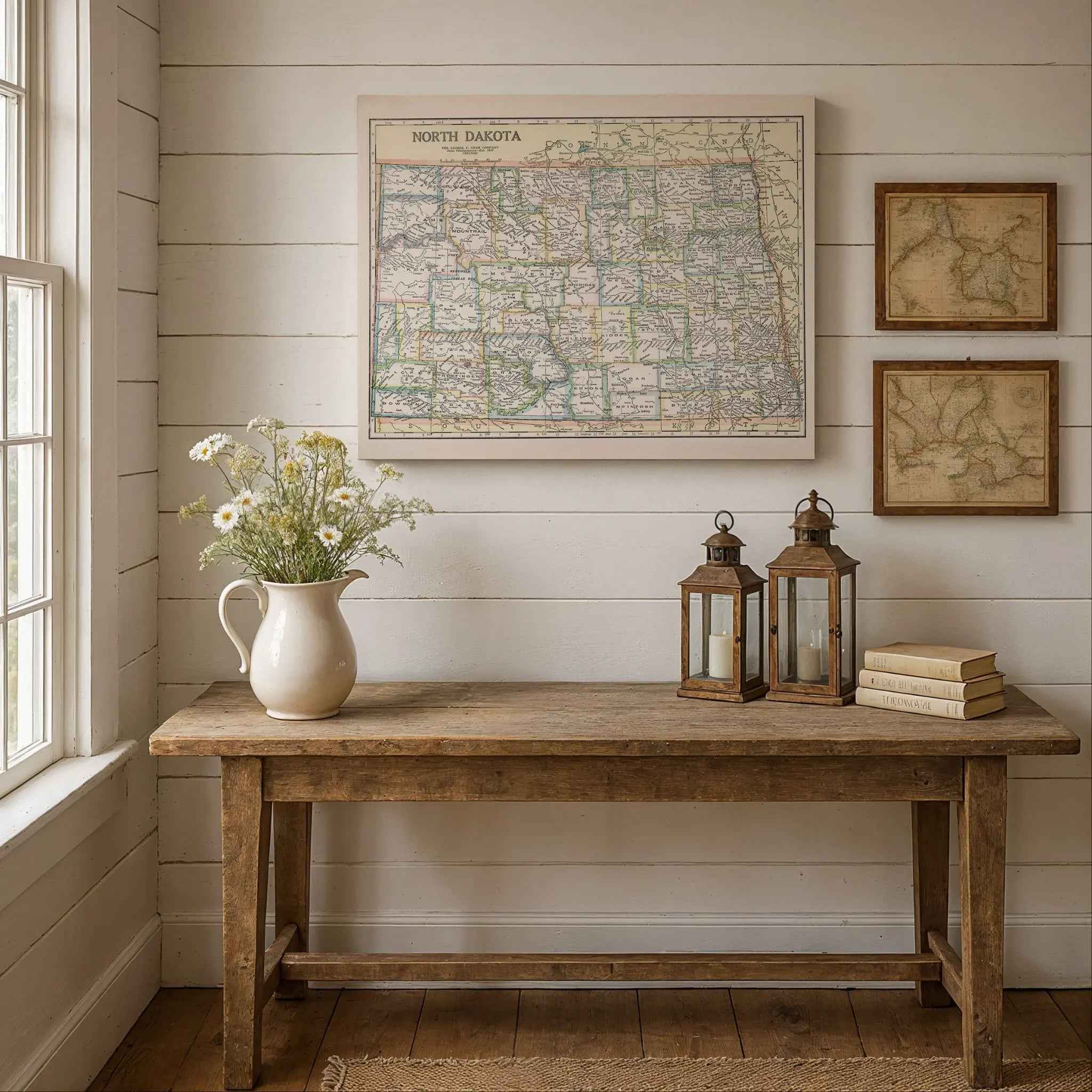
North Dakota Map - Vintage 1920 Historical Map by George F. Cram
Sale priceFrom $39.99
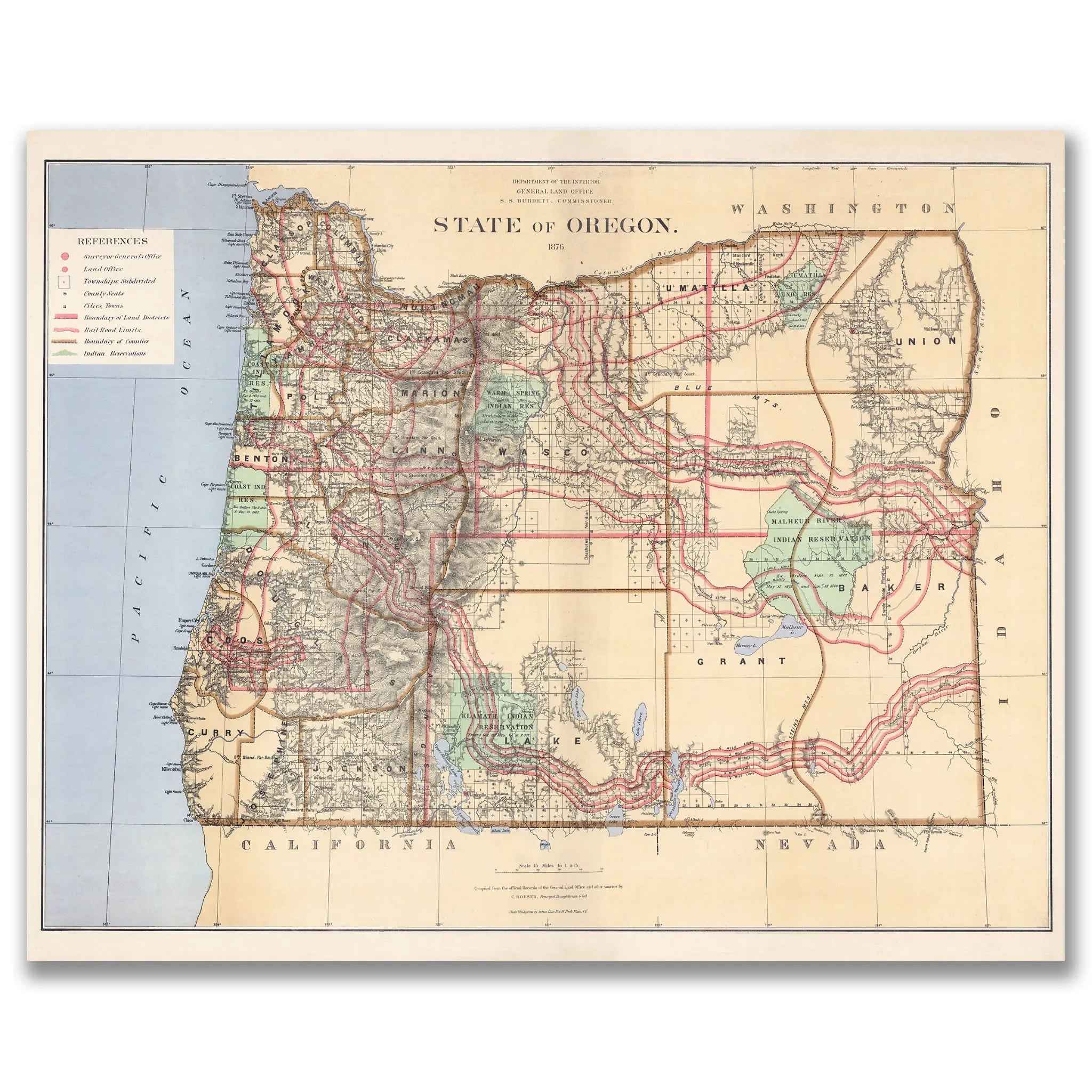
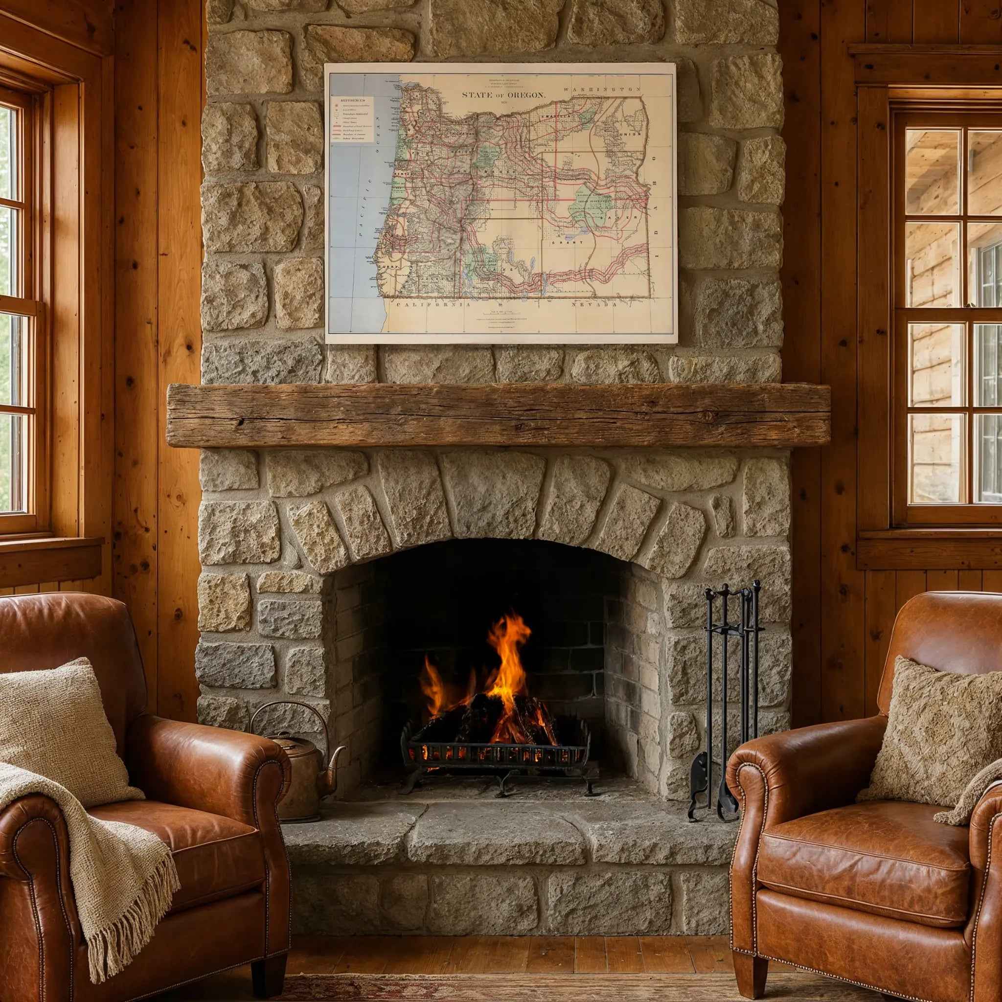
Oregon Map - Vintage 1876 Department of Interior Historical Map
Sale priceFrom $39.99
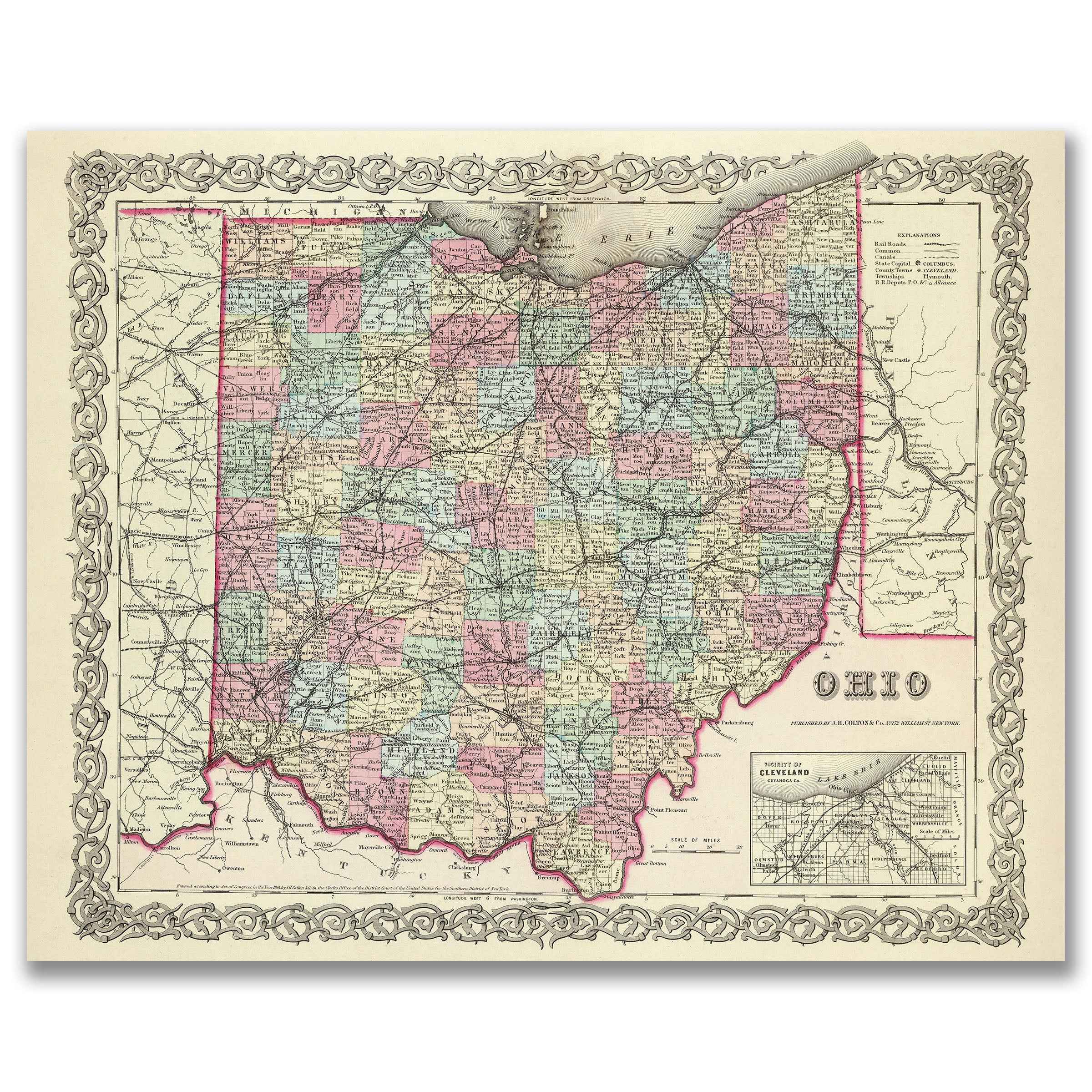
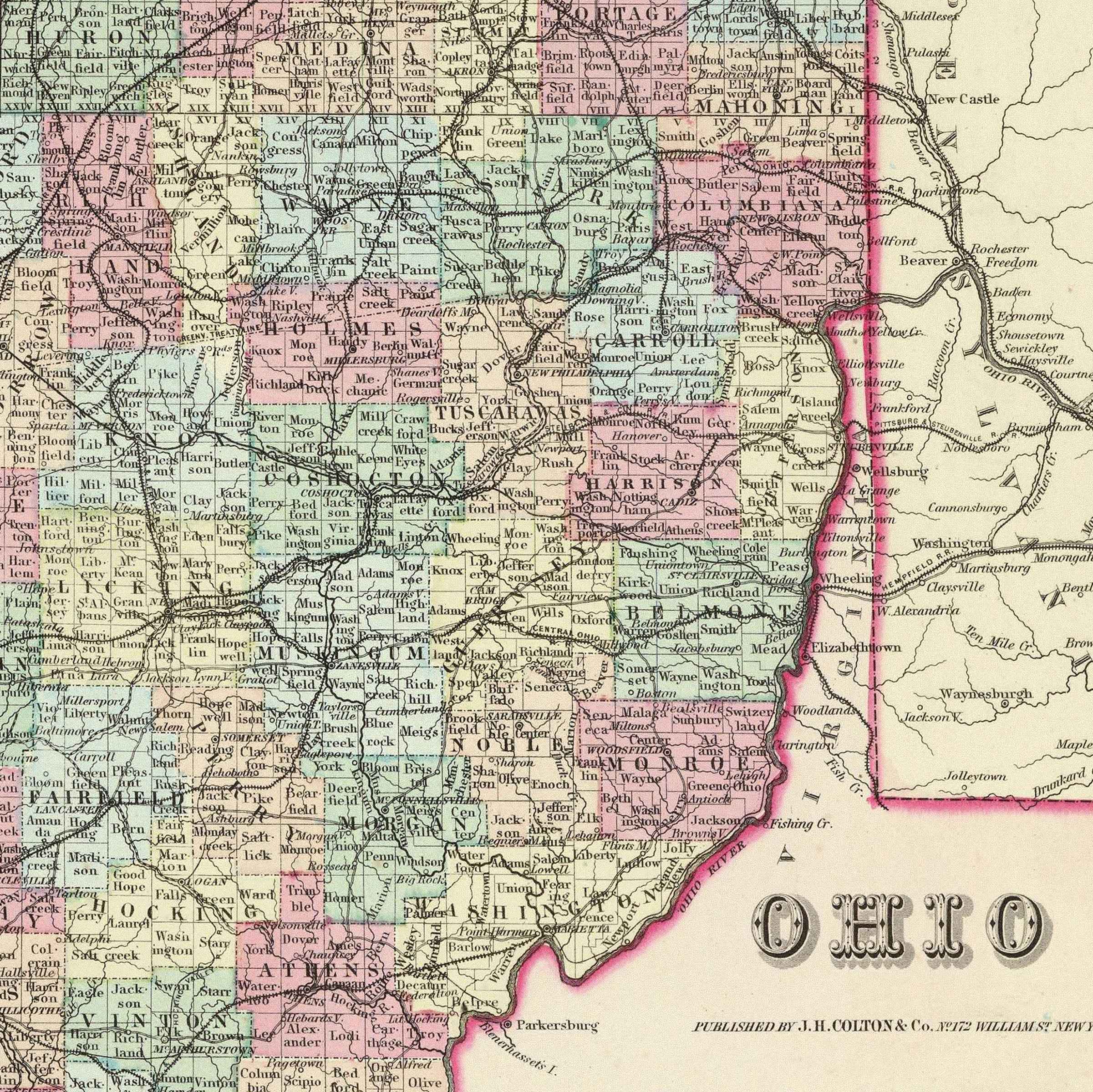
Ohio Map - Vintage 1856 Colton Historical Map with Cleveland Vicinity
Sale priceFrom $39.99