Skip to content

United States

United States Maps

Bring the story of America into your home with our collection of United States maps. From historic wall maps that capture the nation’s early growth to beautifully restored vintage U.S. maps and modern decorative designs, these pieces are created for those who appreciate history, craftsmanship, and meaningful décor.

Our United States map wall art is available in multiple formats, including premium paper posters, stretched canvas, and framed prints. Each map is carefully restored and printed in the USA using archival inks and high-quality materials to ensure lasting color and detail. Whether you are decorating a living room, office, classroom, or study, a U.S. map adds character, depth, and a sense of place to any space.

This collection includes classic political maps, antique railroad maps, early territorial maps, and detailed state-by-state references that highlight how the country was shaped over time. Many designs make exceptional educational wall art for teachers, students, and homeschool spaces, while others are perfect as statement pieces for history lovers, travelers, and collectors.

United States maps also make thoughtful gifts for housewarmings, graduations, military families, and anyone proud of their American roots. Choose from a range of sizes and finishes to match farmhouse, rustic, traditional, or modern décor styles.

Explore our curated selection of United States map wall art and find a piece that connects your space to the geography, history, and spirit of America.

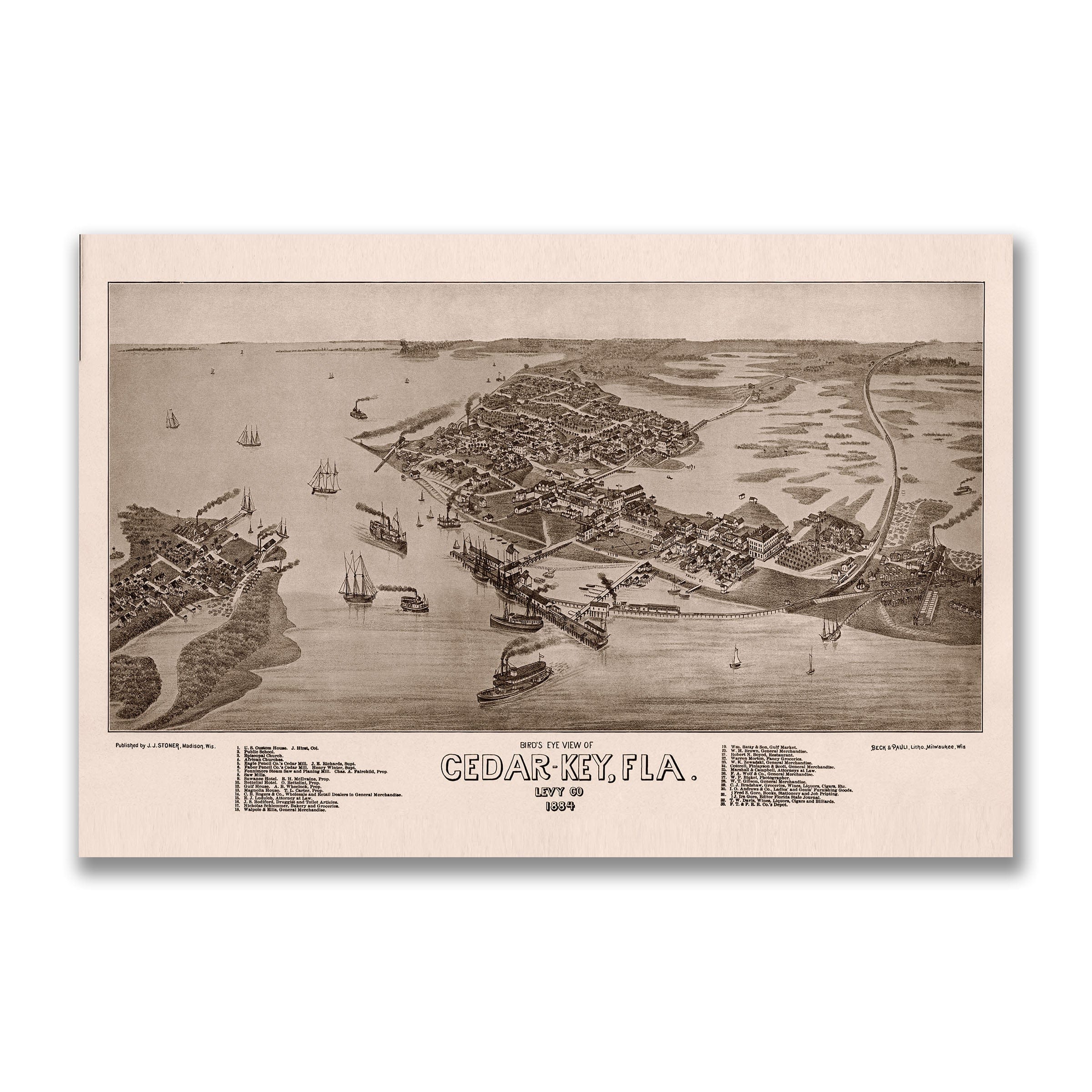
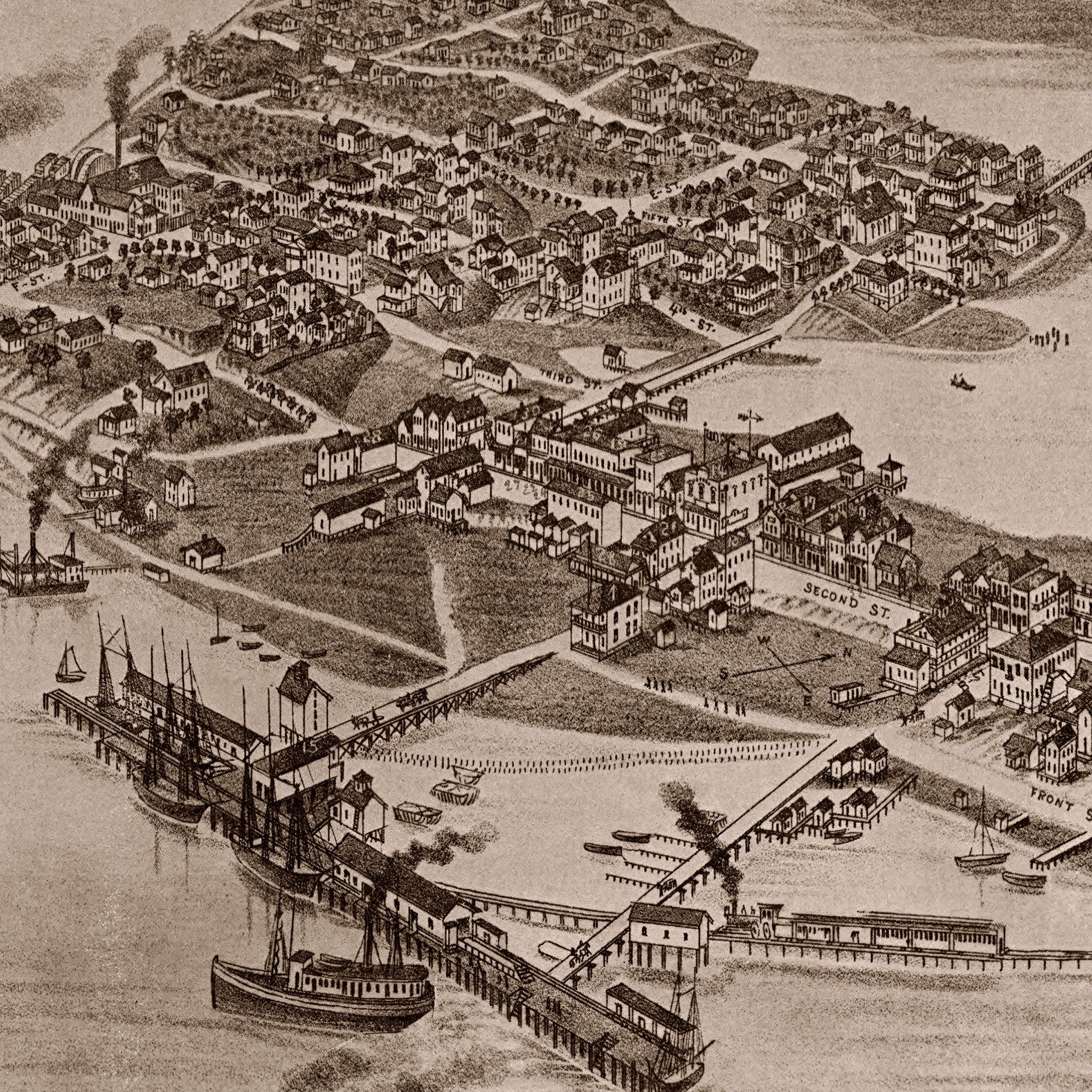
Cedar Key Florida Map - 1884 Historic Gulf Coast Bird's-Eye View - Archive Prints
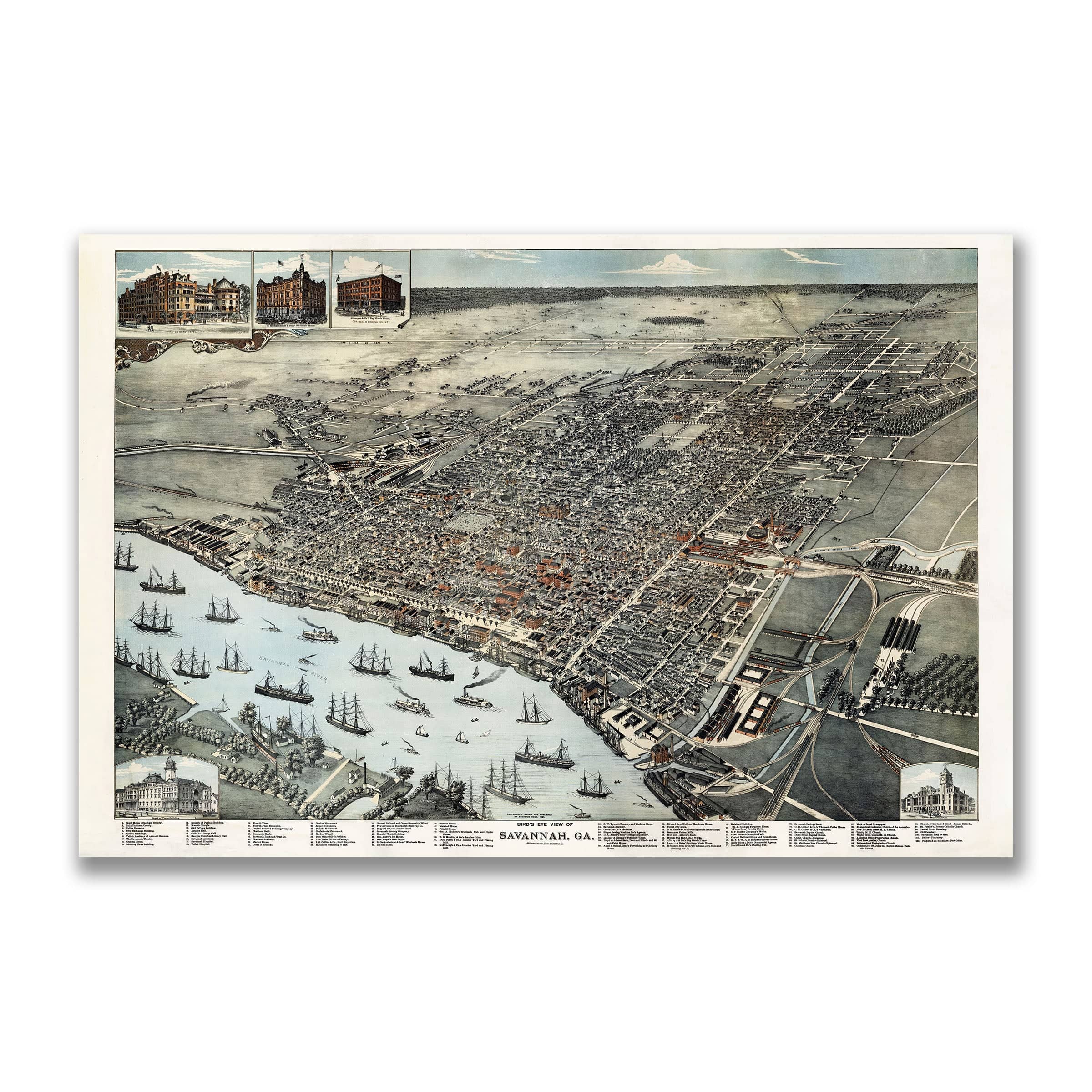
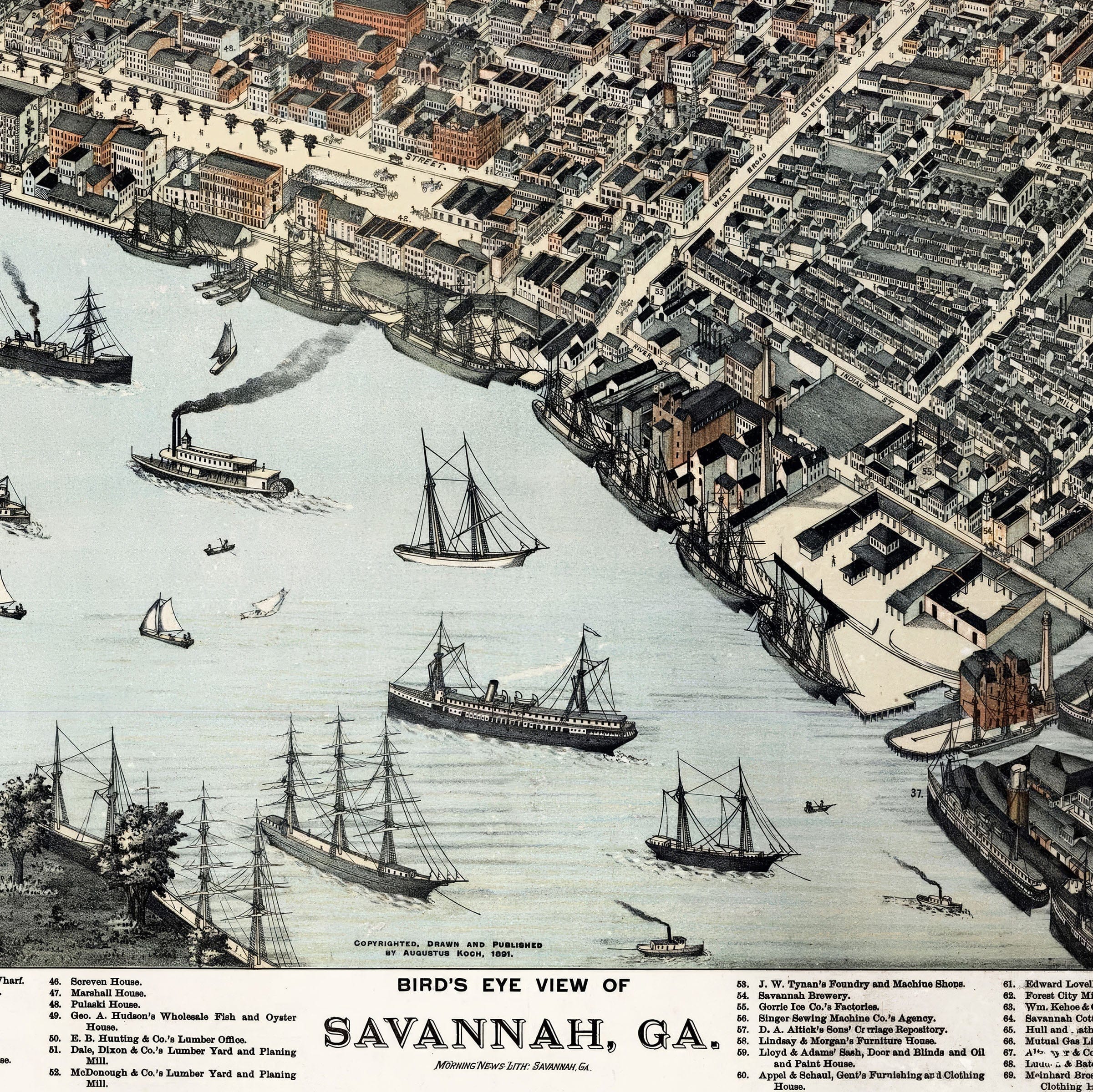
Savannah Georgia Historic Map - 1888 Bird's-Eye View of the City - Archive Prints
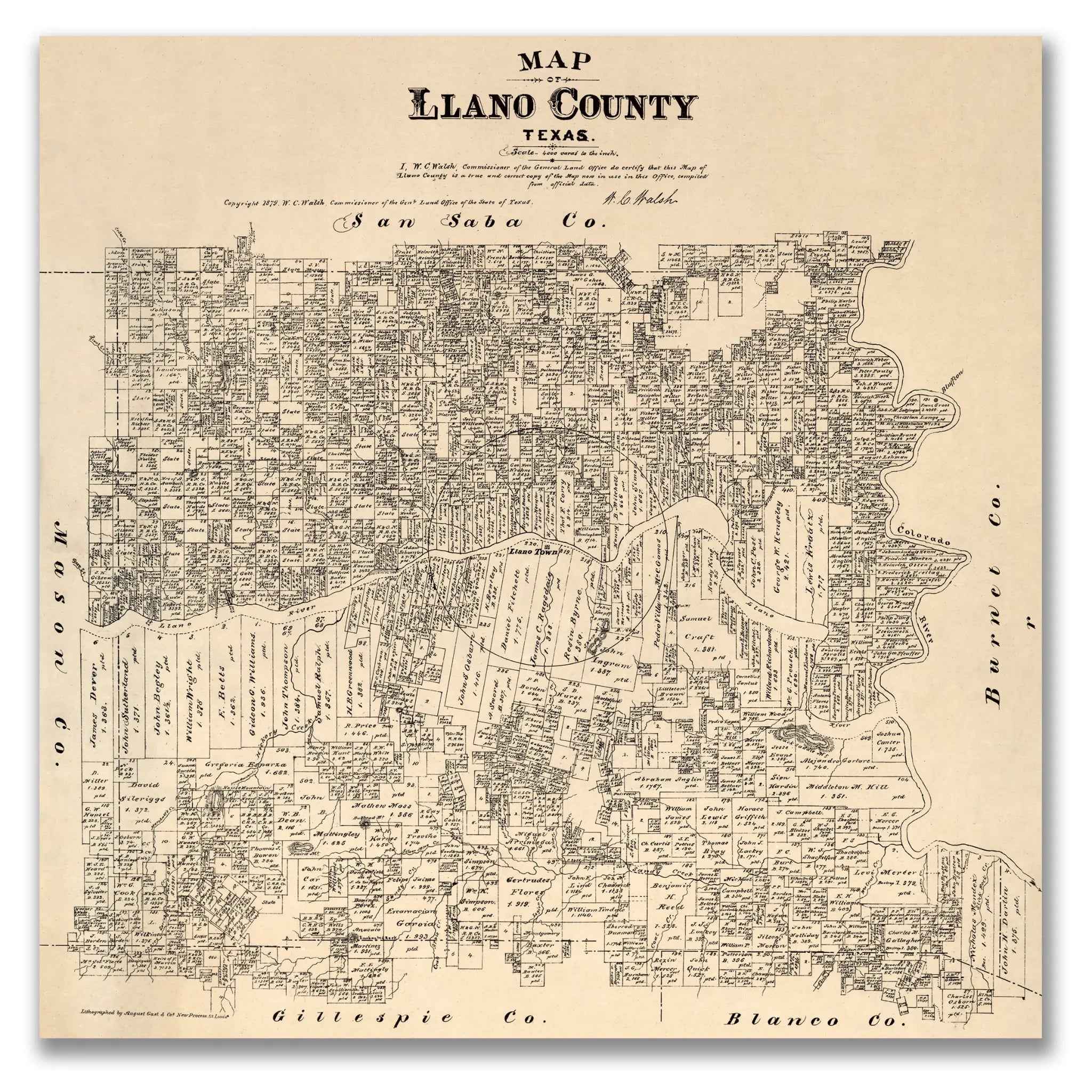
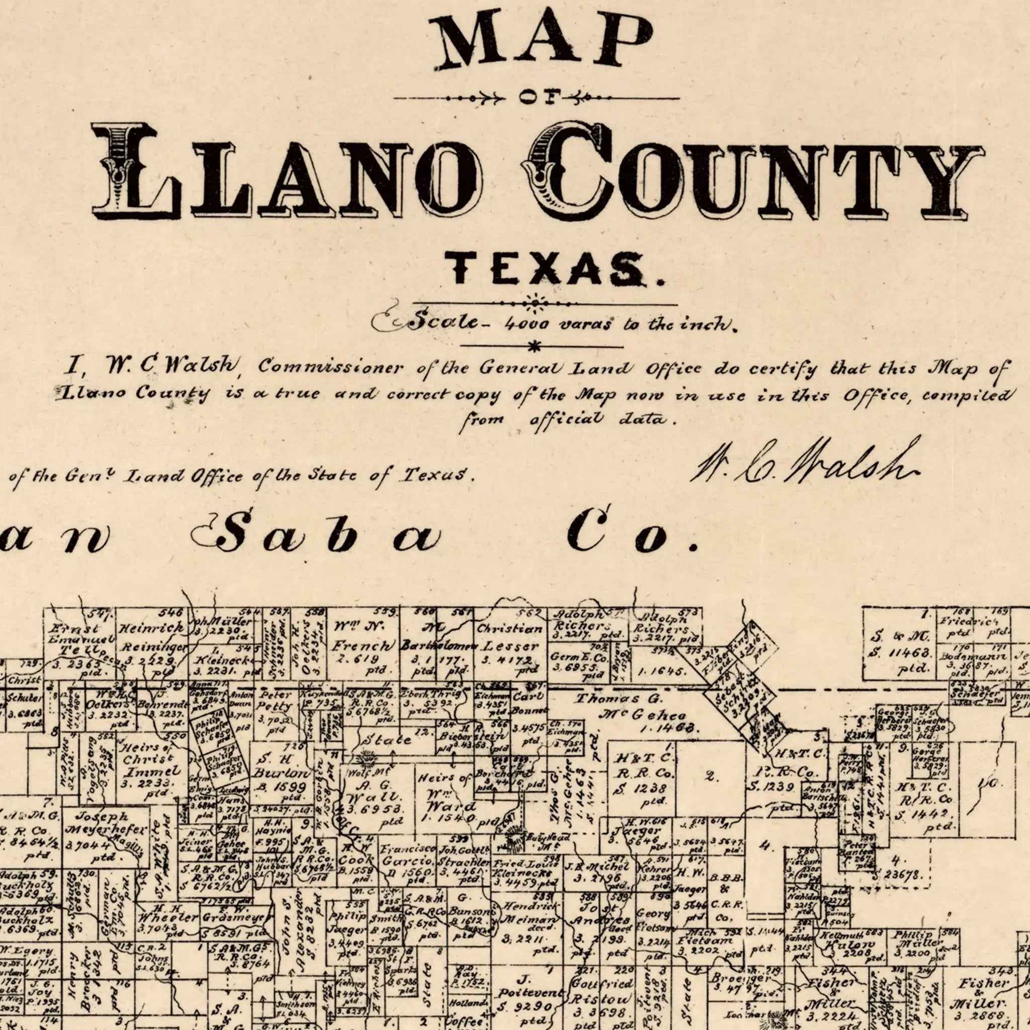
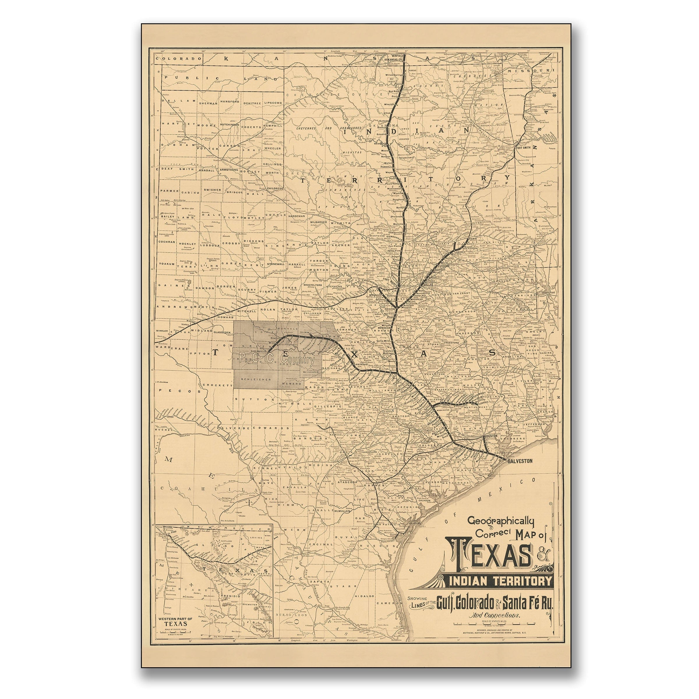
Llano County Vintage Map - Antique 1879 Texas General Land Office Map
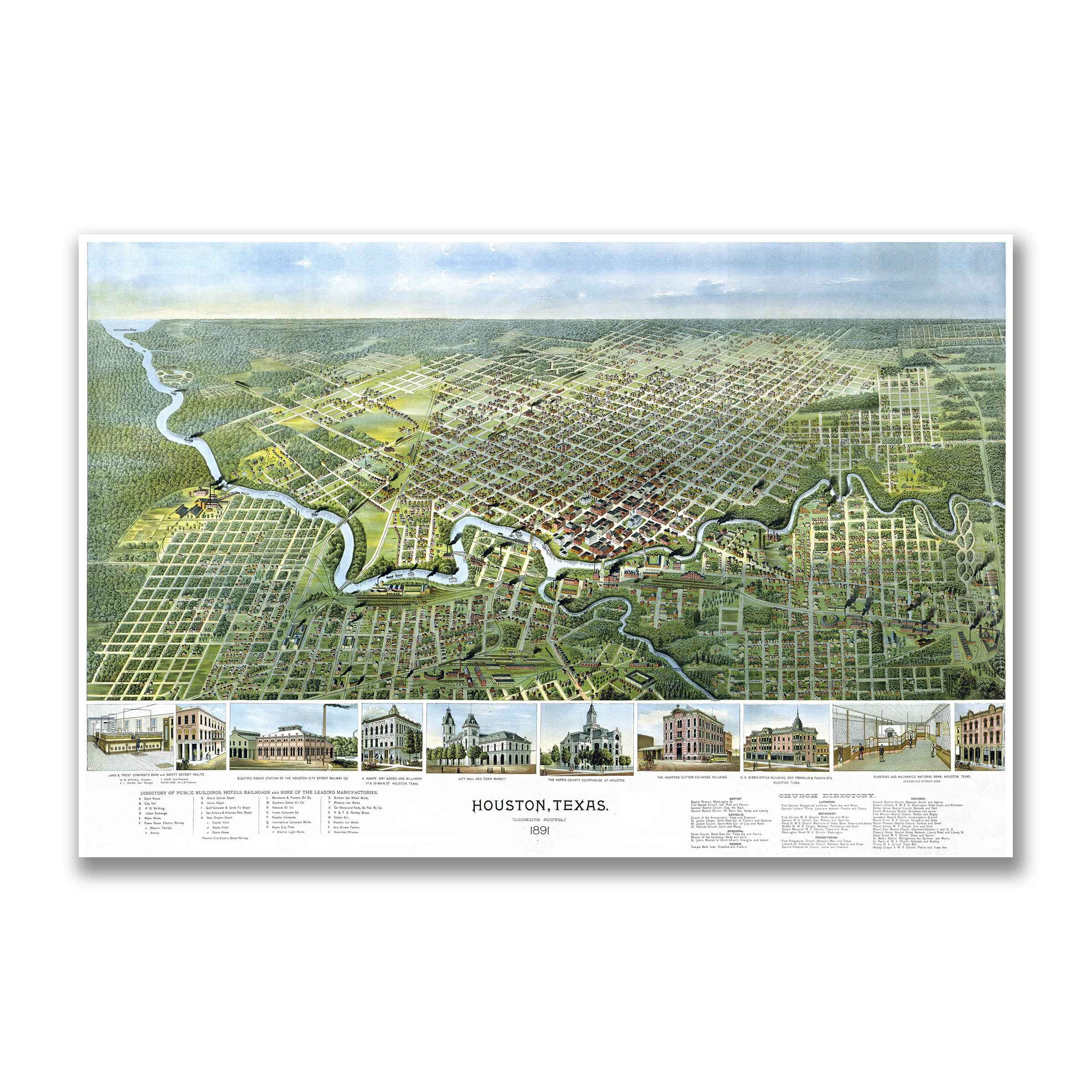
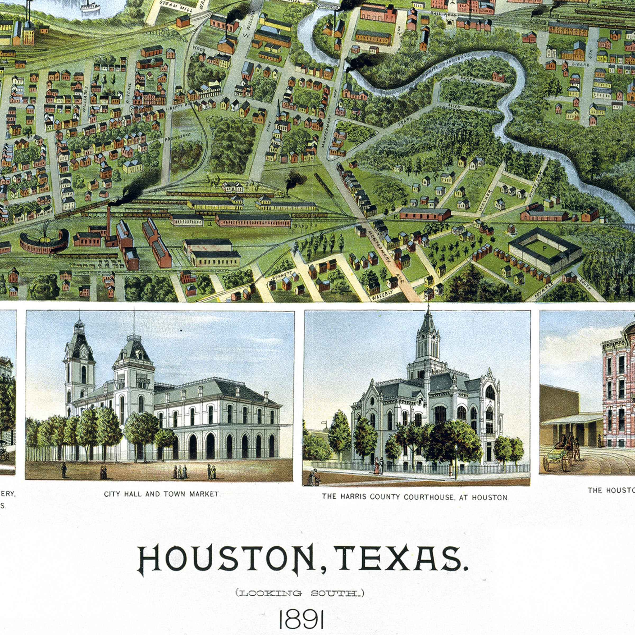
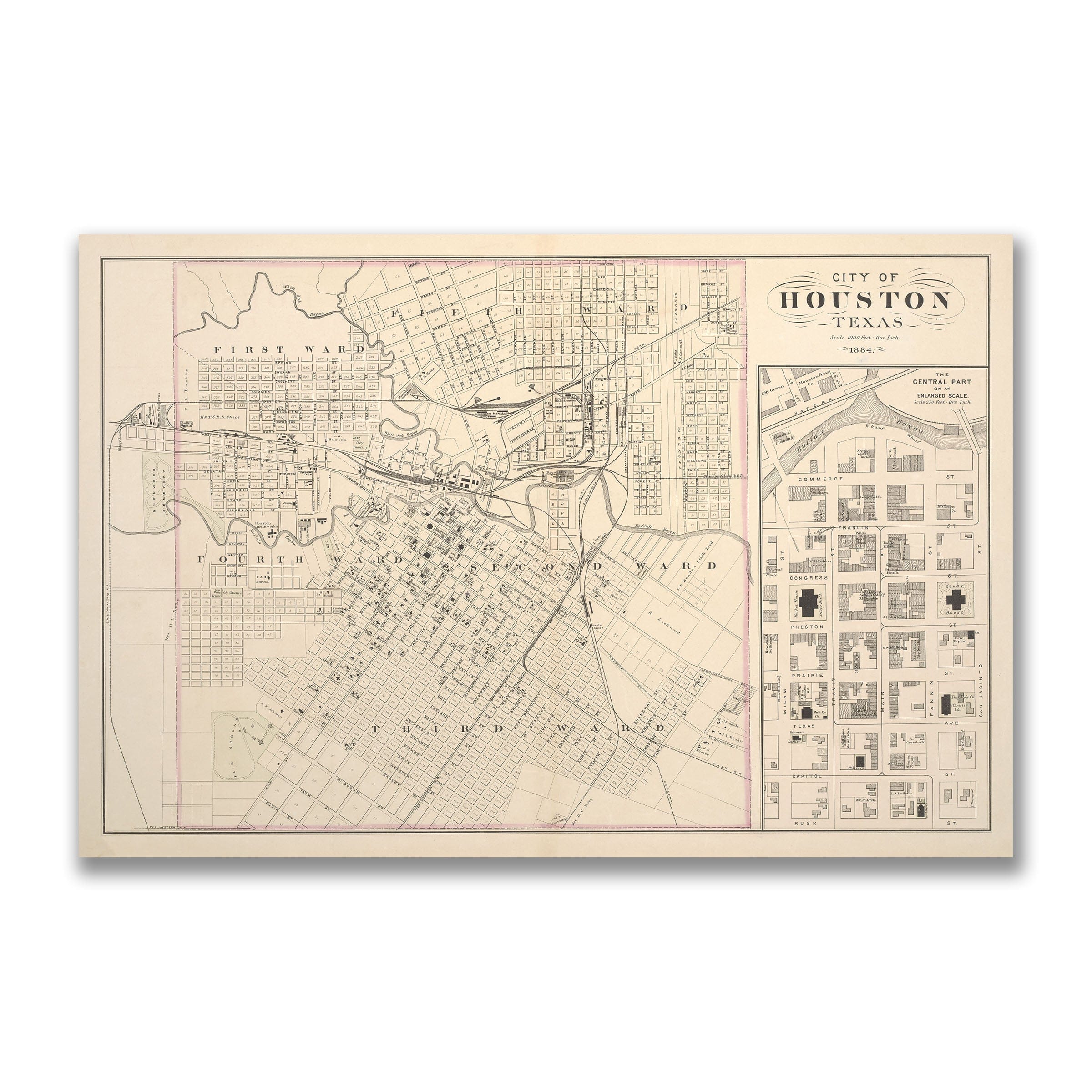
Houston Vintage City Map - 1891 Koch Historical Map of Houston
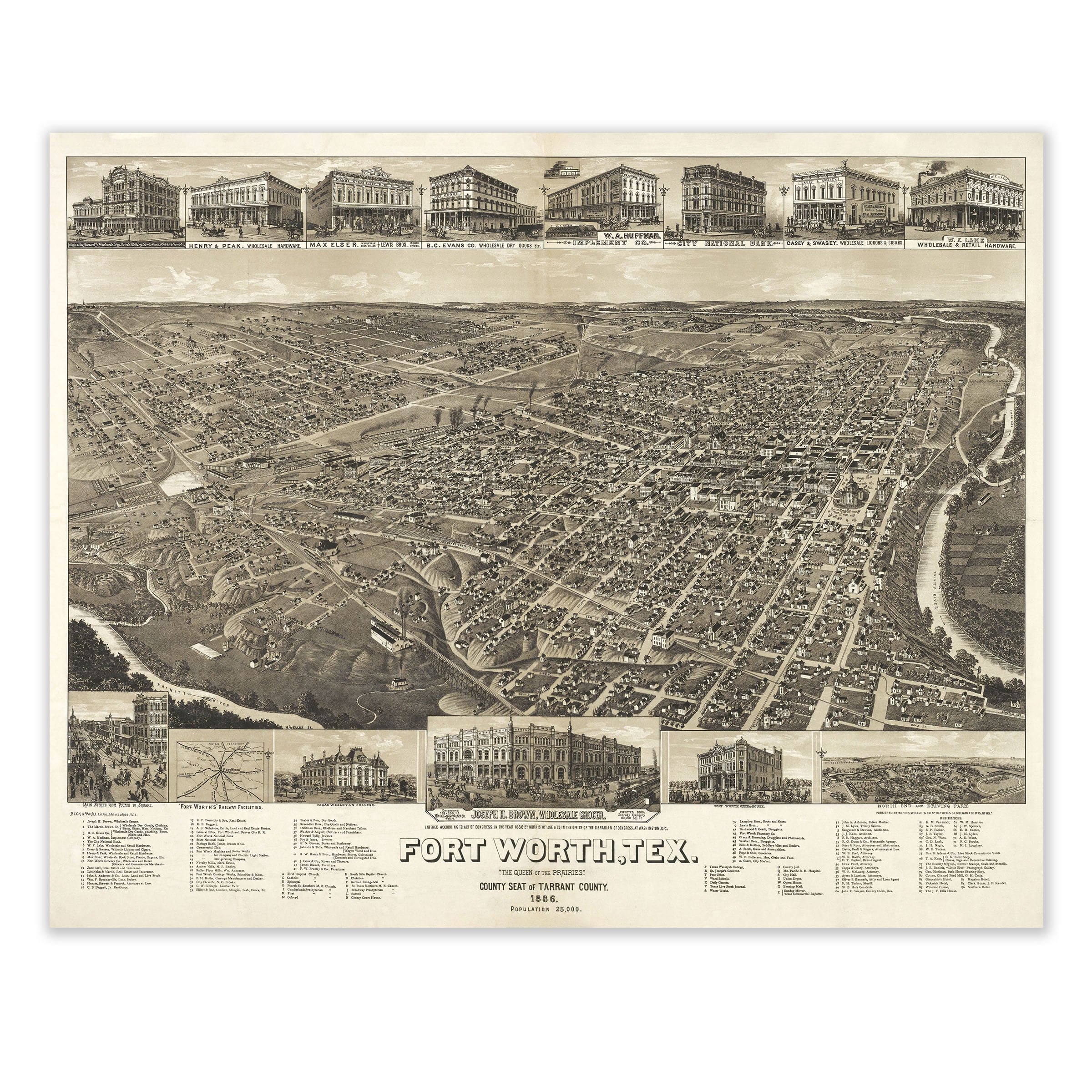
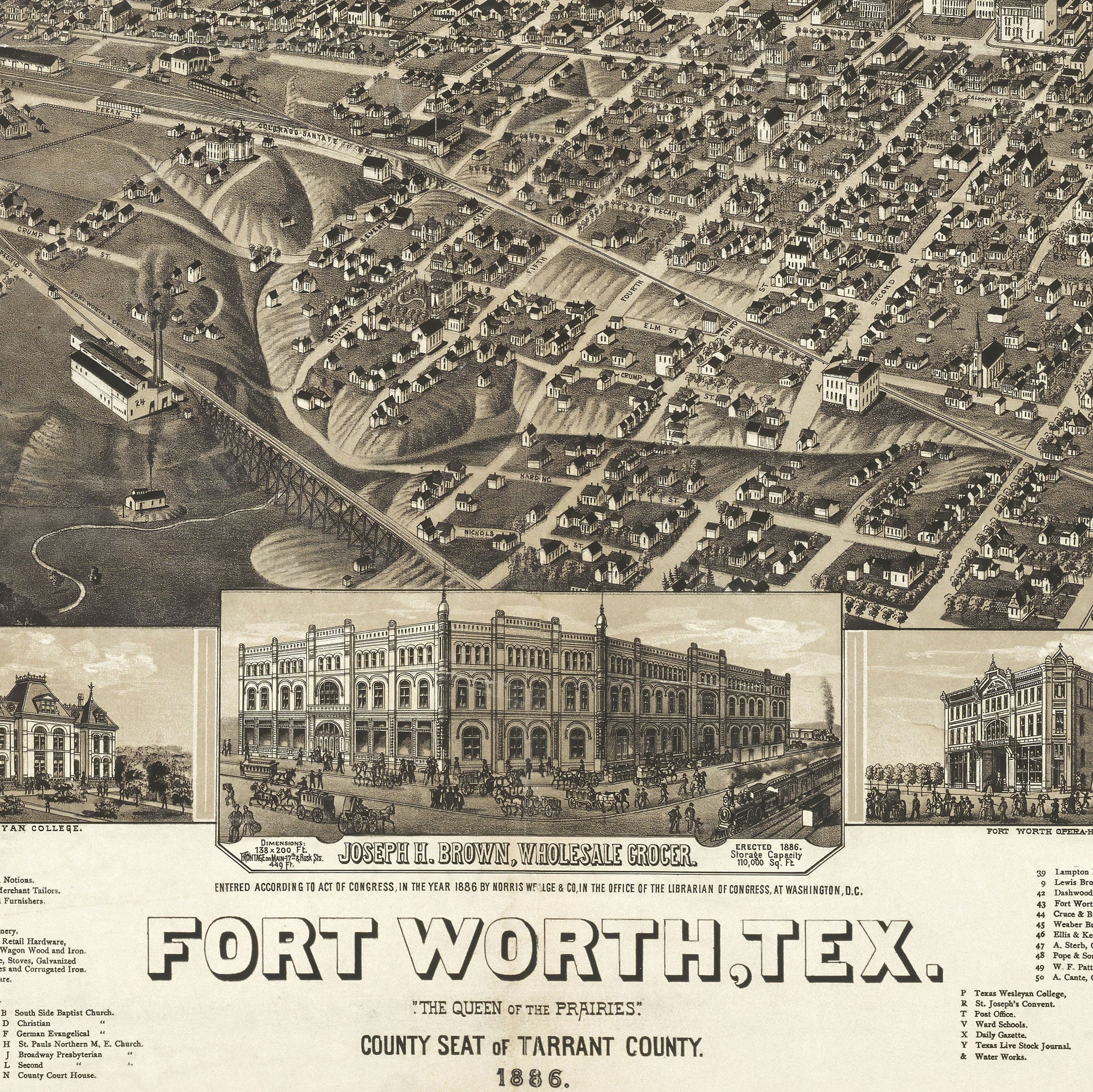
Fort Worth 1886 Décor - Queen of the Prairies Home Accent - Archive Prints
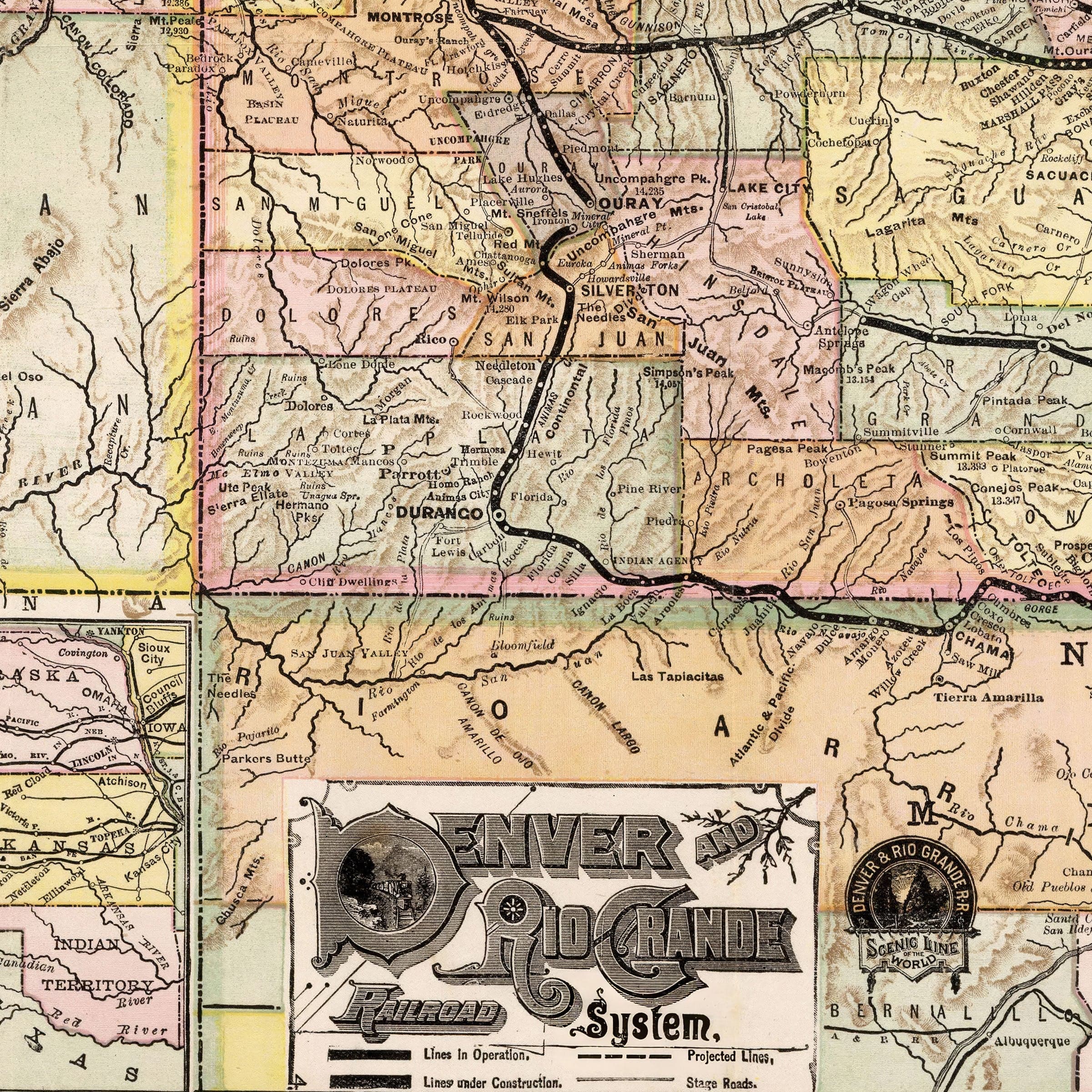
Denver and Rio Grande Railroad Map - Historic System Map from 1883 - Archive Prints
Texas Indian Territory Railway Map 1888 - Gulf Colorado & Santa Fe Railway Historical Print - Archive Prints
Mountain Playground of the University of Colorado 1940 - University of Colorado Fantastical Map - Archive Prints
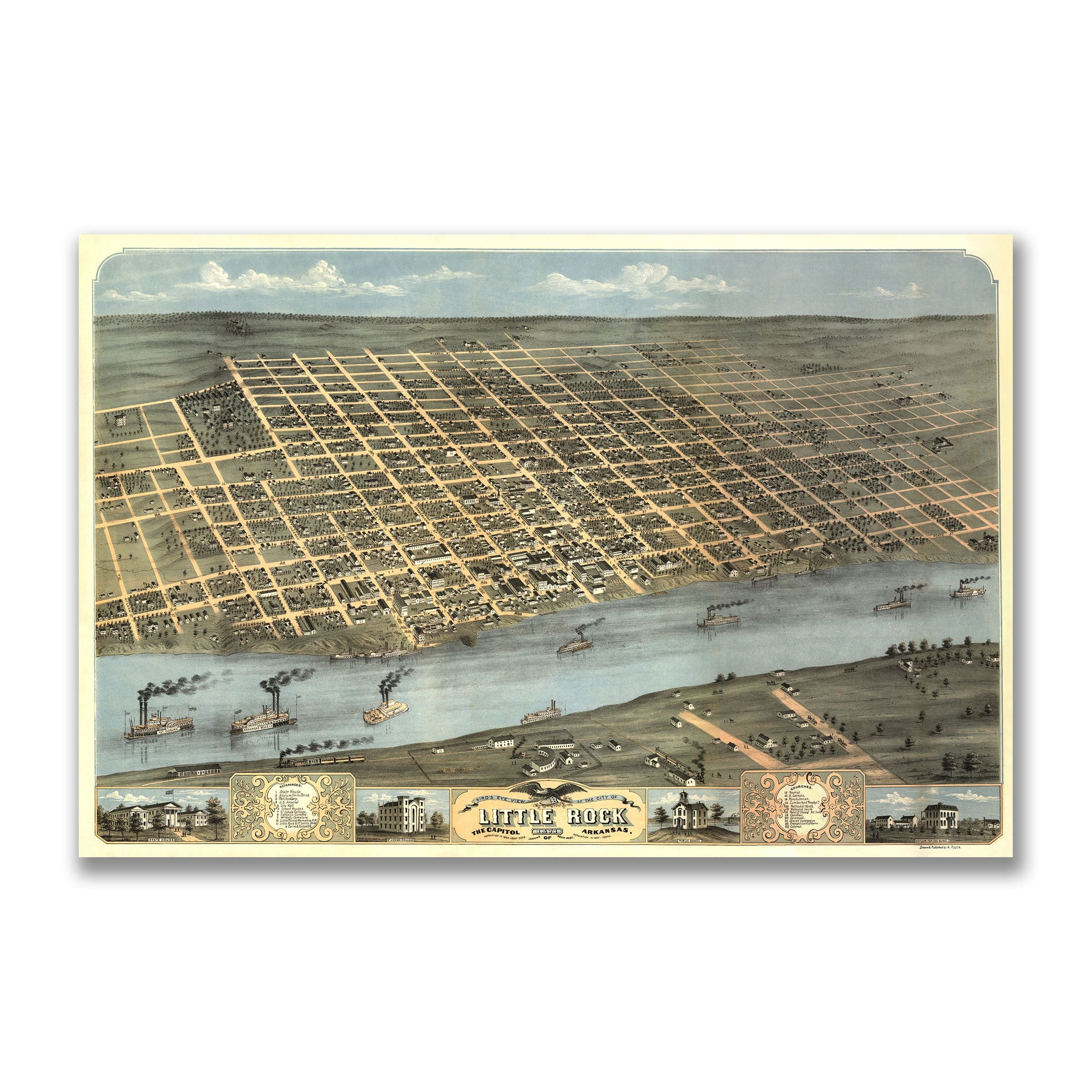
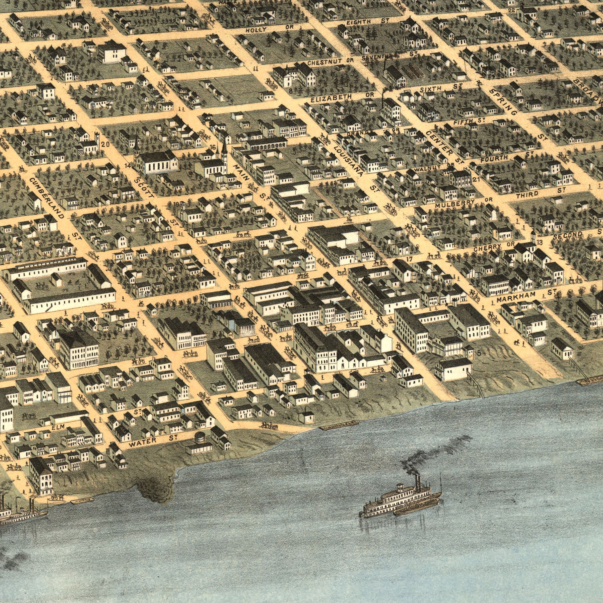
Little Rock Arkansas Historic Map - 1887 Perspective View of the City - Archive Prints
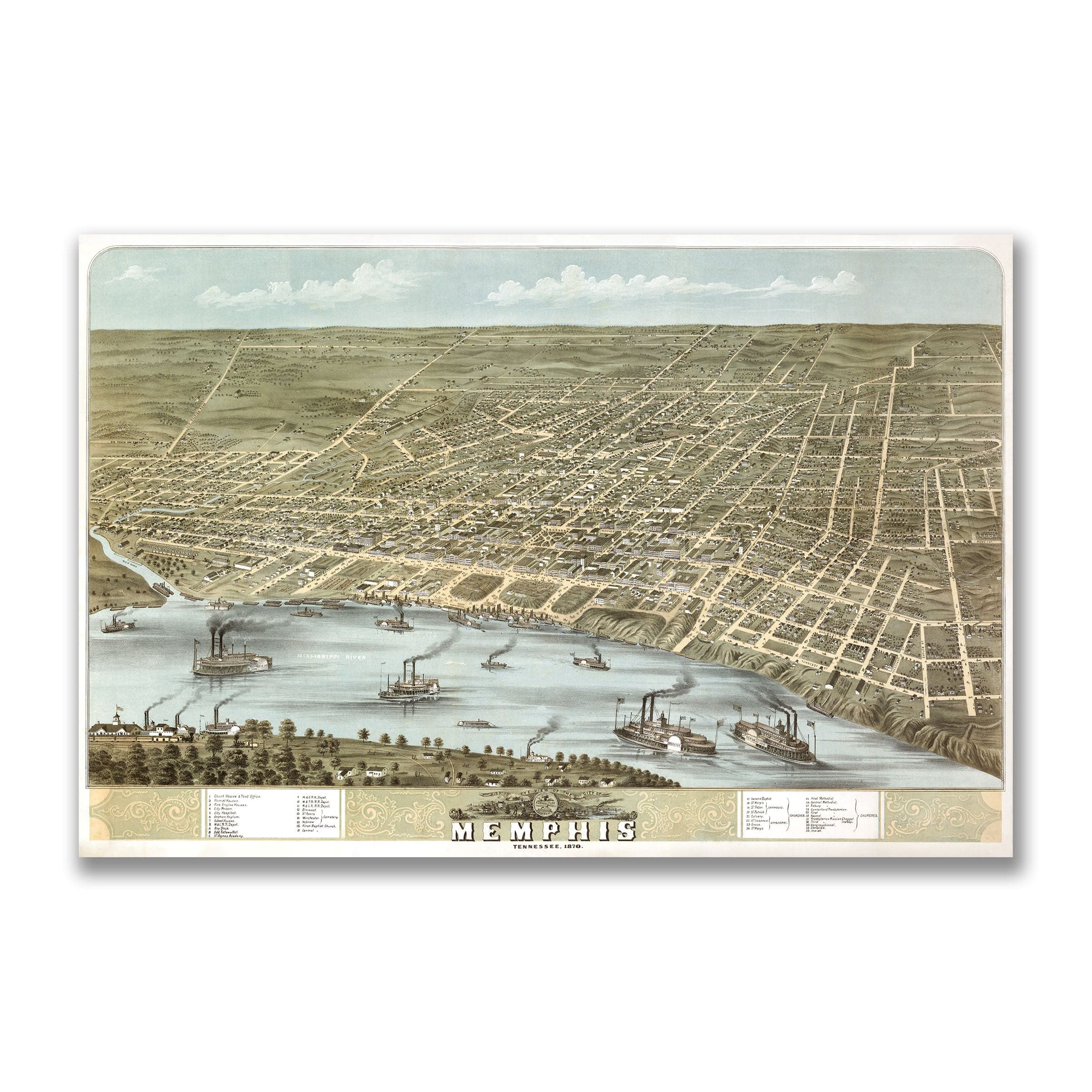
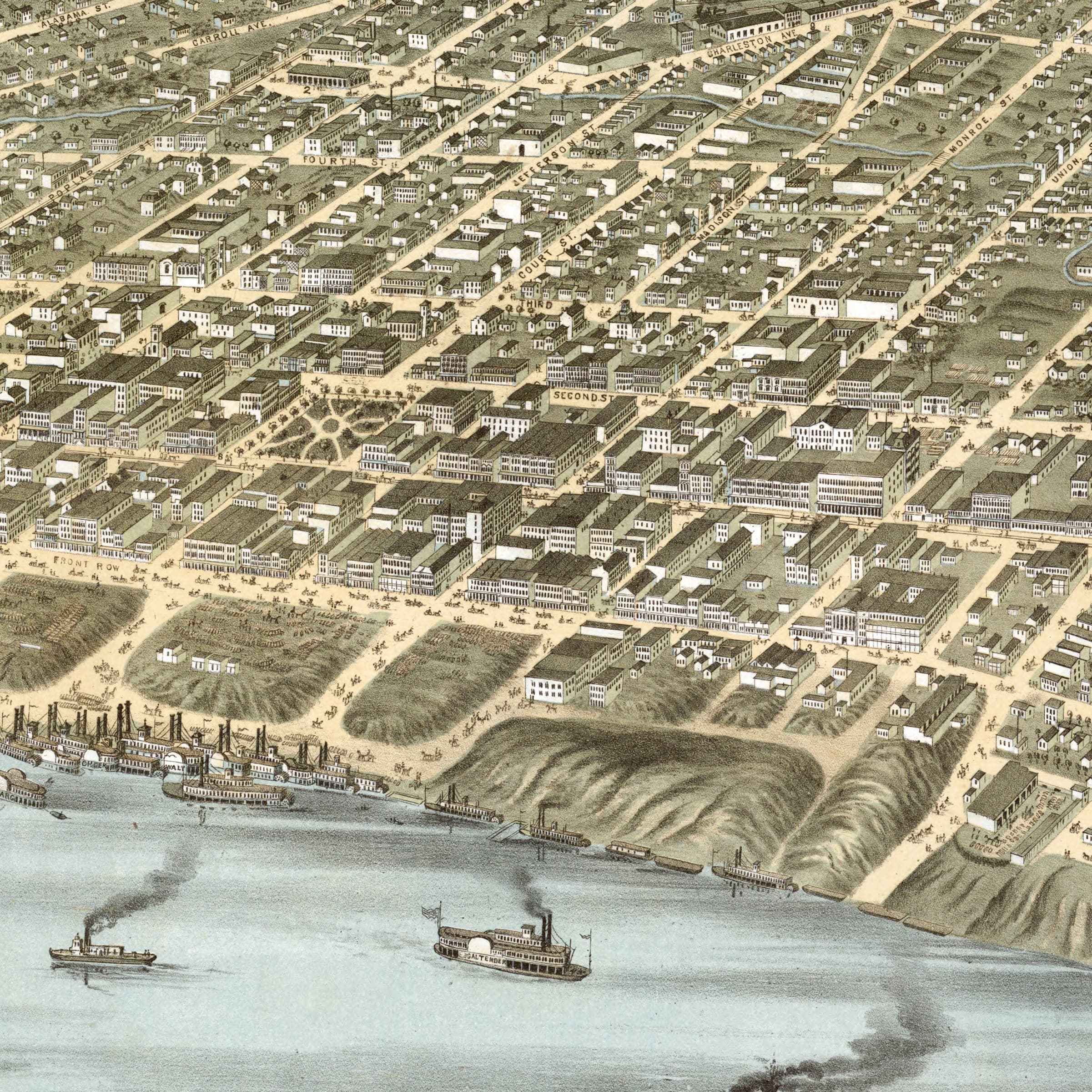
Memphis Tennessee Map - Bird's-Eye View of 1870 Historic River City - Archive Prints
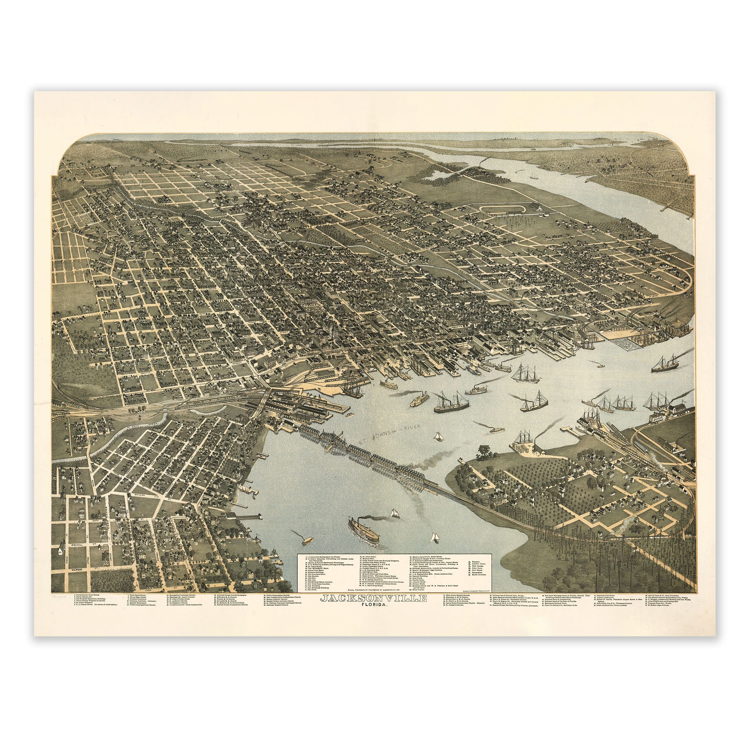
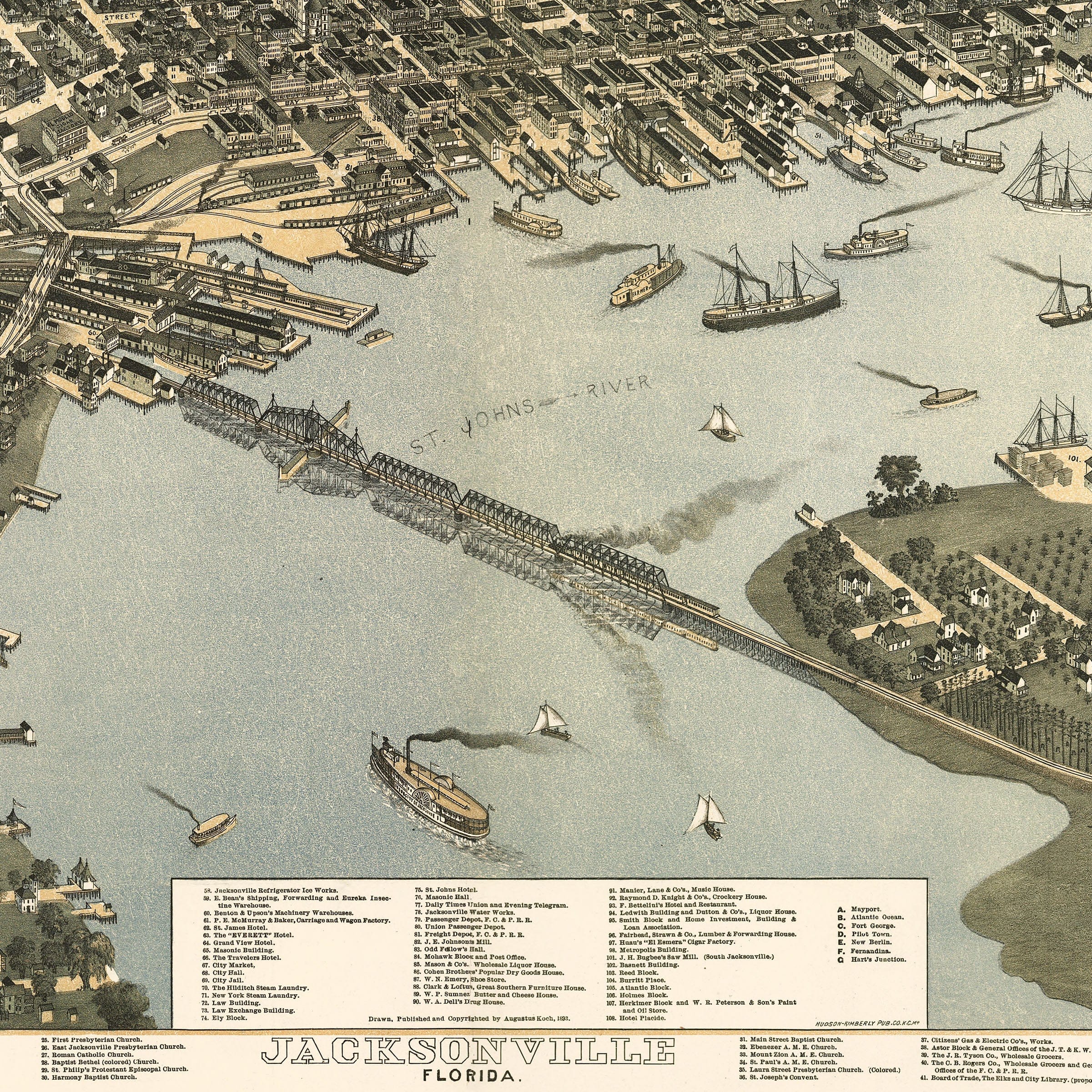
Jacksonville Florida Map - Bird's-Eye View 1893 Historic Gateway - Archive Prints
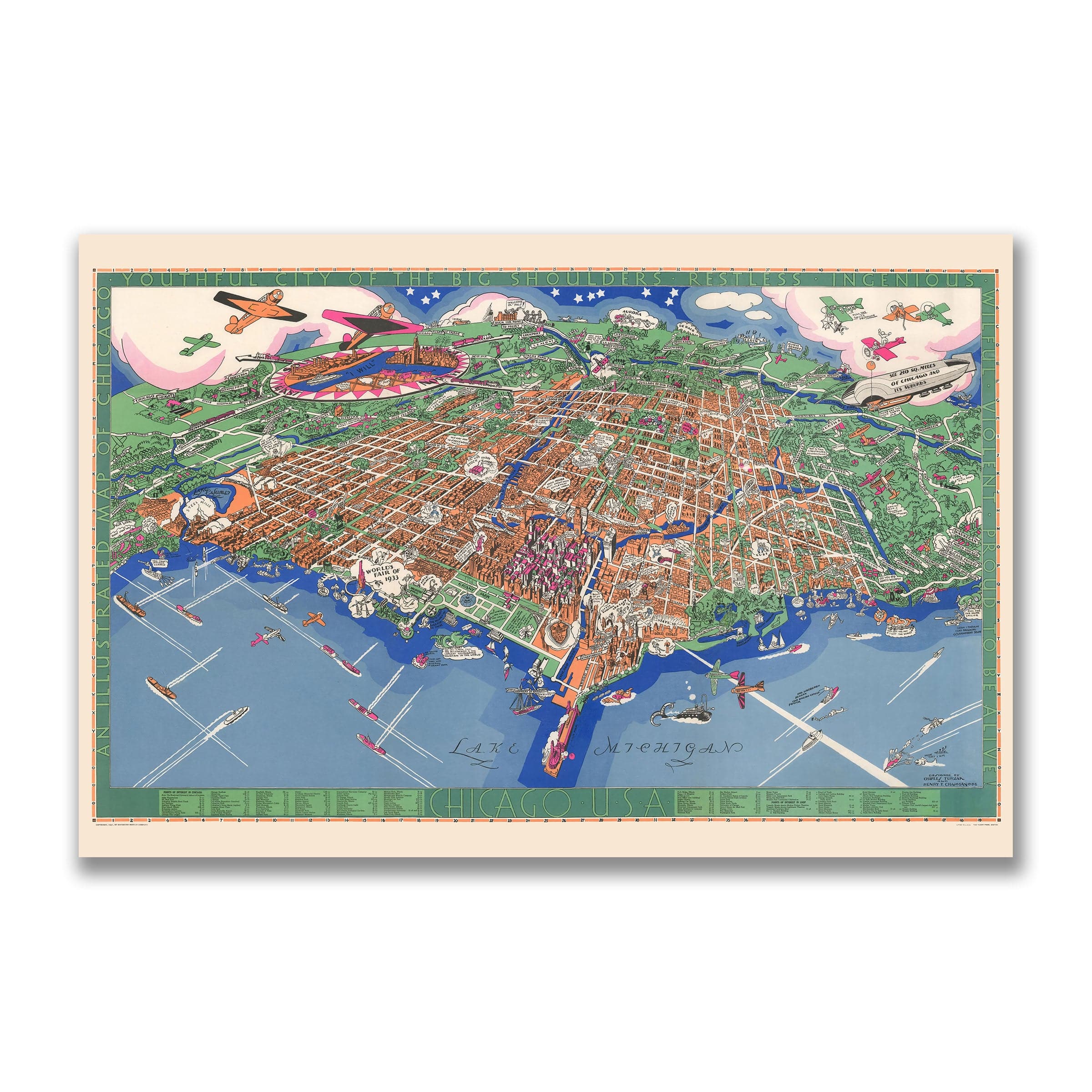
Chicago Illinois Map - Pictorial 1931 Historic City Map - Archive Prints
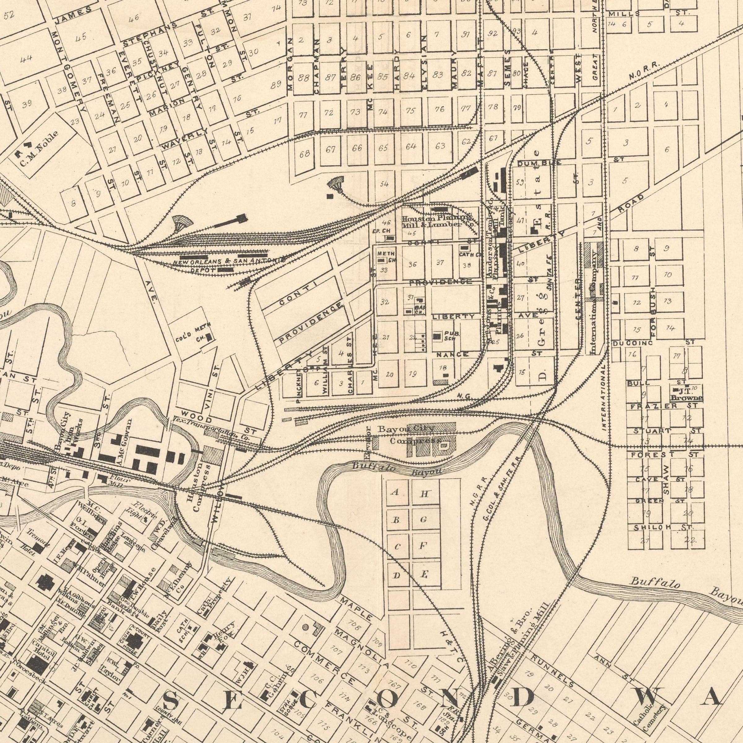
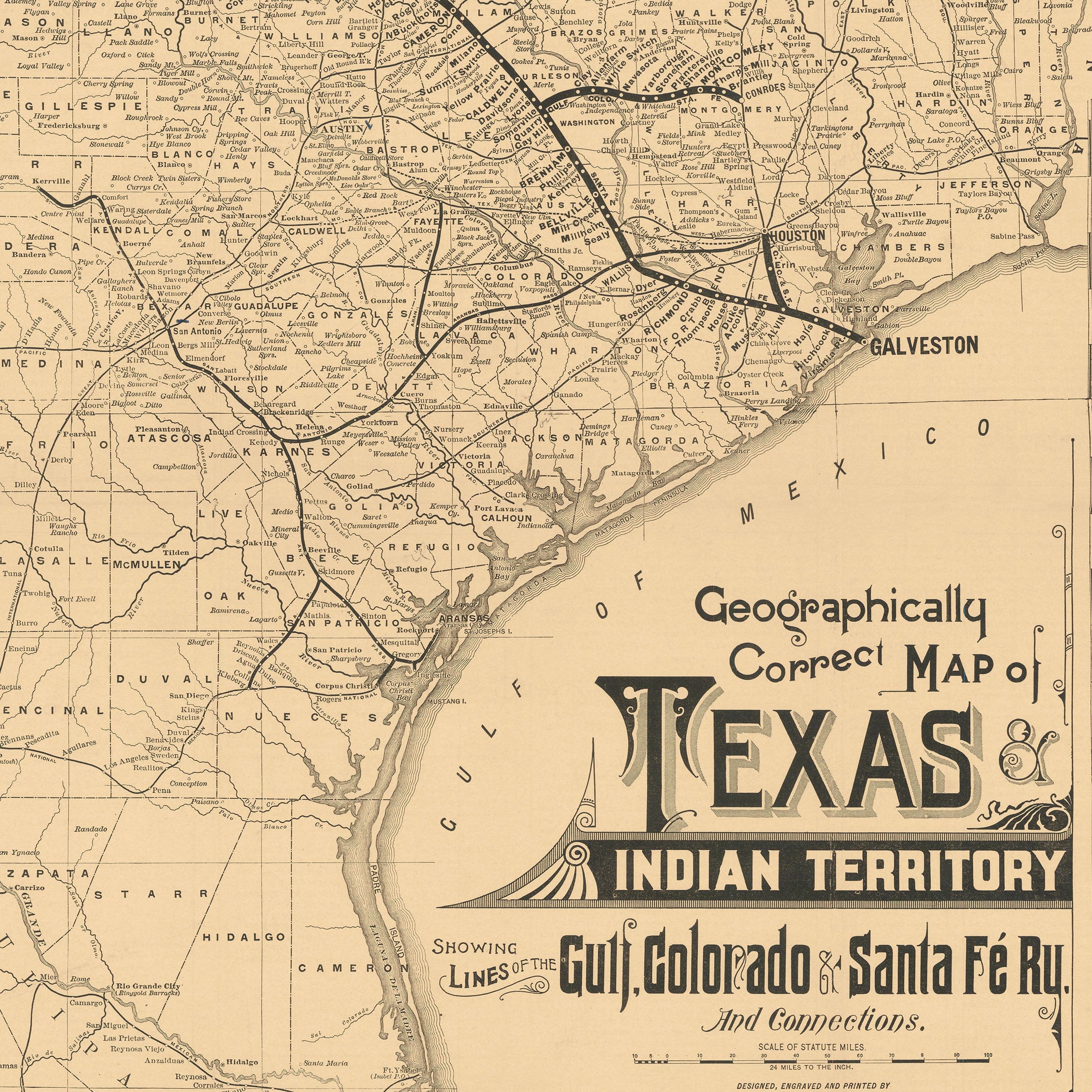
Houston Texas Map - 1884 Historic City Map Art - Archive Prints
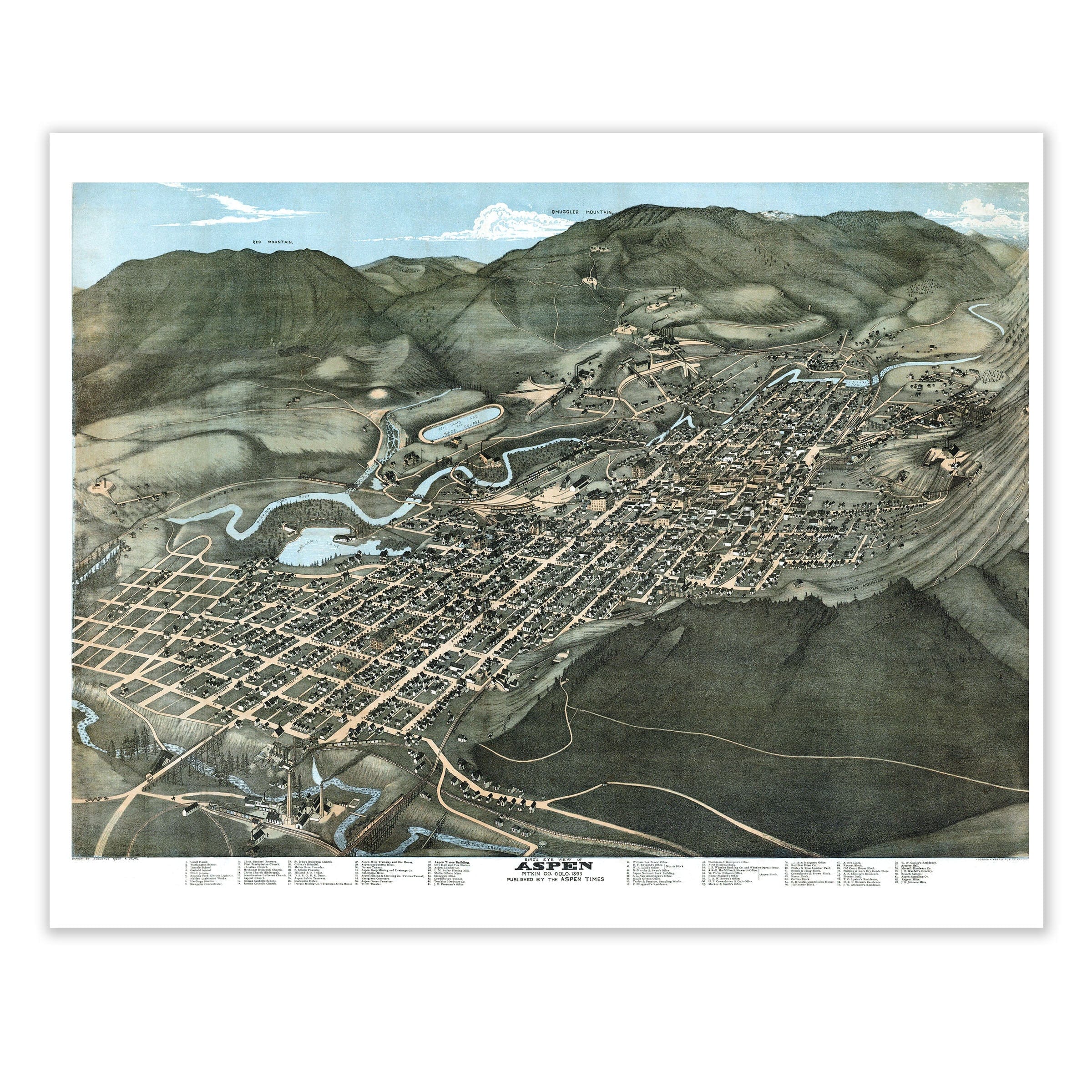
Aspen Colorado Map - 1893 Historic Bird's-Eye View of a Mining Town - Archive Prints
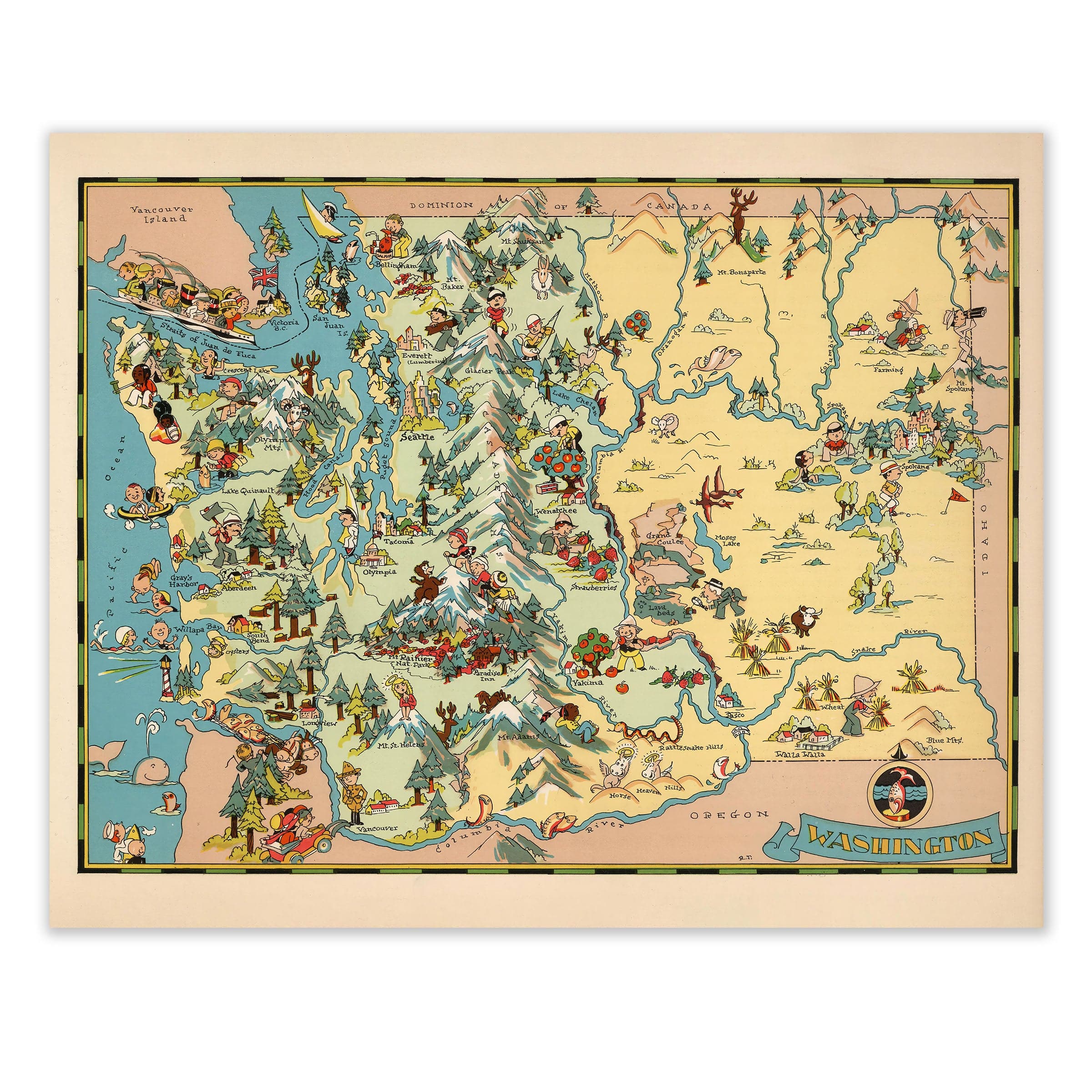
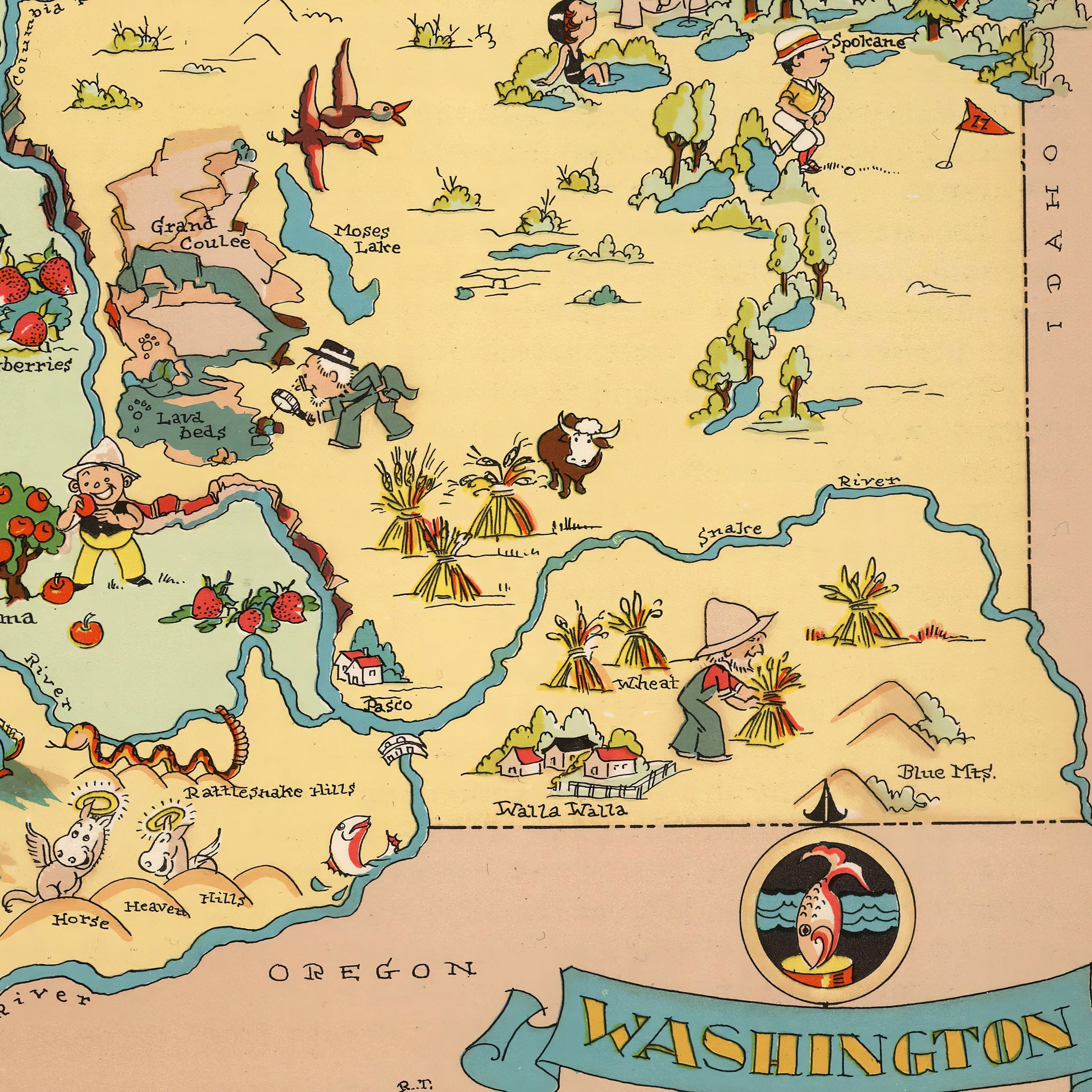
Washington State Map - 1935 Pictorial Journey Through the Evergreen State - Archive Prints
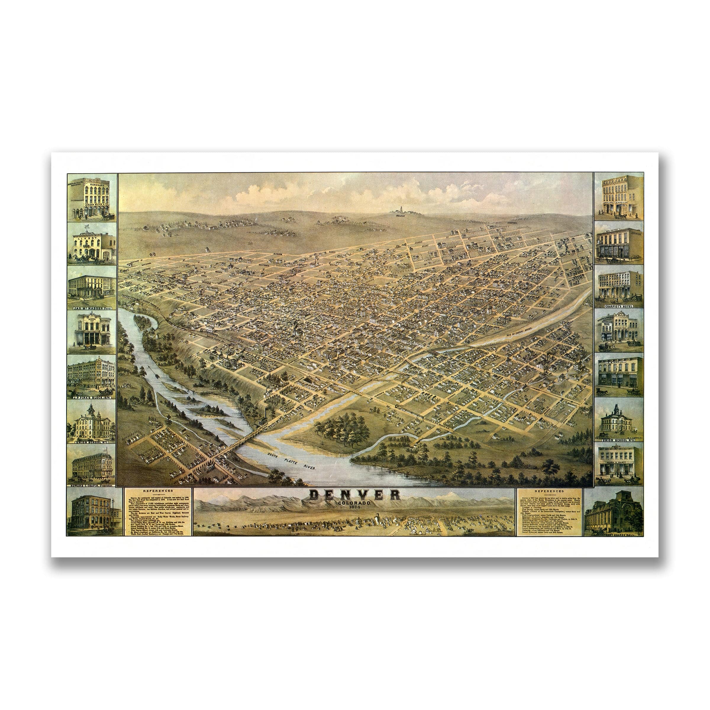
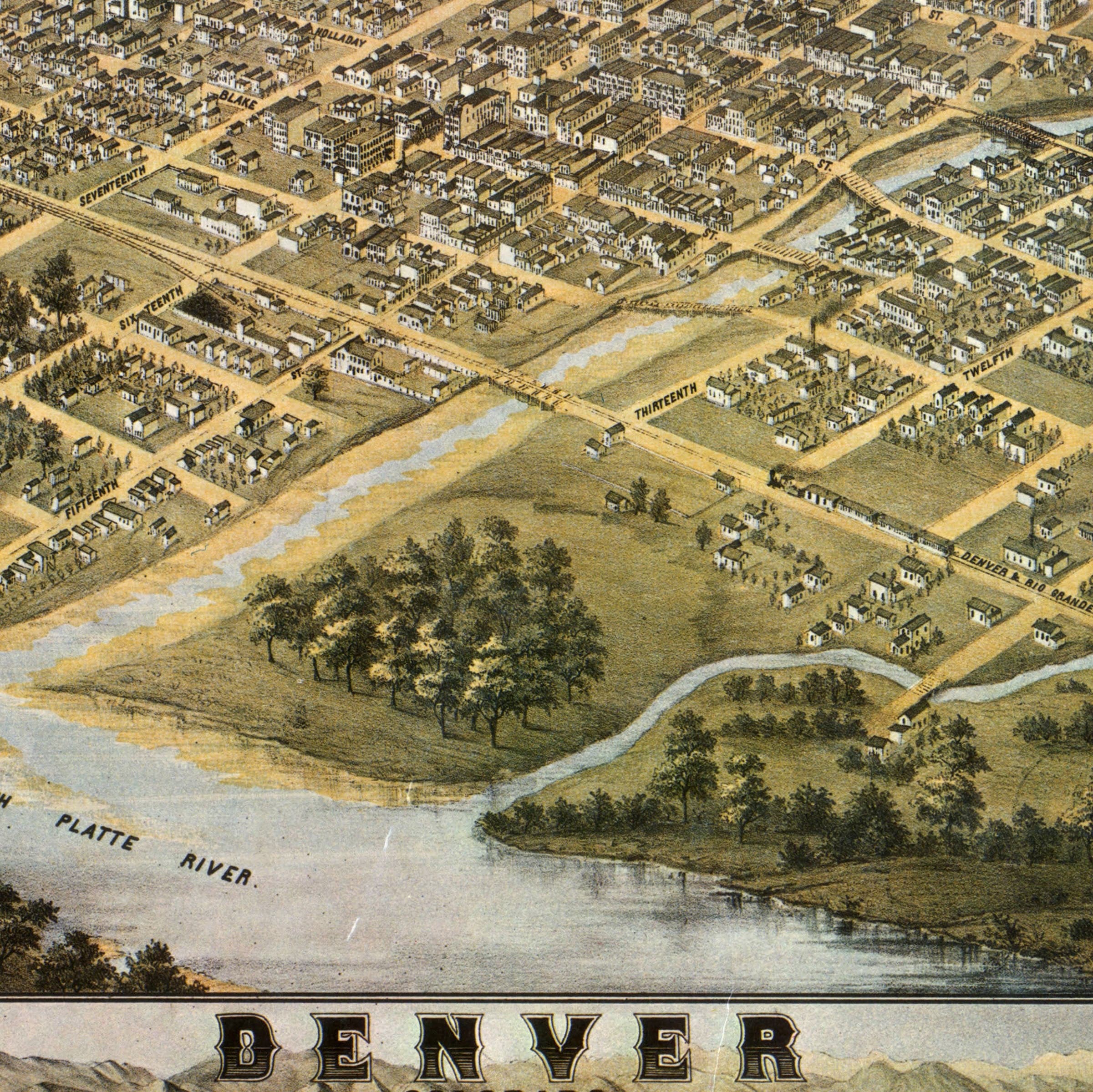
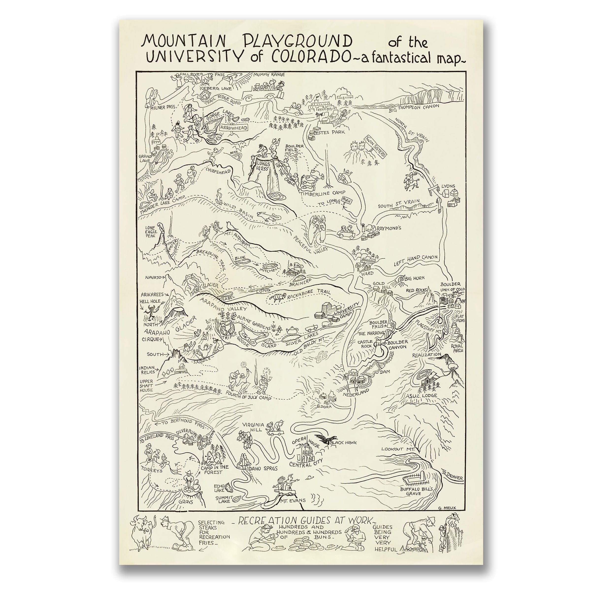
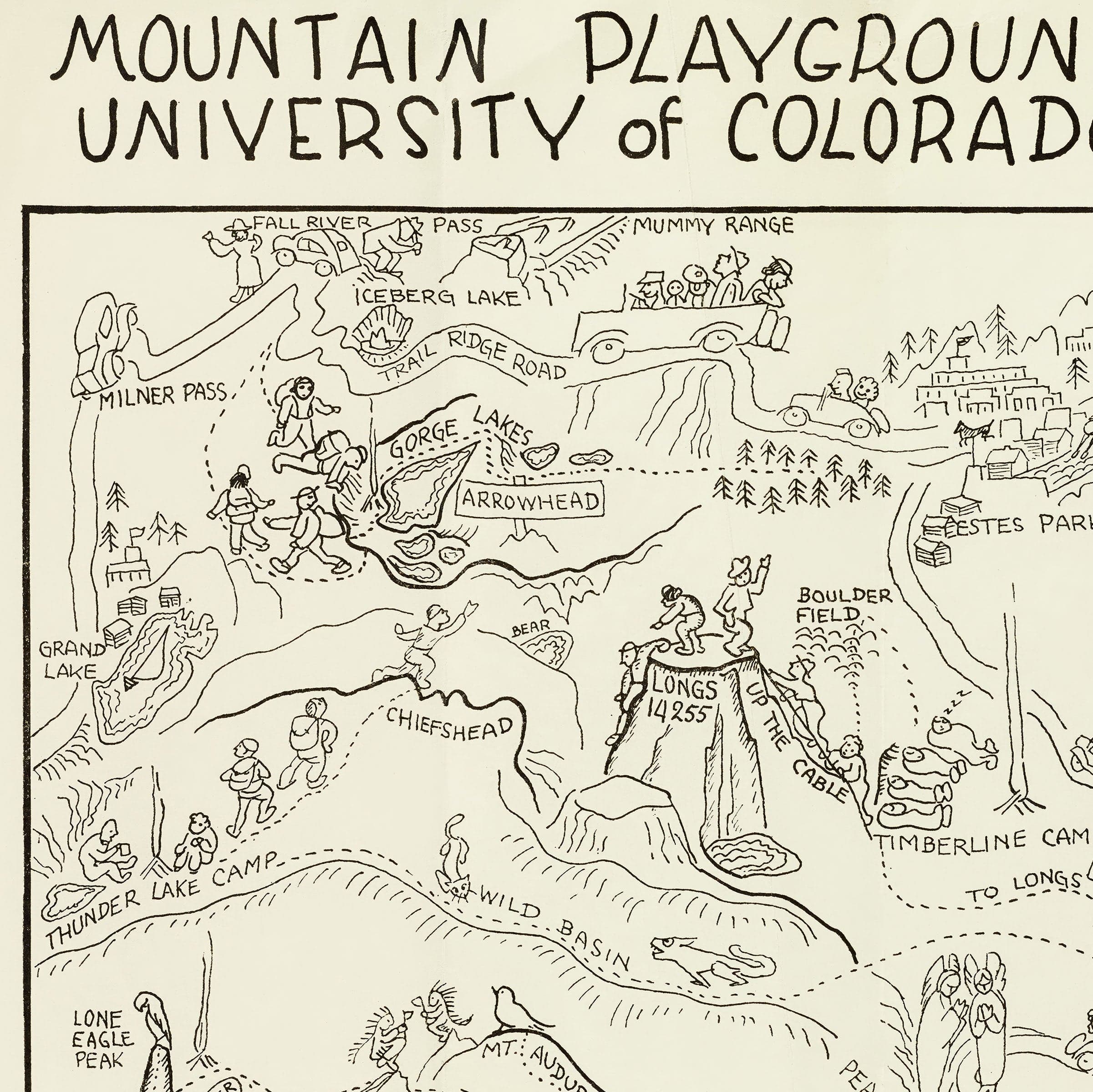
Denver Colorado Map - 1874 Bird's-Eye View Historic Mile High City Map - Archive Prints
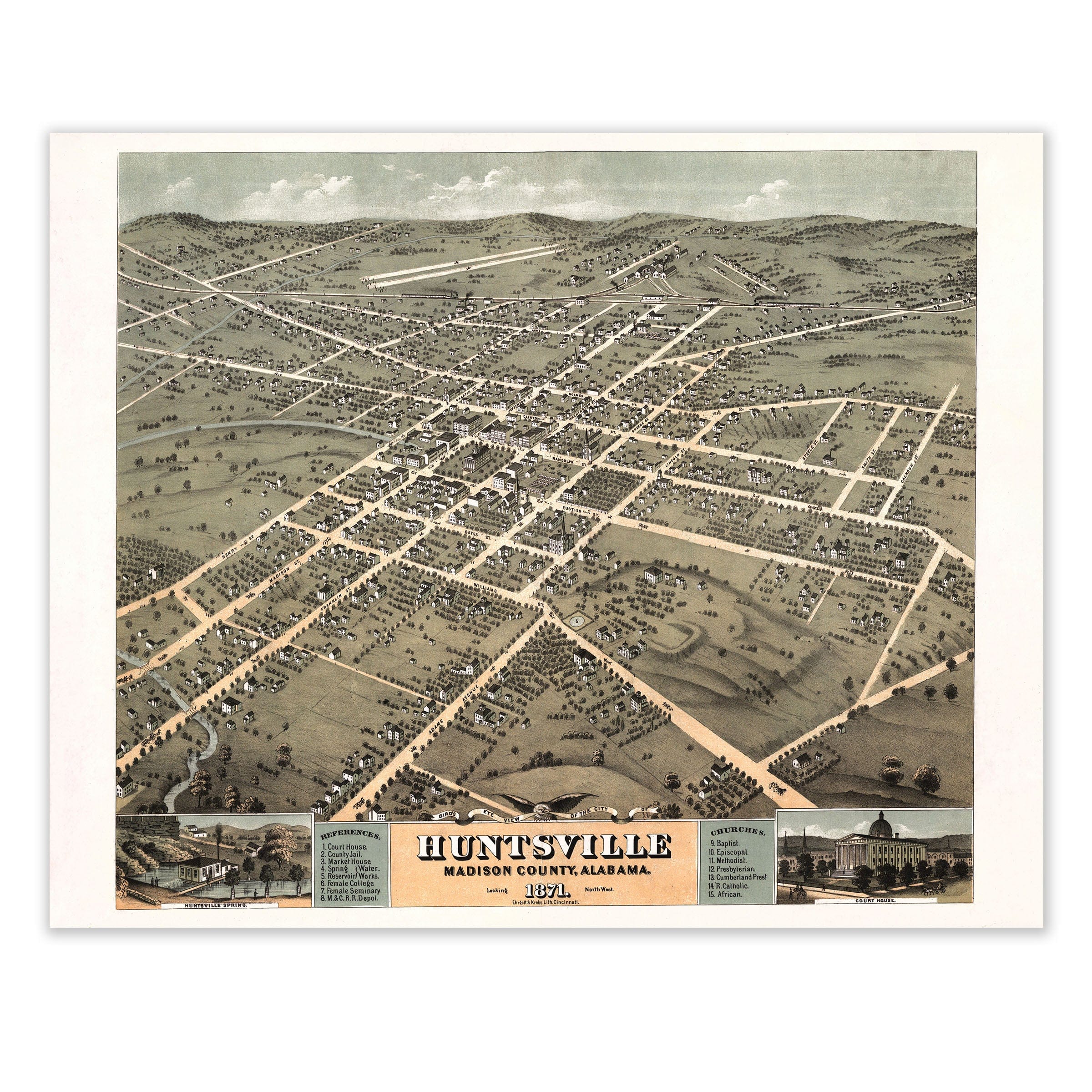
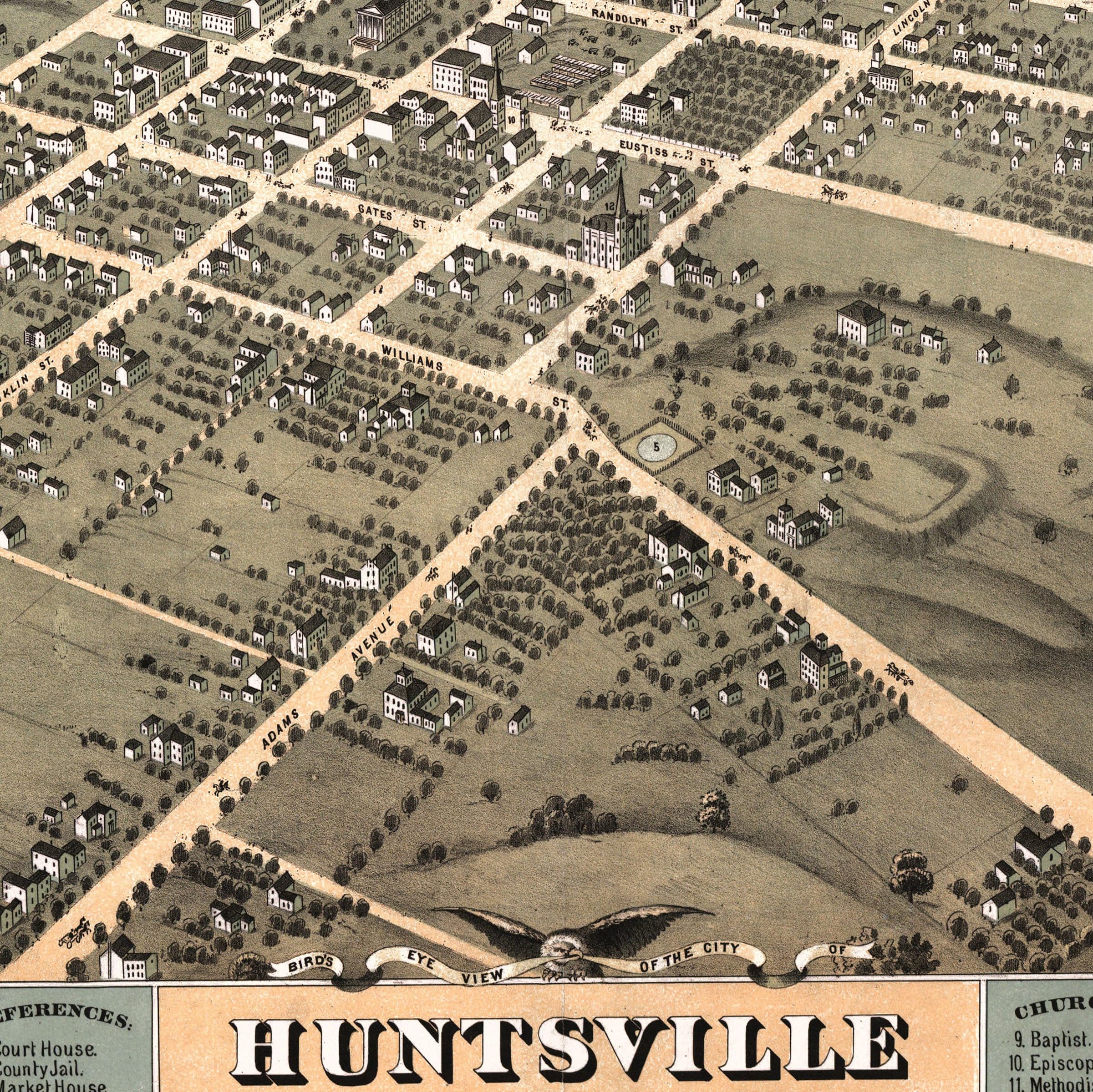
Huntsville Alabama Map - 1871 Bird's-Eye View Historic Madison County Map - Archive Prints
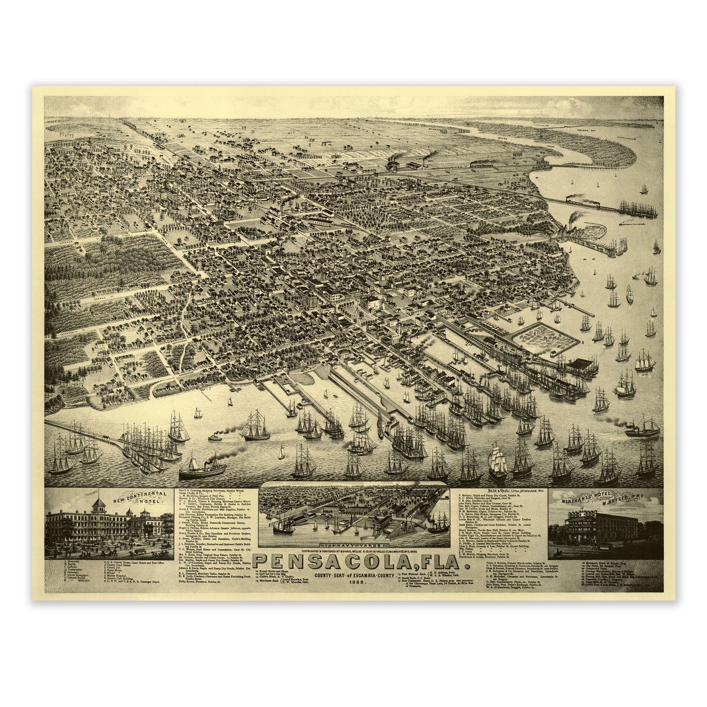
Pensacola, Florida Map - 1885 Bird's-Eye View Historic Gulf Coast Map - Archive Prints
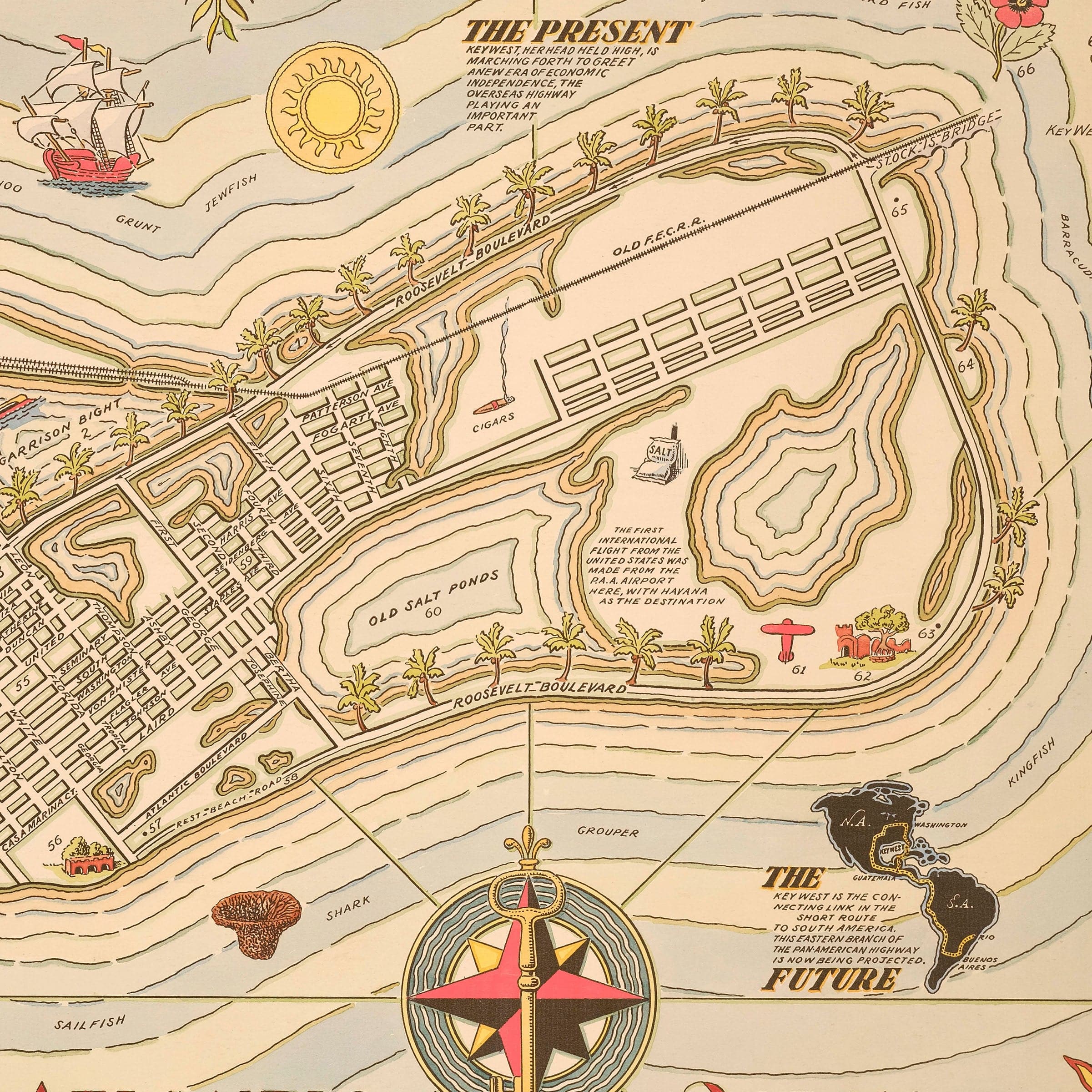
Key West Florida Map - 1935 Cayo Hueso Illustrated Historic Map - Archive Prints
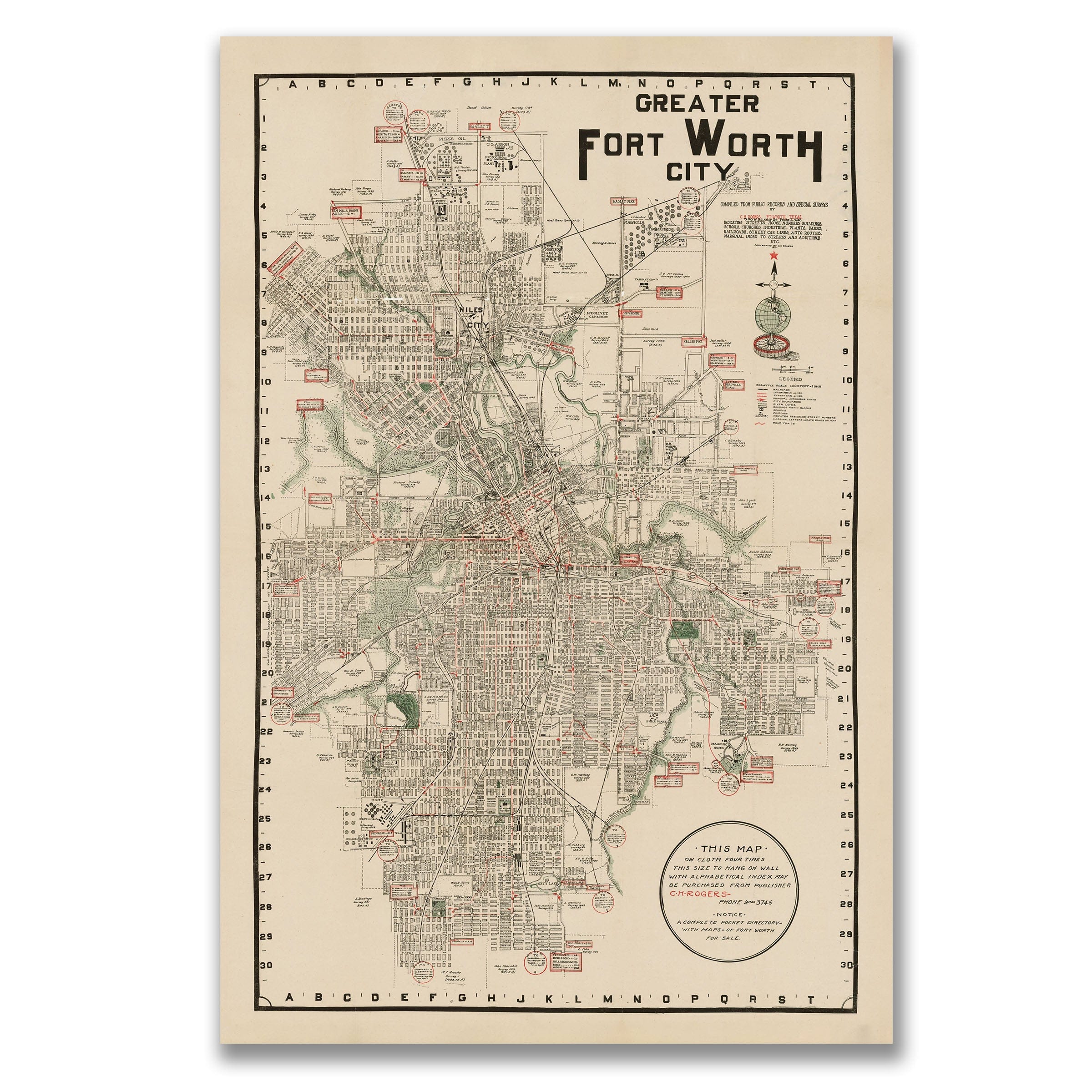
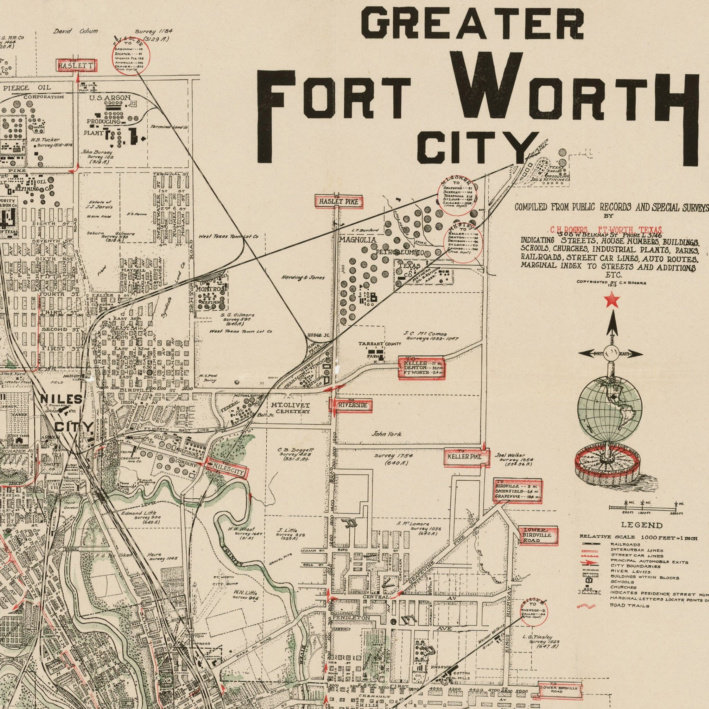
Fort Worth Texas Map - 1928 Greater Fort Worth City Historic Map - Archive Prints