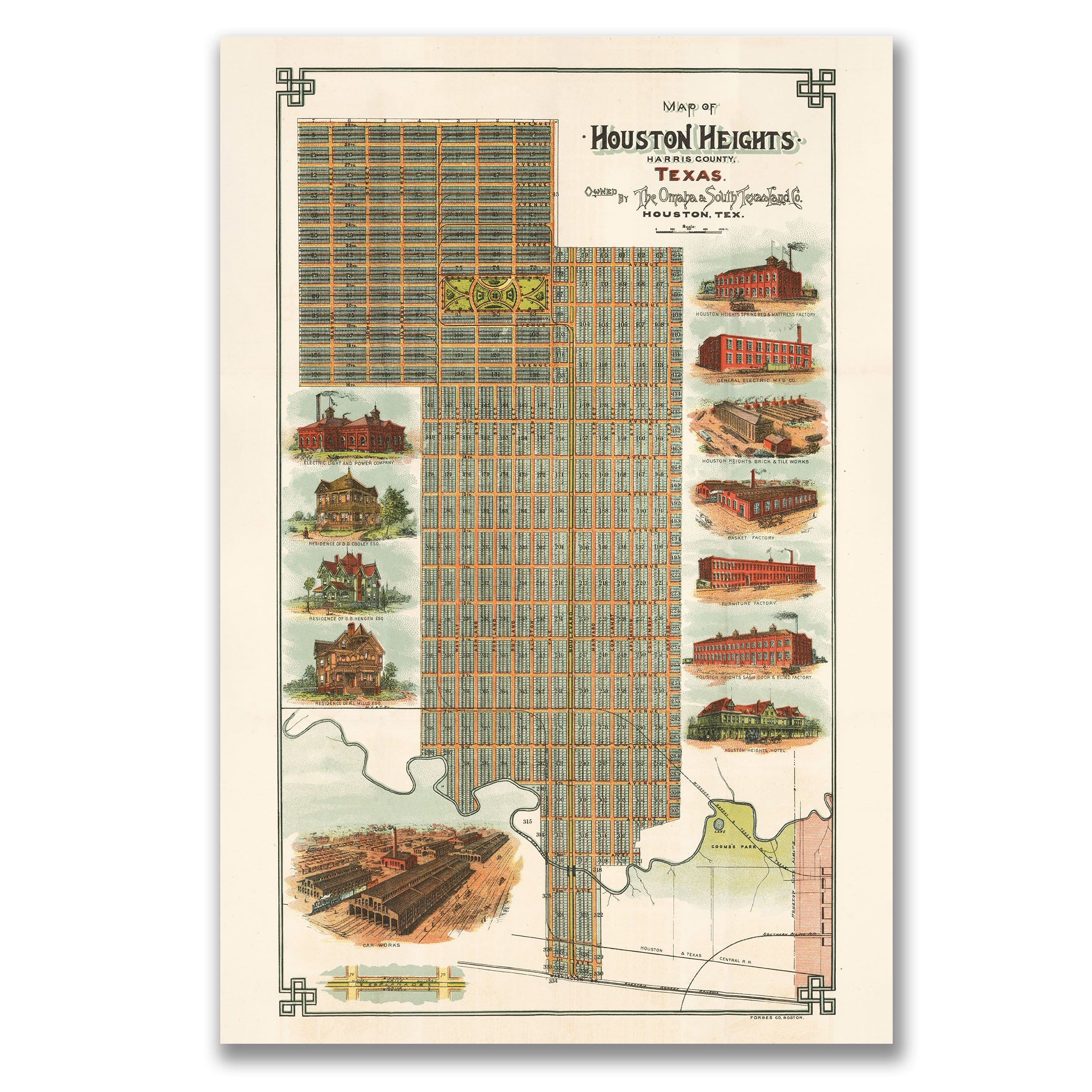
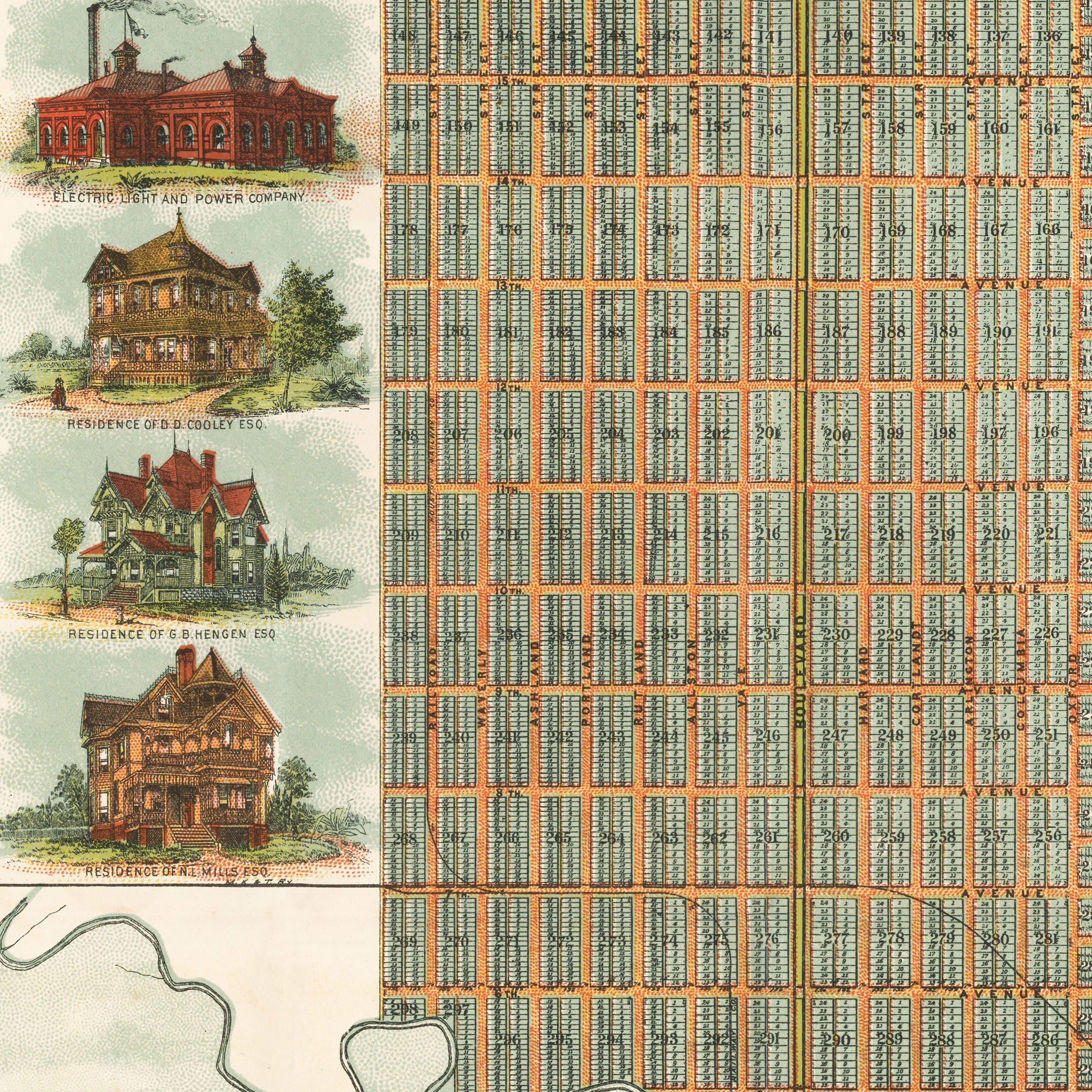
Houston Heights Map - 1896 Historic Map of Houston Heights, Texas
Sale priceFrom $39.99
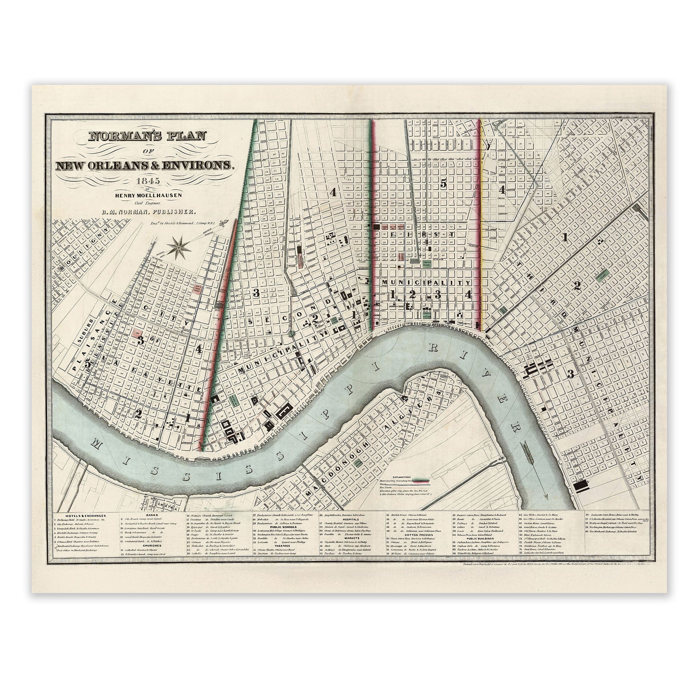
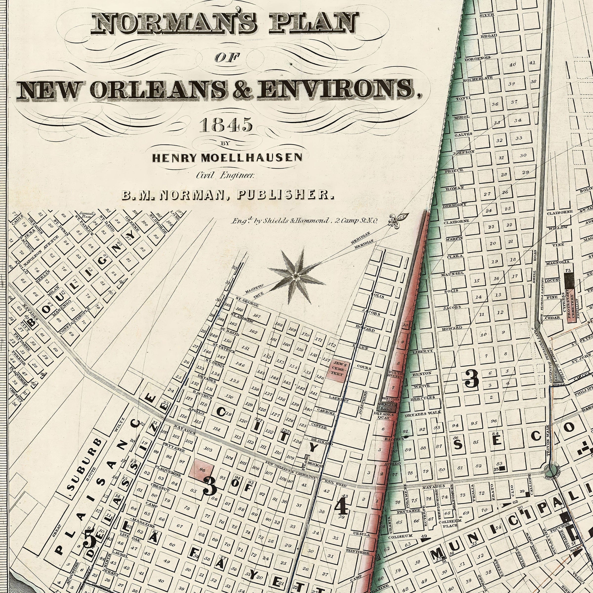
Vintage New Orleans Map - 1845 Norman's Plan of New Orleans & Environs
Sale priceFrom $39.99

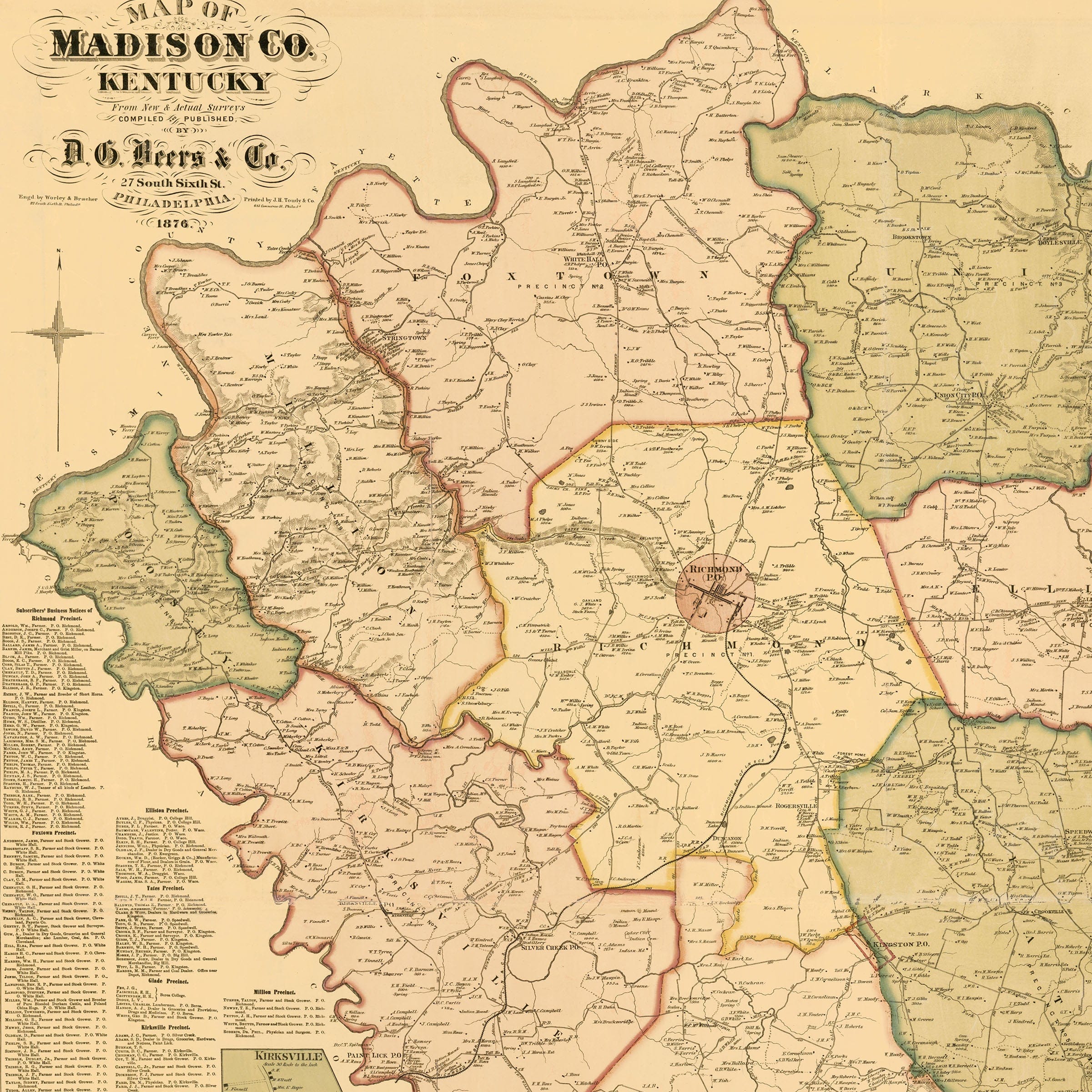
Madison County, Kentucky Map - 1876 Historic County Map
Sale priceFrom $39.99
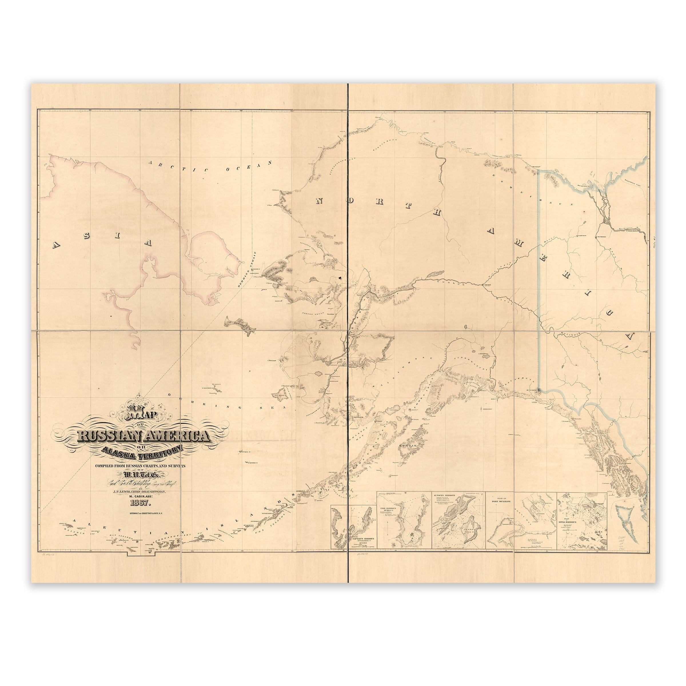
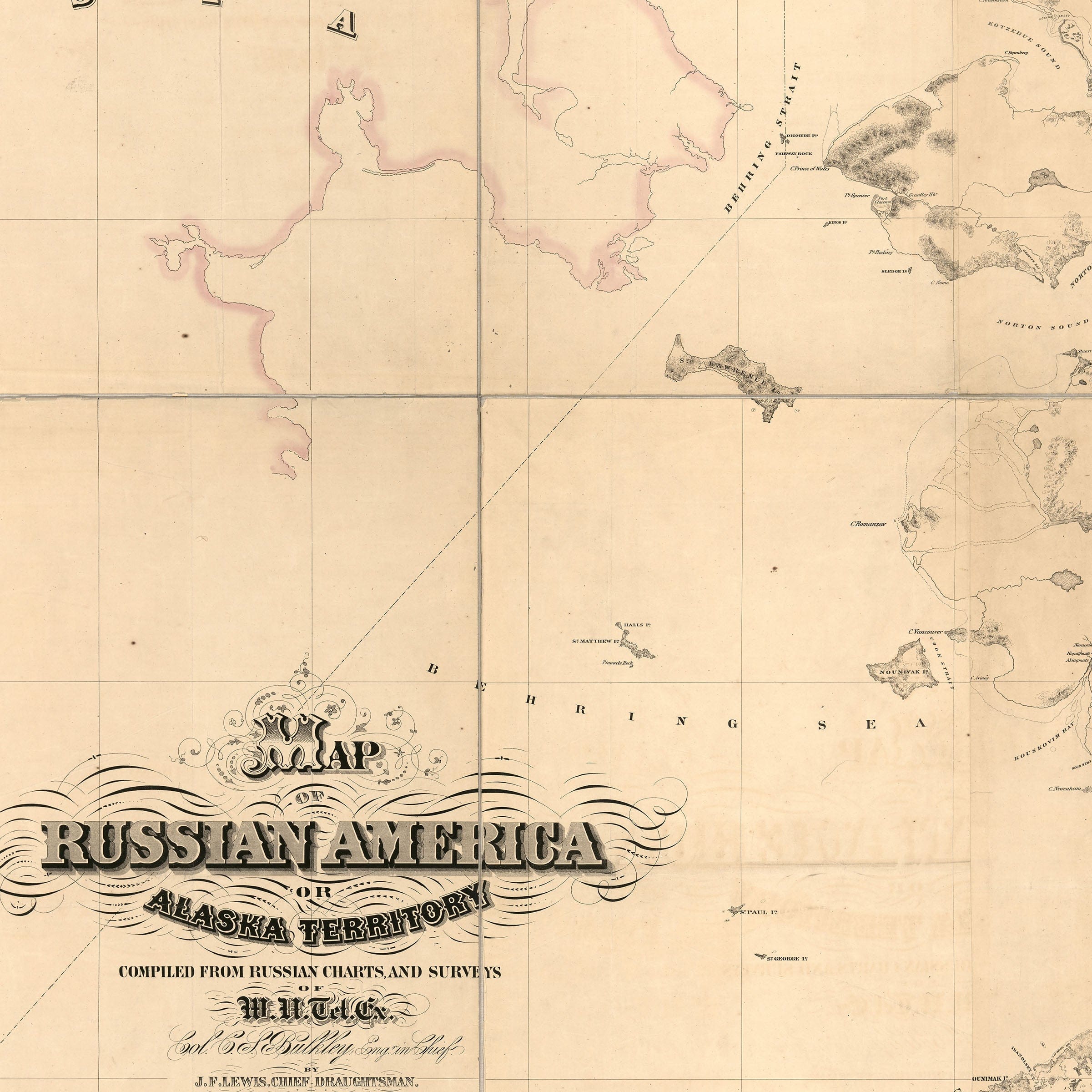
Vintage Alaska Map - 1867 Russian America Territory Map
Sale priceFrom $39.99
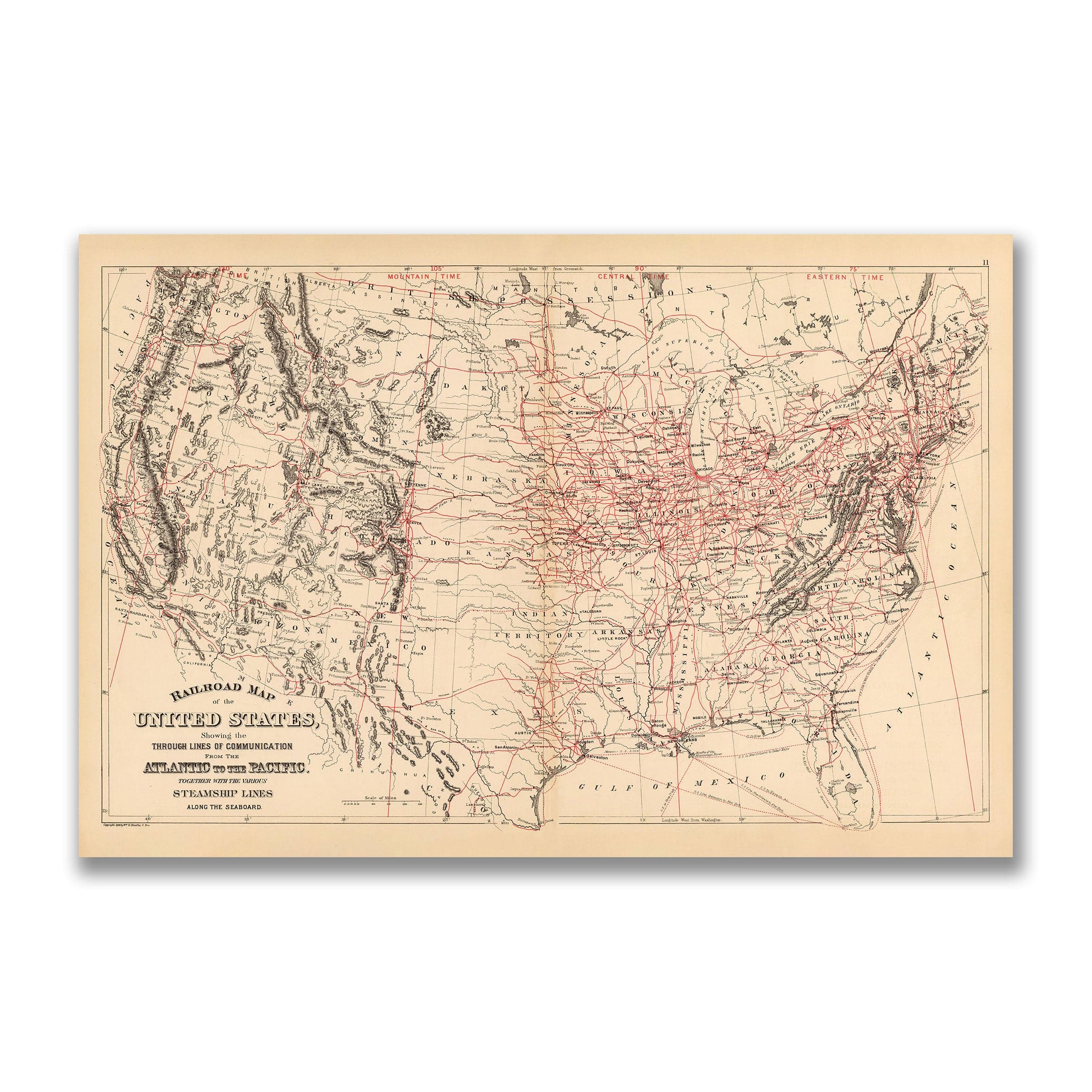
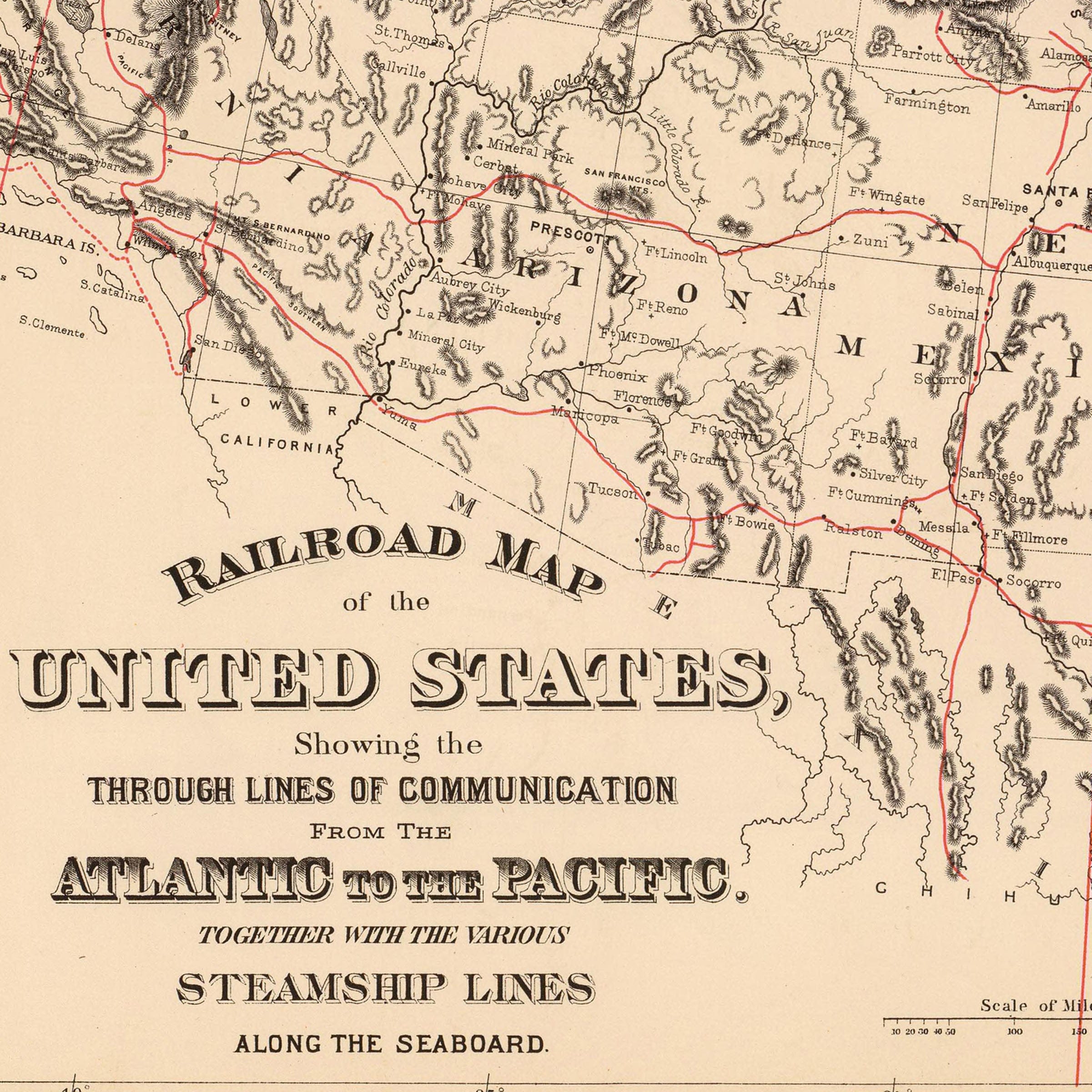
1890 Railroad Map of the US
Sale priceFrom $34.00
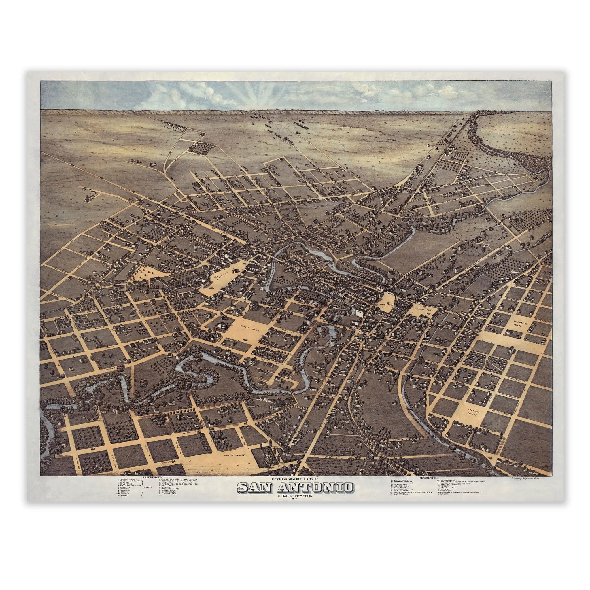
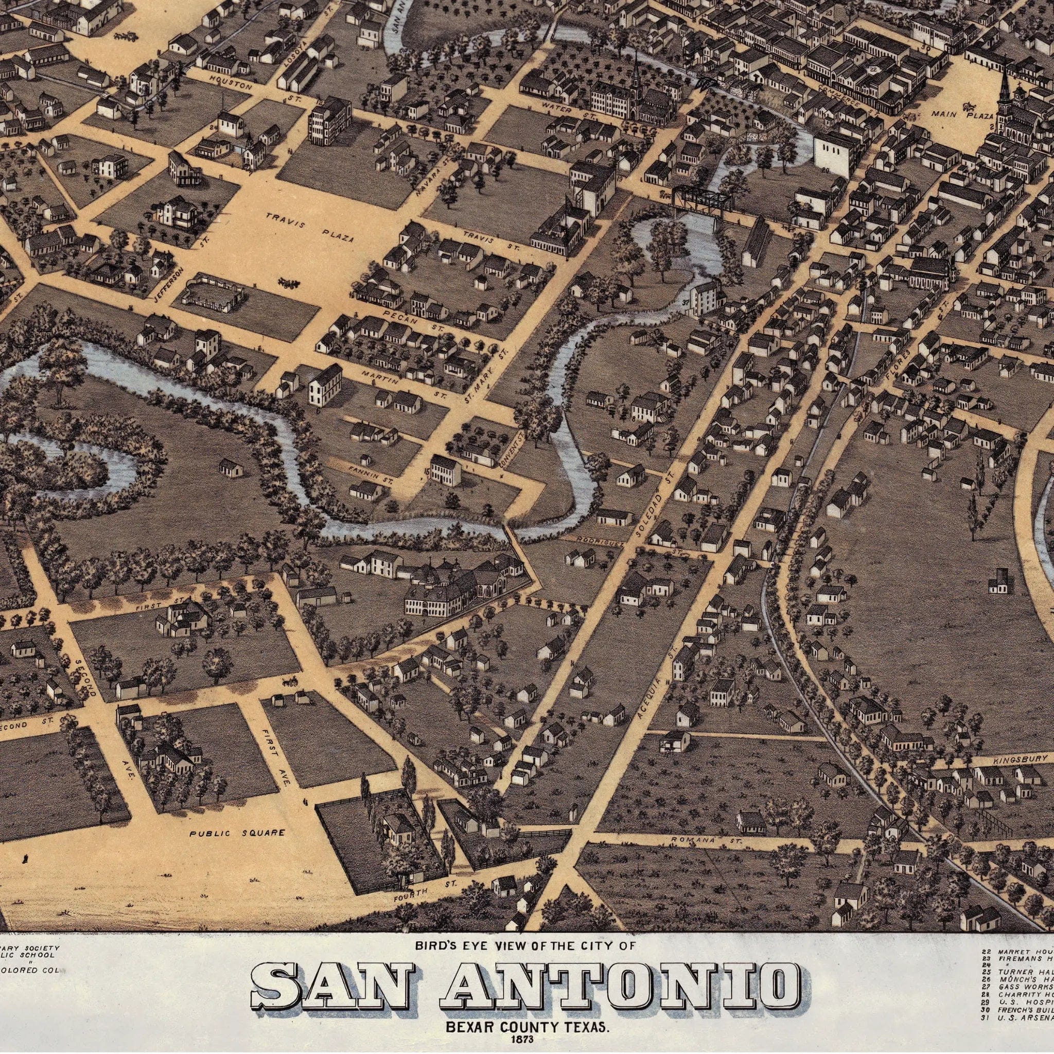
San Antonio Vintage Map - Authentic 1873 Historical City Bird's-Eye View
Sale priceFrom $39.99
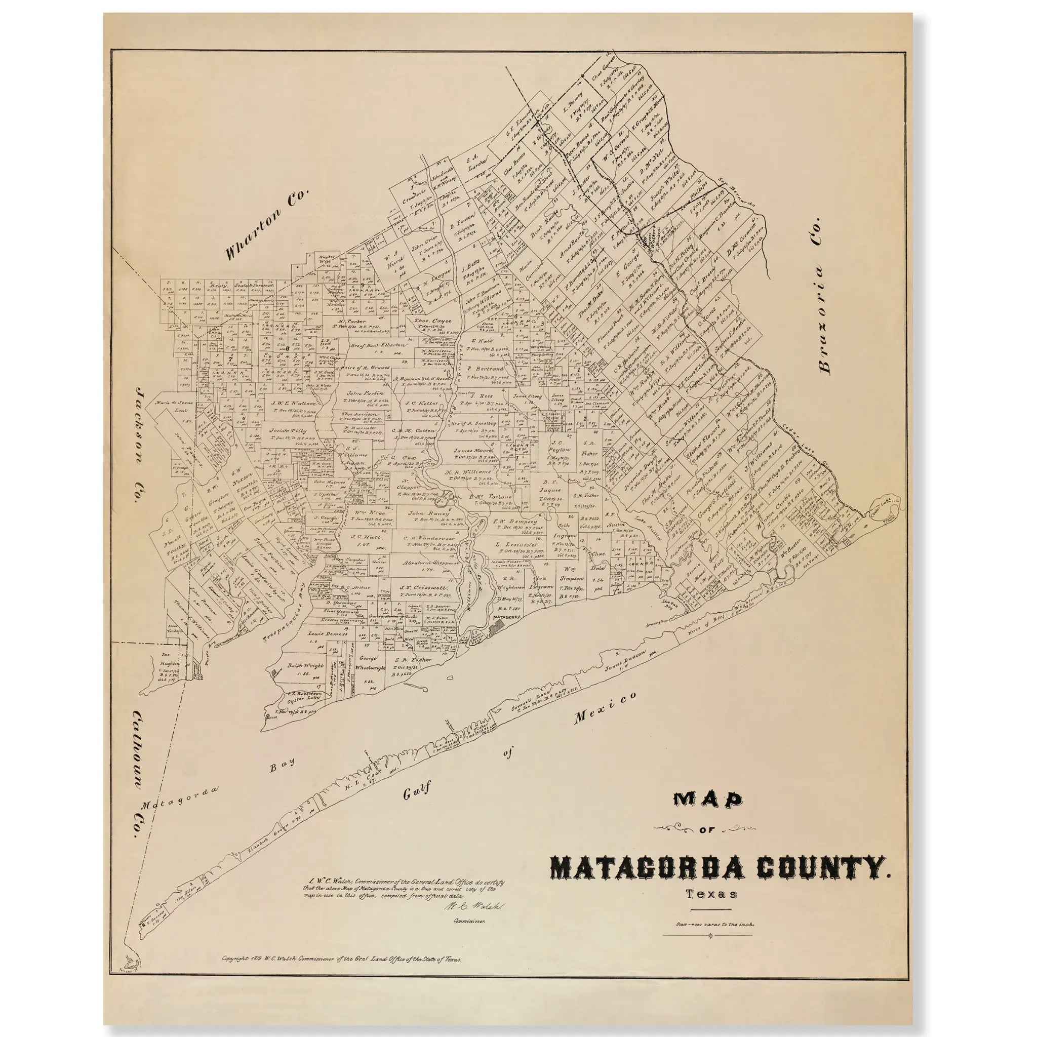
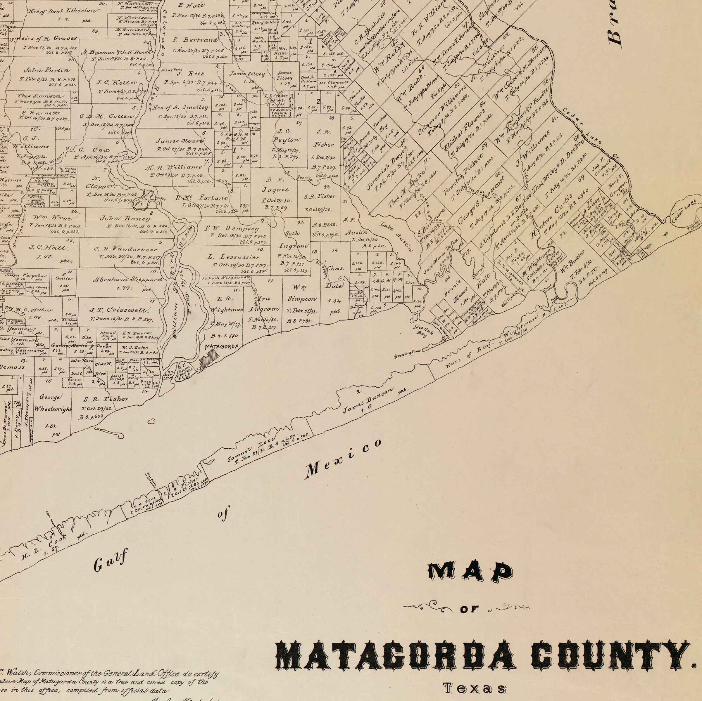
Matagorda County Vintage Map - 1879 Texas General Land Office Artwork
Sale priceFrom $34.00
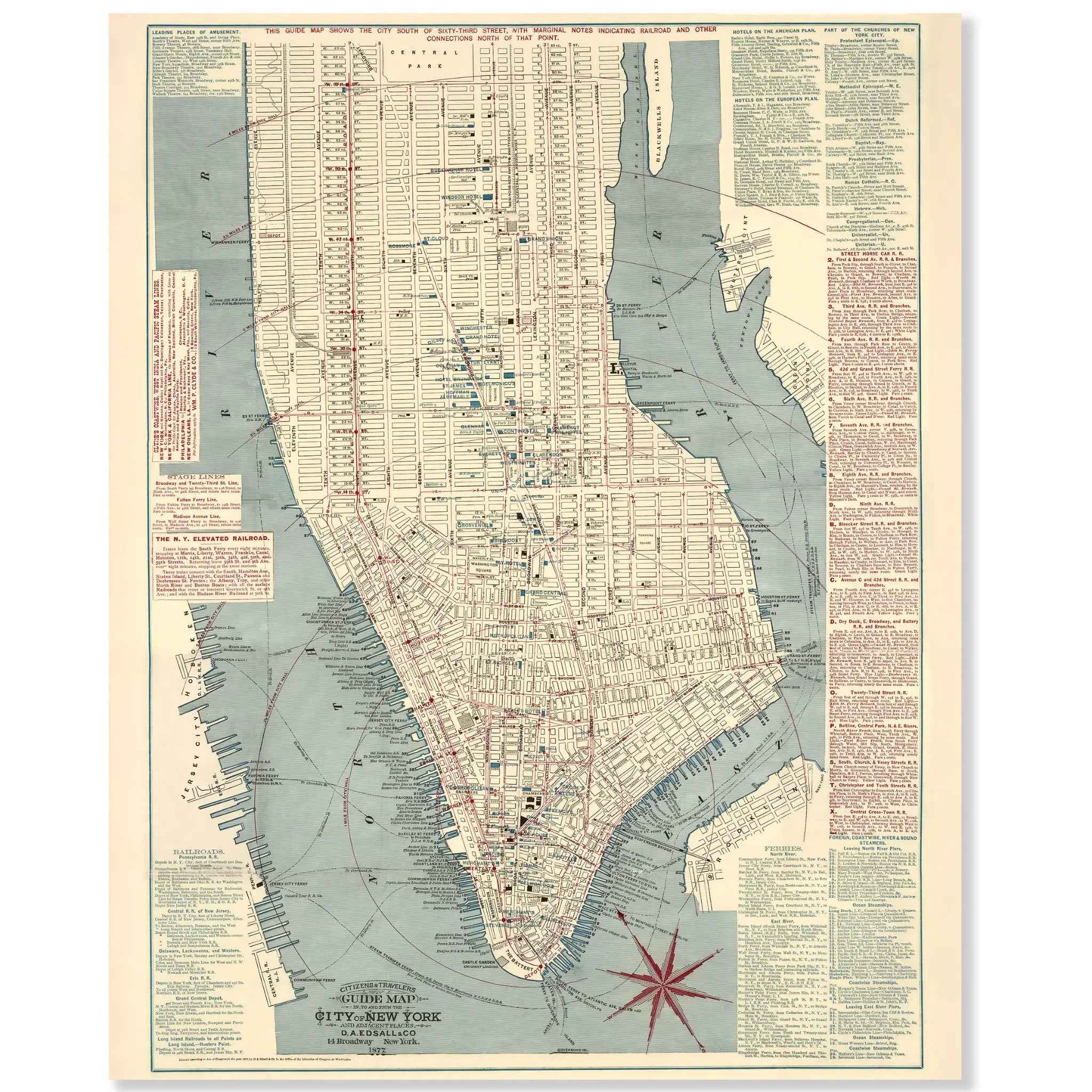
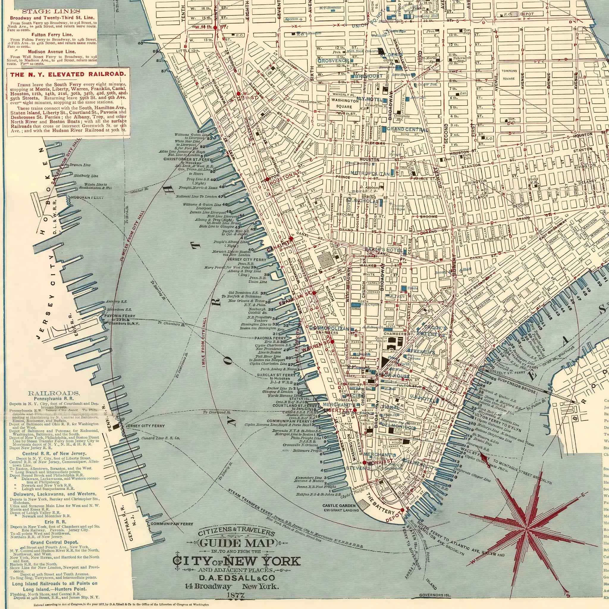
New York City Map - Vintage 1877 Citizens' & Travelers' Guide Map for Collectors
Sale priceFrom $39.99
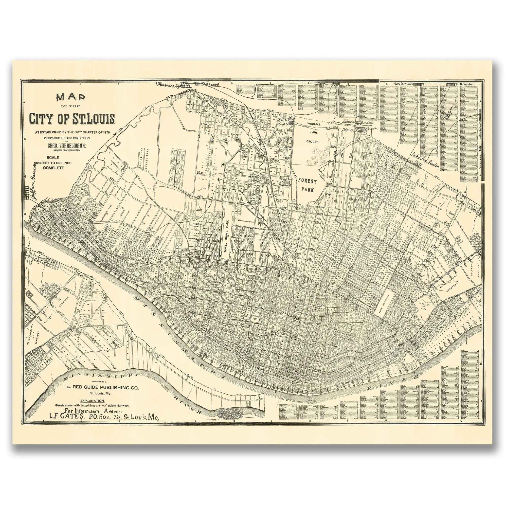
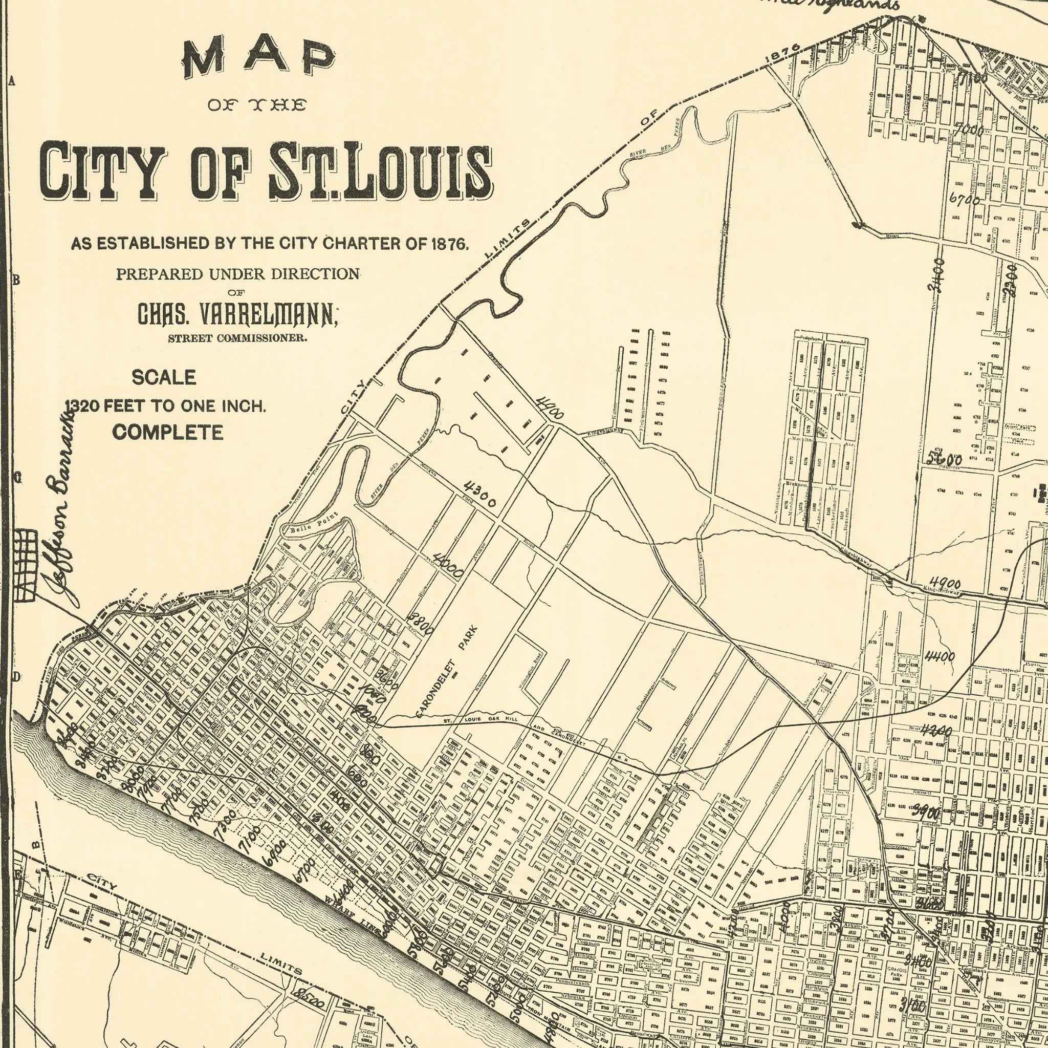
St. Louis Vintage Map 1876 - Historical City Charter Map by Charles Varrelmann
Sale priceFrom $39.99
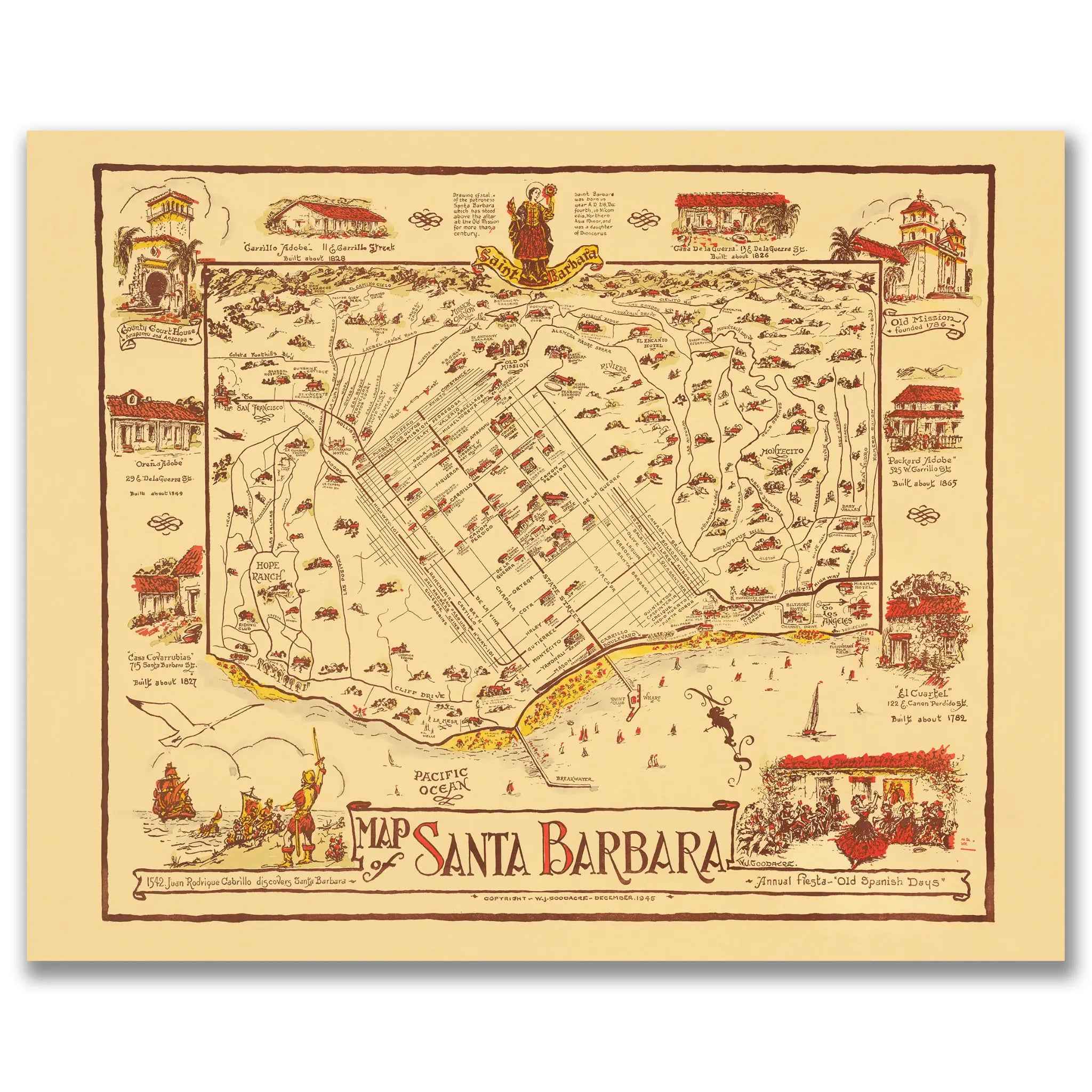
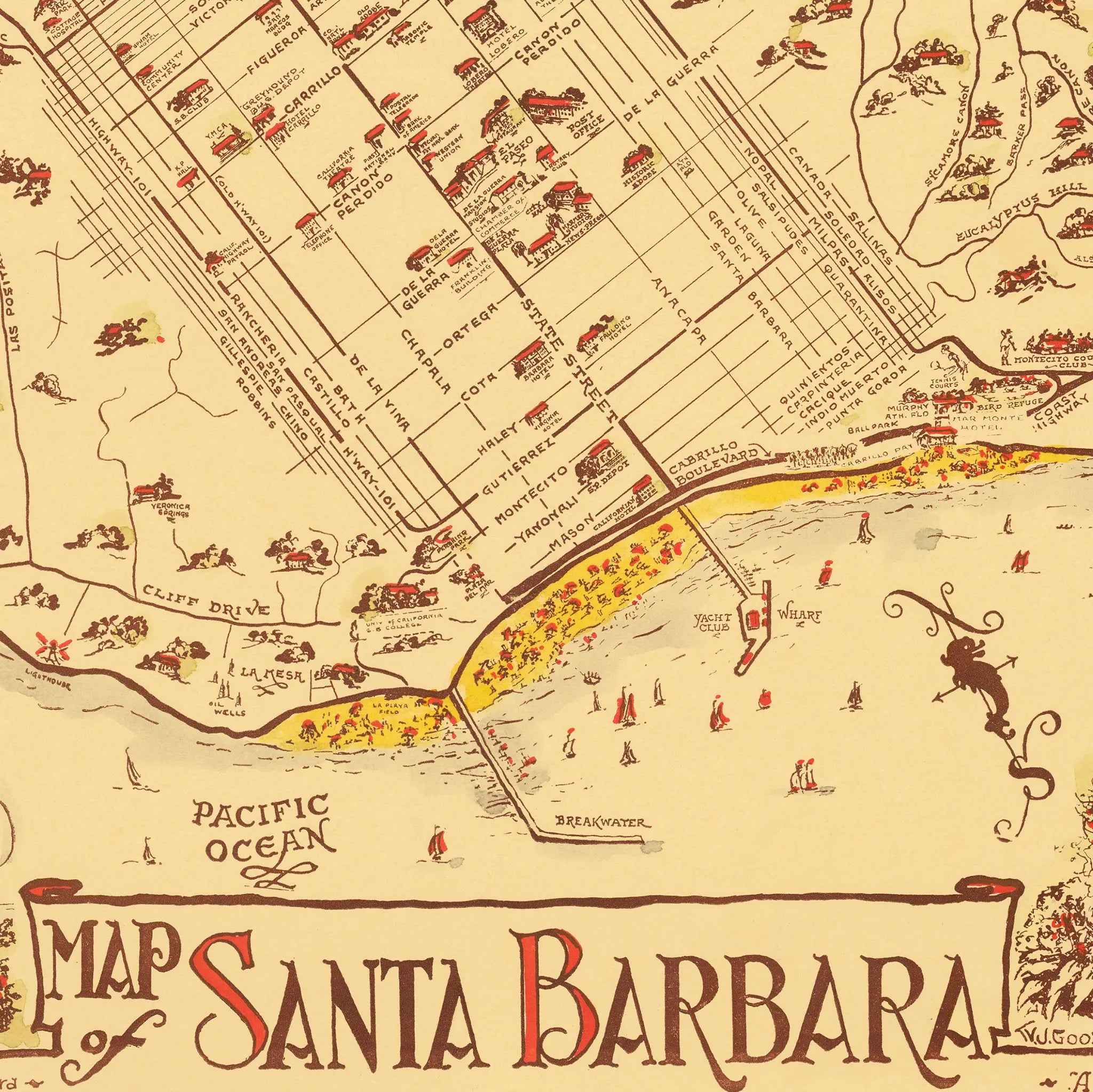
Santa Barbara Vintage Map - 1945 Fiesta & Old Spanish Days Pictorial Art
Sale priceFrom $39.99
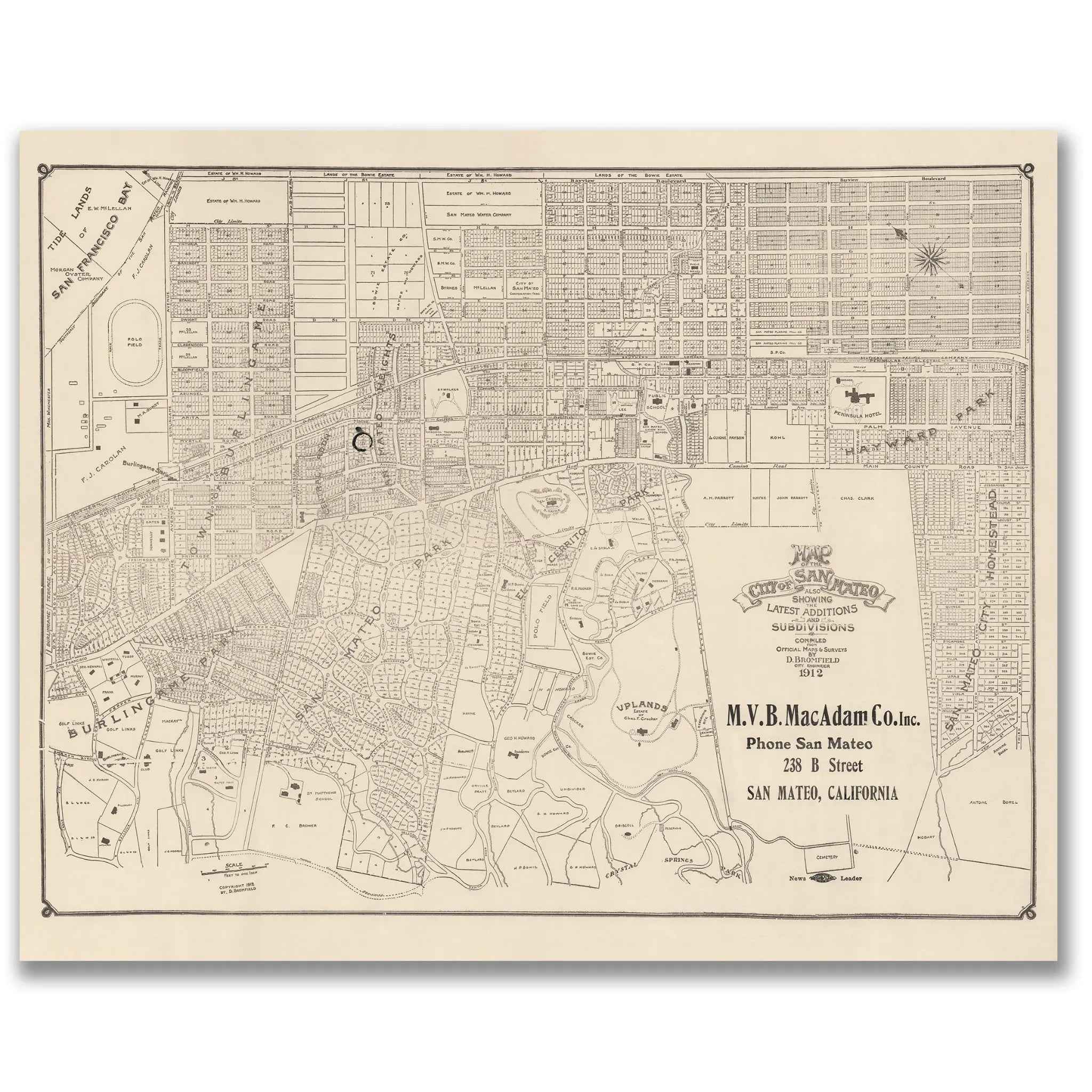
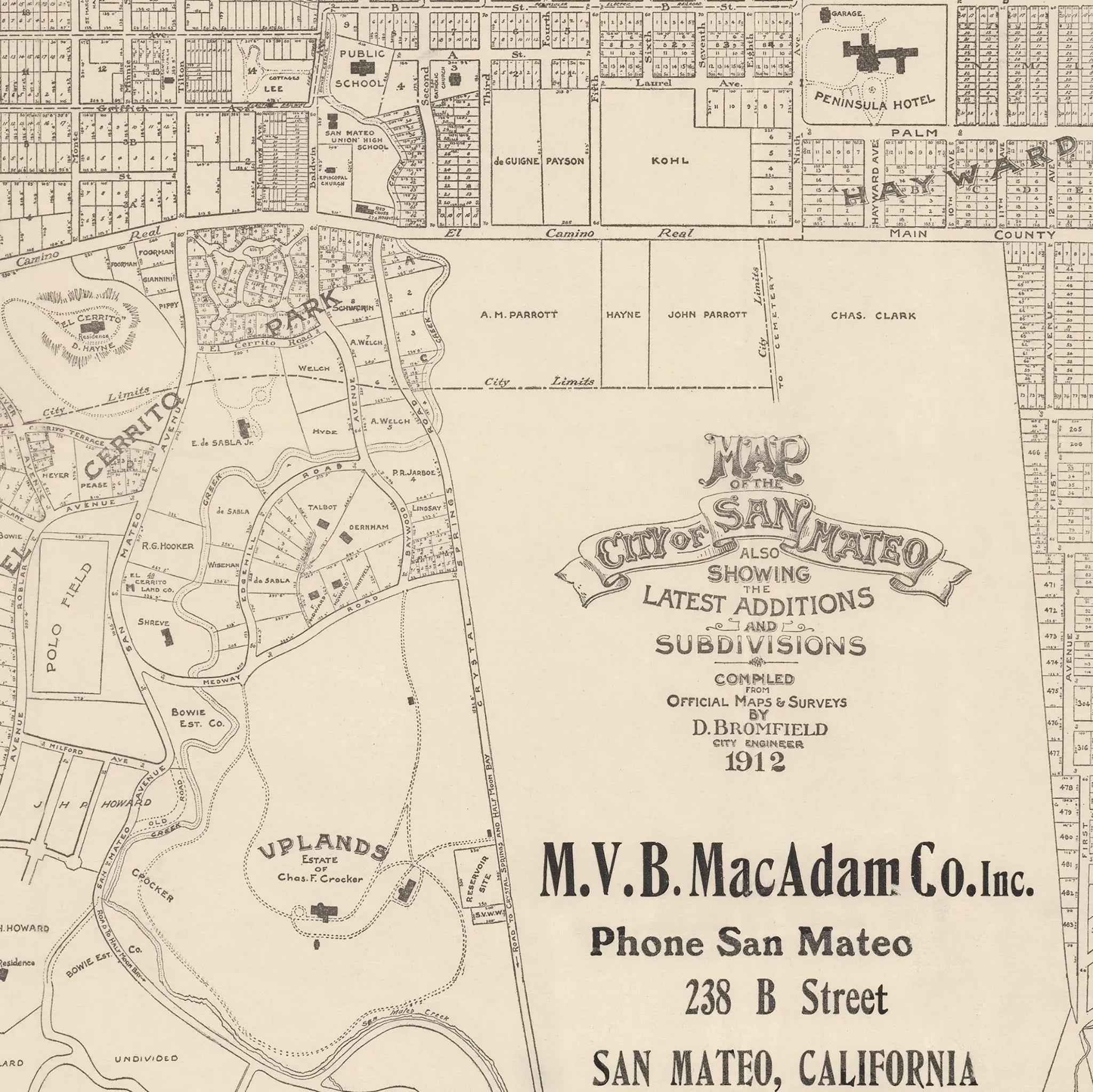
San Mateo Vintage Map - 1912 City Planning & Subdivisions Map
Sale priceFrom $39.99
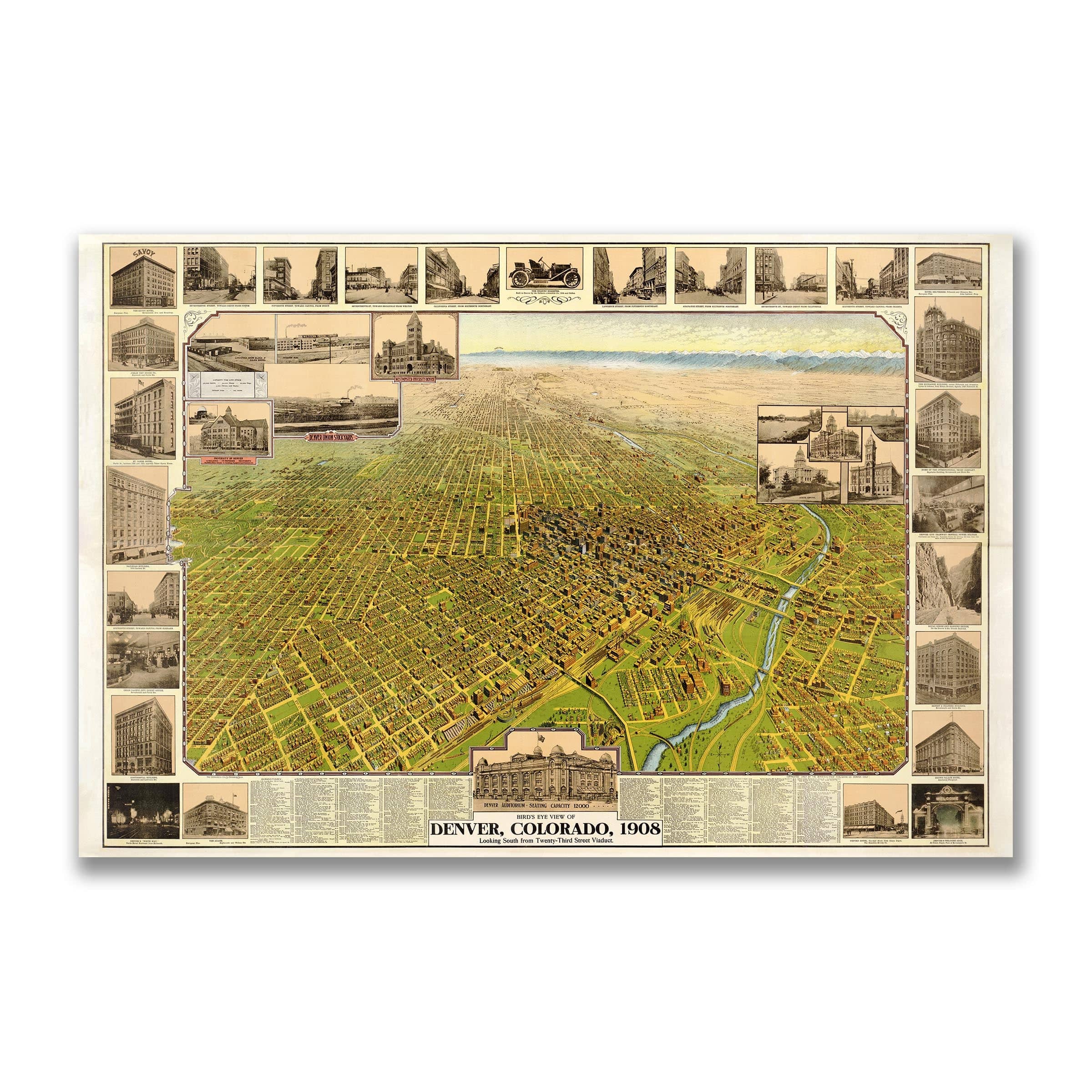
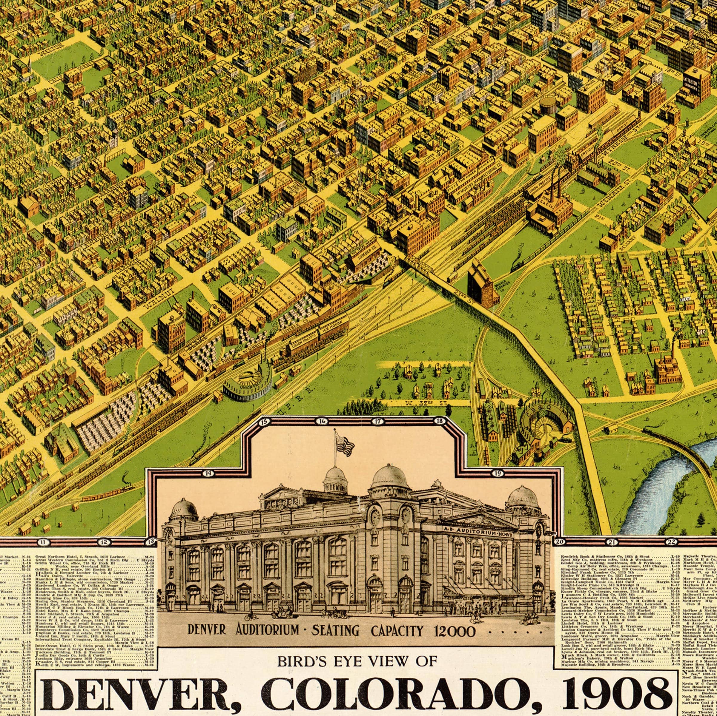
Denver Vintage Bird's-Eye Map - 1908 Colorado Historical City Map
Sale priceFrom $39.99
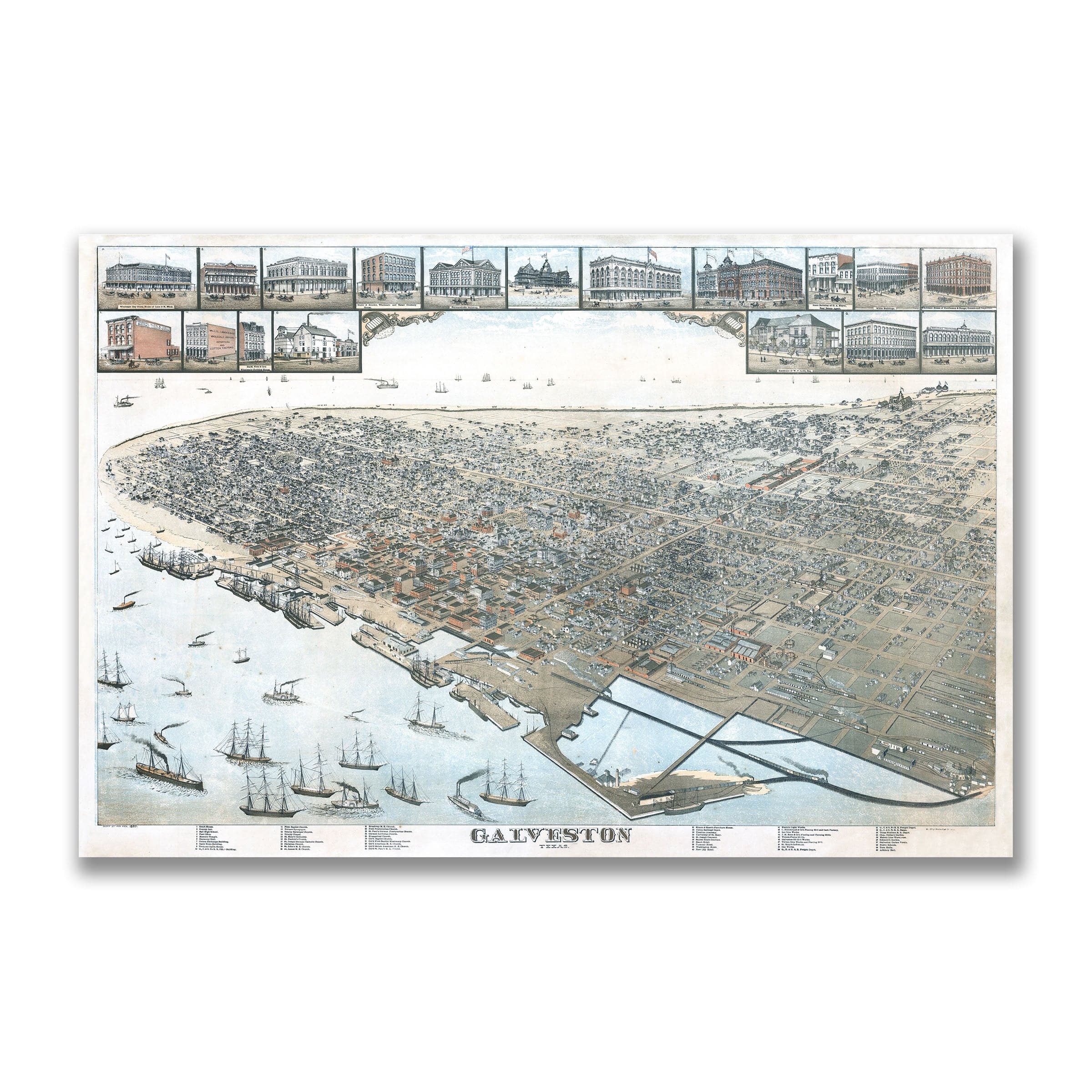

Galveston Vintage Map - 1885 Koch Historical Bird's-Eye City Map
Sale priceFrom $39.99
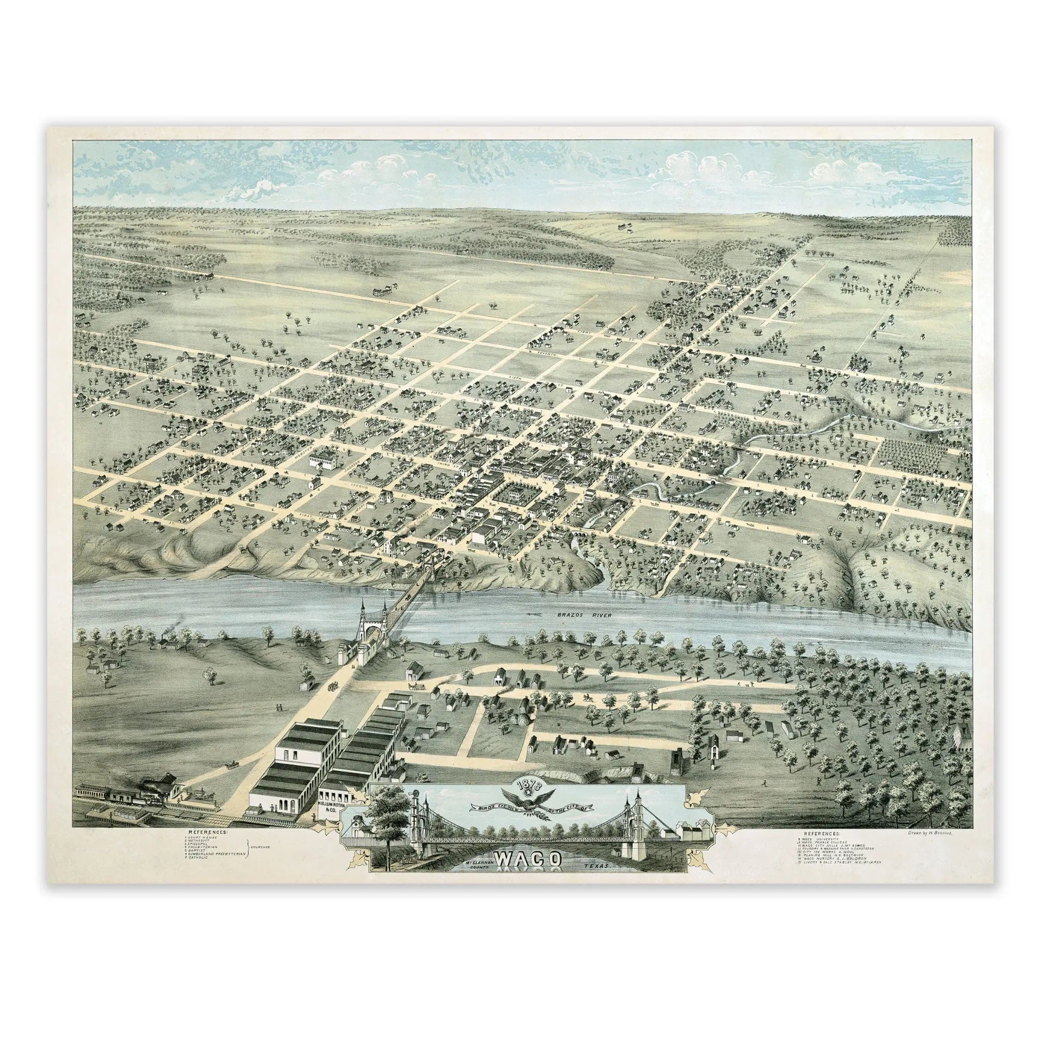
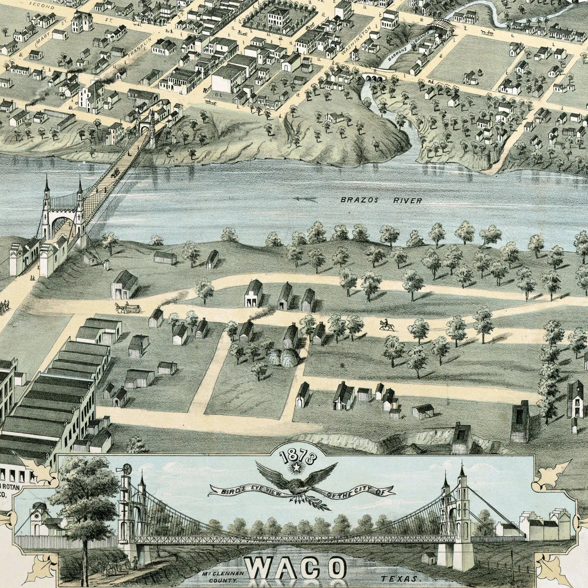
Waco Vintage Historical Map - 1873 Texas City Map Art
Sale priceFrom $39.99
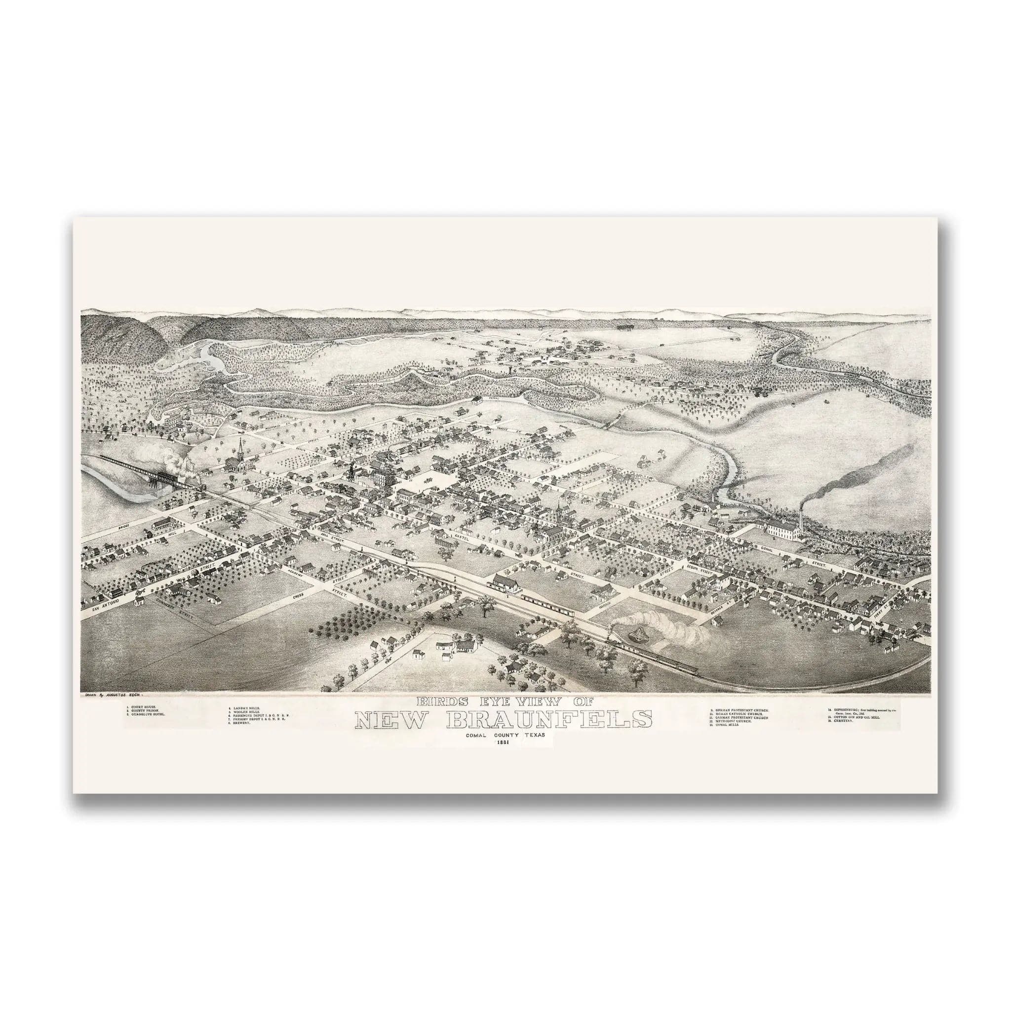
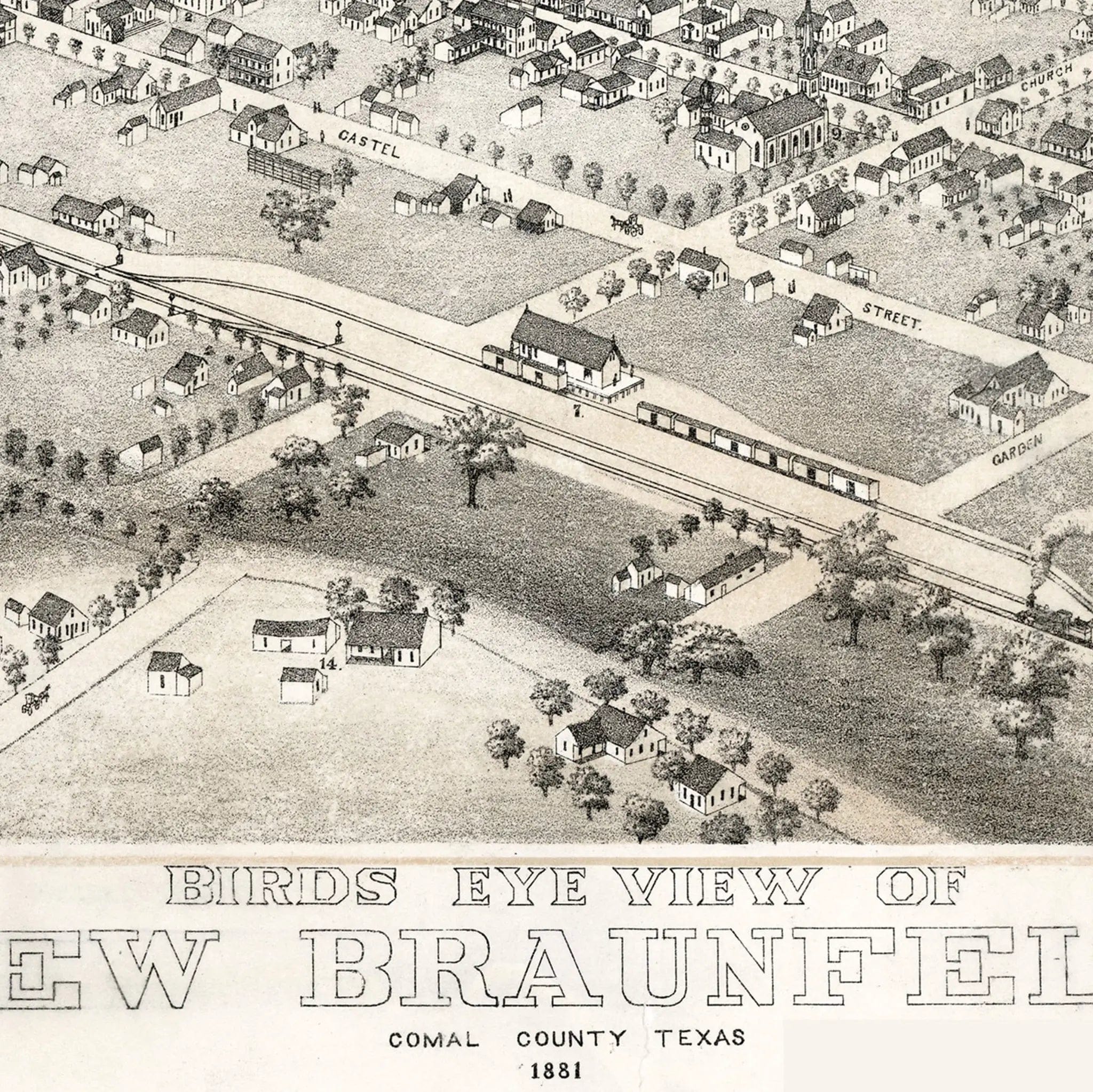
New Braunfels Vintage Map - 1881 Historical City Map of Texas
Sale priceFrom $39.99
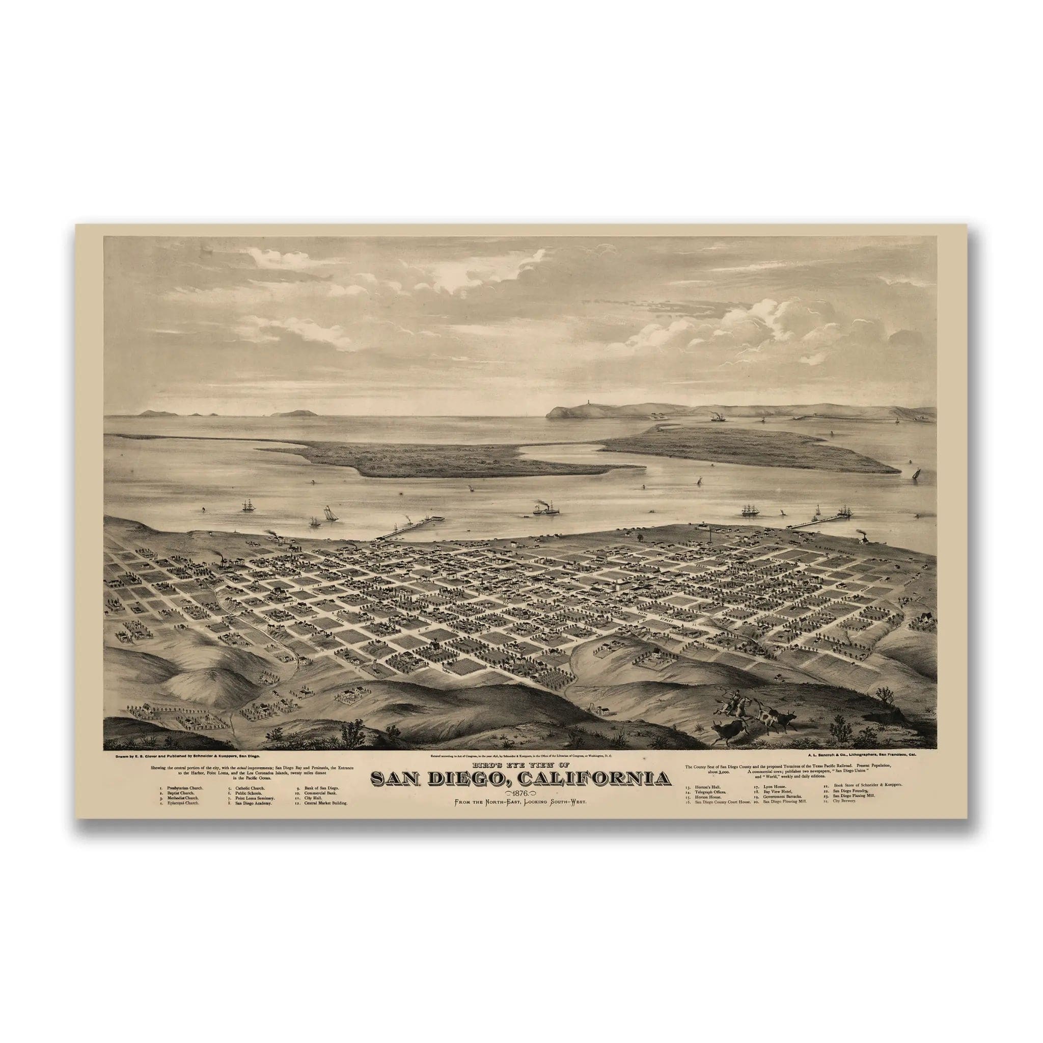
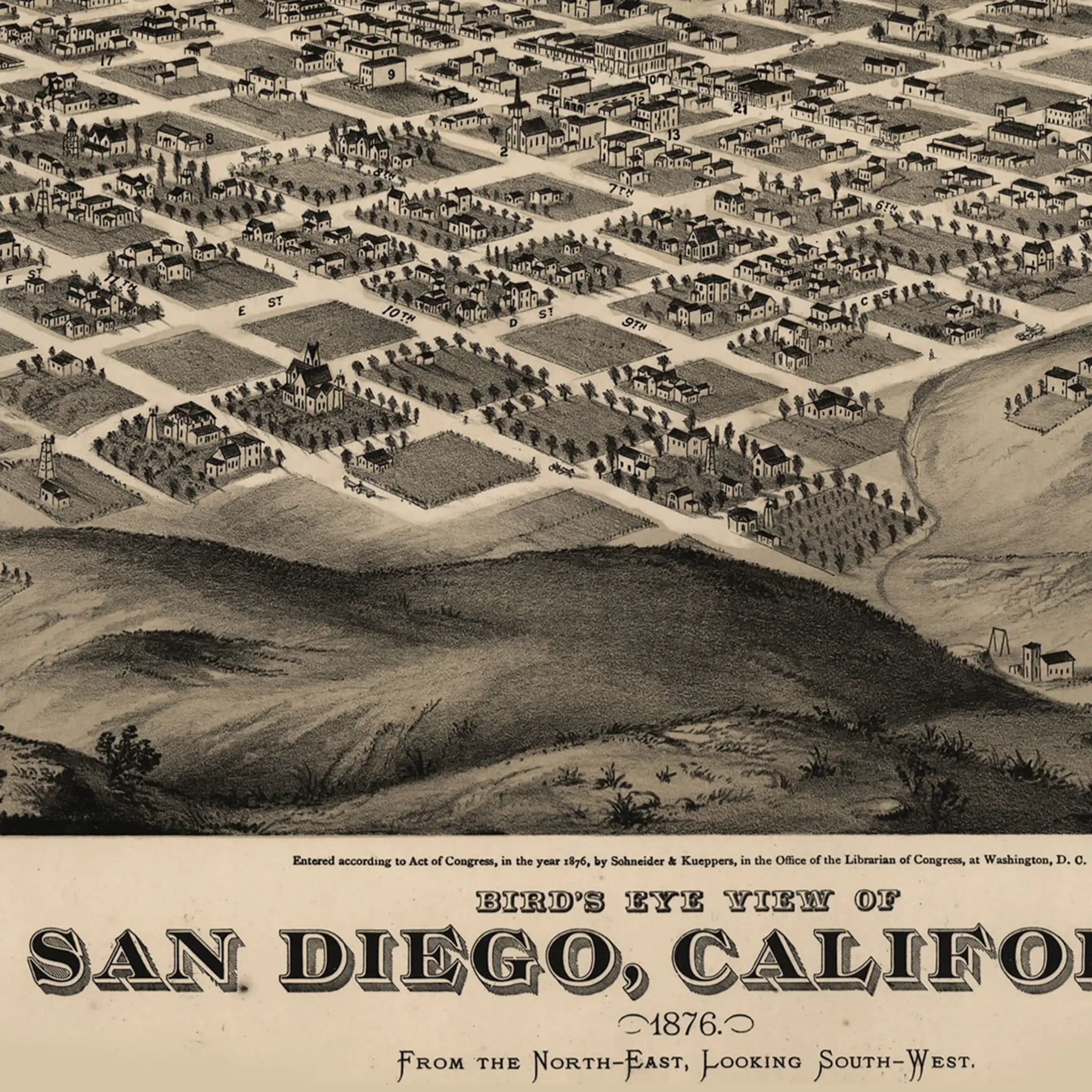
San Diego Bird's-Eye Map - Vintage 1876 California Historical City Map
Sale priceFrom $39.99
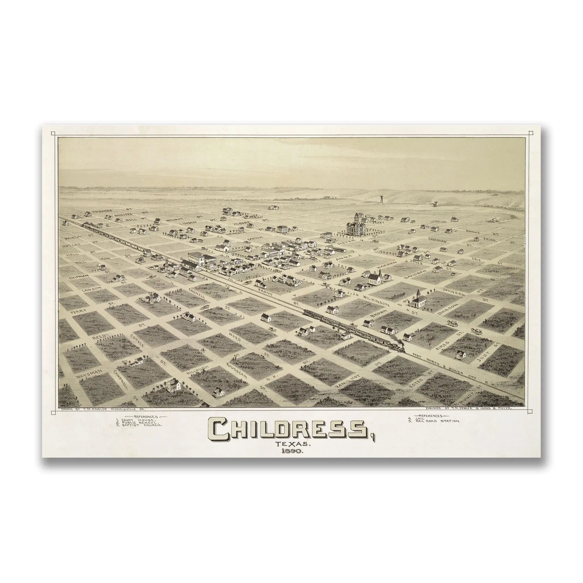
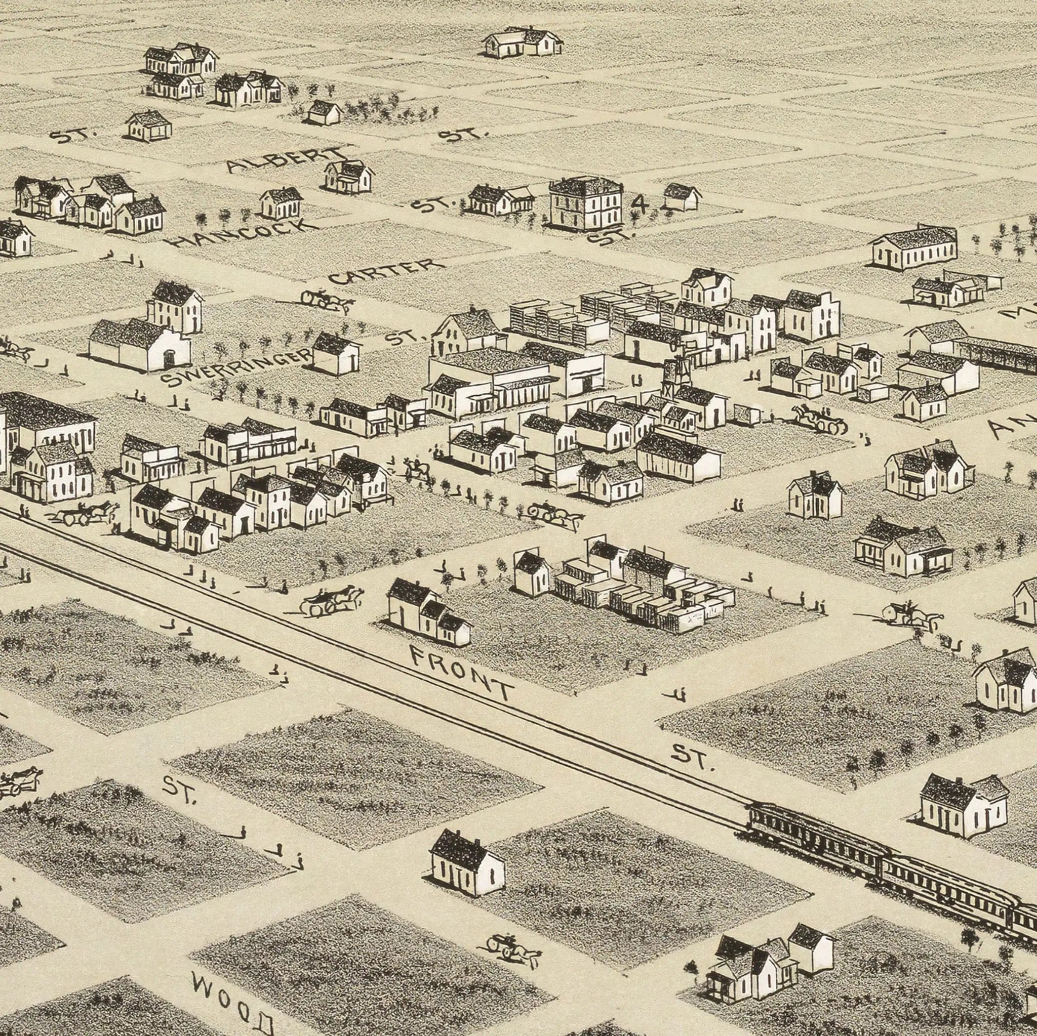
Vintage Childress Texas City Map - 1890 Historical Bird's-Eye View
Sale priceFrom $39.99
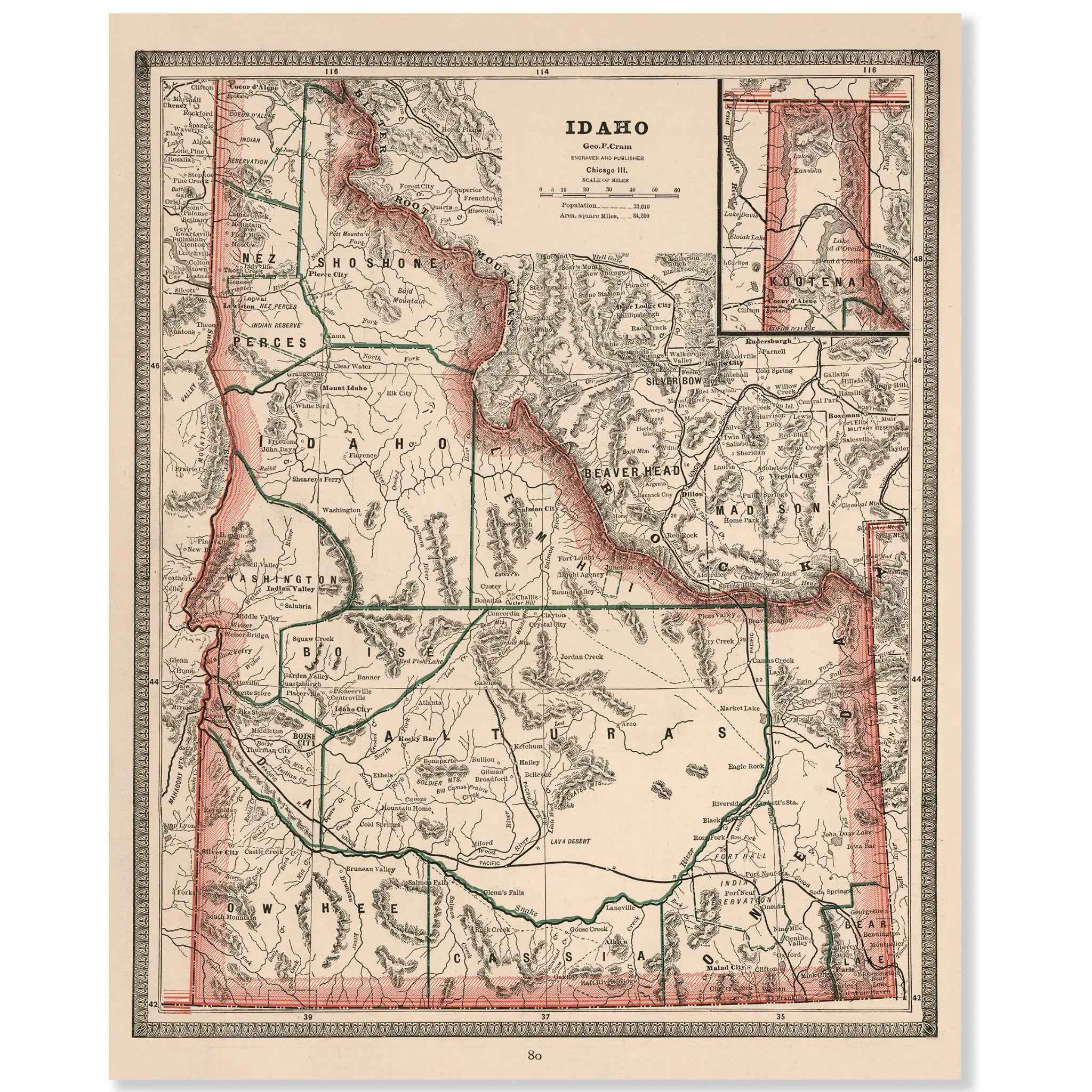
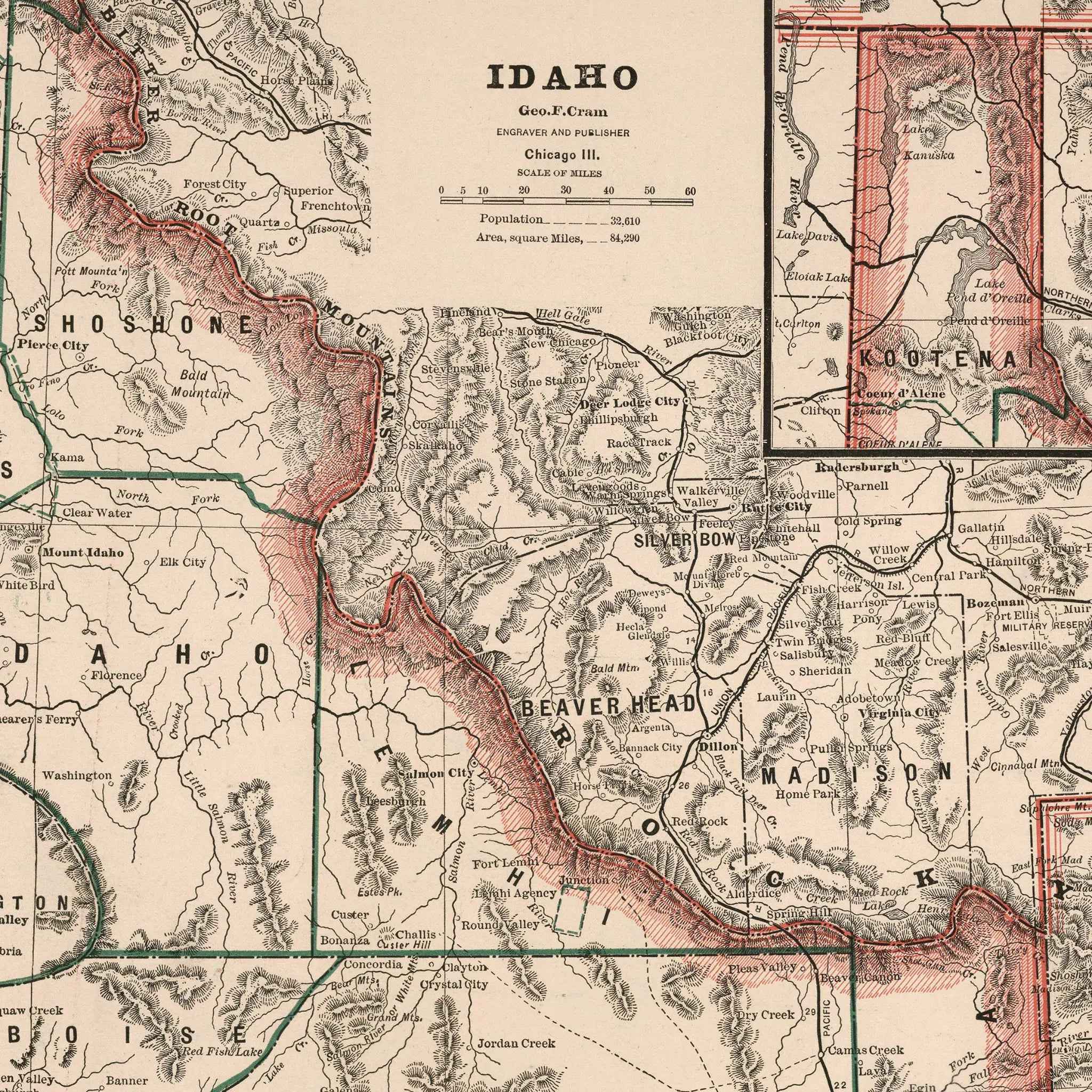
Idaho Map - Vintage 1883 Cram Historical Territory Map
Sale priceFrom $34.00
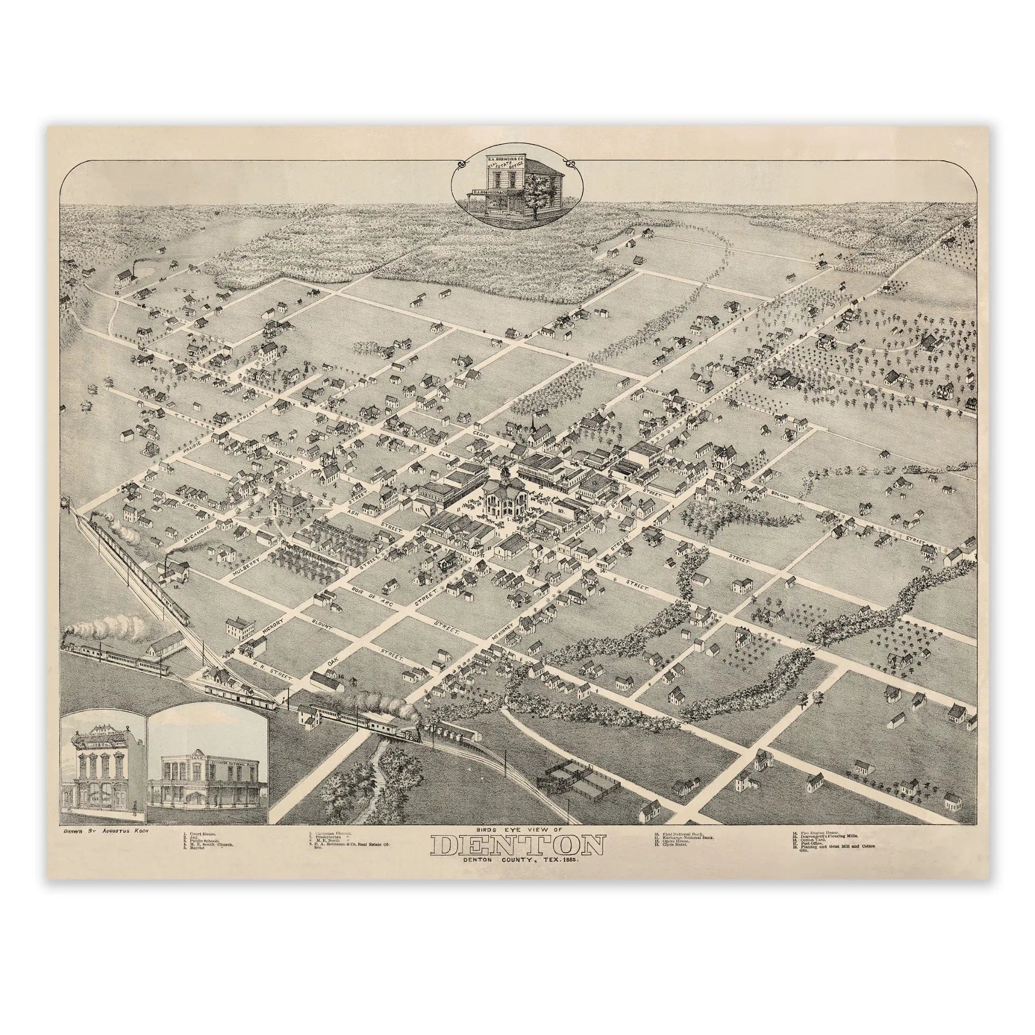
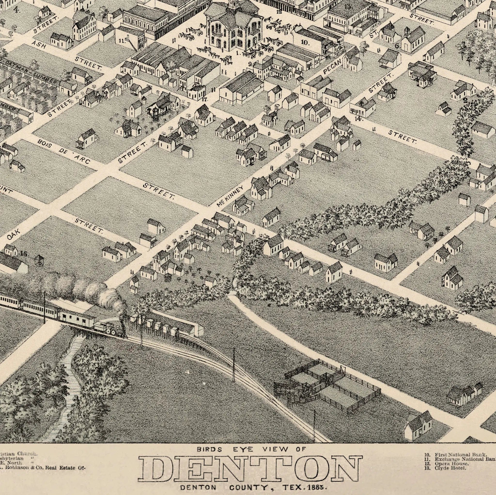
Denton Bird's-Eye Map 1883 - Vintage Texas Historical City Map
Sale priceFrom $39.99
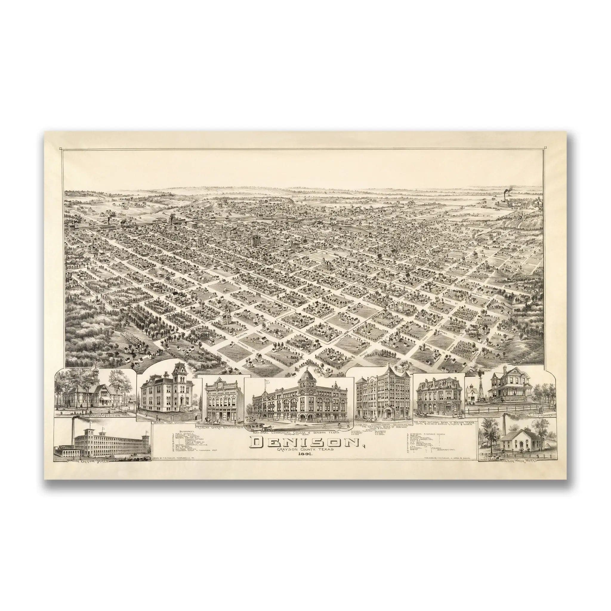
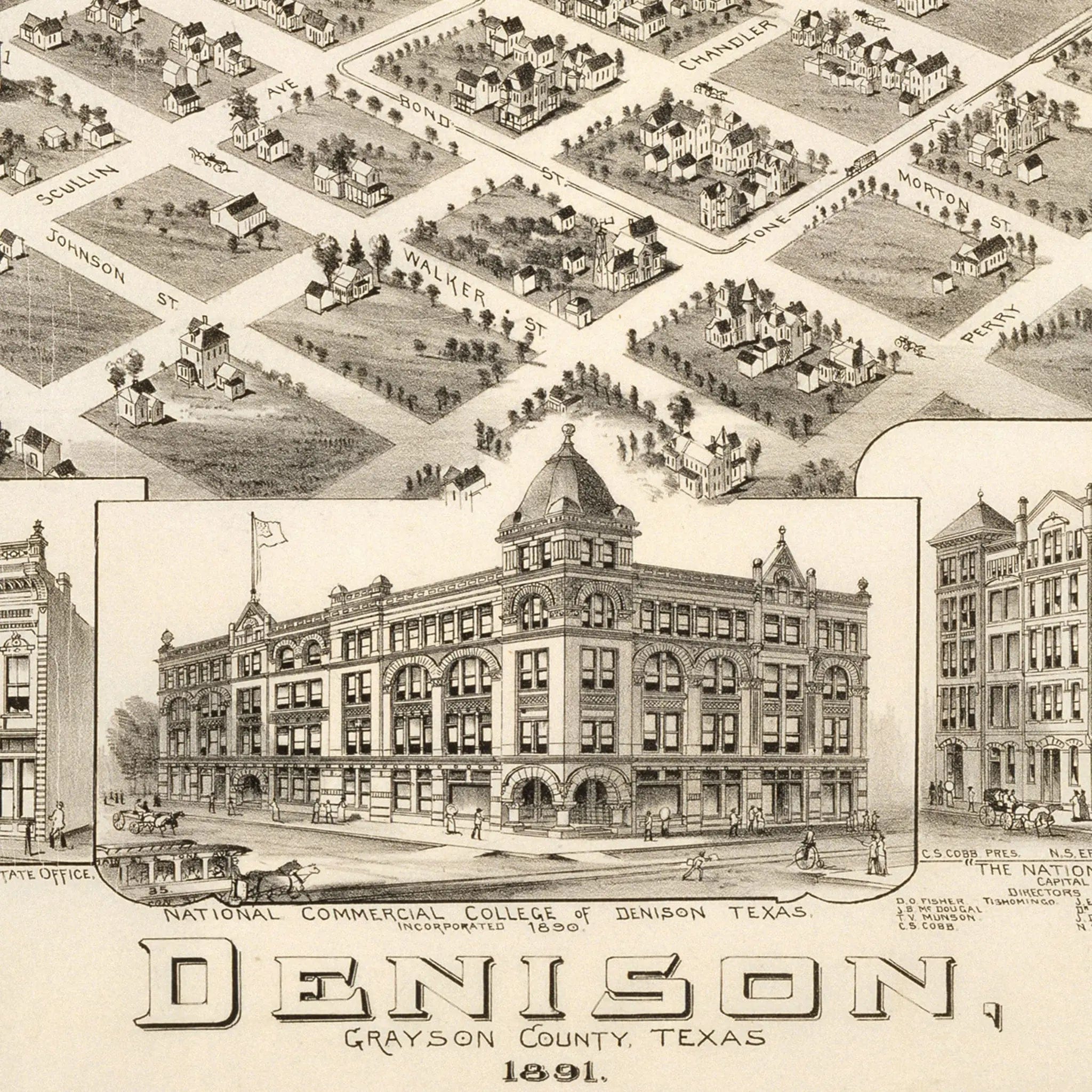
Denison Texas Historical Map - Vintage 1891 Bird's-Eye City View Print
Sale priceFrom $39.99